#bay area ridge trail
Explore tagged Tumblr posts
Text
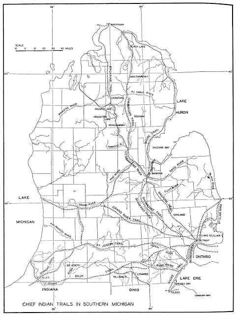
Michigan's first trails were not made by native Americans but ranging buffalo herds in migration. This was especially true on the St. Joseph trail in Southwest Michigan. The major trails in lower Michigan tended to link Indian settlements of Mackinac, Detroit, Saginaw, and Niles. The area around Saginaw had the most native American settlements in the Great Lakes region.
Noted below are native trails that we travel everyday.
Shore Line Trail - A minor trail starting near Toledo and hugging Lake Erie's shore, the Straits of Detroit. Past Fort Gratiot and Lake Huron to a spot near White Rock. White Rock was considered a solemn spiritual place of offering. Today this route is mirrored by Lakeshore Drive from Detroit to Lexington and M-25 north. This trail continues north along the entire shore to Cheboygan. It was considered a minor trail as travel via canoe was preferred along this route. Michigan chose to utilize much of the original Native American trail along Lake Huron and Saginaw Bay to create M-25. Paving of Michigan's First Scenic Highway was started in 1933 and completed in 1940.
Saginaw Trail - One of the oldest trails, this Sauk trail system, went from the Straits of Detroit to Saginaw. Today this starts at the Detroit River and heads northwest up Woodward Avenue to Pontiac, then continues up Dixie Highway through Flint to Saginaw.
Sand Ridge Indian Trail - An ancient trail from Saginaw to Port Austin in Michigan's Thumb. Used primarily for access to the rich hunting ground of the Thumb. Today, M-25 follows much of the same route. However, the old trail is still evident and marked as Sand Road in Huron County. A major canoe passage across Saginaw Bay occurred at Oak Point via Charity Island to reach the AuSable River.
St. Joseph's Trail - A major east-west system called Route du Sieur de la Salle and the Territorial Road. When the Territorial road was first built from Plymouth to St Joseph, a portion of the road was ‘corduroy.’ which means wood lo
25 notes
·
View notes
Text
Luxury Horse Ranch
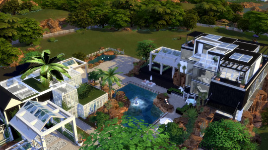
The ultimate in luxury living - when enjoying your Simoleons is your vibe....
• Lot details: 64x64 Residential - Red Roan Field Lot Riders' Glen - Chestnut Ridge - The Sims 4: Horse Ranch • 3 Bedrooms, 5 Bathrooms, Laundry, Kitchen, Dining room, Sauna, Home Gym, BBQ Deck, Jacuzzi, Bar and multiple viewing decks.
This luxury ranch estate offers the ultimate equestrian lifestyle in Chestnut Ridge with miles of riding trails. This property includes luxurious airconditioned stables with 4 stalls, 2 wash bays, a Tack Room, 2 bathrooms, lounge and a stunning loft office that is open to the greenhouse below. The resort-style grounds provide additional recreation areas with pool, multiple seating areas, fully upgraded treehouse.
Now available on Patreon



#youtube#the sims 4#sims 4#showusyourbuilds#ts4#sims 4 community#sims 4 simblr#sims4cc#sims4house#sims4
11 notes
·
View notes
Text
I went the wrong way on a hike today and asked an older chap for directions and not only did he offer to drive me to the actual trail head (I was on the wrong side of the ridge oops) but it turns out he was a local archaeologist/historian and so he spent the next 45 mins telling me all about the local area and the old mining tracks and machinery and gave me a little tour of the canal and explained how the culvert diverted water from the river which used to be tidal and ships used to come all the way up it and this car park used to be the loading bay from mine to canal to ship and I love getting old folks to tell me history !!
#Honestly encouraging people to infodump to me is one of my favourite things#it's amazing how much people have to say if you show a little curiosity#i told my sister about this and her first reaction was horror that i got in a stranger's car and she's not entirely wrong#but also#if you don't trust your fellow human beings to mostly have good intentions you'll miss out on a lot#but also it simply didn't occur to me cos I'm an idiot#. i just didn't want to walk an hour along roads round the ridge#personal post
11 notes
·
View notes
Text

I made a tier list for what I think are the best worlds to reasonably start a horse ranch. The criteria took forever to test, so I limited myself to a central lot in each neighborhood of each world (to test if the horse will go to the farthest, out of the way lot on it's own or not) and only tested the "Go for an energetic Ride" interaction instead of clicking the ground everywhere to "Trot Here". I'm also cheating my horse's and sim's needs to full because tired horses will cancel the interaction faster. The criteria judged: Automatic pathing from going on an energetic ride, the world's theme and my capability to suspend my disbelief that someone would start a horse ranch in a suburb, and any glitches from my horse phasing through decor and lots during the "Go for a Ride" interaction. I spent three days on this for some reason. This is a cry for help.
Best in Show - Good pathing and thematically on point when it comes to horse ranching, even if it's not western themed. Henford-On-Bagley: Cottage style ranch is a yes. Finchwick's village isn't very big and the houses are blocked by stairs but I didn't expect the village center to be a good location for a horse ranch anyway. Old New Henford and the Bramblewood have a lot of dirt trails and the horse will go down many of them, even to some of the set dressing sheds. The Isle of Volpe Park is landlocked though, despite having numerous footpath bridges that lead away from the park. Moonwood Mills: (Forest, dirt paths, lots of room to run? Sounds perfect but now I have to test it.) STUNNING FLAWLESS IMMACULATE (why do i have post apocalyptic vibes, like a cross between silent hill and the last of us?) The horse will do a full circuit around Moonwood Mill and because it's designed with pathing for the werewolves to feral run, the horse has plenty of space and nature to do the same. Even with the grungy warehouse setdressing, the horse doesn't feel out of place. Post apocalyptic or workhorse ranches would fit in well here. Chestnut Ridge: literally made for the horses and thematically perfect for horse rides. I actually think (due to how the Sims 4 is structured to be so empty) that while this world also has a lot of set dressing, it's fitting for the wide stretches of fuckall to actually see or do when it's a horse trail.
Pretty Good - Good pathing and acceptable to see a horse trotting through the landscape Forgotten Hollow: Immaculate vibes for a headless horseman. And aside from Straud's graveyard and the coffin courtyard, the lots are entirely customizable without debug setdressing houses to shame you for style deviation. The world is very small but the pathing goes through the town square and a bit into the woods. Unless your starting point is Straud's mansion, your horse will mainly use the coffin road and the dirt paths through the trees before coming back. Brindleton Bay: Whiskerman's wharf has a route to let the horse wander from Catarina Lynx's house to Tail's End (which has a backdrop of old wooden fencing that feels very appropriate for a ranch) to Club Calico and back again, ignoring the Salty Paws Saloon and Ragdoll Refurb lots. Since the saloon is even farther on the pier and the Ragdoll Refurb is in a much more suburbia city like area, it felt fitting that a ranch wouldn't be in such places and the horse wouldn't go there. Sable Square has very wide brick roads in front of the vet/park and residential lots connected by a wide bridge. The pathing doesn't go through the dirt paths tho. Cavalier Cove has a decently long path through the beach areas but won't go to the Hound's Head lot unless you start there. Deadgrass Isle has good routing, not just pacing in front of the museum, the horse actually walks around on the dirt path to the lighthouse and goes into the cemetery. Sulani: Surprisingly good pathing (no attempts to go horse swimming) that goes throughout the Lani St. Taz island, and the lack of paved roads (and my increasingly beloathed sidewalks) feels more natural. Tropical horse ranch, anyone? The horse does avoid the northernmost lot because of the skinny stretch of sand linking it to the island but that would put the horse a bit too close to the water and possibly make it try to swim. Ohan'ali Town has a coastside path that is surprisingly long but the horse won't go up to the lot near the waterfalls. Mua Pel'am pathing goes from the volcanic lot to the little beach past the mystery cave and back again, which wasn't very surprising, Mua Pel'am is not a large neighborhood and one of the three lots is an empty island. (Honestly thought this entire world was going to be completely awful.) Copperdale: As an old refurbished Mining town it looks fitting for a horse to come through for decades challenges. The horse will go all the way around Copperdale High and up to the front of the auditorium, but it won't go to the track in the football field behind the high school. Around Prescott Square, the horse will go all around town, visitng all the lots including the Prescott household. Plumbite Cove is one part the Pier, one part cannery row, and most parts forested dirt roads. The pathing leads from the rental lot all the way to Totter Park, completely ignoring the LaSuli Point starter lot.
Okay - Pathing is acceptable but the theme isn't particularly welcoming in most of the world. Windenburg: Half of the map is city area and the horse does get around well but does not look thematically appropriate when trotting around the cafe and bars. All of the single lot neighborhoods don't allow great pathing, but for the Ruins and the Von Haunt Estate it's a little bit better than the horse pacing back and forth in front of one mansion. The Crumbling Isle and the Windslar neighborhoods are better placements for a horse ranch and have decent pathing through the area, though the Windslar's path has a very 'cottage roads' theme to it, it's not a sidewalk but a brick path leading from lot to lot. San Sequoia: The world feels a lot more like certain places in Monterey County than the inspiration of San Francisco, if considerably emptier, and I remember horses being rode through town the few times we went to those places as a kid. The world is HUGE and the horse trotting through Anchorpoint Wharf feels like a novel sight someone WOULD see in my experience, but not a great place to build a ranch. In Hopewell Hills, the horse will go through the park on automatic pathing.
Less than Ideal - Pathing isn't fabulous but it's got enough room to visit on horseback, the theme probably does not fit. Del Sol Valley: The theme is atrocious for a ranch. The pathing in Mirage Park is mostly the sidewalks but also surprisingly went behind the two lots across the street from Venessa Jeong's house but not behind hers. Starlight Boulevard is a city center that is not welcoming to a horse trotting around, the pathing is surprising as the horse actually walks in the street rather than the sidewalks though it does avoid walking near Studio BP and the stars walk. The Pinnacles has lots that are certainly big enough for some kind of Hollywood Ranch but the neighborhood pathing is stuck to the sidewalks despite the roads available, unless the horse is cutting through a street to reach another sidewalk or through the grass 'island' in front of Judith Ward's house. No pathing to the overlook behind her house either despite it having ramps instead of stairs. Glimmerbrook: I am not taking the horse to the magic realm. There's no sidewalks! :D But the horse only takes the paved road and ignores the dirt paths and all the lots unless it's the one you started from. A good place aesthetically for a horse ranch but not for gameplay. Evergreen Harbor: I can't suspend my disbelief that a suburb is a place for a ranch. Horse paths follow human sim paths. Won't go over the bridge in Port Promise unless you start at the Sterling household. Will walk all the way over to the Greenburg household. Grimms Quarry, the pathing is almost all sidewalks, the horse won't go near the apartments but will go to the quarry building. In Connifer Station the horse won't use the 'car' roads but will walk all around. Tartosa: Laurent Mansion is landlocked. Anything with stairs isn't pathable to a horse. I had hopes, Tartosa has long extinguished them. (Okay, Melancholy over.) I restarted at the Baia Dell'amore beach lot. There's a lot of area the horse WILL cover that isn't the Laurent mansion. Including the island linked by a stone bridge. It's a little weird looking because it's a Mediterranean city, so I don't think a ranch will fit in. In the Terra Amarosa Neighborhood, the horse would path from Via Romanza to the Markovic household and back, completely ignoring half the neighborhood, the waterfalls, and the Rifugio dei Pirati lot. No waterfall horse rides for us :(
Not Great - The pathing is stagnant or the world is too small. Willow Creek: The horse will just pace in front of the houses and look extremely out of place in almost all of the neighborhoods. The only place with decent pathing that doesn't look like a wayward cowboy is stalking your suburb is the park and it has decent pathing but little else. The sylvan glade has zero pathing for horses, my horse took two steps and the interaction cancelled. Good for screenshots, bad for gameplay. San Myshuno: Horses are not allowed inside of the apartment buildings, let alone the apartments themselves, limiting almost all residential options in the world. Makes sense, putting a horse in an elevator sounds like chaos. Limited pathing that isn't sidewalk and clip clop clipping on the paths in Uptown. The horse would go into some odd places further than expected but the world's neighborhoods are mostly too small for a decent run. The only exception is the San Myshuno park, which has a decently long trail for a horse. Changing the park's lot type to a residential would make this an okay place to build a ranch but thematically clash with all the little history signs littered through the landscape and set dressing garden. Strangerville: (God help me.) I'm not bothering to take the horse to the secret lab. The world is Western themed, but it is not Wild Western Country themed despite the cowboy hat and boots. Rusty Canyon is mostly desert cityscape and the pathing is strictly sidewalk bound, though it does go farther than I expected. The horse did not approach the crashed plane lot, so unless you start a ranch there, your horse will not automatically travel the dirt roads in that desert section. (The centralmost lot was the starter home across from the Sigworth household.) Shady Acres has TINY sidewalks and the horse will constantly swivel to avoid 'collision' with npcs and also plant decor, which at higher speeds looks like your horse is glitching out but isn't, and is primarily sidewalk bound despite the dirt paths other sims will travel along behind the houses. The only pathing off the sidewalk was the driveway up to the Roswell household.
Absolutely not - The pathing is awful. Oasis Springs: The automatic pathing is strictly stuck to the sidewalks and the horse mostly just paces in front of two or three homes going back and forth despite there being other areas that other sims will walk along. You can force the horse to go somewhere else but the world's neighborhoods also aren't big enough or detailed enough for better places to force the horse to go just to take screenshots. The park does not have a path to follow, the horse will just pace the front of the park and cross the street before turning right back around to pace in front of the park again. Newcrest: Same issues as Oasis Springs. Magnolia Promenade: The horse will only pace on the sidewalk along the sides of The Roadstead and JF&S Clothier shops, continuing down the sidewalk next to the set dressing garden, completely ignoring actually going into the park areas. Again, you can force the horse to go through the set dressing garden or over to the bistro tables for screenshots but it absolutely does not fit horses appropriately. Brightchester: No. Just. No. The town is all townhouses and university dorms. The pathing is all sidewalks. Don't build a ranch here. Mt Komorebi: Most of the hiking trails are inaccessible to horses due to being blocked by stairs as an entry. The horse is very out of place in the city areas. At the actual mountain the pathing won't go past the rental houses despite most of the hiking trails not being blocked by stairs as an entry.
Why did I willingly choose to do this
4 notes
·
View notes
Text
THE GREAT OCEAN WALK: A COMPREHENSIVE GUIDE
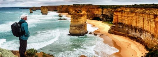
One of Victoria’s greatest walking tracks is the Great Ocean Walk. As it wraps around the coastline of the Southern Ocean, it gives those walking along it the rare opportunity to immerse themselves in this monumental location’s landscape, wildlife, and history. From sweeping ocean views to hidden rainforests, there is something for everyone.
For local and international visitors planning to travel along the Great Ocean Walk, many things are worth knowing before you set off. We have compiled a guide that will give you an insight into the location, what you can expect throughout your journey, and the important considerations to make as you plan.
The walk begins in Apollo Bay, a town in southwestern Victoria. Apollo Bay is a stop on the Great Ocean Road that winds along the coast, passing through the Great Otway National Park. Behind Apollo Bay are the mountains of Otway Ranges, partly forested and cleared for grazing and dairying. When you reach Apollo Bay, keep your eyes peeled for Apollo Bay Visitor Centre, as this will serve as the starting point for your journey.
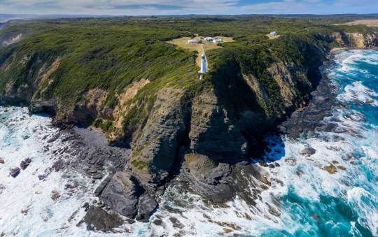
Arrange your transportation from the end of your walk, Port Campbell, back to Apollo Bay (or where you have chosen to park your car). Shuttle services and public transport are available; we suggest organising your preferred transportation option before setting off.
The Great Ocean Walk is often travelled across eight days, allowing travellers to slow down and appreciate the sounds and sights at a gentle pace. There are also daily and multi-day trip options for covering the entire distance in a shorter timeframe.
Camping and lodge accommodations are available for those covering the distance over several days. Seven camping sites have been designed to be reached at the end of a daily hike, approximately ten to sixteen kilometres apart. To secure a camping spot or lodge, check availability ahead of time and book your accommodation.
The majestic locations available as you traverse the Great Ocean Walk can be separated into eight sections:
One: Apollo Bay to Elliot Ridge
Two: Elliot Ridge to Blanket Bay
Three: Blanket Bay to Cape Otway
Four: Cape Otway to Aire River
Five: Aire River to Johanna Beach
Six: Johanna Beach to Ryan’s Den
Seven: Ryan’s Den to Devils Kitchen
Eight: Devils Kitchen to Twelve Apostles
The Great Ocean Walk’s sections are classified as a ‘Grade 3’ hike. This classification was given as it is ‘suitable for most ages and fitness levels’ though some experience in bushwalking is recommended. Some steep staircases and gradients are presented throughout the walk—challenging terrain and areas that require a distance to be covered along the beach. Hikers should remain vigilant of the path as it can be wet and slippery in different areas or due to changing weather conditions.
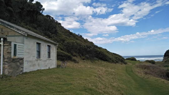
One of the best ways to ensure a smooth and engaging experience on the Great Ocean Walk is by completing the trail with a licenced tour guide. When partnering with a tour company, of which there are over twenty locally, you have access to several services depending on your expected duration and personal needs. From transportation, guided tours, camping and safety equipment hire, supplying food, and more.
Engaging with a licenced tour operator means that a professional will complete all the planning and preparation, allowing you to relax and enjoy every moment of your journey.
If you are walking the Great Ocean Road Walk, whether in a group or independently, we recommend that you take some safety precautions:
There is limited phone reception along the walk, so ensure you mark the last location with reception to walk back to if you need to make an emergency call. We also advise being familiar with the emergency contact numbers 000 and 112.
Consider bringing a personal locator beacon or satellite radio to keep those waiting for you updated on your location or for emergencies.
It is essential to pack a First Aid kit or, where possible, travel with someone who is First Aid certified.
Be vigilant of snakes, especially in the warmer months. Keep your distance and make a wide berth if you come across one. Precautions include keeping your tent and belongings off the ground and secure, checking the area before sitting down, wearing hiking boots, gators, and pants, and more. See the Great Ocean Walk website for more details on ways you can keep safe along the trail.
Bushfires are a serious risk, and the Great Ocean Walk is a high-risk area, especially during the summer. We recommend checking the fire rating for the days you intend to be walking and being familiar with bushfire safety, which you can read more about through the Visit Victoria website.
Many beaches along the trail experience rogue waves and tide changes. Wreck Beach, in particular, is a high-risk area. Keep a minimum ten-metre distance from the water. We also recommend checking the tide timetable. Only travel down to the beach if it is low tide and safe, and remain aware of quickly changing conditions.
You will need expert guidance and organisation for a truly memorable experience on the Great Ocean Walk. With Auswalk, you can enjoy guided, self-guided and tailored walks across Australia. As your qualified travel companion, you can leave everything to us – from accommodation to food. It’s not just about getting you to the destination but also about the journey that leads to it. Come and see the hidden gems of the Great Ocean Walk with Auswalk; contact us today to start your journey.
#groupguided#selfguided#australiawalks#tours#great ocean road#great ocean walk#walking tours#hiking trail
2 notes
·
View notes
Text
Diablo IV: Sanctuary Main areas with zones and sub-zones
Last update: 7/29/23 10:00 AM EST
FRACTURED PEAKS
Desolate Highlands ◈ Kyovashad [Waypoint] ◈ Nevesk (Waypoint) ◈ Father's Cross ◈ Eastern Pass ◈ Boulder Ridge ◈ Icehowl Taiga
Dobrev Taiga ◈ Margrave [Waypoint] ◈ Southeast Foothills ◈ Savina Falls ◈ Radiance Field Cemetery ◈ Krol Forest ◈ Pauper's Descent
Gale Valley ◈ Yelesna [Waypoint] ◈ Zeleny Lowlands ◈ Windfall Hollow ◈ Mistral Woods
Darkened Hold (Dungeon) ◈ Winding Way ◈ Shadowed Glade
Horadrim Vault (Dungeon) ◈ Foyer ◈ Study ◈ Desecrated Archives
Condemned Mines (Cellar) ◈ Stagnant Tunnels ◈ Unstable Mineshafts ◈ Collapsing Depths ◈ The Darkened Way ◈ Kasama
Path of the Firstborn / Cradle? (Dungeon) ◈ Courts of Dawn ◈ Cloisters of Dusk ◈ Mourning Shore ◈ The Black Lake
Frigid Expanse ◈ Eastern Plain ◈ Olyam Tundra & The Asylum Lot ◈ The Deep White & Trough of Orobas ◈ Kylsik Plateau ◈ Shivering Wilds ◈ Lake Klokova ◈ Kor Rohavan
Sarkova Pass ◈ Menestad [Waypoint] ◈ Western Ways ◈ Crags of Ill Wind
Seat of the Heavens ◈ Sinner's Pass ◈ Serac Rupture ◈ Malthus' Perch ◈ Fields of Judgement ◈ The Anointed Ascent ◈ Altar of Redemption ◈ Altar of Martyrdom ◈ Alabaster Monastery & Shrine of the Penitent
The Pallid Glade ◈ The Anemic Falls ◈ Frostbite Trails ◈ The Sallow Riverbanks
Kor Valar
Kor Dragan
NOSTRAVA 🏰 (Stronghold)
MALNOK 🏰 (Stronghold)
SCOSGLEN
Highland Wilds ◈ Ard Lands ◈ Maddux Hill ◈ Old Heimberg ◈ The Great Northern Plains ◈ Loch's Bane Ridge ◈ Gloom Pine Pass ◈ The Withered Scrubs
The Downs ◈ Lochsdale ◈ Umbralwood ◈ South Umbralwood ◈ The Unhallowed Pit ◈ The Harrowfields ◈ The Scorched Orchard ◈ Wealaf Rise ◈ The Fetid Farmlands ◈ Blycroft
The Emerald Chase ◈ Cerrigar [Waypoint] ◈ Cerrigar Outskirts ◈ Shadow Wood ◈ Greenglen Meadows ◈ Woodsman's Glade ◈ Old Forest Clearing ◈ Woodwraith Edge
The Wailing Hills ◈ Braestaig (Waypoint) ◈ Bronagh Expanse ◈ Aisle of Whispers
Westering Lowlands ◈ Eldhaime Keep ◈ Laglend Fen ◈ Carraig Or Ford ◈ Outlaw's Grove ◈ The Witan Woods ◈ Fainne, the Defiled Grove ◈ Gaothmar Grasslands
Deep Forest ◈ Path of Learning ◈ Issalia's Rise ◈ Southern Briars ◈ Dark Thicket ◈ Vasily's Reach ◈ The Ancient's Woods ◈ The Fading Statue ◈ Klettr Scar ◈ The Great Barks Wilderness ◈ Duin Carr
TÚR DÚLRA 🏰 (Stronghold)
Northshore ◈ Marowen [Waypoint] ◈ Marowen Shipyard ◈ Writhing Brook ◈ Abandoned Coast ◈ The Cursed Scarps ◈ Eternal Watch ◈ Stormbreak Cove ◈ Gamall Nook ◈ The Gaunt Eyrrs ◈ Carrowcrest Trail ◈ Scourging Ings ◈ Uaill Basin
Carrowcrest Ruins
THE CURSED BAY 🏰 (Stronghold)
Caen Adar
Strand ◈ Corbach [Waypoint] ◈ Balagar's Rest ◈ Fiabre ◈ Garan Brae ◈ Garan Watch ◈ Razor Shoals ◈ Strandflats ◈ The Cinder Woods ◈ Torvstrath
MOORDAINE LODGE 🏰 (Stronghold)
The Shrouded Moors ◈ Tirmair [Waypoint] ◈ Overgrown Outpost (Cellar) ◈ The Daudur Peats ◈ Faers Watch ◈ The Blood Vale ◈ Heart of the Moors
Untamed Thicket (Dungeon) ◈ Crimson Path ◈ Corrupted Spawning Ground
HAWEZAR
Dismal Foothills ◈ Wejinhani [Waypoint] ◈ The Bitter Road ◈ Bloodpox Basin ◈ Crimson Spoil
Blightmarsh ◈ Corpsewail Deluge ◈ Morass of Misery ◈ Dromir Riverbank
DRY STEPPES
Katama Grasslands ◈ Ked Bardu [Waypoint] ◈ Farobru [Waypoint]: healer, weapons vendor, blacksmith, rings & amulets vendor, stable ◈ Arid Heartland ◈ Wayward Plains ◈ The Wretched Strand ◈ Seaside Descent (dungeon)
Khargai Crags ◈ Hapless Frontier
Chambatar Ridge ◈ Fate's Retreat [Waypoint] ◈ Path of Stray Souls ◈ Forsaken Ascent ◈ Spine of Civo ◈ Kiln of the Primes
Dindai Flats ◈ Khurel Passage
Norgoi Vigil ◈ Norgoi Vigil
The Scarred Coast ◈ Path of the Ill-Fated ◈ Ragged Shore ◈ Seaside Cavern (cellar) ◈ The Ashen Treat ◈ Eroded Cove (cellar) ◈ Tamuur Hinterland ◈ Undying Marches
Fields of Hatred ◈ Alzuuda (waypoint) ◈ Akhai Prairie
KEHJISTAN
Amber Sands ◈ Blistering Descent ◈ Forgotten Coastline ◈ Searing Expanse ◈ Scorching Dunes ◈ Dunes of Despair ◈ Lut Bahadur Outskirts ◈ Road to Alcarnus ◈ Blighted Burrow (cellar) ◈ Ravaged Ruins (cellar) ◈ Shivta Ruins (dungeon)
ALCARNUS 🏰 (Stronghold)
Scouring Sands ◈ Forlorn Badlands ◈ Central Rise ◈ Rusted Sands ◈ Vault of Karamat ◈◈ Halls of the Damned (dungeon) ◈◈ Mortuus ◈◈ Inmergo ◈◈ Daemonium ◈◈ Osseus
Fields of Hatred (PVP) ◈ Bleak Dunes ◈ Shallow Mudcracks
Caldeum ◈ Road to Caldeum ◈ Caldeum Bazaar ◈ Southern Expanse ◈◈ Deserted Underpass (dungeon) ◈ Central Plateau ◈◈ Conclave (dungeon)
Dilapidated Aqueducts
Ragged Coastline ◈ Iron Wolves Encampment [waypoint] ◈ Scorched Plateau ◈◈ Festering Burrow (cellar) ◈ Scorched Gulch ◈ Uldur's Cave ◈◈ Uldur's Cave (dungeon) ◈ Dahlgur Oasis
#diablo iv#diablo 4#lilith diablo#sanctuary#gaming#fractured peaks#dry steppes#scosglen#kehjistan#hawezar#waypoint#stronghold
3 notes
·
View notes
Text
Books of 2023

Book 5 of 2023
Title: Killer Kane Authors: Andrew R. Finlayson ISBN: 9780786477012 Tags: 1968 Washington D.C Riots, Averell Harriman, Bess Clements Abell, Camp David, Catoctin Mountains MD, CH-34 Choctaw, CH-46 Sea Knight, CIA, CIDG, From LAPL, General Herman Nickerson, General Samuel B. Griffith, General William Westmoreland, Jacqueline Kennedy Onassis, John F. Kennedy, Lady Bird Johnson, Martin Luther King Jr, Maryland, North Korea, Okinawa, Okinawa - Northern Training Area (NTA), Robert McNamara, Soviet FROG-3 Missile, SpecOps, US Capitol Building, USA 3rd Infantry Regiment, USAF Kadena Airbase, USAID John Paul Vann, USMC, USMC 12th Marines, USMC 1st Force Recon Co, USMC 1st Force Recon Co - Team Brisbane (Vietnam War), USMC 1st Force Recon Co - Team Circumstance (Vietnam War), USMC 1st Force Recon Co - Team Club Car (Vietnam War), USMC 1st Force Recon Co - Team Countersign (Vietnam War), USMC 1st Force Recon Co - Team Killer Kane (Vietnam War), USMC 1st Force Recon Co - Team Swift Scout (Vietnam War), USMC 1st MarDiv, USMC 1st Marine Air Wing, USMC 1st Marines, USMC 1st Marines - 1/1, USMC 1st Marines - 1/1 - F Co, USMC 1st Marines - 2/1, USMC 1st Marines - 2/1 - E Co, USMC 1st Recon Bn, USMC 1st Recon Bn - E Co, USMC 1st Tank Bn, USMC 26th Marines, USMC 26th Marines - 1/26, USMC 26th Marines - 1/26 - F Co, USMC 3rd Marines, USMC 3rd Marines - 2/3, USMC 5th Marines, USMC 5th Marines - 2/5, USMC 5th Marines - 2/5 - F Co, USMC 7th Marines, USMC 7th Marines - 1/7, USMC 7th Marines - 2/7, USMC 7th Marines - 2/7 - G Co, USMC 9th Marine Amphibious Brigade, USMC Air Observers - Black Coats (Vietnam War), USMC Camp Hansen, USMC Camp Pendleton, USMC Camp Schwab, USMC Force Recon, USMC Marine Barracks Washington (8th and I), USMC Scout Dogs, USMC The Basic School, USMC Washington Barracks Guard Co., USN USS Pueblo (AGER 2), USNA, VNM 1968 Tet Offensive (1968) (Vietnam War), VNM A Shau Valley, VNM A Vuong River, VNM An Bang, VNM An Hoa, VNM An Long, VNM An Son, VNM Antenna Valley, VNM Ap Ba, VNM Arizona Territory, VNM Ba Na Mountain, VNM Base Area 112, VNM Battle of Hue City (1968) (Tet Offensive) (Vietnam War), VNM Battle of Khe Sanh (1968) (Tet Offensive) (Vietnam War), VNM Camp Hansen, VNM Camp Reasoner, VNM Charlie Med, VNM CIA Phung Hoang / Phoenix Program (1965-1972) (Vietnam War), VNM Col de Ba Lien, VNM Command and Control North/FOB-1 (Vietnam War), VNM Da Nang, VNM Da Son, VNM Dam Cao Hai Bay, VNM Dong Nhut Mountain, VNM DRV NVA 2nd Division, VNM DRV NVA 320th Reconnaissance Regiment, VNM DRV NVA 368th Artillery (Rocket) Regiment, VNM DRV NVA 3rd Regiment, VNM DRV NVA 402nd Sapper Battalion, VNM Elephant Valley, VNM Freedom Hill PX, VNM Happy Valley, VNM Hiep Duc, VNM Hill 170, VNM Hill 199, VNM Hill 203, VNM Hill 224, VNM Hill 324, VNM Hill 327, VNM Hill 35, VNM Hill 372, VNM Hill 381, VNM Hill 387, VNM Hill 406, VNM Hill 417, VNM Hill 441, VNM Hill 452, VNM Hill 454, VNM Hill 478, VNM Hill 498, VNM Hill 502, VNM Hill 537, VNM Hill 575 (Tam Dieo Mountain), VNM Hill 582 (Kon Chay Mountain), VNM Hill 592, VNM Hill 594, VNM Hill 623, VNM Hill 678, VNM Hill 749, VNM Hill 800, VNM Hill 89, VNM Ho Chi Minh Trail, VNM Hoi An Thuong, VNM Hon Cau Mountain, VNM Hue, VNM Khe Dienne River, VNM Khe Gio tributary, VNM Khuong Dai, VNM Loc Tu, VNM LZ Finch, VNM MEDCAP, VNM Mortar Valley, VNM Nam O Bridge, VNM Ninh Dinh, VNM Ninh Khanh, VNM Ninh Long, VNM Nong Son Coal Mine, VNM Nui Ba Hoa, VNM Nui Chom, VNM Nui Nhu, VNM Nui Son Ga (Charlie Ridge), VNM Ong Thu Slope, VNM Operation Arizona (1967) (Vietnam War), VNM Operation Calhoun (1967) (Vietnam War), VNM Operation Claxon (1968) (Vietnam War), VNM Operation Knox (1967) (Vietnam War), VNM Operation Pecos (1967) (Vietnam War), VNM Operation Snoopy (People Sniffer) (Vietnam War), VNM Operation Union I (1967) (Vietnam War), VNM Operation Union II (1967) (Vietnam War), VNM Operation Wheeler (1967) (Vietnam War), VNM Phouc Ly, VNM Phouc Tuong, VNM Phouc Tuong (Dogpatch), VNM Phu Bai, VNM Phu Gia Pass, VNM Phu Loc, VNM Quang Duc Duc, VNM Quang Nam Province, VNM Quang Tri Province, VNM Que Son Mountains, VNM Que Son Valley, VNM Route 1, VNM Route 545, VNM RVN RVNP CSDB PRU Provincial Reconnaissance Units (Vietnam War), VNM Saigon, VNM Song Cu De, VNM Song Ly Ly, VNM Song Thu Bon, VNM Song Tinh Yen, VNM Song Vu Gia, VNM Song Yang, VNM Tam Kho, VNM Tam Talou Tributary, VNM Thach Bich, VNM The Enchanted Forest, VNM The Garden of Eden, VNM Thua Thien Province, VNM Thuan Long, VNM Thuong Duc, VNM Ti Tau Mountain, VNM Trang Bang, VNM Trao Hamlet, VNM Tu Phu, VNM US MACVSOG (1964-1972) (Vietnam War), VNM US MACVSOG Road Runner Teams (Vietnam War), VNM USMC AHCB An Hoa Combat Base (Vietnam War), VNM USMC Combined Action Platoon, VNM USMC KSCB Khe Sanh Combat Base (Vietnam War), VNM Vietnam, VNM Vietnam War (1955-1975), VNM Yellow Brick Road, Washington D.C Rating: 5 stars Subject: Books.Military.20th-21st Century.Asia.Vietnam War.Specops.Marine Recon
Description:
The leader of one of the most successful U. S. Marine long range reconnaissance teams during the Vietnam War, Andrew Finlayson recounts his team's experiences in the year leading up to the Tet Offensive of 1968. Using primary sources, such as Marine Corps unit histories and his own weekly letters home, he presents a highly personal account of the dangerous missions conducted by this team of young Marines as they searched for North Vietnamese Army and Viet Cong units in such dangerous locales as Elephant Valley, the Enchanted Forest, Charlie Ridge, Happy Valley and the Que Son Mountains. In numerous close contacts with the enemy, the team (code-name Killer Kane) fights for its survival against desperate odds, narrowly escaping death time and again. The book gives vivid descriptions of the life of recon Marines when they are not on patrol, the beauty of the landscape they traverse, and several of the author's Vietnamese friends. It also explains in detail the preparations for, and the conduct of, a successful long range reconnaissance patrol.
Review:
Finlayson has a very particular point of view on the war, and warfare. Throughout the book, he is constantly made aware that his actions and behaviors are both dangerous and obsessive. Yet, even though he acknowledges it, and says he takes it to heart, he still has the narcissistic bent to ignore them and feel that his way is the right way.
That’s both a positive and a negative.
His teams brought the war to the enemy and were immensely productive as far as kills and intelligence gathered. At the same time, they were in many ways reckless and dangerous.
God loves a fool and who dares wins are basically how he operates.
Overall though, the book gives you great insight into HIS way of running recon teams, and how Team Killer Kane/Swift Scout operated, the gear they took, the places they operated in, and who the people were. His writing style is quick paced and gives you a good sense of his thoughts and emotions and allows you to understand where his head was at and what he experienced.
While there were a few errors, especially in regards to keeping track of a persons rank (one page they’re corporal, next they’re a sergeant), and the weapons (carrying my m-14, and had 5 magazines of 5.56mm), the book is well done.
#Books#Book#booklr#bookblr#ebooks#history#nonfiction#vietnam war#force recon#united states marine corps#usmc
3 notes
·
View notes
Text
Autumn's Best Kept Secrets: Where to Catch Nature's Own Fireworks Display This Fall!
There’s something magical about fall in the US—the air gets crisp, the days a little shorter, and the landscapes transform with vibrant hues of red, orange, and gold. If you’re looking to experience peak fall foliage, you’re in luck. The US is packed with spectacular spots where autumn colors take center stage, from mountain ranges and scenic byways to lakesides and charming small towns. Here’s a guide to some of the best places to soak up the breathtaking fall colors across the country.

1. The White Mountains, New Hampshire
The White Mountains are one of New England’s most iconic fall foliage destinations, and it’s easy to see why. With its dense forests and towering peaks, this area bursts into a kaleidoscope of color each fall. Take the Kancamagus Highway, a 34-mile scenic byway that cuts through the heart of the mountains, for unforgettable views. Stops at the Swift River, Sabbaday Falls, and various scenic overlooks are a must. Plan to visit in late September to early October to catch the colors at their best.
2.��Stowe, Vermont
Vermont is renowned for its idyllic fall landscapes, and Stowe is the perfect town to experience it. Known for its vibrant maples and classic New England charm, Stowe offers plenty of opportunities to view fall foliage. You can take a leisurely hike on trails like the Stowe Pinnacle or head up the Mt. Mansfield Auto Toll Road for sweeping panoramic views. The nearby Trapp Family Lodge also offers beautiful trails and overlooks, making it a prime spot to catch those autumn shades.
3. The Catskills, New York
Just a few hours north of New York City, the Catskills are a favorite fall destination for anyone craving fresh air and amazing foliage. With over 700,000 acres of forests, this area turns into a rich palette of colors by early October. The Catskill Scenic Trail, which passes through open fields and woodlands, is ideal for leaf-peeping. For an unforgettable view, hike up to Kaaterskill Falls or take a scenic drive along Route 28.
4. Blue Ridge Parkway, North Carolina & Virginia
The Blue Ridge Parkway, known as “America’s Favorite Drive,” is a stunning choice for fall foliage. Stretching 469 miles between North Carolina and Virginia, the parkway is lined with scenic overlooks and dense forests that burst into color from late September through early November. Popular stops include Grandfather Mountain, Craggy Gardens, and the Linn Cove Viaduct. For a unique perspective, consider hiking one of the many trails along the route.
5. Great Smoky Mountains, Tennessee & North Carolina
The Great Smoky Mountains offer a long season of fall colors, thanks to their diverse elevation range. Starting in early October at higher elevations and peaking by late October in the valleys, this area provides breathtaking views of the vibrant foliage. Cades Cove and Clingmans Dome are two fantastic spots for fall scenery. With a rich mix of tree species, the Smokies display a wide range of colors, from deep reds to golden yellows.
6. Door County, Wisconsin
Nestled between Lake Michigan and Green Bay, Door County is a Midwest gem for fall lovers. This 70-mile peninsula has over 300 miles of shoreline, giving it a unique coastal beauty that complements the changing leaves. Take a scenic drive along Highway 42, explore Peninsula State Park, or stroll through charming towns like Fish Creek and Sister Bay. Peak foliage usually occurs from late September to mid-October, so plan accordingly for the best views.
7. Aspen, Colorado
Known for its namesake trees, Aspen is a truly unique destination to see fall foliage. Unlike other areas where maples and oaks dominate, Aspen’s fall colors come from the golden aspens that blanket the landscape. The Maroon Bells are one of the most photographed spots in Colorado and provide a jaw-dropping backdrop with the mountains, lake, and vivid yellow leaves. Peak season is typically mid to late September, so catch it early if you can.
8. Upper Peninsula, Michigan
The Upper Peninsula of Michigan offers some of the most impressive fall colors in the Midwest, with its vast forests and scenic lakes. Tahquamenon Falls State Park, with its iconic waterfalls surrounded by bright foliage, is a top choice for fall enthusiasts. For those who love a road trip, the 47-mile Brockway Mountain Drive provides stunning views of Lake Superior and miles of trees decked in autumn hues. Peak season typically falls between late September and mid-October.
9. Columbia River Gorge, Oregon
Oregon’s Columbia River Gorge is a spectacular destination for fall foliage, with rugged cliffs, flowing waterfalls, and lush forests that transform with autumn colors. The Historic Columbia River Highway provides easy access to iconic waterfalls like Multnomah Falls, Horsetail Falls, and Bridal Veil Falls, each framed by the seasonal change in foliage. Early to mid-October is the best time to visit, as the combination of waterfalls and colorful forests creates a magical landscape.
10. Ozark National Forest, Arkansas
The Ozark National Forest is a hidden gem for fall foliage lovers. With more than a million acres of protected land, the Ozarks offer a vibrant display of red, orange, and yellow leaves each autumn. Scenic Byway 7 provides fantastic views, and hiking trails like Whitaker Point (also known as Hawksbill Crag) offer breathtaking vantage points. The fall season here peaks from mid to late October, making it ideal for those who love forested mountain views.
11. Leavenworth, Washington
Leavenworth, a Bavarian-themed town in Washington, takes on an extra layer of charm in the fall when its surrounding mountains and forests are decked out in autumn colors. October is the perfect time to visit for both fall foliage and the town’s famous Oktoberfest celebrations. Take a hike in Icicle Ridge for sweeping views or stroll along the Wenatchee River for a quieter, scenic experience.
12. The Berkshires, Massachusetts
Massachusetts’ Berkshire Mountains are a classic New England fall destination, where rolling hills and small towns are ablaze with color each October. The Mohawk Trail, a scenic route that winds through the Berkshires, provides picturesque views and roadside stops. Towns like Lenox and Stockbridge offer cozy inns, art galleries, and local eateries, making the Berkshires perfect for a fall weekend getaway.
From coast to coast, the US offers incredible destinations for fall foliage, each with its own unique charm and breathtaking views. Whether you’re drawn to the rugged landscapes of New England, the grand mountain views of the Smokies, or the aspen groves of the Rockies, fall is the perfect season to explore the country’s natural beauty. Pack your camera, hit the road, and enjoy the vibrant colors of fall!
youtube
0 notes
Text
Discover Hiking Trails in Ozark National Forest Near Fairfield Bay
Introduction
Nestled in the heart of Arkansas, the Ozark National Forest is a sprawling landscape that beckons adventurers and nature enthusiasts alike. With its lush forests, diverse wildlife, and breathtaking vistas, this natural wonderland offers a plethora of hiking trails that cater to all skill levels. If you find yourself in or near Fairfield Bay, you're in for a treat! This charming community serves as a gateway to some of the pressure washing service best hiking experiences you'll ever encounter. From Sugar Loaf Mountain Trail to Indian Rock House Cave, the trails here promise not just physical challenges but also encounters with stunning scenery and rich history.
In this article, we’ll delve deep into the various hiking trails in Ozark National Forest near Fairfield Bay. We’ll explore everything from the picturesque views at Sugar Loaf Mountain to the unique geological formations found at Indian Rock House Cave. Alongside trail recommendations, we’ll also touch on local attractions such as Greers Ferry Lake and recreational activities available for those seeking adventure beyond hiking.
Discover Hiking Trails in Ozark National Forest Near Fairfield Bay Overview of Ozark National Forest
Ozark National Forest spans over 1.2 million acres of pristine wilderness. The region is characterized by steep ridges, deep valleys, and fast-flowing rivers. The forest is home to an incredible variety of flora and fauna, making it a hotspot for nature lovers. The vibrant fall foliage attracts photographers and leaf-peepers each year, while wildflowers burst into bloom in springtime.
Geography and Ecology
The geography of Ozark National Forest consists mainly of limestone hills, steep cliffs, and clear streams. The ecological diversity is remarkable; the forest supports hardwood forests primarily made up of oak, hickory, and pine trees. Wildlife enthusiasts can spot deer, black bears, wild turkeys, and numerous bird species thriving in their natural habitats.
Why Choose Fairfield Bay?
Fairfield Bay serves as an excellent base camp for exploring the vastness of Ozark National Forest due to its strategic location near several major trails and recreational spots.
Accessibility
Located off Highway 16 and close to Greers Ferry Lake, accessing hiking trails from Fairfield Bay is hassle-free. With ample parking available at various trailheads and an array of accommodations ranging from hotels to campgrounds like Fairfield Bay Campground (Van Buren Recreation Area), visitors can easily plan their itineraries.
Popular Hiking Trails Near Fairfield Bay Sugar Loaf Mountain Trail
One of the crown jewels among hiking trails in Ozark National Forest is undoubtedly Sugar Loaf Mountain Trail. This moderately challenging trail spans approximately 2 miles round trip.
Trail Features:
Elevated views over Greers Ferry Lake.
A rewarding summit that showcases panoramic vistas.
youtube
Best Time To Hike: Spring through autumn offers stunning scenery with blooming wildflowers or vibrant foliage.
youtube
Indian Rock House Cave
For those intrigued by geology and ancient history, Indian Rock House Cave presents an extraordinary hiking
1 note
·
View note
Text

North Bay Nestled against the mountains, North Bay is a quiet, sparsely populated area with a rugged landscape. It’s known for its isolation, making it the perfect home for Blackrock, the city’s high-security prison, and Deepwater, the top-secret research facility. Both sit at opposite ends of North Bay, surrounded by thick forests and rocky terrain. The area offers stunning mountain views and winding trails.
Notable Locations: Blackrock Correctional Facility: A maximum-security prison located on the northernmost edge. Deepwater Research Facility: A highly classified government facility, shrouded in mystery. Mountain Pass Trails: A popular spot for hiking and mountain biking. Fun Fact: North Bay’s remote landscape makes it an ideal place for stargazing, with minimal light pollution from the city.
West Oaks West Oaks is the rural hub of Glen Bay, filled with sprawling farmland and scenic countryside. It’s the city’s agricultural center, where you’ll find Willow Fields, a working farm known for its fresh produce and farmer's market. The area is dotted with small villages, barns, and scenic views of the surrounding fields.
Notable Locations: Willow Fields Farm: A large family-run farm offering fresh produce and seasonal events. West Oaks Farmer's Market: A weekly event that brings in locals and tourists for fresh goods. Oak Ridge Winery: A local winery known for producing small-batch wines from native grapes. Fun Fact: Every fall, West Oaks hosts a massive harvest festival, drawing visitors from across Glen Bay and neighbouring cities for pumpkin patches, hayrides, and a famous pie-eating contest.
City Centre The bustling City Centre is the heart of Glen Bay, where modern skyscrapers meet the historic downtown. It’s a lively urban district, packed with shops, restaurants, and entertainment options. The Glen Bay Galleria, a major shopping destination, is located here just a stone’s throw from Glen Bay Lake, which borders the southern part of the district.
Notable Locations: Glen Bay Galleria: A massive shopping mall with over 330 retail, entertainment, and restaurant spots. Celebration Square: The go-to spot for outdoor concerts, festivals, and cultural events. Glen Bay City Hall: The iconic, historic center of Glen Bay’s government. Fun Fact: The tallest building in Glen Bay is located in the City Centre, offering panoramic views of the entire city from its observation deck.
East River East River is Glen Bay’s suburban heart, known for its quiet streets and family-friendly atmosphere. It’s home to Elmwood University, the city’s major post secondary school, and the surrounding neighborhoods are filled with parks, schools, and community centers. The East River itself flows gently through the area, providing scenic spots for picnics and outdoor activities.
Notable Locations: Elmwood University: A top-ranked university known for its beautiful campus and academic excellence. Riverside Park: A large park along the East River, popular for jogging, cycling, and weekend picnics. East River Library: A large library offering resources for students and the community. Fun Fact: Every spring, East River hosts the University Street Fair, where local vendors, student organizations, and live music set up around the Elmwood University campus.
South Bay South Bay is the beachside getaway of Glen Bay, located along the shores of the Pacific Ocean. Known for its scenic boardwalks, piers, and vibrant waterfront, it’s the city’s top destination for leisure and relaxation. Crystal Castle, a luxury resort, stands out as a popular retreat for tourists and locals alike. The coastline of Glen Bay Lake, along the northern edge of South Bay, is lined with cozy cottages making it a prime vacation spot during the summer.
Notable Locations: Crystal Castle Resort: A high-end luxury resort offering stunning ocean views and world-class amenities. South Bay Boardwalk: A lively boardwalk filled with restaurants, shops, and attractions. Pacific Pier: A historic pier offering boat tours, fishing, and waterfront dining. Fun Fact: South Bay hosts an annual sand sculpture competition, drawing artists and families from all over to create incredible sand sculptures along the shore.
0 notes
Text
Explore St. Thomas: The Best Scenic Routes to Discover by Car

Experience the beauty of St. Thomas by car and uncover some of the most stunning scenic routes the island has to offer. Rent from First Rent A Car to enhance your island adventure, with convenient options available at car rental St. Thomas airport. Don’t miss out on fantastic car rental deals that provide the freedom to explore at your leisure.
St. Thomas, a gem within the U.S. Virgin Islands, is renowned for its pristine beaches, vibrant culture, and breathtaking landscapes. With lush hills, winding roads, and spectacular coastal views, it is the perfect destination for a memorable road trip. Whether you're here for a short visit or a longer stay, exploring St. Thomas by car is the ideal way to see the island’s hidden gems. This guide will introduce you to some of the best scenic routes, ensuring you experience the ultimate island adventure with the best car rental St. Thomas has to offer.
Why Explore St. Thomas by Car?
While St. Thomas might be a small island, its diverse terrain offers a wide range of experiences that feel like a much larger place. By having a Compact car at your disposal, you can effortlessly move from bustling towns to peaceful beaches and lush hillsides. Driving in St. Thomas provides a unique adventure, with winding roads that reveal some of the Caribbean's most scenic views.
Choosing a car rental St. Thomas service is the best way to maximize your island adventure. Renting a car allows you to explore at your own pace, stopping whenever you wish to take in the scenery or discover new spots. Whether you're arriving at the car rental St. Thomas airport or picking up a vehicle in town, you’ll find plenty of car rental deals to make your trip enjoyable and affordable.
Top Scenic Routes to Explore in St. Thomas
Magen’s Bay Road: The Quintessential Beach Drive Kick off your journey with a drive to Magen’s Bay, one of the world's most beautiful beaches. Start in Charlotte Amalie, the island's vibrant capital, and head north on Route 35. As you climb the hills, you’ll be rewarded with panoramic views of the Atlantic Ocean and nearby islands. The road descends to Magen’s Bay Beach, where you can relax by the turquoise waters and soft, sandy shores.
Make sure to pause at Drake's Seat, a famous overlook that offers stunning views of Magen’s Bay and the surrounding area. This route is a must for first-time visitors, providing an unforgettable introduction to the island’s natural splendor.
Mountain Top Drive: Reaching St. Thomas’s Highest Peak For those seeking even more breathtaking views, a drive to Mountain Top is essential. Located on Crown Mountain, the island’s highest point, this route offers spectacular vistas of St. Thomas and the Caribbean Sea. The road to Mountain Top (Route 40) is steep and winding, but the reward is worth the climb.
At the summit, you’ll find the iconic Mountain Top bar, where you can enjoy a refreshing banana daiquiri while taking in panoramic views. On clear days, you can see as far as the British Virgin Islands. This drive is ideal for photographers and anyone looking to capture the island’s stunning scenery.
Hassel Island Loop: A Drive Through History If you’re a history lover or enjoy discovering lesser-known places, the Hassel Island Loop is a fantastic choice. Accessible by car from Charlotte Amalie Harbor, this small island offers a mix of historical ruins, scenic trails, and captivating views.
Begin your drive in Frenchtown and take the causeway to Hassel Island. The roads here are quiet and narrow, providing a more intimate exploration of the island’s landscape. Highlights include Fort Willoughby and the Garrison House, both remnants of St. Thomas’s colonial past. This route is perfect for a half-day adventure filled with exploration.
Skyline Drive: The Ultimate Panoramic Route Skyline Drive, also known as Route 40, is another must-see scenic route. Running along the ridge of the island, it offers breathtaking views of both the Atlantic Ocean and the Caribbean Sea.
This drive is particularly spectacular at sunset, when the sky is painted with vibrant hues of orange and pink. Along the way, you’ll find several lookout points where you can stop and take in the scenery. One popular stop is the Paradise Point overlook, which offers stunning views of Charlotte Amalie and the harbor. This route encapsulates the essence of St. Thomas in a single, unforgettable drive.
Coki Point Road: A Relaxed Coastal Drive For a laid-back scenic drive, head to Coki Point on the island’s eastern side. Start from Route 38, passing through lush vegetation and serene residential areas before arriving at Coki Point Beach. Known for its clear waters and vibrant marine life, this beach is a favorite among both locals and visitors.
Coki Point Road is ideal for those who want to combine a scenic drive with a day of beachside relaxation. After enjoying the beach, consider visiting Coral World Ocean Park, just a short drive away, to explore the island’s underwater wonders.
Best Times to Drive in St. Thomas
Driving in St. Thomas is a joy year-round, but some times are especially magical. Early mornings are perfect for catching the sunrise and avoiding traffic, especially on popular routes like Magen’s Bay Road. The island is peaceful in the morning, with cool breezes and the soft light of dawn illuminating the scenery.
For a more relaxed drive, consider exploring in the late afternoon or early evening. The light at this time is great for photography, and the cooler temperatures make for a comfortable drive. Remember, St. Thomas follows left-hand driving, so take your time to familiarize yourself with the roads and always drive carefully.
FAQs
What do I need to rent a car in St. Thomas? To rent a car in St. Thomas, you'll need a valid driver’s license, a major credit card, and proof of full coverage insurance. If you're arriving by plane, you can easily pick up your rental from car rental St. Thomas airport.
Are there age restrictions for renting a car in St. Thomas? Yes, most car rental St. Thomas companies require drivers to be at least 25 years old. However, some may rent to drivers as young as 21, though an additional fee may apply.
Is parking easy to find in St. Thomas? Parking is generally easy to find near major attractions and beaches, but can be limited in downtown Charlotte Amalie during peak hours. Many car rental St. Thomas services provide maps and guidance on where to park.
Can I rent a car for just one day? Absolutely! Many car rental deals in St. Thomas are available for short-term rentals, allowing you to enjoy a scenic day trip without a long-term commitment.
What are the speed limits in St. Thomas? Speed limits are generally lower than on the mainland, with most roads set between 20-35 mph. It's important to drive cautiously, especially on winding roads and in residential areas.
Is GPS necessary for driving in St. Thomas? While not essential, GPS can be very helpful, especially if you're unfamiliar with the island's roads. Many car rental St. Thomas services offer GPS units as an add-on.
Conclusion
Exploring St. Thomas by car is one of the best ways to experience the island’s natural beauty, vibrant culture, and hidden treasures. From the panoramic views of Skyline Drive to the calm shores of Coki Point, every scenic route offers a unique adventure. With plenty of car rental deals available, you can find the perfect vehicle to suit your needs and budget.
Whether you’re picking up your Compact car at car rental St. Thomas airport or another location on the island, your adventure is just a drive away. So get ready to hit the road and discover all that St. Thomas has to offer.
For more information or to book your rental, contact us at: First Rent A Car Phone: +1 (340) 776-3730 Address: 69A Bournefield, St. Thomas, Virgin Islands 00802, USA Email: [email protected] Hours: Mon-Sat: 9:00 AM - 5:00 PM, Sun: Rotating Sundays (Please call for reservations)
0 notes
Text
Altura in San Diego, CA
For months, we’ve heard that the Altura apartment has notable modern 3 bedroom apartments near Del Mar area. Many small families will benefit from this. Since the apartment complex has irresistible amenities and upscale features, you can plan an amazing lifestyle there. In addition, it has proximity to Qualcomm, Carmel Country Plaza, and Penasquitos Creek Waterfall that are only some of the things you’ll love about Altura. Additionally, their community amenities include pet-friendly community, on-site storage spaces, surrounded by 1,300 acres of preserved natural habitat with trails for hiking and biking, including easy access to SR 56 and Interstates 5 & 805. What’s not to like?
San Diego, CA
In preparing to travel for vacation, it is exciting to select pre-scheduled events. If you’re looking for activities in San Diego, CA, it is necessary to check out online posts. First, there will be Learn to Paint: Getting Started with Art Workshop this coming Sunday, July 21, 2024, at around 1:00 PM at Art on 30th. Second, the QueerGxrl San Diego Pride Party @ The House of Blues was scheduled on Friday, at around 8:00 PM at House of Blues Restaurant & Bar. Lastly, you can also opt to attend the COMP Entry to BABES BOOTCAMP 7/20 Fitness Class @Hard Rock Hotel Rooftop on Saturday, July 20, 2024, at around 11:00 AM at Hard Rock Hotel San Diego.
Belmont Park in San Diego, CA
The beauty of Belmont Park in San Diego, CA is one of the reasons that many people continuously visit the place. If you like exploration, it is also one of the best places you can visit these days. It is also interesting to note that it is an oceanfront historic amusement park located in the Mission Beach area of San Diego, California. Moreover, the park was developed by sugar magnate John D. Spreckels. In addition, it was opened on July 4, 1925 as the Mission Beach Amusement Center. In addition to providing recreation and amusement, it was also intended as a way to help Spreckels sell land in Mission Beach.
Missing Chula Vista hiker found dead in Riverside County
Nowadays, there are numerous shocking news reports in San Diego, CA area. Recently, there was a topic about a hiker who was found dead. Reportedly, a Chula Vista man who went missing during a hike in Riverside County was found dead on Wednesday. Recently, the authorities shared the report. In addition, Hantae Kim, 61, was reported missing around 11:00 in the morning on Sunday, Lt. Deirdre Vickers with Riverside County Sheriff’s Department told FOX 5/KUSI Tuesday. Then, he was last seen in the area of Fuller Ridge Trailhead, which is part of the Pacific Crest Trail, off Black Mountain Road in Whitewater. Lastly, there is no evidence of foul play at this time, Vickers confirmed.
Link to map
Belmont Park 3146 Mission Blvd, San Diego, CA 92109, United States Get on I-5 N from W Mission Bay Dr and Sea World Dr. 9 min (3.9 mi) Continue on I-5 N to Carmel Creek Rd. Take the Carmel Creek Rd exit from CA-56 E 11 min (12.6 mi) Follow Carmel Creek Rd to your destination 1 min (0.3 mi) Altura 11921 Carmel Creek Rd, San Diego, CA 92130, United States
0 notes
Text
Sunday July 21. Siskiwit Bay 10.2 miles according to the map
Apple Watch: 11.6 mi, total time 7:26, average pace 38’, elevation gain 806 ft!
We awoke again this morning to the sound of birds singing and a loon on the lake. Being this far west on EST, first light was 6am. It was chilly overnight, perfect for sleeping nestled in a down sleeping bag.
I dressed, got out of the tent, and headed down to the lake. Although just a few feet away, it was about 10 degrees warmer at the lake! The sun had just risen, casting a beautiful glow over the lake. I returned to the tent to get the rain fly as it was moist on the inside caused by the condensation from our breath.
We set about making breakfast - quite a production with fry bread going in two pans, then scrambled eggs and ham. By the time we ate, cleaned up and packed up, it was 9am as we were taking our morning selfie.
It was a beautiful morning, but we knew it’d be wet pushing through the thick brush so I left camp in my long pants and added my tall gaiters just to be sure. The gang walked nearly a mile before stopping for the first “costume change,” mostly pealing off layers. I was hot, and I unzipped my pants and tucked the legs inside my gaiters. At the next stop - nearly 3 miles, I removed the legs and the gaiters. That stop was at a beautiful waterfall, and since it was hot, we filled a couple Nalgenes out of the falls and treated them with the Steripen - fingers crossed that was good enough!
We started with a couple of miles of overgrown brush, then the trail opened up as we climbed to Feldtman Ridge. The climb afforded us gorgeous views of Feldtman and the mainland beyond that.
We encountered two hikers from Tennessee, doing our route backwards. They gave us some advice to walk the first mile tomorrow along the beach, and also passed on what we’ll hike on Tuesday is more of what they called the “Green Wall.”
We got to Feldtman Tower - the top was closed, but we were able to climb high enough to have an amazing 360 degree view of Lake Superior, Feldtman Lake, probably Canada, Minnesota’s North Shore, and probably Wisconsin! The gorgeous day afforded an outstanding view.
We hiked another couple miles and stopped for lunch on a large slab of granite. Tam laid out her poncho and we had peanut butter and honey on pita, fresh Granny Smith apples, and chocolate covered almonds. After eating, most of us laid on the tarp - could have stayed there an hour - nice breeze, no bugs!
We figured we had three more miles to go, but just like we found last year at Glacier, the mileage on National Park trails isn’t correlated to GPS! I followed close to Gary and tried to hang with him and be done with the hike! We went down from the ridge and back into tons of mosquitoes and stopped to spray down again. We went through areas with birches and large ferns, then back through sunny areas with thimbleberry bushes and cow parsnips occluding the trail. We pushed through it at a rapid pace - you couldn’t see the trail, but you felt it when you stepped off it. The bugs were terrible. When I ate my third mosquito I put on my head net. The buzzing was still driving me crazy, but at least they weren’t trying to get inside my glasses and bite my eyes!
We hit 10.2 miles, should have been the end according to the park map, but Dan was tracking us with the “All Trails” app and it showed we still had some ways to go. We plodded on. The trail brought us through some pretty meadows with fantastic wild flowers, the trail was still quite narrow, but at least it wasn’t shoulder-high foliage!
Finally we arrived at Siskiwit Bay - a mile further than we expected. We found the camp to be deserted, and the paths also overgrown and not really maintained. Being a group of 7, we were supposed to camp in the group sites, but the group sites were far from the water. Instead, we opted for site #5, which had a shelter and was closest to the water. It was 6pm and we didn’t think a ranger was going to come and bust us.
Jeff and I set up our tent, while the others set up to sleep in the shelter. Kent set up his water filtration process while some of us jumped in the lake - about as cold as jumping in the North Sea last fall, but it felt good today! I jumped in with my clothes on to wash them too.
We set out to make dinner but have a mystery about what happened to it!? After searching all the packs, we gave up! Did we not bring it? Did we accidentally throw it out Saturday morning? Is it stuck in someone’s pack? Will this remain an unsolved mystery!?
We had extra breakfast stuff, so we made three batches of eggs, and Blueberry Wild Rice pancakes, with chocolate for dessert - that filled our tummies and all is well.
A quiet night, with the lake almost eerily calm! It’s cooling off nicely, will be another good nights sleep!!
0 notes
Text

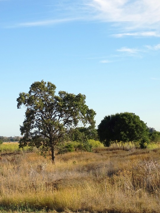
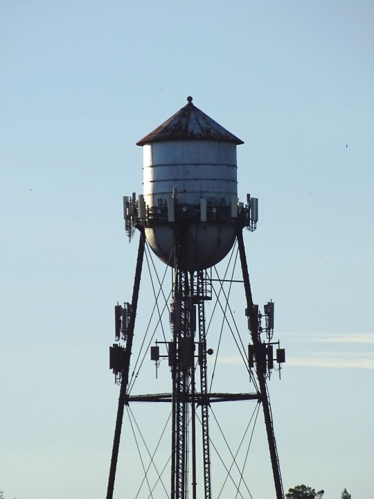
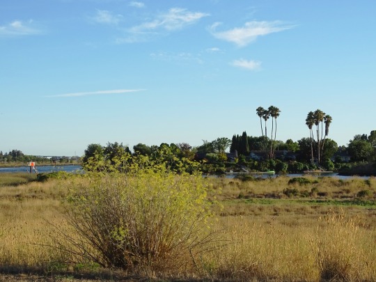


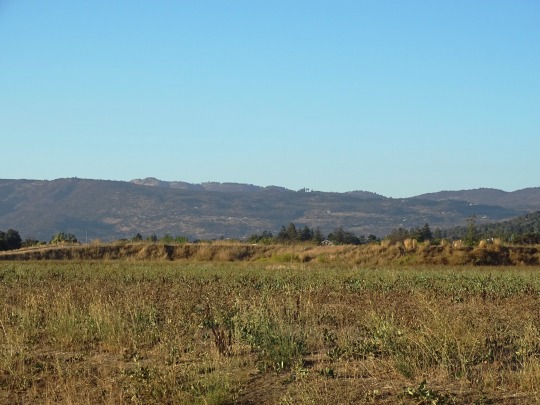


Napa Valley Vine Trail, CA (No. 4)
It’s remarkable how a single trail brings together an entire region. As California’s Napa Valley Vine Trail grows to reach its ultimate 47-mile potential, community members and visitors realize the beauty of connectivity and accessibility.
Chuck McMinn, founder and president of the Napa Valley Vine Trail Coalition, championed the trail—a vision of practicality and aesthetics—from the beginning. When vacationing throughout the world, McMinn says he and his wife always made it a point to rent bicycles to explore the region. Living in the scenic Napa Valley, he said it struck him, “Why don’t we have a trail like these other places?”
Napa Valley is synonymous with the green, rolling hillsides of classic wine country. There’s a particular appeal to walking or biking between the long-established vineyards, creating a deeper relationship between the people utilizing the trail with the grape growers and vintners who are the heart of the region.
Launched in 2008, the trail currently covers nearly 20 miles, which are open in a few disconnected sections. Beginning in Vallejo, the trail travels north through the City of Napa and its Rail Arts District, an outdoor art exhibit. Lined with vineyards, the paved pathway continues to Yountville, paralleling the Napa Valley Wine Train and State Route 29, offering a safer alternative to sharing the road with vehicles.
In 2022, the gap between Vallejo and the City of American Canyon on the southern end of the route, as well as the section between St. Helena and Calistoga on the northern end, will open, adding another 12 miles. The remaining 15 miles is in the works. By the project’s completion, anticipated by 2025, the Vine Trail will connect two counties (Napa and Solano), five cities and one town, and will link to two expansive regional projects, the Bay Area Ridge Trail and the San Francisco Bay Trail.
“I can’t say enough good things about this project,” said Joel King, board member of the Napa County Bicycle Coalition and avid Vine Trail cyclist. “There are so many benefits.”
King said prior to his retirement, he bicycled daily to work, and now appreciates the opportunity to pedal into town for errands, as well as use the trail for recreation. Although King is a lifelong bicycling enthusiast, the Napa Valley Vine Trail holds an appeal for all types of trail users, particularly because many residents live within just a half-mile from the route.
“You see a lot of regular people riding on it,” commented King. “The Vine Trail makes it so easy for people to get on the trail and go. You can go car free through the entire Napa Valley.”
Source
#California live oak#Napa Valley Vine Trail#Napa Valley#Napa#Napa River#evening light#travel#original photography#vacation#tourist attraction#landmark#cityscape#landscape#countryside#flora#floeer#tree#palm tree#river bank#USA#California#West Coast#wine country#summer 2022#evening stroll#blooming#nature#meadow#hills#architecture
0 notes
Text
Hatteras Island to Virginia
Tuesday, March 12, 2024 We start the morning with a long walk on the beach.
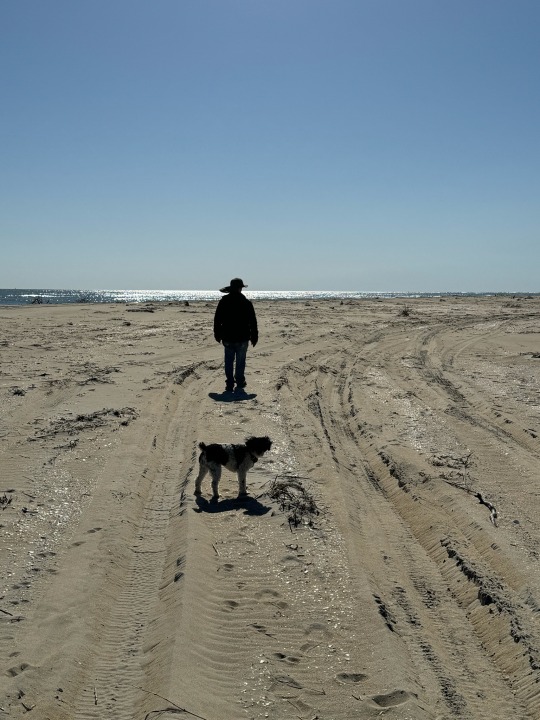
The wind has made striking patterns on the sand.



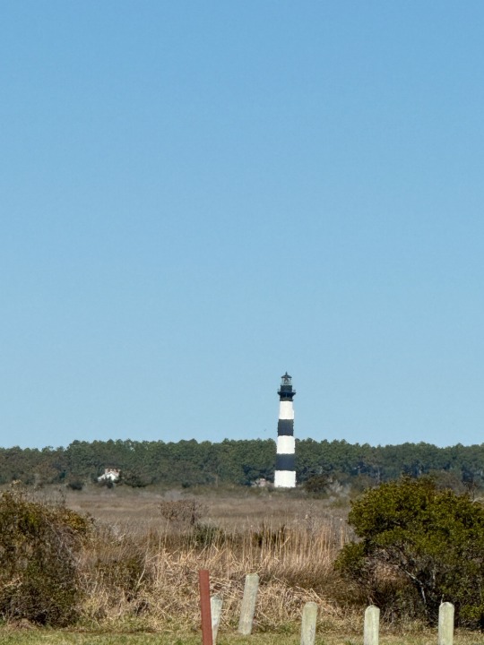
Another historic lighthouse in the distance. I think it is the Bodie Island Lighthouse, but we never got close enough to see the signs.
We watch the birds. I had a hard time picking the one video per entry that Tumblr allows, but finally settled on the brown pelican soaring. (The videos of Dora running on the beach were really cute too.)
We pack up and head for Virginia over the Chesapeake Bay Bridge. It's a long flat bridge over the water with two tunnels under the shipping channels and an arching bridge at the Virginia end.

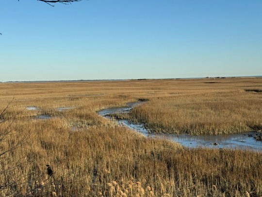
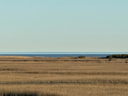
We camp at a rest area at end of the bridge. It's a quiet area at this time of year. There are nature trails out of the truck parking area, so we go for a walk down to the marsh.
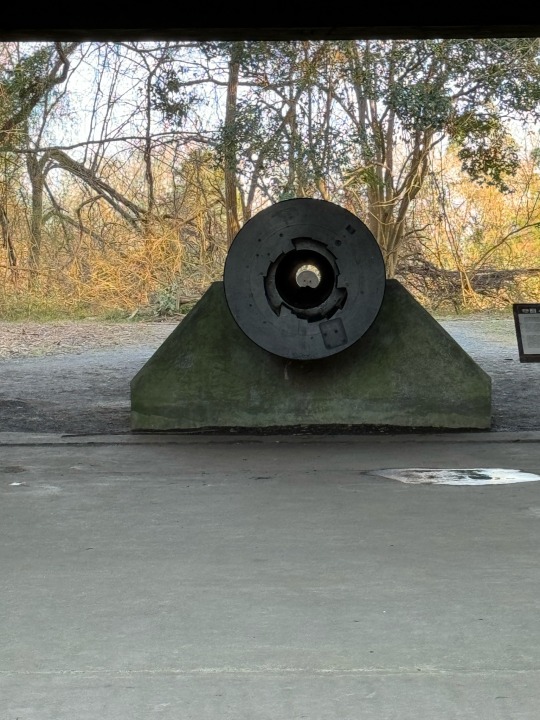
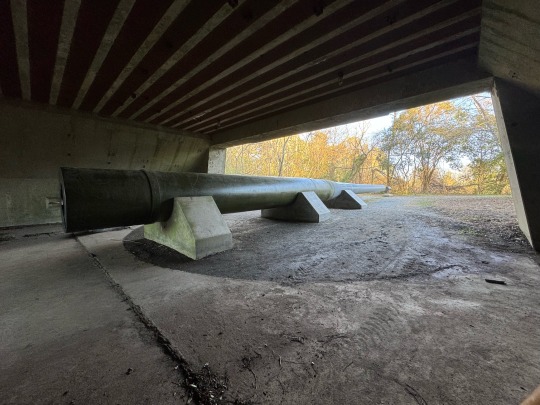
There is a historic WW2 cannon aimed out at the bay. The four-lane highway goes over it. The approach is an interesting photo with the shell at the end of the circle. But as I walked around the cannon, it was huge! Keep in mind, this is an obscure rest area on a not very traveled, not divided highway. No signs, nothing. It was fabulous.
There is a long staircase up to a lookout on a steep ridge with sweeping views of the marshes out to Chesapeake Bay.
Wednesday we got up early and headed for home. We made it -- it was the usual NJ, NY, CT, MA run, so I'm not writing it up.
0 notes
Text
Best Places Around the Area to See Fall Foliage!

Autumn’s natural glory will soon be ablaze with color, making it a great time to plan your leaf-peeping. Mid-October is generally the best time to start seeking out fall foliage, and the colors can continue well into November. For an animated map showing the progression of color across the U.S., check out this online illustration from The Farmer’s Almanac.
So where should you go locally to experience autumn at its finest? Here we offer some of the best spots in the DMV for photographing fall scenery – whether it’s for dynamic social media posts, placing your pictures in a frame, or just taking snapshots with your mind.
Tidal Basin
Washington, D.C.
Spanning 107 acres, but just 10 feet deep, the Tidal Basin is well known for its lovely cherry blossoms in the spring, but in the fall these same trees turn a beautiful orange and gold! Enjoy a stroll around an easy two-mile loop.
Theodore Roosevelt Island
George Washington Memorial Parkway Arlington, VA
A two-mile path follows the island’s shore, moving into the swamp and tidal inlet where nature frames views of Washington, D.C. Buy the book “Finding Solace at Theodore Roosevelt Island” by Melanie Choukas-Bradley for an even more meaningful meander.
State Arboretum of Virginia
Blandy Experimental Farm Boyce, VA
Virginia’s State Arboretum spans 172 acres of tree and shrub collections dating back to the early 1930s. You can also experience the glorious golden 300 tree Ginkgo grove every fall.
Georgetown’s Cobblestone neighborhoods
Georgetown, D.C.
Georgetown is renowned for federalist architecture, cobblestone streets, and historic brick and frame row houses, some of which date to the mid-1700s. It’s also an origination point for the historic C & O Canal, a National Park which runs 184.5 miles into Cumberland, Md. Enjoy a fall stroll and consider taking a guided tour.
Rock Creek Park
Washington, D.C.
Created in 1890, Rock Creek Park is the oldest urban park in the National Park Service. Its 1,754 acres generally follows the Potomac River tributary of Rock Creek and includes a golf course, equestrian trails, an amphitheater, and picnic and playground facilities. It also includes Peirce Mill, a water-powered grist mill built in the 1820s.
Seneca Creek State Park
Gaithersburg, MD
More than 50 miles of trails wind through a variety of habitat, including the 90-acre Clopper Lake. A restored 19th-century cabin adds charm to your fall photographs.
Great Falls Park
McLean, VA
Three overlooks within a short walk front the Great Falls Park Virginia Visitor Center allow for spectacular scenery. Two of the overlooks are handicap and stroller accessible.
Great Falls Park
Potomac, MD
Visit the Great Falls Tavern Visitor Center on the Maryland side of Great Falls Park, located at mile 14.3 along the C&O Canal towpath in Montgomery County, Md.
Shenandoah National Park
Luray, VA
Located in the Blue Ridge Mountains of Va., the park stretches 105 miles from the northern entrance in Front Royal to the southern entrance near Waynesboro. Skyline Drive is the main road running the span of the park – a scenic byway that can get especially busy during peak leaf-peeping times.
Harpers Ferry National Historical Park
Harpers Ferry, WV
Almost Heaven, but just a hop, skip, and a jump from the D.C. Metro area, Harpers Ferry is a time capsule nestled in the Blue Ridge mountains where the Shenandoah and Potomac rivers come together and continue eastward to the Chesapeake Bay as the Potomac river. Unfortunately, this fall’s rockslide stabilization project will make the travel to Harpers Ferry a bit tricky, so check your options online or through your favorite phone app.
South Mountain State Park
Boonsboro, MD
This 40-mile park weaves along South Mountain Ridge. Visitors can walk the same paths as the Civil War soldiers who fought at the 1862 Battle of South Mountain, climbing to enjoy breathtaking views.
Rappahannock River Heritage Trail
Fredericksburg, VA
This paved pathway makes for an easy walk, but don’t let the pavement fool you – beautiful views of the Rappahannock River, Old Mill Park, and several historic mills are seen throughout the trail.
#jamierichards#realtorjamier#realestatetips#realestate#realestateagent#realtor#fall#fall foliage#dmv#dmv fall#dmv fall foliage
0 notes