#also i never realized ks borders just four states
Explore tagged Tumblr posts
Photo
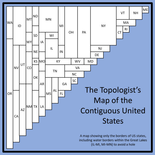
Something I've observed is that, without the water borders in the Great Lakes, this chart could still remain unholed. If WI extended all the way up, cutting off MN from MI, it still shows the Wis/Mich land border, but then for WI-IL-IN-MI-back to WI, filling the hole means these four have land borders one after the other, but no overlaps, creating a second four corners situation. In this way, Lake Michigan is replaced by an instantaneous point, but it still accurately shows land borders.

A topologist map of the US showing all state borders
#geography#topological maps#ig the idea of illinois bordering michigan just feels wrong and this would fix that#also i never realized ks borders just four states#here tx also borders 4 us states#but irl texas ALSO borders 4 Mexican states#and has a substantial coastline#so suck it kansas
833 notes
·
View notes