#UNESCO’s World Heritage
Explore tagged Tumblr posts
Text
"Over 10,000 square miles of additional protected area will be added to the Heard and McDonald Islands in Australia’s far southern territorial waters.
Coupled with other expansions of existing marine sanctuaries, it puts Australia on course to have 52% of its ocean territory protected, more than any other nation, by the end of the current administration’s term.
“This is not just a huge environmental win for Australia, it’s a huge environmental win for the world,” said Australian Environment Minister Tanya Plibersek. “This is a unique and extraordinary part of our planet. We are doing everything we can to protect it.”
Located over 2,000 miles south of the Australian continent, Heard and McDonald Islands make up about 144 square miles of volcanic terrain that represent one of the most remote places on Earth.
They are important breeding grounds for 19 species of bird, including 4 species of penguins, but dozens of other bird species take refuge there. It is a UNESCO Natural Heritage Site, and a RAMSAR Wetland in addition to being an Australian national marine sanctuary.
The quadrupling of the sanctuary borders amounts to 11.5 thousand square miles, (30,000 sq km) of additional protection, but represents one-tenth of the total proposed expansions of marine protected areas.
Under the current guidance, prepared by nationally sanctioned scientific surveys, the total marine protected areas will make up an area the size of Italy.
The current administration of Prime Minister Anthony Albanese is seeking to establish a new environmental protection agency, as well as set a high bar for the country’s commitments to an international philosophy of conservation governance known shorthand as “30×30�� or “30 by 30,” which states that to prevent the worst effects of general environmental degradation worldwide, 30% of land and waters should be under protections. Often the second thirty refers to a hypothetical 2030 deadline."
-via Good News Network, October 10, 2024
#australia#islands#unesco world heritage site#marine protected area#marine sanctuary#30 by 30#birds#environment#environmental news#climate action#climate hope#biodiversity#conservation#good news#hope
2K notes
·
View notes
Photo
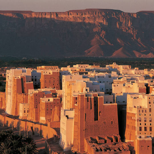
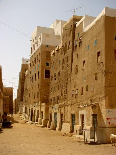


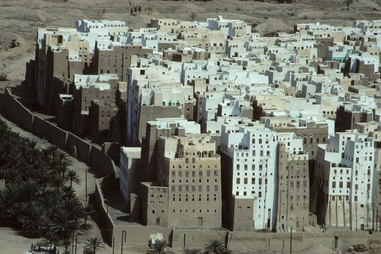
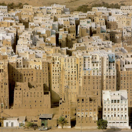

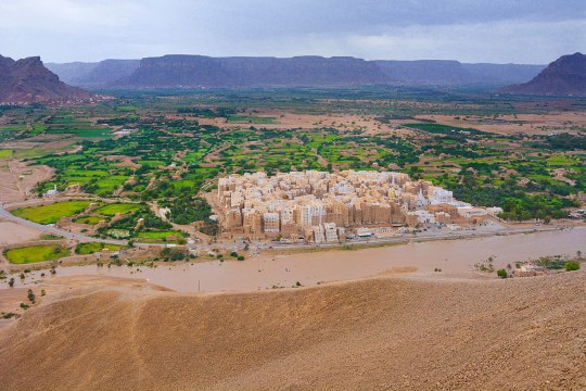
Shibam - This ~1,700-year-old walled city in Yemen is considered to be the oldest vertically constructed city in the world. Its trapezoidal buildings (most were built in the 16th century) are made of mud bricks and need constant maintenance due to rain and wind erosion.
7K notes
·
View notes
Text
Sagrada Família, Barcelona, Spain: The Basílica i Temple Expiatori de la Sagrada Família, otherwise known as Sagrada Família, is a church under construction in the Eixample district of Barcelona, Catalonia, Spain. It is the largest unfinished Catholic church in the world. Wikipedia
#Sagrada Família#Catholic#Minor basilica#Gothic Revival#Art Nouveau#Modernista#Antoni Gaudí#Francisco de Paula del Villar#Barcelona#Catalonia#Spain.#UNESCO World Heritage Site#europe
338 notes
·
View notes
Text
Petra, Jordan: Petra is an historic and archaeological city in southern Jordan. Famous for its rock-cut architecture and water conduit systems, Petra is also called the "Rose City" because of the colour of the sandstone from which it is carved. The city is one of the New 7 Wonders of the World and a UNESCO World Heritage Site. Wikipedia
270 notes
·
View notes
Text
Jim Jim Falls, Northern Territory, Australia: The Jim Jim Falls is a plunge waterfall on the Jim Jim Creek that descends over the Arnhem Land escarpment within the UNESCO World Heritage–listed Kakadu National Park in the Northern Territory of Australia. The Jim Jim Falls area is registered on the Australian National Heritage List. Wikipedia
201 notes
·
View notes
Text

Old Town, Edinburgh, Scotland, United Kingdom: The Old Town is the name popularly given to the oldest part of Scotland's capital city of Edinburgh. The area has preserved much of its medieval street plan and many Reformation-era buildings. Together with the 18th/19th-century New Town, and West End, it forms part of a protected UNESCO World Heritage Site. Wikipedia
191 notes
·
View notes
Text

Kölner Dom Cologne, Germany
#photographers on tumblr#architecture#churches#cologne#germany#köln#chatedrals#cologne cathedral#kölner dom#gothic#unesco world heritage site#world heritage#vertical#original photographers#original photography
251 notes
·
View notes
Text
Hadrian's Wall
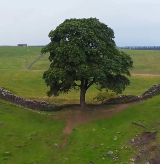
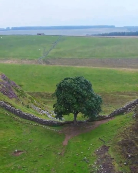
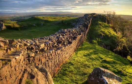
Hadrian's Wall is an impressive masterpiece of military engineering built along steep ups and downs that cross space and history between England and Scotland.
The old wall, sculpted for almost 2000 years by wind and rain, climbs over hills, immerses itself in a moor to suddenly resurface among the blades of light of a wood, a karst presence that seems to absorb the energy of landscape to challenge its gravity and logic in a rollercoaster of harsh ups and downs that cross space and history.
Hadrian's Wall is no longer England but it is not yet Scotland, even if the land to the north seems wilder.
But perhaps it is just a state of mind of those who look at it, subtly altered by the emotion of treading the same stones on which the Roman legionaries walked.
In reality, unlike what many believe, the Wall is within English territory, even if it has helped define the borders of the two countries since the emperor from whom it takes its name ordered its construction in 122 AD to "separate the Romans from the barbarians," the hostile tribes of the Picts who populated today's Scotland, a tough nut to crack even for the Roman legions.
To build it in just six years, about fifteen thousand men were employed, three legions that faced the challenges of a terrain carefully chosen to exploit its advantages.
The result is an impressive masterpiece of military engineering, a UNESCO World Heritage Site since 1987, stretching from one coast of England to the other for eighty Roman miles, about one hundred and seventeen kilometers from Solway Firth to the west and Wallsend to the east.
It is one of the many place names linked to its existence and then extending southwards with ports and coastal fortifications.
For nearly three centuries, Hadrian's Wall was northernmost and most fortified boundary of the Roman limes, a gigantic defensive system that stretched for over five thousand kilometres — from the Atlantic coast of Great Britain to the Black Sea across Europe — then continuing through present-day Middle East to Red Sea and from there cutting across North Africa to the Atlantic.
The 117km long (80 Roman miles) Hadrian's Wall was punctuated by 14 main forts, 80 minor ones and 2 watchtowers every third of a mile.
In addition to the actual wall, mainly made of stone, about 5m high and up to 3m thick, becoming six metres thick in the earthen sections, the Wall was reinforced by a ditch bristling with pointed stakes, a military road that connected the forts and allowed any point to be reached quickly and by a deep embankment, the Vallum.
The forts, rectangular in plan, varied in size according to the importance of the garrison, a pattern repeated with slight differences along the entire limes that protected the borders of the empire.
A moat and a wall punctuated by towers protected the perimeter and each side had a gate protected by two massive towers.
Inside were the headquarters — the praetorium where the praefectus castrorum reside; barracks; a hospital; warehouses and latrines, generally under the walls, while the bathrooms were outside the fortifications.
In granary, food supplies were stored to face the harsh winters or possible sieges.
In the Vicus, the civilian settlement, lived the families of the soldiers, often auxiliaries who officially could not marry.
In these villages that grew spontaneously around the forts, merchants, artisans and prostitutes also lived, attracted by the soldiers' wages.
There were also temples dedicated to Roman, local and even oriental deities that reflected the different religions of soldiers from all over the empire because Romans were very tolerant as long as the social order and the emperor were not questioned.
🎥: © pindropandhop via IG
#Hadrian's Wall#England#Scotland#Emperor Hadrian#Britannia#defensive fortification #stonewall#UNESCO World Heritage Site #British cultural icon#military engineering
85 notes
·
View notes
Text
Brazil's Lencois Maranhenses National Park, famed for its white dunes that fill with blue and emerald lagoons in the rainy season, was on Friday declared a UNESCO World Heritage Site. The vast park, named for the dunes' resemblance to a bedsheet spread across the landscape—"lencois" means sheets in Portuguese—is located in the northeastern state of Maranhao, in a transition zone between the Amazon, Cerrado, and Caatinga biomes. The decision was taken during the 46th annual meeting of the United Nations World Heritage Committee, which is taking place in India's capital New Delhi.
Continue Reading.
#Science#Environment#Conservation#UNESCO World Heritage Site#Lencois Maranhenses National Park#Brazil
84 notes
·
View notes
Text
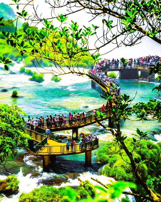
Iguazú National Park, Argentina: The Iguazú National Park is a national park of Argentina, located in the Iguazú Department, in the north of the province of Misiones, Argentine Mesopotamia. It has an area of 677 km2. The area of the park was inhabited 10,000 years ago by the hunter-gatherers of the Eldoradense culture. They were displaced around 1,000 CE by the Guaraní, who brought new agricultural technologies..Wikipedia
#Iguazú National Park#Misiones Province#Argentine Mesopotamia#Argentina#UNESCO World Heritage Site#south america#south american continent
112 notes
·
View notes
Text

H A L L S T A T T
#hallstatt#village#aldea#lake#lago#unesco#world heritage#patrimonio mundial#salzkammergut#austria#europe#europa
353 notes
·
View notes
Text

Ancient Laurels, Fanal Forest
Madeira’s Fanal forest, a UNESCO World Heritage Site, is known for it’s ancient laurel forest, some of the trees as old as 500 years. Once covering southern Europe, these trees can now only be found on the island of Madeira, the Canary Islands and parts of southern Portugal. Fanal is well known for an almost constant presence of fog, which we were lucky to experience here, to create a further sense of mystery to these beautiful trees.
By Optimal Focus Photography
#optimal focus photography#photographer#ancient laurels#flickr#fanal forest#forest#madeira#unesco world heritage site#nature#landscape#trees
52 notes
·
View notes
Text
Huangshan Mountains, China: Huangshan is a mountain range in southern Anhui province in eastern China. It was originally called "Yishan", and it was renamed because of a legend that Emperor Xuanyuan once made alchemy here. Vegetation on the range is thickest below 1,100 meters, with trees growing up to the treeline at 1,800 meters. The area is well known for its scenery, sunsets, peculiarly-shaped granite peaks, Huangshan pine trees, hot springs, winter snow and views of the clouds from above. Wikipedia
#Huangshan Mountains#Mt. Huangshan#Mount Huangshan#Huangshan#Anhui province#eastern China#china#UNESCO World Heritage Site#Asia
201 notes
·
View notes
Text

there is a basilica in aquileia that has an ancient roman mosaic of a giant bowl of mushrooms on the floor and i have to admit, nothing would make me feel closer to god than that
#it's a unesco world heritage site now btw.#tagamemnon#queueusque tandem abutere catilina patientia nostra
504 notes
·
View notes
Text

Budj Bim Cultural Landscape, Victoria, Australia: The Budj Bim Cultural Landscape is located in the traditional Country of the Gunditjmara Aboriginal people in south-eastern Australia. The three serial components of the property contain one of the world's most extensive and oldest aquaculture systems... Budj Bim, also known as Mount Eccles, is a dormant volcano near Macarthur in southwestern Victoria, Australia. It lies within the geologically-defined area known as the Newer Volcanics Province, which is the youngest volcanic area in Australia and stretches from western Victoria to south-eastern South Australia. Wikipedia
#Budj Bim Cultural Landscape#Budj Bim#Youngest volcanic area#Aboriginal cultural#UNESCO World Heritage#Newer Volcanics Province#Victoria#Australia#oceania#oceania continent
78 notes
·
View notes
Text

Reims Cathedral, Reims, France: Notre-Dame de Reims, known in English as Reims Cathedral, is a Roman Catholic cathedral in the French city of the same name, the archiepiscopal see of the Archdiocese of Reims. The cathedral was dedicated to the Virgin Mary and was the traditional location for the coronation of the kings of France. Wikipedia
148 notes
·
View notes