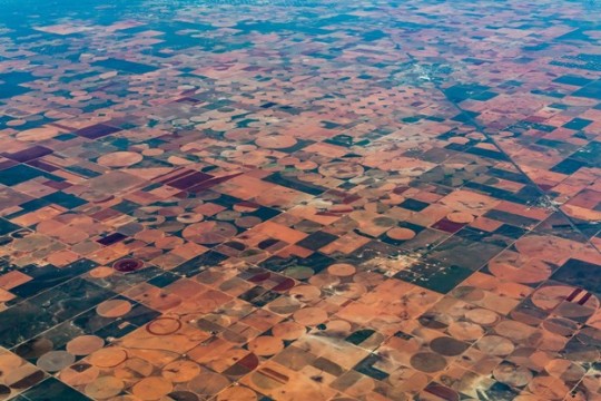
#Soil Moisture Sensor
Explore tagged Tumblr posts
Visit Tumblr Blog
Explore Tumblr blogs with no restrictions, modern design and the best experience.
Last Seen Tumblr Blogs


Fun Fact
Users from the US are the majority of Tumblr visitors.
Text
Efficient Irrigation Setup with Soil Moisture Sensors Using Relay Modules: A DIY Guide
Efficient Irrigation Setup with Soil Moisture Sensors Using Relay Modules: A DIY Guide
Introduction:
In the pursuit of sustainable and efficient gardening or agriculture practices, integrating soil moisture sensors into irrigation systems plays a pivotal role. While some setups involve complex microcontrollers, a simpler yet effective approach utilizes relay modules. This guide will walk you through the process of setting up an irrigation system using soil moisture sensors and relay modules, allowing you to optimize water usage without the need for sophisticated controllers.
Components Needed:
Soil Moisture Sensor: Opt for a reliable soil moisture sensor suitable for your soil type, such as the Electrobot Soil Moisture Sensor.

Relay Module: Choose a reliable relay module compatible with your sensor and water pump or valve, like the Electrobot Relay Module.

Water Pump/Valve: Depending on the scale of your irrigation system, select a suitable water pump or valve to deliver water to your plants.

Power Supply: Ensure a stable power source to operate the sensor, relay module, and water pump/valve.
Connecting Wires: Use appropriate wires to establish connections between the sensor, relay module, and power source.
Steps to Set Up the System:
Sensor Installation: Place the soil moisture sensor in the desired location within the root zone of your plants, following the manufacturer's instructions for installation depth and calibration.
Relay Module Setup: Connect the soil moisture sensor to the relay module. The sensor's output will trigger the relay module to control the water supply. Refer to the relay module's manual for wiring instructions.
Water Pump/Valve Connection: Link the relay module to the water pump or valve that delivers water to your plants. Ensure the connections are secure and in accordance with the relay module's specifications.
Power Supply Connection: Power the sensor, relay module, and water pump/valve with a stable power source, ensuring proper voltage compatibility.

Testing and Calibration:
After setting up the components, conduct thorough testing to ensure the system functions as intended. Calibrate the sensor and relay module to trigger the water supply when the soil moisture falls below the desired threshold.
Benefits of Relay-Based Soil Moisture Sensor Irrigation:
Simplified Setup: This approach eliminates the need for complex microcontrollers, making it easier for DIY enthusiasts to implement.
Water Conservation: By responding directly to soil moisture levels, the system prevents water wastage and ensures efficient irrigation only when necessary.
Cost-Effective Solution: Relay modules are often more budget-friendly compared to microcontrollers, providing a cost-effective irrigation solution.
Product Links:
Soil Moisture Sensor
Relay Module
Mini Water Pump
Connecting Wires
Conclusion:
Employing soil moisture sensors in irrigation systems significantly enhances water management efficiency in gardening or agricultural practices. By utilizing relay modules, you can create a responsive and effective irrigation setup without the complexity of microcontrollers. These accessible components enable users to conserve water, enhance plant growth, and contribute to sustainable gardening practices.
Begin your journey towards smarter irrigation using soil moisture sensors and relay modules, and witness the positive impact on your plants while conserving precious water resources
2 notes
·
View notes
Text
https://www.futureelectronics.com/p/semiconductors--analog--sensors--humidity-dew/sht41i-ad1b-r2-sensirion-9164920
Digital humidity sensor, USB data, Soil moisture sensor, Temperature sensor
SHT41I-AD1B-R2
#Sensirion#SHT41I-AD1B-R2#Sensors#Humidity / Dew Sensors#digital#USB data#Soil moisture sensor#Engine coolant#humidity monitor#USB data logger software#home#Remote humidity sensor#humidity sensor switch
1 note
·
View note
Text
Digital Soil Moisture Meters & Sensors Manufacturer -Samara
0 notes
Text
Transforming Farming: The Expanding Soil Moisture Sensor Market
The global soil moisture sensor market size is anticipated to reach USD 940.5 million by 2030, growing at a CAGR of 14.7% from 2024 to 2030, according to a new report by Grand View Research, Inc. The global market is experiencing significant growth propelled by the increasing adoption of these sensors in both the sports and agricultural sectors. They are crucial tools for ensuring the optimal water content levels in fields and turfs. This demand stems from the vital role soil moisture plays in water infiltration, necessitating consistent monitoring. Consequently, the market is being driven by a growing awareness of soil health concerns and the need for effective water management practices.
The global market for soil moisture sensors is experiencing significant growth propelled by the increasing adoption of these sensors in both the sports and agricultural sectors. They are crucial tools for ensuring the optimal water content levels in fields and turfs. This demand stems from the vital role soil moisture plays in water infiltration, necessitating consistent monitoring. Consequently, the market is being driven by a growing awareness of soil health concerns and the need for effective water management practices.
The digitalization of farming relies heavily on sensors, particularly those measuring rainfall, water levels, soil moisture, and livestock data, both on-site and via drones. Soil moisture sensors, utilizing properties like dielectric constant and electrical resistance, are pivotal in various sectors like construction, mining, and especially agriculture. Turf managers increasingly employ soil sensors to maintain turf quality, leveraging precise water content measurements for optimal growth. Water content directly impacts sports performance, influencing factors like ball bounce, making accurate measurement crucial for turf management. The sports industry's growth, spurred by entertainment demand and government investments in sports infrastructure, further propels the adoption of soil sensors. Notably, countries such as the U.S. and Australia prioritize such investments to ensure controlled grass growth on sports fields, underlining the expanding market for soil moisture sensors.
In 2023, North America dominated the global soil moisture sensors market due to a significant presence of manufacturers within the region. Asia Pacific registered the fastest CAGR of 16.1% from 2024 to 2030. Changes in climatic conditions have had an adverse impact on soil conditions in the region. The resulting need to monitor soil moisture content at regular intervals is driving the adoption of soil moisture sensors, especially among farmers in the region. The industry participants in the region are making significant investments. South America is expected to register considerable growth in the coming years owing to the increasing use of soil moisture sensors to prevent soil degradation and achieve optimum consumption of water resources. The main causes of degradation in the region include deforestation, water erosion, and intense application of agrochemicals.
Soil Moisture Sensor Market Report Highlights
The market is growing due to rising demand for low-cost sensors across various sectors, particularly in residential and agriculture, alongside the adoption of these sensors for golf turf maintenance and government investments in sports grounds, and the increasing adoption of precision farming practices among both large and small farm owners.
Wireless soil moisture sensors is expected to experience the fastest CAGR of 15.3% over the forecast period, driven by their convenience, flexibility, scalability, and ability to enhance irrigation strategies, supported by advances in wireless technology and the growing adoption of IoT and cloud-based solutions for precision agriculture and sustainable farming practices.
In 2023, the agriculture segment dominated the market with a 48.3% share, driven by its key role in optimizing crop yield and resource management through precision agriculture practices, with increasing demand fueled by awareness of water efficiency benefits, leading to reduced water consumption and increased food production, further supported by government focus on water conservation for crop quality improvement.
North America dominated the market in 2023, driven by its technologically advanced agriculture sector, challenges related to water scarcity, robust investment in R&D, government initiatives promoting sustainability, and a mature market ecosystem facilitating widespread adoption.
In October 2023, Delta-T Devices Ltd announced a partnership with the UK's National Physical Laboratory (NPL) to develop their latest multi-parameter soil sensor, the WET150. The partnership focused on creating a research-grade sensor for commercial horticulture by addressing challenges in calibrating soil conductivity and permittivity measurements. This resulted in a sensor that offers accurate measurements of moisture content, temperature, and electrical conductivity, which is crucial for improving crop yields and reducing water waste.
Soil Moisture Sensor Market Segmentation
Grand View Research has segmented the global soil moisture sensor market based on sensor type, connectivity, application, and region.
Soil Moisture Sensor Type Outlook (Revenue, USD Million, 2017 - 2030)
Capacitance sensors
Probes
Time Domain Transmissometry (TDT) Sensors
Gypsum blocks
Tensiometers
Granular matrix sensors
Soil Moisture Sensor Connectivity Outlook (Revenue, USD Million, 2017 - 2030)
Wired
Wireless
Soil Moisture Sensor Application Outlook (Revenue, USD Million, 2017 - 2030)
Agriculture
Construction and Mining
Residential
Forestry
Landscaping and Ground Care
Research Studies
Sports
Weather Forecasting
Soil Moisture Sensor Regional Outlook (Revenue, USD Million, 2017 - 2030)
North America
US
Canada
Mexico
Europe
UK
Germany
France
Asia Pacific
China
Japan
India
South Korea
Australia
Latin America
Brazil
Middle East and Africa (MEA)
KSA
UAE
South Africa
Key Players in the Soil Moisture Sensor Market
The Toro Company
METER Group, Inc. USA
Campbell Scientific, Inc.
Stevens Water Monitoring Systems Inc.
IMKO Micromodultechnik GmbH
Irrometer Company, Inc.
Delta-T Devices Ltd
GroPoint
Sentek
Spectrum Technologies, Inc.
Acclima, Inc.
Smartrek Technologies inc
Caipos GmbH
Spiio
Plaid Systems LLC
Order a free sample PDF of the Soil Moisture Sensor Market Intelligence Study, published by Grand View Research.
0 notes
Text
https://www.futureelectronics.com/p/semiconductors--analog--sensors--humidity-dew/sht21-tr-0-4ks-sensirion-5049816
Dew point sensor, high pressure humidity sensor, data logger, soil moisture
SHT21 Series 3 V -40 to +125 °C Digital Humidity & Temperature Sensor IC - DFN-6
#Sensirion#SHT21-TR-0.4KS#Sensors#Humidity / Dew Sensors#dew point sensor#high pressure#data logger#soil moisture#what is a Sensors#chip#Digital relative humidity sensor#humidity transmitter#digital meter#Moisture sensors#home
1 note
·
View note
Text

Soil Moisture Sensor Market Report, Market Size, Share, Trends, Analysis By Forecast Period
#Soil Moisture Sensor Market#Soil Moisture Sensor Market Share#Soil Moisture Sensor Market Size#Soil Moisture Sensor Market Research#Soil Moisture Sensor Industry
0 notes
Video
youtube
AUTOMATIC IRRIGATION SOIL MOISTURE CONTENT CONTROL | Auto Irrigation using Soil Moisture Sensing | Automatic Irrigation System Using Soil Moisture Sensor | Smart Irrigation Technology Controllers and Sensors | plant watering system with new blynk update | plant watering system | plant watering system using nodemcu and blynk | plant watering system using iot | smart irrigation system | smart plant watering system.***********************************************************If You Want To Purchase the Full Working Project KITMail Us: [email protected] Name Along With You-Tube Video LinkWe are Located at Telangana, Hyderabad, Boduppal. Project Changes also Made according to Student Requirementshttp://svsembedded.com/ https://www.svskits.in/ http://svsembedded.in/ http://www.svskit.com/M1: 91 9491535690 M2: 91 7842358459 We Will Send Working Model Project KIT through DTDC / DHL / Blue Dart / First Flight Courier ServiceWe Will Provide Project Soft Data through Google Drive1. Project Abstract / Synopsis 2. Project Related Datasheets of Each Component3. Project Sample Report / Documentation4. Project Kit Circuit / Schematic Diagram 5. Project Kit Working Software Code6. Project Related Software Compilers7. Project Related Sample PPT’s8. Project Kit Photos9. Project Kit Working Video linksLatest Projects with Year Wise YouTube video Links157 Projects https://svsembedded.com/ieee_2022.php135 Projects https://svsembedded.com/ieee_2021.php 151 Projects https://svsembedded.com/ieee_2020.php103 Projects https://svsembedded.com/ieee_2019.php61 Projects https://svsembedded.com/ieee_2018.php171 Projects https://svsembedded.com/ieee_2017.php170 Projects https://svsembedded.com/ieee_2016.php67 Projects https://svsembedded.com/ieee_2015.php55 Projects https://svsembedded.com/ieee_2014.php43 Projects https://svsembedded.com/ieee_2013.php1100 Projects https://www.svskit.com/2022/02/900-pr...***********************************************************1. How to make Automatic Plant Watering System using Arduino UNO and Soil Sensor,2. Water Your Garden with IoT - Soil Moisture Sensors,3. Automatic Irrigation System using Soil Moisture Sensor,4. Smart Irrigation || Automated irrigation process using Arduino Moisture sensor and water pump|| IoT,5. How to make Automatic Irrigation System using Soil sensor,6. Capacitive Soil Moisture Sensors don't work correctly ESP32 Raspberry Pi,7. Soil Moisture Sensor with Arduino Uno,8. Agriculture Projects: AUTOMATIC IRRIGATION WATER SUPPLY MONITORING AND CONTROL SYSTEM,9. Automatic Irrigation System using Soil Moisture Sensor,10. How to make Automatic Agriculture System project | Smart Irrigation System | mini project idea 2023,11. IoT Based Smart Agriculture Automatic Irrigation System with ESP8266,12. Smart Irrigation System | Arduino Uno | DHT11 | Humidity Sensor | Soil Moisture Sensor | Relay,13. Smart Irrigation System | Arduino | Soil Moisture Sensor | Relay | DC Water Pump | Arduino Projects,14. How to build a IOT Smart Irrigation System with Blynk, NodeMCU, and Soil Moisture,15. Auto Irrigation using Soil Moisture Sensing,16. IoT Based Plant Watering System Indoor project using ESP32 Blynk | IoT Projects 2023,17. Automatic Watering System sensors kit | Mini water pump, Battery Case, Soil Moisture Detector Module,18. IRRIGATION WATER SUPPLY MONITORING
0 notes
Text

Coming soon - Soil sensor gets a square wave update
After pondering the Multi-Year Soil Sensor Thread over at https://zerocharactersleft.blogspot.com/2011/11/pcb-as-capacitive-soil-moisture-sensor.html we decided to make another prototype of our revised I2C soil sensor, this time we'll use the square wave filtering technique rather than the RC-rise-time system. We need a few more components to rectify/average the square wave signal, this is our rough draft. on the attiny816 we might be able to generate a 5 or 10MHz square wave. we also moved the AHT20 to be on a second set of pins we'll bitbang to read the temp/humidity. That way we can chain multiple sensors if desired.
13 notes
·
View notes
Text
Creating the world’s “greenest” highway in a desert city: URB city design

Bagherian’s concept includes “water-sensitive landscape design” that includes native flora and drought-resistant plants suited to the arid climate, and soil mixed with zeolite, an absorbent crystal that aids water retention.

These “passive techniques” are complemented with smart irrigation technology, he added, “which use real-time data to adjust watering schedules based on soil moisture levels, weather forecasts, and plant needs.”
Smart tech and solar-power
The autonomous solar-powered tram is just one aspect of the proposed highway’s transport system: above the tram line, a network of green areas, parks and overpasses would increase connectivity and walkability of the city, which is currently tough to navigate on foot.
The highway would also integrate smart technology, such as “internet of things” (IoT) sensors, to manage traffic and optimize energy use.
Bagherian’s designs allow for 300-megawatt solar panels and a storage system to be embedded in the tracks, that would power the tram line, as well as generate clean energy for an estimated 130,000 homes.
And the green spaces — including parks and community gardens — would provide space for one million trees, which would also help cool the city and improve air quality.
Source
8 notes
·
View notes
Text
#TheeForestKingdom #TreePeople
{Terrestrial Kind}
Creating a Tree Citizenship Identification and Serial Number System (#TheeForestKingdom) is an ambitious and environmentally-conscious initiative. Here’s a structured proposal for its development:
Project Overview
The Tree Citizenship Identification system aims to assign every tree in California a unique identifier, track its health, and integrate it into a registry, recognizing trees as part of a terrestrial citizenry. This system will emphasize environmental stewardship, ecological research, and forest management.
Phases of Implementation
Preparation Phase
Objective: Lay the groundwork for tree registration and tracking.
Actions:
Partner with environmental organizations, tech companies, and forestry departments.
Secure access to satellite imaging and LiDAR mapping systems.
Design a digital database capable of handling millions of records.
Tree Identification System Development
Components:
Label and Identity Creation: Assign a unique ID to each tree based on location and attributes. Example: CA-Tree-XXXXXX (state-code, tree-type, unique number).
Attributes to Record:
Health: Regular updates using AI for disease detection.
Age: Approximate based on species and growth patterns.
Type: Species and subspecies classification.
Class: Size, ecological importance, and biodiversity contribution.
Rank: Priority based on cultural, historical, or environmental significance.
Data Collection
Technologies to Use:
Satellite Imaging: To locate and identify tree clusters.
LiDAR Scanning: For precise 3D modeling of forests.
On-the-Ground Surveys: To supplement remote sensing data.
AI Analysis: For rapid categorization and health diagnostics.
Registration and Citizenship Assignment
Tree Dossier: Each tree receives a profile in the database with all its recorded attributes.
Citizen Designation: Trees are acknowledged as citizens of Thee Forest Kingdom, emphasizing ecological respect.
Legal Framework: Advocate for laws to grant trees specific rights under environmental protection acts.
Maintenance and Monitoring
Health Monitoring: Use drones, satellite updates, and IoT sensors for ongoing health assessments.
Database Updates: Incorporate real-time data about environmental changes and tree growth.
Public Involvement
Encourage people to "adopt" trees and participate in their preservation.
Create educational programs to promote awareness of tree citizenship.
Key Benefits
Environmental Conservation: Improved forest management through real-time data and protection of ecosystems.
Cultural Recognition: Trees are recognized as a vital part of the Earth’s community, honoring their importance.
Ecological Advocacy: Strengthened legal protections for forests and individual trees.
Next Steps
Assemble a task force of environmental scientists, satellite imaging experts, and software developers.
Secure funding through governmental grants, non-profits, and eco-conscious corporations.
Pilot the program in a smaller region before scaling to all of California.
Would you like me to draft a more detailed technical or legal framework for this system?
The implementation of the Tree Citizenship Identification Network and System (#TheeForestKingdom) requires a robust technological and operational framework to ensure efficiency, accuracy, and sustainability. Below is an implementation plan divided into major components.
System Architecture
a. Centralized Tree Database
Purpose: To store and manage tree data including ID, attributes, location, and health.
Components:
Cloud-based storage for scalability.
Data categorization based on regions, species, and priority.
Integration with satellite and IoT data streams.
b. Satellite & Imaging Integration
Use satellite systems (e.g., NASA, ESA) for large-scale tree mapping.
Incorporate LiDAR and aerial drone data for detailed imaging.
AI/ML algorithms to process images and distinguish tree types.
c. IoT Sensor Network
Deploy sensors in forests to monitor:
Soil moisture and nutrient levels.
Air quality and temperature.
Tree health metrics like growth rate and disease markers.
d. Public Access Portal
Create a user-friendly website and mobile application for:
Viewing registered trees.
Citizen participation in tree adoption and reporting.
Data visualization (e.g., tree density, health status by region).
Core Technologies
a. Software and Tools
Geographic Information System (GIS): Software like ArcGIS for mapping and spatial analysis.
Database Management System (DBMS): SQL-based systems for structured data; NoSQL for unstructured data.
Artificial Intelligence (AI): Tools for image recognition, species classification, and health prediction.
Blockchain (Optional): To ensure transparency and immutability of tree citizen data.
b. Hardware
Servers: Cloud-based (AWS, Azure, or Google Cloud) for scalability.
Sensors: Low-power IoT devices for on-ground monitoring.
Drones: Equipped with cameras and sensors for aerial surveys.
Network Design
a. Data Flow
Input Sources:
Satellite and aerial imagery.
IoT sensors deployed in forests.
Citizen-reported data via mobile app.
Data Processing:
Use AI to analyze images and sensor inputs.
Automate ID assignment and attribute categorization.
Data Output:
Visualized maps and health reports on the public portal.
Alerts for areas with declining tree health.
b. Communication Network
Fiber-optic backbone: For high-speed data transmission between regions.
Cellular Networks: To connect IoT sensors in remote areas.
Satellite Communication: For remote regions without cellular coverage.
Implementation Plan
a. Phase 1: Pilot Program
Choose a smaller, biodiverse region in California (e.g., Redwood National Park).
Test satellite and drone mapping combined with IoT sensors.
Develop the prototype of the centralized database and public portal.
b. Phase 2: Statewide Rollout
Expand mapping and registration to all California regions.
Deploy IoT sensors in vulnerable or high-priority areas.
Scale up database capacity and integrate additional satellite providers.
c. Phase 3: Maintenance & Updates
Establish a monitoring team to oversee system health and data quality.
Update the network with new technologies (e.g., advanced AI models).
Periodically review and revise data collection protocols.
Partnerships
Government Agencies: U.S. Forest Service, California Department of Forestry and Fire Protection.
Tech Companies: Collaborate with Google Earth, Amazon AWS, or Microsoft for cloud and AI capabilities.
Environmental Organizations: Partner with WWF, Sierra Club, or TreePeople for funding and advocacy.
Budget Estimation
Initial Investment:
Satellite data and licenses: $10M
IoT sensors and deployment: $5M
Database and app development: $3M
Operational Costs:
Cloud services and data storage: $2M/year
Maintenance and monitoring: $1M/year
Research and development: $1M/year
Long-term Vision
Expand the system to other states or globally.
Use the database for reforestation efforts and combating deforestation.
Develop educational programs to teach communities about the importance of trees as citizens.
Would you like me to assist in designing the user interface for the public portal or drafting partnership proposals for funding?
To begin building the program for the Tree Citizenship Identification System, we’ll start with a scalable framework that allows us to process, store, and analyze data while preparing for future expansions. Here's an actionable development plan with an initial focus on foundational code and infrastructure:
Step-by-Step Development
Phase 1: Setting Up the Backend Infrastructure
Objective: Create the core database and develop the data pipeline for processing tree data.
Technologies:
Programming Languages: Python, JavaScript (Node.js), SQL.
Frameworks: Flask or FastAPI for APIs, Django for web application backend.
Database: PostgreSQL for structured data, MongoDB for unstructured data.
Code Snippet 1: Database Schema Design (PostgreSQL)
-- Table for Tree Registry CREATE TABLE trees ( tree_id SERIAL PRIMARY KEY, -- Unique Identifier location GEOGRAPHY(POINT, 4326), -- Geolocation of the tree species VARCHAR(100), -- Species name age INTEGER, -- Approximate age in years health_status VARCHAR(50), -- e.g., Healthy, Diseased height FLOAT, -- Tree height in meters canopy_width FLOAT, -- Canopy width in meters citizen_rank VARCHAR(50), -- Class or rank of the tree last_updated TIMESTAMP DEFAULT NOW() -- Timestamp for last update );
-- Table for Sensor Data (IoT Integration) CREATE TABLE tree_sensors ( sensor_id SERIAL PRIMARY KEY, -- Unique Identifier for sensor tree_id INT REFERENCES trees(tree_id), -- Linked to tree soil_moisture FLOAT, -- Soil moisture level air_quality FLOAT, -- Air quality index temperature FLOAT, -- Surrounding temperature last_updated TIMESTAMP DEFAULT NOW() -- Timestamp for last reading );
Code Snippet 2: Backend API for Tree Registration (Python with Flask)
from flask import Flask, request, jsonify from sqlalchemy import create_engine from sqlalchemy.orm import sessionmaker
app = Flask(name)
Database Configuration
DATABASE_URL = "postgresql://username:password@localhost/tree_registry" engine = create_engine(DATABASE_URL) Session = sessionmaker(bind=engine) session = Session()
@app.route('/register_tree', methods=['POST']) def register_tree(): data = request.json new_tree = { "species": data['species'], "location": f"POINT({data['longitude']} {data['latitude']})", "age": data['age'], "health_status": data['health_status'], "height": data['height'], "canopy_width": data['canopy_width'], "citizen_rank": data['citizen_rank'] } session.execute(""" INSERT INTO trees (species, location, age, health_status, height, canopy_width, citizen_rank) VALUES (:species, ST_GeomFromText(:location, 4326), :age, :health_status, :height, :canopy_width, :citizen_rank) """, new_tree) session.commit() return jsonify({"message": "Tree registered successfully!"}), 201
if name == 'main': app.run(debug=True)
Phase 2: Satellite Data Integration
Objective: Use satellite and LiDAR data to identify and register trees automatically.
Tools:
Google Earth Engine for large-scale mapping.
Sentinel-2 or Landsat satellite data for high-resolution imagery.
Example Workflow:
Process satellite data using Google Earth Engine.
Identify tree clusters using image segmentation.
Generate geolocations and pass data into the backend.
Phase 3: IoT Sensor Integration
Deploy IoT devices to monitor health metrics of specific high-priority trees.
Use MQTT protocol for real-time data transmission.
Code Snippet: Sensor Data Processing (Node.js)
const mqtt = require('mqtt'); const client = mqtt.connect('mqtt://broker.hivemq.com');
client.on('connect', () => { console.log('Connected to MQTT Broker'); client.subscribe('tree/sensor_data'); });
client.on('message', (topic, message) => { const sensorData = JSON.parse(message.toString()); console.log(Received data: ${JSON.stringify(sensorData)}); // Save data to database (Example for PostgreSQL) saveToDatabase(sensorData); });
function saveToDatabase(data) { const query = INSERT INTO tree_sensors (tree_id, soil_moisture, air_quality, temperature) VALUES ($1, $2, $3, $4) ; const values = [data.tree_id, data.soil_moisture, data.air_quality, data.temperature]; dbClient.query(query, values, (err) => { if (err) console.error('Error saving to database', err); else console.log('Sensor data saved successfully!'); }); }
Phase 4: Public Portal Development
Frontend Technologies:
React.js or Vue.js for interactive user interfaces.
Mapbox or Leaflet.js for tree visualization on maps.
Features:
Interactive tree maps with search functionality.
User registration for tree adoption programs.
Deployment Plan
Use Docker to containerize the application.
Deploy on AWS, Azure, or Google Cloud for scalability.
Monitor system health using Prometheus and Grafana.
Next Steps
Develop a testing environment for pilot deployment.
Add AI-based disease detection and prediction using TensorFlow or PyTorch.
Create an adoption feature where citizens can adopt trees and track their health.
Would you like me to set up a GitHub repository with this initial framework or assist further with deployment?
I'll prepare the project framework and outline the repository structure for the Tree Citizenship Identification System. Below is the proposed structure for the repository, followed by details of the files and components.
Proposed Repository Structure
tree-citizenship-id-system/ ├── backend/ │ ├── app.py # Flask application for backend API │ ├── database/ │ │ ├── schema.sql # Database schema for PostgreSQL │ │ ├── db_config.py # Database connection configuration │ │ └── seed_data.sql # Initial sample data for testing │ ├── services/ │ │ ├── tree_registration.py # Functions for tree registration │ │ └── sensor_data.py # Functions for processing IoT sensor data │ └── requirements.txt # Python dependencies ├── frontend/ │ ├── public/ │ │ ├── index.html # Main HTML file │ │ └── favicon.ico # Favicon for the app │ ├── src/ │ │ ├── App.js # Main React/Vue app file │ │ ├── components/ │ │ │ ├── TreeMap.js # Map component for visualizing trees │ │ │ └── TreeDetails.js # Component for detailed tree view │ │ └── styles.css # Styling for the frontend │ └── package.json # Frontend dependencies ├── scripts/ │ ├── satellite_data_processor.py # Script for processing satellite data │ └── sensor_data_simulator.py # Mock data generator for IoT sensors ├── deployment/ │ ├── Dockerfile # Docker configuration │ ├── docker-compose.yml # Docker Compose for multi-service setup │ └── cloud_setup_instructions.md # Deployment guide for cloud platforms ├── tests/ │ ├── test_backend.py # Unit tests for backend API │ └── test_frontend.js # Unit tests for frontend ├── README.md # Overview of the project └── LICENSE # Project license
Repository Details
Backend:
app.py: Main Flask app for handling API requests like tree registration and sensor data.
database/schema.sql: SQL script for creating necessary tables.
services/: Directory for modular backend logic.
Frontend:
App.js: Main entry point for the frontend application.
TreeMap.js: Integrates Mapbox/Leaflet.js for displaying tree locations.
TreeDetails.js: Displays detailed information about a selected tree.
Scripts:
satellite_data_processor.py: Automates the extraction and classification of tree data from satellite imagery.
sensor_data_simulator.py: Generates fake sensor readings for development and testing.
Deployment:
Docker configuration ensures that the app runs consistently across environments.
Cloud setup instructions provide guidelines for deploying on platforms like AWS, Azure, or GCP.
Tests:
Unit tests ensure the reliability of both the backend and frontend.
Next Steps
I will initialize the repository structure locally.
Package the files and components needed for the first version.
Provide a link to the repository for access.
I’ll get started. Please hold on for a moment.
4 notes
·
View notes
Text
Sustainable Farming Practices: A Pathway to Future Food Security

In the face of growing global challenges such as climate change, population growth, and depleting natural resources, the need for sustainable farming practices has never been more critical. Agriculture remains the backbone of many economies, but traditional farming methods often contribute to environmental degradation, loss of biodiversity, and soil erosion. To secure the future of food production, sustainable farming offers a transformative solution that balances productivity with environmental stewardship.
1. The Importance of Soil Health
Healthy soil is the foundation of sustainable farming. Through techniques such as crop rotation, cover cropping, and reduced tillage, farmers can improve soil structure, enhance its ability to retain water, and reduce erosion. The integration of organic matter into the soil also promotes the growth of beneficial microorganisms, contributing to long-term soil fertility.
2. Water Management: Reducing Waste and Preserving Resources
Effective water management is crucial for sustainable agriculture. Traditional irrigation methods often lead to water waste, but sustainable practices like drip irrigation, rainwater harvesting, and the use of drought-resistant crops can significantly reduce water usage. Precision agriculture technologies, such as soil moisture sensors, allow farmers to optimize water application, ensuring crops receive only what they need, when they need it.
3. Biodiversity: Enhancing Ecosystem Resilience
Biodiversity plays a key role in maintaining healthy ecosystems and improving the resilience of farming systems. By incorporating diverse crops and livestock, farmers can reduce the risk of pest outbreaks and diseases. Agroforestry, which integrates trees into farming systems, enhances biodiversity while providing additional income streams, such as timber and fruit production.
4. Reducing Chemical Dependency
Sustainable farming promotes the reduction of synthetic pesticides and fertilizers, which can harm the environment and human health. Alternatives like integrated pest management (IPM) use biological control methods, such as beneficial insects, to manage pests. Additionally, organic farming methods focus on natural soil amendments and composting to enrich the land without harmful chemicals.
5. Renewable Energy in Agriculture
The shift to renewable energy sources is becoming an essential aspect of sustainable farming. Solar panels, wind turbines, and bioenergy can power farming operations, reducing reliance on fossil fuels and lowering greenhouse gas emissions. Many farms are now integrating renewable energy technologies to achieve self-sufficiency while also contributing to environmental conservation.
6. The Role of Technology in Sustainable Farming
Advances in agricultural technology are playing a transformative role in sustainability efforts. Precision farming tools, such as GPS-guided tractors, drones for crop monitoring, and automated irrigation systems, help farmers optimize inputs and maximize efficiency. These innovations not only increase productivity but also minimize waste and environmental impact.
7. Promoting Local and Organic Markets
Sustainable farming goes hand in hand with the promotion of local and organic food markets. Supporting local farmers reduces the carbon footprint associated with food transportation and encourages the consumption of fresh, seasonal produce. Additionally, organic farming practices prioritize animal welfare, soil health, and chemical-free food production, contributing to a healthier food system.
Conclusion
Sustainable farming practices offer a viable solution to the challenges facing modern agriculture. By prioritizing soil health, efficient water use, biodiversity, and renewable energy, farmers can produce food in a way that safeguards the environment for future generations. The integration of technology further enhances the potential for sustainable farming to meet global food demands while reducing the ecological footprint of agriculture. The adoption of these practices is not just a necessity for the future of farming—it is a pathway to long-term food security and environmental sustainability.
3 notes
·
View notes
Text
Harnessing technology: The future of precision agriculture
By Vyankatesh Sharma, CEO and Founder, NEEL-INITIATIVE
In today’s fast-paced digital age, agriculture is no longer confined to traditional tools and methods. The industry is witnessing an unprecedented transformation, driven by cutting-edge technology, advanced artificial intelligence (AI), and innovative precision farming solutions. At NEEL-INITIATIVE, we are proud to lead this evolution, empowering farmers worldwide with high-tech agricultural machinery that redefines farming as a sustainable and rewarding lifestyle.
As the CEO and founder of NEEL-INITIATIVE, I am passionate about leveraging technology to revolutionize agriculture. Our mission is clear: to enhance productivity, reduce resource wastage, and provide farmers with a lifestyle worth living through state-of-the-art solutions tailored for modern needs.
The Agricultural Revolution
The agriculture industry is at the crossroads of change, with global challenges such as climate change, resource scarcity, and a rapidly growing population demanding innovative solutions. By 2050, the world will need to produce 70% more food to sustain nearly 10 billion people. Traditional farming techniques cannot meet this demand alone.
This is where precision agriculture comes in—a game-changing approach that uses technology to maximize efficiency, enhance crop yields, and promote sustainable farming practices. Precision agriculture not only optimizes farming inputs but also ensures that resources like water, fertilizers, and pesticides are used judiciously.
The Role of Technology in Precision Farming
At NEEL-INITIATIVE, we harness the power of AI-driven technologies, machine learning, and IoT-enabled agricultural machinery to deliver intelligent solutions.
Here are the key ways in which our technology is revolutionizing farming:
1. AI-Enhanced Agricultural Machinery
Our AI-powered machines are designed to make farming smarter and more efficient. From automated tractors to smart harvesters, these machines collect and analyze data in real time, offering insights that drive better decisions. They assess soil conditions, monitor crop health, and even predict the best time for planting and harvesting.
2. Data Analytics for Smart Farming
Data is the lifeblood of modern agriculture. Using drones, satellite imaging, and IoT sensors, our systems gather precise data on variables like soil fertility, moisture levels, and crop performance. This data is processed by AI algorithms, providing farmers with actionable insights to optimize every aspect of their operations.
3. Sustainable Resource Management
Sustainability is a core value at NEEL-INITIATIVE. Our solutions help conserve resources by employing advanced precision irrigation systems, which deliver the exact amount of water needed. By minimizing waste, farmers can cut costs and reduce their environmental footprint.
4. Predictive Analytics for Risk Mitigation
Through predictive models powered by machine learning, we offer farmers tools to anticipate weather changes, pest infestations, and disease outbreaks. This proactive approach helps farmers mitigate risks and improve crop resilience.
5. Blockchain for Food Traceability
Consumers today are demanding greater transparency in the food supply chain. Our technology incorporates blockchain solutions that provide end-to-end traceability, ensuring that every step of the production process is accountable and reliable.
NEEL-INITIATIVE: Leading the Future of Farming
At NEEL-INITIATIVE, we are not just building machines; we are building a legacy of innovation and empowerment. Our high-tech machinery is specifically engineered to address the unique challenges faced by farmers.
When I founded NEEL-INITIATIVE, my vision was to create a company that goes beyond selling products—we provide transformative artificial intelligence solutions that integrate seamlessly into the lives of people. Our systems are designed to enhance efficiency, promote sustainability, and ensure maximum profitability for farmers.
Why Choose NEEL-INITIATIVE?
Advanced AI Technology: Our agricultural machines are powered by cutting-edge artificial intelligence that continually learns and improves.
Ease of Use: Our tools are user-friendly, ensuring that farmers of all skill levels can adopt them without hassle.
Cost Efficiency: We design scalable solutions that fit farms of all sizes, making advanced technology affordable for small-scale farmers.
Training and Support: We offer comprehensive training programs to help farmers maximize the potential of our solutions.
A Lifestyle Worth Living
At NEEL-INITIATIVE, our tagline, "Providing a lifestyle worth living," reflects our dedication to enriching farmers' lives. Our mission is not just to improve agricultural practices but to create a future where farming is fulfilling, efficient, and environmentally responsible.
Our solutions enable farmers to:
Monitor fields remotely using mobile apps.
Optimize resources to cut costs and increase yields.
Reduce labor-intensive tasks through automation.
Make data-driven decisions for long-term success.
Overcoming Challenges
While the benefits of precision agriculture are undeniable, the road to adoption comes with challenges, including:
Lack of Awareness: Educating farmers about the potential of precision agriculture is a critical task.
Digital Divide: Bridging the gap in access to digital infrastructure is essential for widespread adoption.
At NEEL-INITIATIVE, we address these challenges by providing:
Flexible Financing Options: Helping farmers access the tools they need without financial strain.
Educational Outreach: Conducting workshops and training sessions to showcase the advantages of precision farming.
Accessible Solutions: Designing equipment that works efficiently even in areas with limited connectivity.
The Future of Agriculture
The future of agriculture lies in embracing technology and innovation. Precision agriculture is no longer a luxury—it is a necessity. By integrating AI, IoT, and big data analytics into farming, we can address the challenges of feeding a growing population while preserving the planet’s resources.
At NEEL-INITIATIVE, we are proud to be at the helm of this transformation. Our advanced tools and machinery are paving the way for a brighter, more sustainable future in agriculture.
Join the Revolution
As the CEO of NEEL-INITIATIVE, I invite farmers, technologists, and stakeholders to join us in shaping the future of farming. Together, we can create an ecosystem where technology and nature coexist harmoniously.
The future of agriculture is here, and at NEEL-INITIATIVE, we’re building it one innovation at a time.
Vyankatesh Sharma CEO and Founder, NEEL-INITIATIVE
#artificial intelligence#startup#agriculture#neelinitiative#vyankatesh sharma#economy#robust#technology#farming#sustainablefarming#NEEL-INITIATIVE
2 notes
·
View notes
Text
Just helped run the final presentations for a middle school hackathon. Pretty fun. I wish I had more opportunity to interact with science kids
The challenge was to find a way to use a micro:bit to combat climate change. There were a bunch more teams but this was the finals, so we had 5 teams, presenting their finished projects with any updates they had made since judging in earlier rounds
Two groups made educational video games, using the micro:bit as a controller. Another person used the micro:bit to make an AI lens, which would be used to help sort waste! The prototype was only programmed to recognize a few kinds of garbage, but the idea is, you present the trash in front of the lens, it says "recycling" or "garbage", and then opens the correct bin. So instead of opening the bins yourself, you pass the object before the lens and the right bin opens. I thought this was an awesome idea!
Another group used them to rig up a whole bunch of sensors: wind speed, ground moisture, temperature, etc., to create a warning system for wildfires. They even build a prototype sand dispenser, which would be set to go off at a certain level of Fire risk or if a fire was detected, to help stop the spread before it starts.
The kid that won did a tree watering program. The idea is that the micro:bits are hooked up to moisture sensors that detect the level of moisture in soil around community trees, which all have a tree name or a letter assigned to them. He made these micro:bit keychains that link up to the sensors, and the LEDs will flash to show you the trees that most need Water in the neighborhood. So it's a community initiative! You sign up and get a keychain, and can know that 2hen you Water the trees that are flashing up, you're being helpful and not overwatering
The kids are alright
5 notes
·
View notes
Text


A Deluge for Roswell
Fall and summer tend to be the rainiest seasons in New Mexico, but the deluge that fell on parts of the state in late October 2024 stands out for its intensity.
According to the Albuquerque office of the National Weather Service, the Roswell airport received 5.78 inches (147 millimeters) of rain on October 19, an all-time daily record. That’s more than four times the average October rainfall for the region and half of its average annual rainfall. Other areas surrounding Roswell received as much as 9 inches (229 millimeters) in a matter of hours, according to the National Weather Service.
Much of the flooding in Roswell spilled from the Spring River, which runs through the city. By the time clouds had cleared enough for NASA’s Terra satellite to capture this image (top) on October 21, much of that water had receded. However, floodwaters were still visible along the Pecos River, to the east of Roswell. Terra acquired the other image (lower) on October 14, before the extreme rainfall. Both images were captured by the MODIS (Moderate Resolution Imaging Spectroradiometer) sensor.
The false-color images were composed from a combination of infrared and visible light (MODIS bands 7-2-1), to make it easier to distinguish the water. Floodwater appears dark blue; saturated soil is light blue; vegetation is bright green; and bare ground is brown.
The unusual amount of rain was produced by an upper-level cut-off low that stalled over Arizona and funneled large amounts of moisture to New Mexico from the Gulf of Mexico, according to meteorologist Jeff Berardelli. The flash floods that ensued caused widespread damage to the town of 48,000 people. Floodwaters inundated roads, swept away and submerged cars, and damaged bridges and buildings. Authorities rescued 290 people, according to a statement from the New Mexico National Guard.
National Weather Service forecasts indicate that storms could bring another round of flash flooding to Roswell in the coming days. Flood monitoring resources and tools powered by NASA satellite data include the Flood Dashboard from the NASA Disasters Program, the Global Flood Monitoring System from the University of Maryland, a data pathfinder from the Earth Science Data Systems Program, and flooding monitoring and modeling training from the Applied Remote Sensing Training Program.
NASA Earth Observatory images by Wanmei Liang, using MODIS data from NASA EOSDIS LANCE and GIBS/Worldview. Story by Adam Voiland.
2 notes
·
View notes
Text
Top 10 Projects for BE Electrical Engineering Students
Embarking on a Bachelor of Engineering (BE) in Electrical Engineering opens up a world of innovation and creativity. One of the best ways to apply theoretical knowledge is through practical projects that not only enhance your skills but also boost your resume. Here are the top 10 projects for BE Electrical Engineering students, designed to challenge you and showcase your talents.
1. Smart Home Automation System
Overview: Develop a system that allows users to control home appliances remotely using a smartphone app or voice commands.
Key Components:
Microcontroller (Arduino or Raspberry Pi)
Wi-Fi or Bluetooth module
Sensors (temperature, motion, light)
Learning Outcome: Understand IoT concepts and the integration of hardware and software.
2. Solar Power Generation System
Overview: Create a solar panel system that converts sunlight into electricity, suitable for powering small devices or homes.
Key Components:
Solar panels
Charge controller
Inverter
Battery storage
Learning Outcome: Gain insights into renewable energy sources and energy conversion.
3. Automated Irrigation System
Overview: Design a system that automates the watering of plants based on soil moisture levels.
Key Components:
Soil moisture sensor
Water pump
Microcontroller
Relay module
Learning Outcome: Learn about sensor integration and automation in agriculture.
4. Electric Vehicle Charging Station
Overview: Build a prototype for an electric vehicle (EV) charging station that monitors and controls charging processes.
Key Components:
Power electronics (rectifier, inverter)
Microcontroller
LCD display
Safety features (fuses, circuit breakers)
Learning Outcome: Explore the fundamentals of electric vehicles and charging technologies.
5. Gesture-Controlled Robot
Overview: Develop a robot that can be controlled using hand gestures via sensors or cameras.
Key Components:
Microcontroller (Arduino)
Motors and wheels
Ultrasonic or infrared sensors
Gesture recognition module
Learning Outcome: Understand robotics, programming, and sensor technologies.
6. Power Factor Correction System
Overview: Create a system that improves the power factor in electrical circuits to enhance efficiency.
Key Components:
Capacitors
Microcontroller
Current and voltage sensors
Relay for switching
Learning Outcome: Learn about power quality and its importance in electrical systems.
7. Wireless Power Transmission
Overview: Experiment with transmitting power wirelessly over short distances.
Key Components:
Resonant inductive coupling setup
Power source
Load (LED, small motor)
Learning Outcome: Explore concepts of electromagnetic fields and energy transfer.
8. Voice-Controlled Home Assistant
Overview: Build a home assistant that can respond to voice commands to control devices or provide information.
Key Components:
Microcontroller (Raspberry Pi preferred)
Voice recognition module
Wi-Fi module
Connected devices (lights, speakers)
Learning Outcome: Gain experience in natural language processing and AI integration.
9. Traffic Light Control System Using Microcontroller
Overview: Design a smart traffic light system that optimizes traffic flow based on real-time data.
Key Components:
Microcontroller (Arduino)
LED lights
Sensors (for vehicle detection)
Timer module
Learning Outcome: Understand traffic management systems and embedded programming.
10. Data Acquisition System
Overview: Develop a system that collects and analyzes data from various sensors (temperature, humidity, etc.).
Key Components:
Microcontroller (Arduino or Raspberry Pi)
Multiple sensors
Data logging software
Display (LCD or web interface)
Learning Outcome: Learn about data collection, processing, and analysis.
Conclusion
Engaging in these projects not only enhances your practical skills but also reinforces your theoretical knowledge. Whether you aim to develop sustainable technologies, innovate in robotics, or contribute to smart cities, these projects can serve as stepping stones in your journey as an electrical engineer. Choose a project that aligns with your interests, and don’t hesitate to seek guidance from your professors and peers. Happy engineering!
5 notes
·
View notes
Text
Harnessing the Power of Hyperspectral Imaging in Agriculture
The field of hyperspectral imaging in agriculture is making significant strides, offering a wide range of benefits to the industry. Space technologies play a pivotal role in providing extensive coverage and with the application of hyperspectral imaging, offer crucial and granular insightsfor overall agricultural productivity.
This article discusses how this technology presents a valuable solution to tackle critical challenges faced by agricultural businesses, including crop health monitoring, yield improvement, pest detection, and nutrient content assessment.
Optimizing Crop Management and Yield Enhancement:
The agricultural sector faces several challenges regarding crop management and yield estimation and optimisation, while coping with a growing global population and declining natural resources. Traditional approaches to assessing crop and soil health are often labor-intensive, time-consuming, and lack accuracy, resulting in decreased productivity and adverse environmental impacts.
Hyperspectral Imaging utilizes its ability to capture a wide range of spectral bands to provide accurate and real-time information about the biochemical composition and health of crops. By providing precise information about variations in crop growth, nutrient imbalances, soil conditions, and early warnings for pest infestations and crop diseases, hyperspectral imaging empowers farmers and agronomists to make informed decisions and take timely actions.
Precise Weed Control and Nutrient Optimization:
One notable application of hyperspectral imaging is its ability to differentiate between crop species and weeds, facilitating targeted weed control measures, and reducing herbicide usage. By analyzing field-level details, farmers can observe changes in crop health and promptly address any issues.
Hyperspectral imaging also aids in monitoring nutrient content, pinpointing specific imbalances in plants or soil, enabling precise fertilization strategies, minimizing waste, and optimizing nutrient uptake.
Efficient Water Management, Effluent Monitoring, and Resource Conservation
Water scarcity and efficient water management, including effluent monitoring, are critical points of concern in modern agriculture. To address these challenges, hyperspectral imaging technology offers valuable insights and tools for optimizing water usage in agricultural systems.
By utilizing advanced sensors capable of capturing a wide range of electromagnetic wavelengths, hyperspectral imaging enables detailed monitoring of crop water stress, soil moisture levels, and irrigation needs. This capability enables farmers and agronomists to make data-driven decisions regarding irrigation scheduling, ensuring that water is applied precisely where and when it is needed.
By accurately assessing plant water status and optimizing irrigation practices, hyperspectral imaging helps conserve water resources, improve water use efficiency, and enhance crop productivity. Additionally, by integrating hyperspectral imaging data with other relevant parameters such as weather patterns and crop growth stages, farmers can develop predictive models and decision support systems for proactive water management, effluent monitoring, and resource conservation.
This holistic approach to water management empowers farmers to achieve sustainable agricultural practices, reduce water waste, and mitigate the impacts of water scarcity on crop production.
Early Disease Detection and Field Margin Monitoring:
Hyperspectral imaging contributes to early disease detection by analyzing the unique spectral signatures of crops, allowing farmers to proactively mitigate their spread and minimize crop losses. Additionally, hyperspectral imaging supports field margin monitoring, by providing valuable insights to assess and manage the health and biodiversity of these critical areas.
Furthermore, hyperspectral imaging assists in effluent monitoring, tracking, and managing agricultural waste and its environmental impact.
Precision Agriculture: Optimizing Crop Health and Variety Selection
In the realm of precision agriculture, hyperspectral imaging presents itself as a powerful tool for enhancing vegetation stress assessment and crop classification. By capturing data on stressors like water scarcity, nutrient imbalances, and pest infestations, hyperspectral imaging offers valuable insights into the overall health of crops. Armed with this information, farmers can proactively implement targeted mitigation measures to ensure optimal productivity.
Furthermore, the high spectral resolution of hyperspectral imaging enables accurate classification of different crop varieties based on spectral data analysis. This capability empowers farmers to effectively manage their fields, selecting the most suitable crop varieties for specific environmental conditions. By harnessing the precision of hyperspectral imaging, farmers can further optimize their operations, promote crop health, and maximize yields in the realm of precision agriculture.
Hyperspectral imaging is capable of addressing key challenges and providing valuable insights for efficient crop management. Embracing the potential of hyperspectral imaging is a vital choice for the agricultural industry to unlock its full range of benefits, leading to enhanced yields, improved pest detection, optimized nutrient assessment, efficient soil health evaluation, accurate disease detection, meticulous field margin monitoring, and informed pasture and herbal ley management.
As the agricultural sector continually seeks innovative and sustainable practices, hyperspectral imaging paves the way for a more productive and environmentally conscious future across the field.
#Hyperspectral Imaging#agtech#agritech#agriculture#farming#multispectral#satellite imagery#satellite#remote sensing
2 notes
·
View notes