#San Joaquin Marsh
Explore tagged Tumblr posts
Text

San Joaquin Marsh
#Tules#pond#wetlands#irvine#photo#San Joaquin Marsh#orange county#california#original photographers#digital#autumn#fall
32 notes
·
View notes
Text


Mallard Anas platyrhynchos
5/7/2023 San Joaquin Marsh, California
#mallard#mallards#duckling#ducklings#baby animal#cute animals#baby bird#baby birds#duck#ducks#bird#birds#bird photography#birblr#wildlife#wildlife photos#wildlife photography#nature#nature photos#nature photography#birding#birdwatching#birding photos#my photos#california#california wildlife
545 notes
·
View notes
Text

American Coot San Joaquin Marsh and Wildlife Sanctuary Irvine, California, USA December, 2019
(more coots here)
32 notes
·
View notes
Text


Native plants and scenes from the San Joaquin Marsh where I spent most of my recent birthday! I couldn’t ID the plant on the top, but the others are native bladderpod and California Brittlebrush. They were still blooming strong in the mild Southern California winter.
3 notes
·
View notes
Text


Cormorant at San Joaquin Marsh
#photographers on tumblr#original photographers#tumblr photographers#double crested cormorant#i like birds#san joaquin wildlife sanctuary
37 notes
·
View notes
Text
Nutria is a South American 20 pound rat with an 18 inch tail.
Sacramento-San Joaquin Delta is a 700,000-acre estuary.
0 notes
Photo

Weather: Pacific Northwest
Report generated at 2024-12-17 08:00:07.121480-08:00 using satellite imagery and alert data provided by the National Weather Service.
Winter Weather Advisory
WA:
Central Chelan County
Kittitas Valley
Lower Slopes of the Eastern Washington Cascades Crest
Northern Blue Mountains of Oregon
Northwest Blue Mountains
Okanogan Highlands
Okanogan Valley
South Washington Cascades
Upper Slopes of the Eastern Washington Cascades Crest
Waterville Plateau
Wenatchee Area
West Slopes North Cascades and Passes
West Slopes North Central Cascades and Passes
West Slopes South Central Cascades and Passes
Western Chelan County
Western Okanogan County
Yakima Valley
OR:
Northern Blue Mountains of Oregon
Northwest Blue Mountains
Southern Blue Mountains of Oregon
ID:
Bear River Range
Big Hole Mountains
Blackfoot Mountains
Caribou Range
Centennial Mountains/Island Park
Marsh and Arbon Highlands
Teton Valley
High Wind Warning
WA:
Central Coast of Oregon
Clatsop County Coast
South Washington Coast
Tillamook County Coast
OR:
Central Coast of Oregon
Clatsop County Coast
South Washington Coast
Tillamook County Coast
CA:
Eastern Santa Monica Mountains Recreational Area
Santa Susana Mountains
Western San Gabriel Mountains and Highway 14 Corridor
Western Santa Monica Mountains Recreational Area
Wind Advisory
WA:
Admiralty Inlet Area
Central Coast
North Coast
San Juan County
Western Skagit County
Western Whatcom County
OR:
Grande Ronde Valley
CA:
Calabasas and Agoura Hills
Central Ventura County Valleys
Eastern Santa Monica Mountains Recreational Area
Interstate 5 Corridor
Lake Havasu and Fort Mohave
Lake Mead National Recreation Area
Malibu Coast
Northern Ventura County Mountains
San Bernardino County-Upper Colorado River Valley
San Luis Obispo County Mountains
Santa Barbara County Interior Mountains
Santa Clarita Valley
Santa Lucia Mountains
Santa Susana Mountains
Santa Ynez Mountains Eastern Range
Southeastern Ventura County Valleys
Southern Ventura County Mountains
Western San Fernando Valley
Western San Gabriel Mountains and Highway 14 Corridor
Western Santa Monica Mountains Recreational Area
NV:
Lake Havasu and Fort Mohave
Lake Mead National Recreation Area
San Bernardino County-Upper Colorado River Valley
Flood Watch
WA:
Mason
Willapa and Wahkiakum Lowlands
Hydrologic Outlook
WA:
Clallam
Winter Storm Warning
OR:
Cascades of Lane County
Cascades of Marion and Linn Counties
East Slopes of the Oregon Cascades
North Oregon Cascades
Ochoco-John Day Highlands
Dense Fog Advisory
CA:
Carquinez Strait and Delta
Caruthers - San Joaquin - Selma
Central Sacramento Valley
Coastal North Bay Including Point Reyes National Seashore
East Bay Interior Valleys
Fresno-Clovis
Hanford - Corcoran - Lemoore
Los Banos - Dos Palos
Marin Coastal Range
Merced - Madera - Mendota
North Bay Interior Mountains
North Bay Interior Valleys
Northern Monterey Bay
Northern Salinas Valley/Hollister Valley and Carmel Valley
Northern San Joaquin Valley
Planada - Le Grand - Snelling
San Francisco
San Francisco Bay Shoreline
San Francisco Peninsula Coast
Santa Clara Valley Including San Jose
Santa Cruz Mountains
Sonoma Coastal Range
Southern Monterey Bay and Big Sur Coast
Southern Sacramento Valley
West Side of Fresno and Kings Counties
High Surf Advisory
CA:
San Luis Obispo County Beaches
Santa Barbara County Central Coast Beaches
Flood Advisory
CA:
Sonoma
Red Flag Warning
CA:
Calabasas and Agoura Hills
Central Ventura County Valleys
Eastern Santa Monica Mountains Recreational Area
Interstate 5 Corridor
Malibu Coast
Santa Clarita Valley
Santa Susana Mountains
Southeastern Ventura County Valleys
Southern Ventura County Mountains
Ventura County Beaches
Ventura County Inland Coast
Western San Fernando Valley
Western San Gabriel Mountains and Highway 14 Corridor
Western Santa Monica Mountains Recreational Area
0 notes
Text
6 Reasons to Move to Brentwood CA: Why Youll Love Living Here
6 Reasons to Move to Brentwood, CA: Why You’ll Love Living Here https://ift.tt/KNdTMlD Nestled in the East Bay region just east of San Francisco, Brentwood, CA, is a hidden gem that blends small-town charm with the amenities and opportunities of big-city living. Known for its idyllic weather, high quality of life, and ample outdoor recreation, Brentwood has plenty to offer everyone looking to call it home. From its rich agricultural history and focus on local produce to its robust calendar of community events, there are countless reasons to consider a move to this thriving city. So, if you’re looking for homes for sale in Brentwood, apartments for rent, or are just curious about what the area has to offer, this Redfin guide is for you. To give you a taste, here are 6 reasons to move to Brentwood, CA, and why you’ll love living here. 1. Weather Brentwood has a Mediterranean climate, making it popular for people who love plenty of sunlight and limited rainfall. Winters are generally mild and wet, while summers are hot and dry with cool evenings. This kind of weather allows for plenty of outdoor activities throughout the year, including biking, hiking, and picnics. The sunlight is also perfect for gardening and agricultural activities, contributing to the area’s rich produce. 2. Location The city is situated just east of the San Francisco Bay Area, providing a balance of urban and suburban life. Living in Brentwood means you can enjoy the tranquility of a smaller city while still having access to the amenities and opportunities of larger cities like San Francisco, Sacramento, and San Jose. The city’s location also makes it an excellent place for people who love scenic drives and enjoying the natural beauty of coastal California. 3. Agriculture and local produce Brentwood is famous for its agricultural heritage. The area is rich in farmlands, producing a variety of fruits and vegetables, including peaches, cherries, and corn. These fresh and locally grown items are a regular feature at the city’s farmers’ markets and roadside fruit stands. It’s a food lover’s paradise, particularly for those who appreciate fresh, organic, and farm-to-table dining experiences. 4. Outdoor recreation Brentwood is nestled between Mt. Diablo and the Sacramento and San Joaquin Rivers, making for beautiful contrasting scenery and plenty of recreational possibilities. The Marsh Creek Regional Trail, for example, provides a great place for jogging, cycling, or leisurely walks. Round Valley Regional Preserve, meanwhile, offers beautiful trails and picnic spots, making it perfect for weekend hikes and family outings. The nearby Delta area is also a hub for water-related activities like boating, fishing, and kayaking. 5. Community events The community spirit in Brentwood is strong, with numerous local events throughout the year that encourage community participation and engagement. The annual Harvest Time Festival, for instance, celebrates local farms and their bounties, providing residents with U-Pick, tours, and more. Another popular option is the weekly Brentwood Farmers’ Market, which offers an array of fresh local produce and artisan goods. And if you like music, Concerts in the Park provides weekly concerts every summer in the heart of the city. 6. Growth and development Brentwood has seen significant growth and development in recent years, with its population growing by nearly 300% since 2000. This has contributed to economic stability and increasing job opportunities. Continuous development has also led to new restaurants, shopping centers, and entertainment venues, enhancing the city’s appeal. If you’re seeking a place with plenty to offer and lots of room still to grow, Brentwood may be an excellent choice. The post 6 Reasons to Move to Brentwood, CA: Why You’ll Love Living Here appeared first on Redfin | Real Estate Tips for Home Buying, Selling & More. via Redfin | Real Estate Tips for Home Buying, Selling & More https://ift.tt/P9nj8d6 July 28, 2023 at 02:03PM
0 notes
Photo
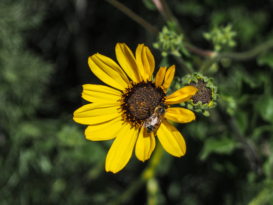


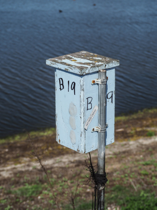
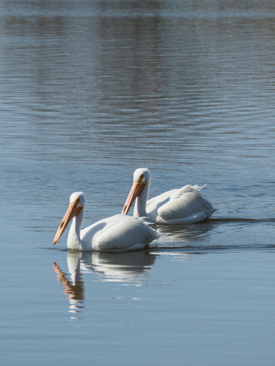


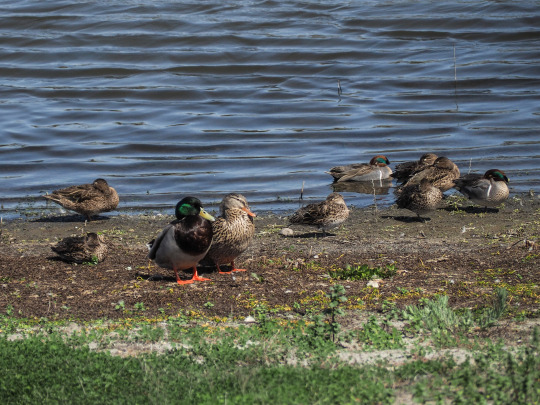

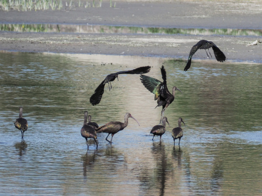
At 300 acres, the San Joaquin Wildlife Sanctuary in Irvine, California is home to dozens of species of birds and other animals that either stay there or stop by during migration. Aside from the trails that are on the perimeter of the freshwater pools, there is also a butterfly park. Additionally, the Audubon Society maintains a chapter office in one of the structures on site.
3 notes
·
View notes
Video
San Francisco Bay by European Space Agency Via Flickr: The Copernicus Sentinel-2 mission takes us over San Francisco Bay in the US state of California. San Francisco Bay, almost 100 km in length, is a shallow estuary surrounded by the San Francisco Bay Area – an extensive metropolitan region that is dominated by large cities such as San Francisco, Oakland and San Jose. The densely populated urban areas around the bay contrast strongly with the surrounding green forest and park areas. In the upper right of the image, the delta of the Sacramento and San Joaquin rivers is visible – with the brown, sediment-filled water flowing down into San Pablo Bay. Here, the murky waters mix before flowing into the larger bay area, which is connected to the Pacific Ocean via the Golden Gate strait. A large sediment plume can be seen travelling westward into the Pacific in the left of the image. The Golden Gate Bridge, around 2.7 km long, is visible crossing the opening of the bay into the Pacific Ocean between Marin County and the city of San Francisco – which can be seen at the tip of the southern peninsula in the centre of the image. Treasure, Angel and Alcatraz islands can be seen sticking out of the waters of the bay, with several bridges connecting its east and west shores. Several boats are also visible. The bright green and yellow colours in the bottom right of the image are salt ponds and are part of the Don Edwards National Wildlife Refuge. Covering an area of around 120 sq km, the refuge contains salt marsh, mudflat and vernal pool habitats for millions of migratory birds and endangered species. Sentinel-2 is a two-satellite mission to supply the coverage and data delivery needed for Europe’s Copernicus programme. The mission’s frequent revisits over the same area and high spatial resolution allow changes in water bodies to be closely monitored. This image, captured on 25 January 2019, is also featured on the Earth from Space video programme. Credits: contains modified Copernicus Sentinel data (2019), processed by ESA, CC BY-SA 3.0 IGO
#ESA#European Space Agency#Space#Space Science#Bay Area#SF#San Francisco Bay#San Francisco#USA#US#West Coast#San Francisco Bay Area#CA#California#Earth from Space#Observing the Earth#Earth Observation#Earth Explorer#Satellite image#Copernicus#Sentinel#Oakland#San Jose#Golden Gate Bridge#San Pablo Bay#Treasure#Angel#Alcatraz#Don Edwards National Wildlife Refuge#Sacramento river
6 notes
·
View notes
Text

Winter Marsh Panorama
8 notes
·
View notes
Text
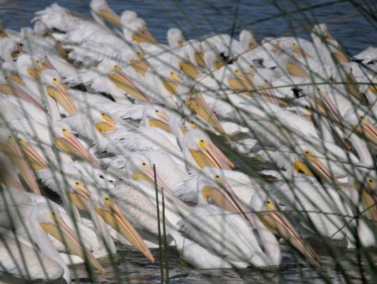
American White Pelican Pelecanus erythrorhynchos
11/6/2022 San Joaquin Marsh, California
#I'm obsessed with this picture#we turned a corner and just saw this absolute Horde of pelicans#it was wild#pelican#pelicans#american white pelican#bird#birds#bird photography#birblr#wildlife#wildlife photos#wildlife photography#nature#nature photos#nature photography#birding#birdwatching#birding photos#my photos#california#california wildlife
306 notes
·
View notes
Text

American Coot, land-mobile San Joaquin Marsh and Wildlife Sanctuary Irvine, California, USA December, 2019
One thing I have heard people say- try your best not to look or think too much about coots' feet.
(more coots here)
42 notes
·
View notes
Text

Day 1914: November 3, 2019
Anna's Hummingbird
I photographed this male hummingbird at San Joaquin Marsh, a wildlife sanctuary run by the "Sea to Sage Audubon Society" in Irvine, California. Like similar wetland sanctuaries in Las Vegas, it is a partnership with the local water district and is also used for water reclamation.
Riparian View, Irvine, California
#picoftheday#irvine#california#orange county#birds#birding#hummingbirds#wildlife refuges#wildlife photography#parks#flowers
2 notes
·
View notes
Text


Say’s Phoebe chilling on a post at San Joaquin Marsh.
#photographers on tumblr#original photographers#tumblr photographers#says phoebe#bird#san joaquin wildlife sanctuary
28 notes
·
View notes
Video
Tree swallow 相片擁有者 Guang Chow
0 notes
