#Kings-Canyon-NP
Explore tagged Tumblr posts
Text


Sequoia & Kings Canyon National Park
#fujifilm#fujixseries#original photographers#photographers on tumblr#slow travel#fujifilmxseries#landscape photography#sequoia national park#national park#NPS#hiking#nature photography#nature hikes#travel diary#travel blog#travelling#sunset#kings canyon#camping#wilderness#wanderlust#landscape photoset#photoset
435 notes
·
View notes
Text
The Sierras Nevada mountains bear ancient scars.
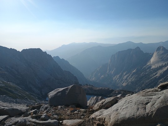
(Pic: the valley that forms the path of the Middle fork of the Kaweah River, going westward from the Kaweah gap. Sequoia NP.)
These relatively young mountains started as a plateau in Western North America (or rather, Laurasia) during the Cretaceous and early Paleogene. But soon afterwards, rivers carved a rugged landscape. As glaciation periods began ~30-40 mya, the advancing and retreating of rivers of ice from the mountaintops scoured this further into deep, granite canyons. Their scouring revealed buried pockets of magma, solidified into domes, spires, and monoliths, many of which are named and iconic.

(Pic: half dome viewed from El Capitan. Yosemite NP.)
Now, with humans, the fate of these canyons has been varied.
The Yosemite Valley is by far the most well known and recognizable of these canyons. While it is protected as a national park, it is one of the most famous and highly visited parks in the entire US, and a world famous recreation destination. Because of this, it's well preserved, but fairly built up. The Yosemite village has full time habitation from park workers, car traffic, two hotels, restaurants, shops, and more. A natural wonder and recreation destination to be sure, and the neighboring high country is extremely wild, but certainly notably built up.

(Pic: East Yosemite valley from the Yosemite falls trail. The Ahwanee hotel is visible on the left.)
Within the boundaries of the same national park is a sadder story: Hetch Hetchy. Hetch Hetchy valley, just North of the Yosemite valley, boasts similar granite features to Yosemite itself- but some are submerged forever. In the early 20th century, the valley was dammed and flooded to supply water to the booming city of San Francisco. It still does. Some proposals have been made to drain it, but some believe that the damage is already done.
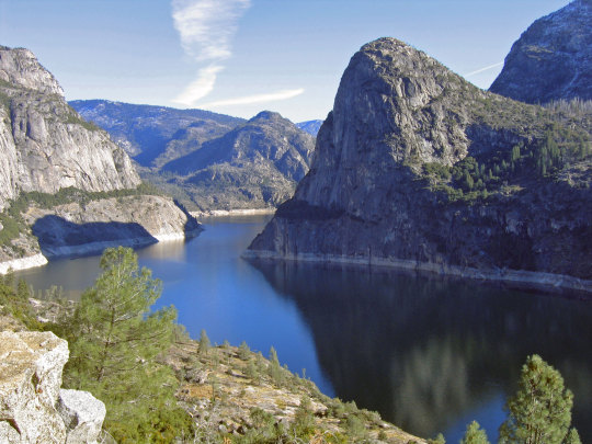
(Pic: Hetch Hetchy reservoir. Only pic in this post not by me, taken from NPS website.)
Kings Canyon represents a middle ground. In 1940, General Grant national Park was expanded to include the canyon, and subsequently renamed Kings Canyon National Park, now jointly managed with Sequoia NP. Car access is possible, and there are visitor services at the bottom, but nothing in the scale of Yosemite. A more typical national park experience, it feels a lot more rugged and wild, while boasting many similar granite features.

(Pic: looking down the paradise valley as it connects to Kings Canyon.)
And then.... There's the Kern valley.
Tucked discreetly in the Southeast of the Sierras, relatively little people know of its existence, despite being as deep and grand as the others.
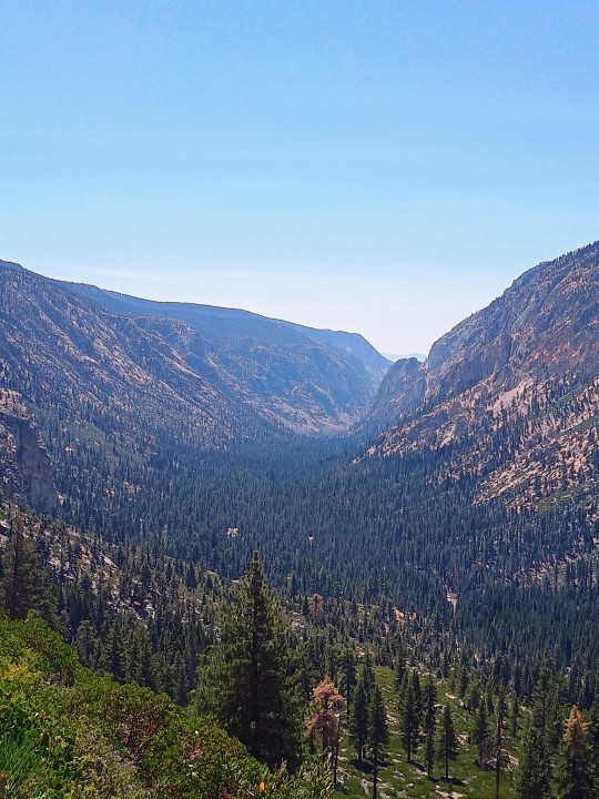
The reason for this is it's level of protection. The Kern Valley is a wilderness area of Sequoia NP- the highest level of protection for conservation in the United States. In wilderness zones, no permanent structures or roads are permitted- only hiking trails and primitive campsites.
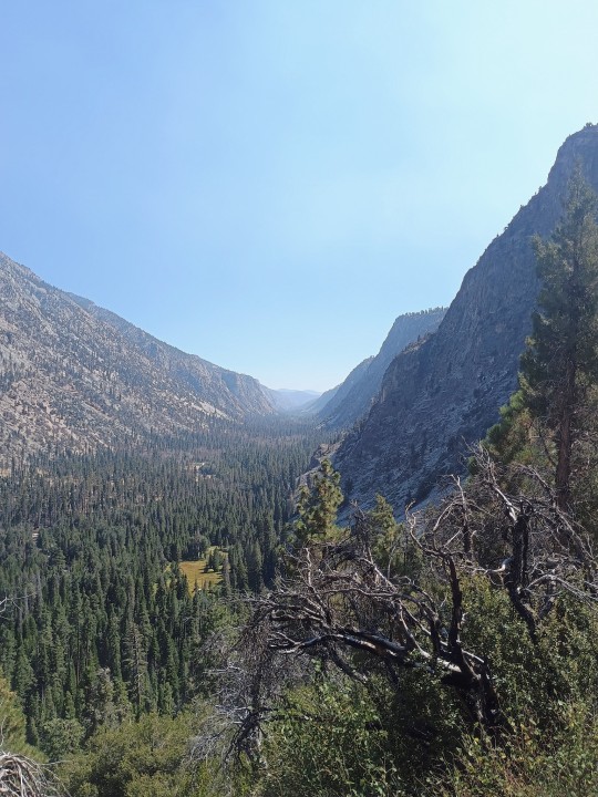
Some parts of the lower Kern fall outside of this boundary, but the upper Kern is only accessible by multiple days on foot. Numerous hiking trails cross cross the area, including the High Sierra Trail, which I completed a week ago.
It's gorgeous, and even though it's used by hikers, it feels untouched by human hands.
But.
We can show it something else.
Some kind of .... Body part. That has a day of the week based following in this website.
That's right, you fools.
THIS IS ANOTHER TGIRL TUMMY TUESDAY POST!
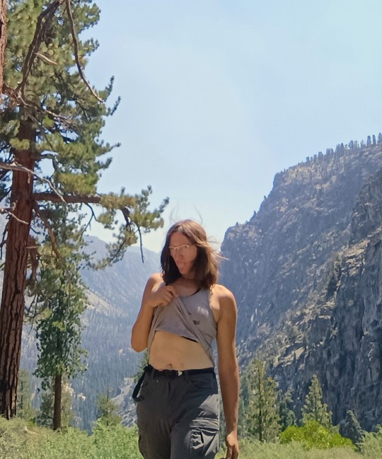
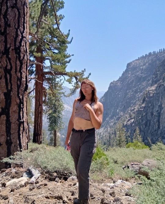
On August 24th, I descended into the Kern from the West via the HST, and decided to show it what I know best- some good fucking tgirl tummy.
Happy Tuesday to the freaks, the degens, and the losers, and the business they get up to, to make their lives more interesting, whatever if may be.
Tags under the cut!
@lilithtransrights @xenasaur
@whalesharkcat @godless-of-the-hunt
@anarqueeen @shakukon-to @eruditegeek
@puzzlecatt @sagasolejma
@havingsecondthots @quinns-sinns
#tgirl tummy tuesday#cute trans#hot trans#trans is beautiful#hiking#hikeblr#midriff#tgirl tummy#transgender#trans#trans woman
93 notes
·
View notes
Text

Fred Blackburn
This is a 40 foot diameter tree. Largest diameter Sequoiadendron Giganteum I know. Third largest tree in the world by volume.
Grant Grove, Kings Canyon NP
56 notes
·
View notes
Photo

Weather: Pacific Northwest
Report generated at 2024-11-21 12:00:11.784188-08:00 using satellite imagery and alert data provided by the National Weather Service.
High Wind Watch
WA:
Central Coast of Oregon
Clatsop County Coast
South Washington Coast
Tillamook County Coast
OR:
Central Coast of Oregon
Clatsop County Coast
South Washington Coast
Tillamook County Coast
Wind Advisory
WA:
Bellevue and Vicinity
Central Coast
East Puget Sound Lowlands
North Coast
OR:
Central and Eastern Lake County
Jackson County
Klamath Basin
Modoc County
Northern and Eastern Klamath County and Western Lake County
CA:
Central Sacramento Valley
Central and Eastern Lake County
Klamath Basin
Mendocino Coast
Modoc County
Northeast Foothills/Sacramento Valley
Northern Humboldt Coast
Northern Humboldt Interior
Northern Sacramento Valley
Northern and Eastern Klamath County and Western Lake County
Southern Humboldt Interior
Southwestern Humboldt
NV:
Greater Reno-Carson City-Minden Area
Mineral and Southern Lyon Counties
Flood Watch
WA:
Mason
OR:
South Central Oregon Coast
CA:
Central Sacramento Valley
Coastal Del Norte
Coastal North Bay Including Point Reyes National Seashore
Del Norte Interior
Marin Coastal Range
Mendocino Coast
Mountains Southwestern Shasta County to Western Colusa County
North Bay Interior Mountains
North Bay Interior Valleys
Northeast Foothills/Sacramento Valley
Northeastern Mendocino Interior
Northern Humboldt Coast
Northern Humboldt Interior
Northern Lake County
Northern Sacramento Valley
Northwestern Mendocino Interior
Shasta Lake Area / Northern Shasta County
Sonoma Coastal Range
Southeastern Mendocino Interior
Southern Humboldt Interior
Southern Lake County
Southern Trinity
Southwestern Humboldt
Southwestern Mendocino Interior
High Wind Warning
OR:
Central and Eastern Lake County
Curry County Coast
Klamath Basin
Modoc County
Northern and Eastern Klamath County and Western Lake County
South Central Oregon Coast
CA:
Central Siskiyou County
Central and Eastern Lake County
Coastal Del Norte
Del Norte Interior
Klamath Basin
Modoc County
Northeast Siskiyou and Northwest Modoc Counties
Northern and Eastern Klamath County and Western Lake County
Flood Warning
OR:
Coos
Siskiyou, CA
CA:
Humboldt
Mendocino
Siskiyou
Winter Storm Warning
ID:
Big Lost Highlands/Copper Basin
Sawtooth/Stanley Basin
Sun Valley Region
CA:
Greater Lake Tahoe Area
Lassen-Eastern Plumas-Eastern Sierra Counties
Mono
Northern Trinity
NV:
Greater Lake Tahoe Area
Lassen-Eastern Plumas-Eastern Sierra Counties
Winter Storm Watch
ID:
Big Lost Highlands/Copper Basin
Sawtooth/Stanley Basin
Sun Valley Region
CA:
Grant Grove Area
Kaiser to Rodgers Ridge
Kings Canyon NP
Sequoia NP
South End of the Upper Sierra
Upper San Joaquin River
West Slope Northern Sierra Nevada
Western Plumas County/Lassen Park
Yosemite NP outside of the valley
Flood Advisory
CA:
Butte
Humboldt
Lake
Lassen
Marin
Trinity
Beach Hazards Statement
CA:
Northern Monterey Bay
High Surf Advisory
CA:
Coastal North Bay Including Point Reyes National Seashore
San Francisco
San Francisco Peninsula Coast
Southern Monterey Bay and Big Sur Coast
2 notes
·
View notes
Text
RV Camping in California - 7 Free Tips on why this is a Must-See Destination

by Madelaine Graff California, known for diverse landscapes and breathtaking natural beauty, offers an abundance of opportunities for RVers & outdoor enthusiasts..... Introduction California has some of the nation's most diverse landscapes and breathtaking natural beauty. So it follows that it has a lot of great camping opportunities for outdoor enthusiasts. Among the many ways to explore the Golden State, RV camping is a great choice. Camping with an RV in California offers a cost-effective vacation where you can build cherished memories with your family and friends. California provides a combination of modern RV campgrounds, stunning national parks, scenic coastal routes, and charming mountain ranges. Yosemite National Park 7 Reasons to Visit California in an RV Majestic National Parks In California Sierra Madres in Yosemite National Park California has some of the nation's most diverse landscapes and breathtaking natural beauty. California is home to some of the most renowned national recreation areas and parks in the United States, making it a paradise for nature lovers. RV camping allows visitors to immerse themselves in the wonders of these protected areas. From the towering granite cliffs of Yosemite National Park to the ancient giant sequoias of Sequoia and Kings Canyon National Parks, the state offers breathtaking landscapes that are easily accessible by RV. There are hiking trails, wildlife spotting, and awe-inspiring vistas while camping in the heart of nature. If you are a serious hiker, you'll find challenging hiking trails across the state. There are varying difficulties of such trails which allow visitors to venture deep into the heart of these natural wonders. Whether it's the challenging Half Dome hike in Yosemite, the scenic Rim Trail in the Grand Canyon of the Tuolumne, or the diverse trails in Redwood National and Redwoods State Parks, there are options for every skill level and interest. Hiking in Redwoods National Park Some of the best lake camping in California can be found in the northern part of the state. If you are more of an adventurous traveler, try Death Valley National Park, known for its extreme landscapes, showcases vast salt flats, sand dunes, and the lowest point in North America. Lake vista in a California State Park California camping allows you to explore Death Valley's unique beauty and harsh environment, providing an unforgettable experience. Imagine waking up to the sun rising over the vast salt flats, with nothing but the sound of silence surrounding you. As you step outside your RV, you can feel the dry desert air on your skin, reminding you of the incredible resilience of life in such extreme conditions.However, it's not just the national parks administered by the NPS that make California RV camping special. The state's coastal routes offer a whole new level of scenic beauty. Imagine driving along the iconic Pacific Coast Highway, with the sparkling blue ocean on one side and rugged cliffs on the other. You can stop at charming coastal towns, soak up the sun on pristine beaches, and indulge in delicious seafood along the way. Sierra Nevada Map For those who prefer the tranquility of mountains, California's mountain ranges provide a perfect escape. Whether it's the majestic Sierra Nevada or the stunningly beautiful Shasta Cascade region, RV camping allows you to immerse yourself in the peacefulness of nature. You can hike through lush forests, fish in crystal-clear lakes, and breathe in the fresh mountain air. For those who prefer the tranquility of mountains, California's mountain ranges provide a perfect escape. So, if you're looking for an unforgettable vacation that combines stunning landscapes, outdoor adventures, and the freedom to explore at your own pace, RV Travel is the perfect choice. Whether you're a nature lover, an adventure seeker, or simply someone who wants to escape the hustle and bustle of everyday life, California offers a world of possibilities waiting to be discovered. Pack your bags, hit the open road, and let the wonders of RV camping in California unfold before your eyes. Coastal Beauty State Park along California Coast The California coastline is a treasure trove of scenic beauty and coastal charm. RV camping along the Pacific Coast Highway (Highway 1) is a bucket-list experience, allowing travelers to witness the crashing waves, rugged cliffs, and golden beaches. Iconic destinations like Big Sur, with its dramatic vistas, and Pismo Beach, known for its sand dunes and vibrant sunsets, are among the best camping spots in California for RV camping. California's coastal campgrounds offer a unique opportunity to wake up to the sound of the ocean and savor incredible sunrises and sunsets. Point Dume Sunset The California coastline is a treasure trove of scenic beauty and coastal charm. RV Camping in the coastal beauty of California also provides photographers and adventurers alike with the utmost beautiful scenery..... Read More... Read the full article
0 notes
Link
Check out this listing I just added to my Poshmark closet: Yosemite, Sequoia & Kings Canyon NP guide - Lonely Planet.
0 notes
Text
Deckcember Day 3: National Park decks


For Deckcember day 3 I'm featuring four different decks: Illustrated National Parks; Peaks, Plateus, and Canyons of the Colorado Plateau, Peaks, Plateus, and Canyons of the Grand Circle, and Yosemite. I bought them all in national park gift shops. You can buy the Illustrated National Parks here
, and I honestly wouldn't recommend buying any of the others unless you're in a gift shop that carries them, as they all cost twice as much online.
The Illustrated National Parks are certainly my favorite of the four, although I dislike the tuck box and am not the biggest fan of the backs. The tuck just seems too busy and the backs are uninspired. The fronts of the cards, though, are gorgeous, and feature that really cool NPS poster art style.
The next deck was a little more disappointing. It has the same art style, but the tuck is even worse(just a collage of the card faces), the backs are the same as the tuck, and, worst of all, there are only 13 posters across the cards. However, instead of putting one on each face and keeping the numbers generic, like a normal designer, the people behind this one decided that each value would get one picture. So all the kings have the same poster, all the aces have the same poster, all the fours have the same poster. Nightmare. And I'd never play any games with any of them.
After that is a deck with a very similar name. It's got photos from different places around Southern Utah and the Grand Canyon. (I'm from Utah, by the way). The design of the tuck and the backs is pretty cheesy, and I don't like just printing photos on cards. The photos themselves are pretty, though. Funny enough, this is easily the deck I have played the most games with. I have another copy of it that got water damaged while I was camping, so I now take it everywhere as a travel deck that I can risk damaging. Most days I play a game or two of Solitare with it.
Last is the Yosemite deck, which I actually hadn't opened until today. It's very similar to the Grand Circle one; just photos and indices. It was only $5, but I regret buying it still because it's just fairly underwhelming.
1 note
·
View note
Text
Australia - New Horizons - Neue Horizonte
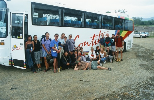
Looking back, it was probably a work colleague who gave me the idea of traveling to Australia - by talking to me about his travel plans. Sometimes enthusiasm is contagious. I was mostly traveling with an international tour group (provider “Contiki”) in Australia: Americans, Dutch, French, British, Japanese, Danes, Germans and of course “Aussies” aged 18 to 35. It can be quite stressful, if you are traveling with wild party people for a total of almost 5 weeks. The party highlight was certainly “The Woolshed” in Cairns, where it is customary to dance exuberantly on the tables when the music starts to play. Contiki is a provider that offers you the opportunity to try many leisure activities. I tried or dared to do river rafting, jet skiing, 4-wheel motorcycling, skydiving, ballooning and sailing. Trying new things generally makes us braver - it shows our subconscious that we can master such things. I didn't find this out until years later, when I did a little research into psychology.
I made two trips to Australia: the first trip was from the north along the west coast (please do not underrate the beauty of Western Australia!!!) - the second trip was from the north along the east coast and later along the south coast. On the first trip I met D. - with whom I later maintained a long-term acquaintance. She was a feminist and I loved to discuss and argue about this topic with her - and by that learned a lot from her about women's view on this world. I could still laugh today: I talked to her in English for almost half an hour until I realized that she was German - and even from my area. She spoke English fluently. It was because of her that I didn't climb Ayers Rock (Uluru) one year later because she told me that the rock is sacred to the Aborigines. The Aborigines deserve respect because they were there before us and we „white people“ simply pushed them away from the land where they had lived for thousands of years. D. later married a New Zealander whom she had met on a Contiki trip through the USA and I lost contact with her after she emigrated to New Zealand. There are so many stories, big and small, that broadened my horizons and my courage on these journeys.
youtube
youtube
Itinerary:
Trip1: Darwin - Litchfield NP - Kununurra/Lake Argyle - El Questro Wilderness Park - Purnululu NP (Bungle Bungle) - Geiki Gorge NP - Broome - Karijini NP - Ningaloo Reef - Shark Bay/Monkey Mia - Kalbarri NP - Nambung NP/Pinnacles Desert - Perth
Trip2: Darwin - Kakadu NP - Katherine NP - Uluru (Ayers Rock) - Kata Tjuta - Kings Canyon - Alice Springs - Cairns - Great Barrier Reef - Magnetic Island - Airlie Beach/ Whitsundays - Hervey Bay/Fraser Island - Brisbane - Surfers Paradise - Byron Bay - Sydney - Blue Mountains - Melbourne - Great Ocean Road/ Twelve Apostles - Adelaide
-Simplicius Simplicissimus
Note: For more photos about my Australia trips - refer to my side blog „play-of-colors“.
0 notes
Text
Day 1... Rainy day @ King's Canyon & Sequoia NP... Visited the general Sherman tree.... Got soaked lol. Camped out


hello back from five days in the sierra nevadas.... pics pending........ etc....
34 notes
·
View notes
Text
Ya know.... I really need to make the California Vacation happen this year. You know: 3 years into the plague, 3 years after its initial planned date... Come hell or high water, and I know we’ll be getting both.
Still aiming to end up at Sequoia/King’s Canyon NP, and since I’m planning on taking the Amtrak California Zephyr line, I’ll find myself in the bay area. Hopefully I’ll see some things in the area, and check out some redwoods before moving south.
I mean, I’ve never made it out to California yet and it’s high time I did. Been and done the east coast, it’s time to head properly west (once more!!!)
(Glacier National park is ALSO on the bucket list, and is even easier to access because I live a few miles from the Empire Builder Amtrak line)
#april rambles#vacation#sequoia and kings canyon NP#california has long eluded me!#I know y'all are flooded now so I'm pretty anxious about the usual mix of trouble that is in store for this summer#in minnesota we've been practicing with our own two years of severe drought#guys I HAVE TO SEE GIANT TREES#and mountains of course#this would be my first time on an actual train#is that sad? maybe#whatever I don't get out much
31 notes
·
View notes
Text


Sequoia & Kings Canyon National Park
#fujifilm#fujixseries#original photographers#photographers on tumblr#slow travel#fujifilmxseries#landscape photography#sequoia national park#kings canyon#camping#national parks#NPS#original photography#photographers of tumblr#photography blog#nature photography#lightroom#hiking#wanderlust#travel diary#travel blog
28 notes
·
View notes
Text


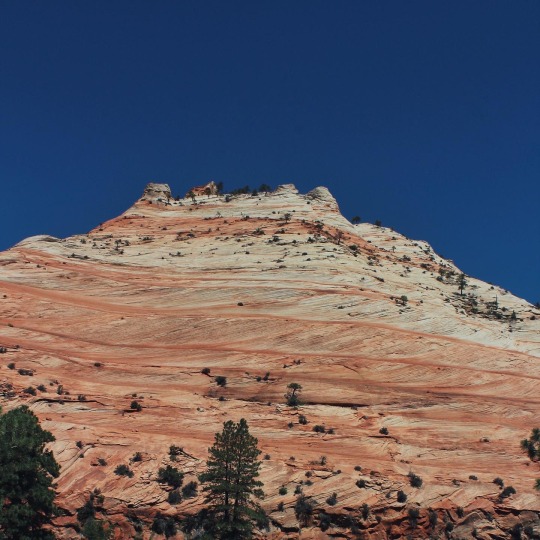


It’s so hard to leave— until you leave…
**************************************************
📷: Canon Rebel T6
6.10.22-6.14.22
#john green quotes#hard to leave#need to leave#just leave#travel the world#explore#learn thyself#know thyself#national park#valley of fire state park#sequoia national park#kings canyon national park#zion national park#nps#live a life of adventure#to live not just survive
2 notes
·
View notes
Text

You've activated a ramble trap card!
Remember, largest does not mean tallest.
The tallest tree in the world is a coast redwood in Redwood National Park, also in California, but almost in the opposite corner of it. Coast redwoods are taller, but thinner than Giant Sequoias.
Coast Redwoods and Giant Sequoias are closely related, and as such, are often mistakenly called by each other's names interchangeably. People who have seen both trees, however, can easily show you the differences.
Coast redwoods are a fairly common sight on large stretches of the California coast, from Central Cal, through the Santa Cruz mountains and SF Bay Area, all the way up the coast to just over the border with Oregon. Redwoods grow rapidly, and can exist in a variety of conditions along the California Coast ranges. But, when the conditions are just right, they cut loose and are able to grow to their full potential.
In contrast, Giant Sequoias are adapted to the cold but dry alpine environments of the Western Sierras. I generally think that the term "ice age relic" is overused, but if it applies to anything, it applies to Sequoias. While the Coast Redwood has a continuous range across coastal California, the Giant Sequoia is isolated to a few dozen specific sites that have ideal conditions for them to grow. They get most of their water from winter snowfall, since it rarely rains there, grow slowly, and are shorter and fatter than the tallest coast redwoods. Then again, "shorter" still means almost 300ft tall in this case, but it does make a difference. They also require large, flat areas to spread their roots out to support trees with that amount of mass. So what you end up with is a tree that can only exist in flat areas that are alpine enough to have deep snow in winter, flat enough to spread roots out, and aren't too high in elevation, because conditions would be too harsh.
The largest grove of Giant Sequoias is less than 2000 acres, and most are much smaller than that. Luckily, every single giant sequoia has some kind of protection- Sequoia NP, Kings Canyon NP, Yosemite NP, national forest lands, and state park lands protect every single one of them.
The upside? Sequoias are much harder, and much longer lived than their coastal cousins. A large, old redwood is hundreds of years old. A large, old Sequoia is thousands.
The differences in their growth also explain the differences in how the National Park service handles each one.
Redwood National Park, in the Northwest corner of California, is one place where redwoods are cutting loose. The right mix of rain, mist, and a protected valley is ideal for them to grow to their full potential height. The location of the tallest tree in the world is kind of an "open secret". Moreso than it being hush hush, it's more that there are SO many coast redwoods in a small area of Redwood NP (the aptly-named tall trees grove) that are constantly outgrowing each other and also being clipped by the wind at the top, that the exact tallest tree in the world is ever-changing. Somewhere in the tall trees grove, at any given time, however, there are always several trees that are ~400-410 feet tall- well outclassing any other location or species. So, the NPS doesn't publicize the specific tallest one, because it would be hard to put up new protections and fences and signs each time it changes. You can easily visit the Tall Trees grove itself, though- it's a nice day hike, and you can also backpack deeper into it (which I did several weeks ago, I'm just behind on my trip updates! My mountain lion sighting was actually really closer to it.)
Sequoia NP, in contrast, has a paved walkway around the Sherman tree and most other iconic giant sequoias, with fences, ranger patrols, and signs directing you where exactly is safe for the trees to walk on.
I'll dig up some pictures of my Redwood NP adventures in a bit to show some good comparisons here, but I recently cleaned my phone pics out and need to access my backup.
I highly recommend seeing both of them! If anyone is interested, I have some nifty tips about seeing the areas around both of these trees that will show you some beautiful stuff.
Okay I'm just at a rest stop now and REALLY have to get going lol
The General Grant Tree.
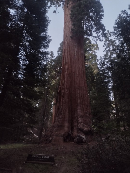
When the Civil War ended, the United States had an abundance of soldiers in the East, and a bunch of recently-brutally-colonized lands to the West. So, they put two and two together, and waves of soldiers went West. Most of that legacy is brutality. But some of that is positive- the first park rangers for newly-formed national parks in the Sierra Nevada mountains were part of these companies. Among others, this includes the Buffalo soldiers, all black regimens that scouted and mapped the Sierras, and helped establish better public access.
When they were sent to survey the West, they found giants. The Giant Sequoias, ice age relics clinging to isolated groves on the West slopes of the Sierras, are the largest single stem trees in the world. The largest individual trees were given names by these soldiers, and naturally, they named them after their commanding officers.
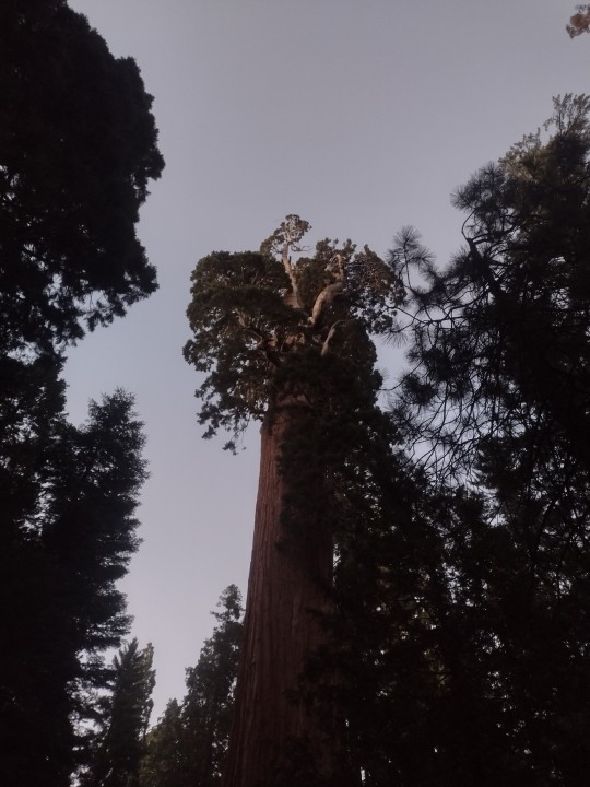
The General Sherman tree in Sequoia National Park is the largest single-stem tree on the planet, but many come close- including the General Grant tree in Kings Canyon national park.
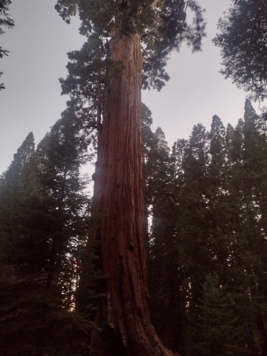
Unlike the Sherman tree, however, the Grant tree obtained a kind of mythic quality. It's been named a national shrine to veterans and the military, as well as the Nation's Christmas tree.
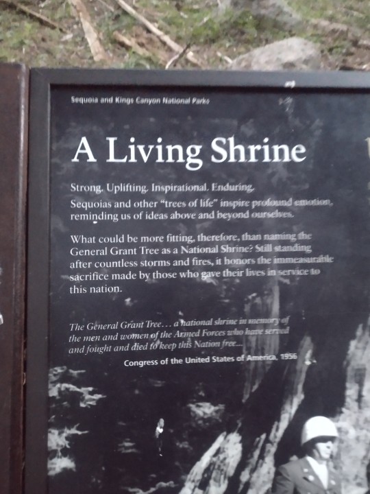
But me? Well, I like the Sequoias themselves as a symbol of enduring nature more than I love the military or Christmas. I love the towering immensity of Sequoias, and largely disconnect myself from the other meanings that this tree has been given.
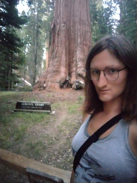
But y'know what else I love?
Tgirl tummy.
That's right.
This is a tgirl tummy Tuesday post.
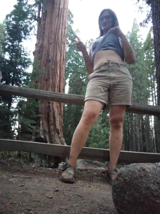
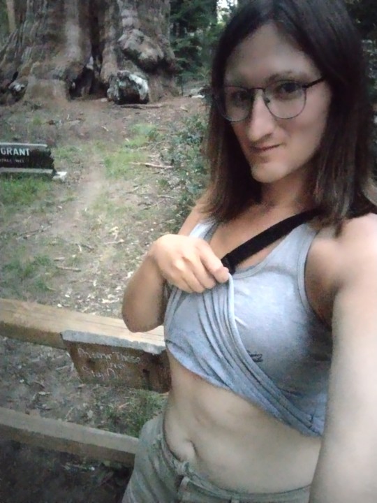
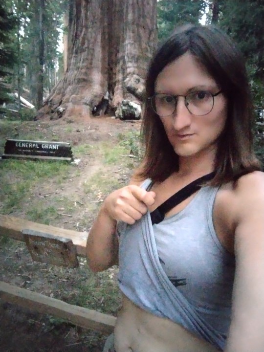
Happy tgirl tummy Tuesday from the General Grant tree! I hope I'm being adequately degenerate at this "national shrine" to help divorce it from the US military. I stopped for the night in Grant Grove on my way deeper into the Sierras, so yeah, this is past Sierra with a scheduled post. Apologies for the image quality, these were all taken at twilight. Stay gender fucked, stay faggoty, eat well, and enjoy your public lands!
@xenasaur @lilithtransrights @anarqueeen @whalesharkcat @godless-of-the-hunt @shakukon-to @sagasolejma @eruditegeek @havingsecondthots @subsequentlysilly
501 notes
·
View notes
Photo

Weather: Pacific Northwest
Report generated at 2024-11-21 04:00:09.509505-08:00 using satellite imagery and alert data provided by the National Weather Service.
High Wind Watch
WA:
Central Coast of Oregon
Clatsop County Coast
South Washington Coast
Tillamook County Coast
OR:
Central Coast of Oregon
Clatsop County Coast
South Washington Coast
Tillamook County Coast
CA:
Coastal Del Norte
Del Norte Interior
Northern Humboldt Coast
Northern Humboldt Interior
Southern Humboldt Interior
Southwestern Humboldt
Wind Advisory
WA:
Bellevue and Vicinity
Central Coast
East Puget Sound Lowlands
North Coast
OR:
Central and Eastern Lake County
Jackson County
Klamath Basin
Modoc County
Northern and Eastern Klamath County and Western Lake County
CA:
Central Sacramento Valley
Central and Eastern Lake County
Coastal North Bay Including Point Reyes National Seashore
Klamath Basin
Marin Coastal Range
Mendocino Coast
Modoc County
North Bay Interior Mountains
North Bay Interior Valleys
Northeast Foothills/Sacramento Valley
Northern Sacramento Valley
Northern and Eastern Klamath County and Western Lake County
San Francisco
San Francisco Bay Shoreline
San Francisco Peninsula Coast
Sonoma Coastal Range
NV:
Greater Reno-Carson City-Minden Area
Mineral and Southern Lyon Counties
Flood Watch
WA:
Mason
OR:
South Central Oregon Coast
CA:
Central Sacramento Valley
Coastal Del Norte
Coastal North Bay Including Point Reyes National Seashore
Del Norte Interior
Marin Coastal Range
Mendocino Coast
Mountains Southwestern Shasta County to Western Colusa County
North Bay Interior Mountains
North Bay Interior Valleys
Northeast Foothills/Sacramento Valley
Northeastern Mendocino Interior
Northern Humboldt Coast
Northern Humboldt Interior
Northern Lake County
Northern Sacramento Valley
Northwestern Mendocino Interior
Shasta Lake Area / Northern Shasta County
Sonoma Coastal Range
Southeastern Mendocino Interior
Southern Humboldt Interior
Southern Lake County
Southern Trinity
Southwestern Humboldt
Southwestern Mendocino Interior
Winter Storm Warning
WA:
Okanogan Highlands
ID:
Big Lost Highlands/Copper Basin
Sawtooth/Stanley Basin
Sun Valley Region
CA:
Burney Basin / Eastern Shasta County
Greater Lake Tahoe Area
Lassen-Eastern Plumas-Eastern Sierra Counties
Mono
Northern Trinity
West Slope Northern Sierra Nevada
Western Plumas County/Lassen Park
NV:
Greater Lake Tahoe Area
Lassen-Eastern Plumas-Eastern Sierra Counties
Winter Weather Advisory
WA:
Northeast Mountains
Northern Panhandle
OR:
Northern and Eastern Klamath County and Western Lake County
Siskiyou Mountains and Southern Oregon Cascades
South Central Oregon Cascades
ID:
Central Panhandle Mountains
Northeast Mountains
Northern Panhandle
CA:
North Central and Southeast Siskiyou County
South Central Siskiyou County
High Wind Warning
OR:
Central and Eastern Lake County
Curry County Coast
Klamath Basin
Modoc County
Northern and Eastern Klamath County and Western Lake County
South Central Oregon Coast
CA:
Central Siskiyou County
Central and Eastern Lake County
Klamath Basin
Modoc County
Northeast Siskiyou and Northwest Modoc Counties
Northern and Eastern Klamath County and Western Lake County
Flood Warning
OR:
Coos
Siskiyou, CA
CA:
Siskiyou
Winter Storm Watch
CA:
Grant Grove Area
Kaiser to Rodgers Ridge
Kings Canyon NP
Sequoia NP
South End of the Upper Sierra
Upper San Joaquin River
West Slope Northern Sierra Nevada
Western Plumas County/Lassen Park
Yosemite NP outside of the valley
Lake Wind Advisory
CA:
Greater Lake Tahoe Area
Flood Advisory
CA:
Alameda
Humboldt
Lassen
Marin
Beach Hazards Statement
CA:
Northern Monterey Bay
High Surf Advisory
CA:
Coastal North Bay Including Point Reyes National Seashore
San Francisco
San Francisco Peninsula Coast
San Luis Obispo County Beaches
Santa Barbara County Central Coast Beaches
Southern Monterey Bay and Big Sur Coast
Frost Advisory
CA:
Calabasas and Agoura Hills
Ojai Valley
Avalanche Warning
CA:
South Central Siskiyou County
2 notes
·
View notes
Photo

Everyone has seen a tree. Their branches and bark are familiar to us. We know what to expect when we look at them, touch them and smell them. Maybe that’s why visiting the towering giants at Sequoia and Kings Canyon National Parks in California is so overwhelming. The sequoias are trees, but somehow more than trees. You can expect them to be tall, but seeing them for the first time is a jarring experience. How can something so familiar feel so astounding? It’s just something you have to experience for yourself. Photographer Antonina Pattiz remembers her visit well, “The scene felt like pure magic because we were the only ones on the trail. In the quiet chill of the January air, we felt like we had the world at our feet.” Photo courtesy of Antonina Pattiz .
#sequoia and kings canyon national park#sequoia national park#sequoia#national park#national park service#nps#california#usinterior#findyourpark#find your park#travel#outdoors#america's great outdoors#nature#trees#giant sequoia#winter#amazing view#awesome experience#public lands
4K notes
·
View notes
Link
Check out this listing I just added to my Poshmark closet: Yosemite, Sequoia & Kings Canyon NP guide - Lonely Planet.
0 notes