#Franconia Ridge Loop
Explore tagged Tumblr posts
Text
Transform Your Weekend: The Ultimate Hiking Trails Near You
#Appalachian Trail#Bryce Canyon Rim Hiking Trail#Continental Divide Trail#Franconia Ridge Loop#Grand Canyon#Hiking Trails#John Muir Trail#Kalalau Trail#Pacific Crest Trail#South Kajson Kaibab to Bright Angel Trail#Teton Crest Trail#Wonderland Trail
0 notes
Text
Rime Time
And so it has begun. Stick a mountain in the clouds at this a time of year and you might end up seeing some rime ice. That was the case for one returning guest lead, again, by Redline Guide Chase Hall. This time they took on the classic Franconia Ridge Loop (clockwise) and while we want to ask our guest if they had a good experience, the ear-to-ear smiles tell the tale. Check it out for yourself…

View On WordPress
0 notes
Text
Almost there: Continue the NH 48 journey with Mount Twin South Peak, Lincoln, Lafayette, and Madison.
Mount Twin, South Peak - Elevation: 4902 ft
Difficulty Level: The South Peak of Mount Twin is a moderate hike. As stated in last week’s post regarding Mount Twin, North Peak, this is an opportunity to peak bag. This chance comes more naturally, as the most popular and direct trail to the summit requires that you summit North Twin first.
Trail: The most common way to summit South Twin is via the North Twin trail. AllTrails link below:
North Twin and South Twin Mountain via North Twin Trail, New Hampshire - 762 Reviews, Map | AllTrails
View from South Peak:

The Presidentials from South Twin Mountain. (n.d.). Mountain Project. https://www.mountainproject.com/photo/108118562/the-presidentials-from-south-twin-mountain
Mount Lincoln - Elevation: 5089 ft
Difficulty Level: With Mount Lincoln, we finally reach an over 5,000 footer! Mount Lincoln is generally considered a difficult hike. It is a section of “The Franconia Ridge”, which attracts people from various parts of the United States and beyond. I want to stress that even though both Mount Lincoln and Lafayette (will be discussed below) are very beautiful, these are NOT easy hikes, and the weather can change very quickly. Like Mount Flume (detailed in my January 22nd post), these trails are for experienced hikers. Many unprepared trekkers have been rescued from this area, and others have died. There are frequent incidents where people have tried to summit in tennis shoes with no extra food. Others have been blown off the trails due to high wind speeds or lost. A good book to read before considering the Franconia Ridge is The Last Traverse. The story details the events of a specific rescue attempt from this area. Here is the Amazon link to purchase: The Last Traverse; Tragedy and Resilience in the Winter Whites: Gagne, Ty: 9781734930832: Amazon.com: Books. That being said, I have yet to complete this summit, but I have heard amazing things from my experienced hiker friends. One of my friends has even hiked the Franconia Ridge multiple times in all four seasons.
Trail: The two most popular trails to summit Mount Lincoln are via Falling Waters trail to the Franconia Ridge trail (you will summit Little Haystack mountain first), and the Franconia Ridge Trail loop (where you will summit Mount Lafayette first then Mount Lincoln, then Little Haystack). AllTrails link below:
Mount Lincoln via Little Haystack Mountain, New Hampshire - 432 Reviews, Map | AllTrails
Explore Mount Lafayette and Franconia Ridge Trail Loop | AllTrails
View of Mount Lincoln:
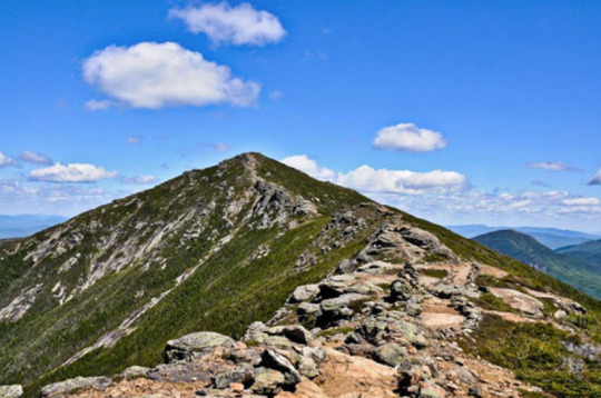
Mount Lincoln NH Lincoln New Hampshire White Mountains Hike Mt Lincoln 4000 Footer Lincoln Mountain. (n.d.). http://4000footers.com/lincoln.shtml
Mount Lafayette - Elevation: 5260 ft
Difficulty Level: For Mount Lafayette, I would like to echo every point I made regarding Mount Lincoln. This area of the White Mountains is amazing, yet often unforgiving for even the most experienced of hikers. Please monitor the weather, and come prepared with food, layers, and the right hiking equipment. Like Lincoln, you can peak bag across the Franconia Ridge, which will make this hike even more difficult.
Trail: The most common trails to hike Mount Lafayette are the out and back Old Bridle Path trail, or the Franconia Ridge Trail loop. AllTrails link below:
Mount Lafayette via Old Bridle Path, New Hampshire - 751 Reviews, Map | AllTrails
Mount Lafayette and Franconia Ridge Trail Loop, New Hampshire - 12,561 Reviews, Map | AllTrails
View from Mount Lafayette looking at the Franconia Ridge:
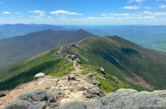
Green, S. (2023, November 7). Mt Lafayette & Franconia Ridge NH. Trailspotting’s NH Summits. https://www.trailspotting.com/2021/10/mt-lafayette-and-franconia-ridge.html
Mount Madison: Elevation: 5367 ft
Difficulty Level: Mount Madison is another very difficult hike. It is within the presidential range, which can also present challenging weather conditions. As always, stay vigilant, and come prepared. The hike is well worth the hard work, as the views are pretty incredible. It is about 1.4 miles from Mount Adams, so many hikers use this chance to peak bag. Mount Adams, which I will detail in the next post, is another rugged peak, so proceed with caution if this is your choice.
Trail: The two most common trails for Mount Madison are Valley Way Trail to just Madison, and then Valley Way trail to Madison and Adams. AllTrails links below:
Mount Madison via Valley Way Trail, New Hampshire - 1,119 Reviews, Map | AllTrails
Mount Madison and Adams via the Valley Way Trail, New Hampshire - 464 Reviews, Map | AllTrails
View from Mount Madison looking at Mount Adams:
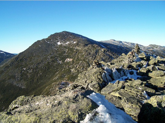
Dailey, C. (n.d.-d). Mount Madison / Adams / Jefferson ~ November 13th, 2010. https://whitemountainimages.blogspot.com/2010/11/mount-madison-adams-jefferson-november.html
0 notes
Text
Best White Mountain Hikes In USA
The United States is home to some of the most beautiful and diverse hiking trails in the world, and the White Mountains of New Hampshire are no exception. These majestic peaks offer an unparalleled hiking experience with stunning views, challenging terrain, and an abundance of wildlife. Here are some of the best White Mountain hikes in the USA:
The Presidential Traverse: This iconic hike covers the peaks of the Presidential Range, including Mount Washington, the highest peak in the Northeastern United States. The hike is approximately 23 miles long and is considered one of the most challenging hikes in the White Mountains, with steep ascents and rocky terrain. The hike can take one to two days to complete, but the views from the summits are well worth the effort.
The Franconia Ridge Loop: This challenging hike offers a variety of scenery, from dense forest to exposed alpine summits. The loop covers 8.9 miles and includes the peaks of Little Haystack, Mount Lincoln, and Mount Lafayette. The hike offers breathtaking views of the Franconia Range and the Pemigewasset Wilderness.
The Pemi Loop: This classic White Mountains hike covers 30 miles and takes hikers through some of the most beautiful and remote areas of the Pemigewasset Wilderness. The loop includes the peaks of Mount Bond, Mount Bondcliff, and Mount Guyot. The hike offers challenging terrain and breathtaking views of the Franconia Range and the Pemigewasset Wilderness.
The Lonesome Lake Trail: This family-friendly hike is perfect for those looking for a shorter and more leisurely hike. The trail is 3 miles round-trip, and leads to the beautiful Lonesome Lake, offering picturesque views of the surrounding peaks and wildlife.
The Huntington Ravine Trail: This challenging hike is perfect for experienced hikers who are looking for a rugged adventure. The trail is 3 miles round-trip and leads to the summit of Mount Washington. The trail is steep and rocky, and requires a good level of fitness and experience to complete. The trail passes through the beautiful Huntington Ravine, offering stunning views of the surrounding peaks and wildlife.
The Tuckerman Ravine Trail: This challenging hike is for those who are looking for a strenuous hike. The trail is 4.2 miles round-trip and leads to the summit of Mount Washington. The trail passes through the Tuckerman Ravine, one of the most popular and challenging ski and snowboarding areas in the East. The trail is steep and rocky, and requires a good level of fitness and experience to complete.
When planning a hike in the White Mountains, it's important to be prepared for a wide range of weather conditions and to bring the necessary gear and supplies. Always check the forecast before your hike, and be prepared for sudden changes in weather. It's also important to know your limits and to choose a hike that is appropriate for your skill level and fitness.
It's also important to note that it's important to obey Leave No Trace principles, pack out all your trash, don't disturb wildlife, and stick to designated trails to help preserve the natural beauty of the White Mountains. and respect the wilderness, always obey Leave No Trace principles, pack out all your trash, don't disturb wildlife, and stick to designated trails.
Overall, the White Mountains of New Hampshire offer some of the most beautiful and challenging hiking trails in the United States. Whether you're a seasoned hiker or just looking for a leisurely stroll, these mountains have something to offer everyone. With stunning views, challenging terrain, and an abundance of wildlife, the White Mountains are a must-visit destination for any hiking enthusiast.
0 notes
Text
Time lapse of the clouds rolling down the back side of Cannon Mountain in New Hampshire. Taken from Mt. Lafayette 12/23/18
#hiking#new hampshire#white mountains#winter#franconianotch#franconia ridge loop#mt lafayette#cannon mountain#nh#snow#time lapse#slomo#tilt shift#ll bean#new england life
25 notes
·
View notes
Text
Franconia Ridge Loop
The big day finally came, which is more than I expected. All week long, the forecast looked as though the weekend was going to have some type of rain-with-thunder combo on both days, making this hike unsafe. Friday arrived and suddenly the days looked a bit better. We decided to head up to NH and just see what happened. Even the night before our hike, the forecast sounded as if there may be thunder in the mix. We were looking at a shorter hike of Moosilauke with a later start, that would allow us to avoid it, instead.
Sunday morning arrives and I hear Greg say "no rain just clouds, we're good to go." I actually don't remember his exact words, but that was about the gist of it. I was nice and cozy and sleepy and warm, wrapped up like a cocoon, and this wasn't what I wanted to hear. Combined with the doubts about my fitness level, his proclamation elicited a groan from me. But I got up and got ready.
The Franconia Ridge Loop is a hike that brings you up and across a good portion of Franconia Ridge, made up of a number of mountain summits in Franconia Notch. A traverse of the entire ridge would include Mount Liberty (4459') and more than one car, but you can start and end at the same parking area for a loop that brings you up Little Haystack (4780'), over Lincoln (5089') (and Truman, 5000', which isn't marked on most maps), and finally up Lafayette (5249'), the tallest peak in the Franconia Range and highest mountain outside the Presidential Range.

Franconia Ridge Loop
We got ourselves over to the trailhead and started our hike right around 7:40. Conditions were cloudy and cool, which was great for a hard hike. I was just hoping to have a chance for the fantastic view coming across the ridge which I was denied to me the previous time I did this hike. If the clouds were high enough, or lifted during the hike, it would happen.
We worked our way up Falling Waters Trail, which is the best way to begin this loop. You can start by going up Old Bridle Trail, but you'll reach the AMC Greenleaf Hut when you're about 1/3 done with the hike and most of the way up Lafayette. You may not feel like stopping or need to stop for anything at that point. If you begin with Falling Waters, (which is slightly steeper), you get the hard climb out of the way when you're fresh, and can look forward to resting at the hut after crossing over the peaks.
I used my poles the whole way. For every big step up, I assisted with my arms. We also took a very slow yet steady pace, allowing all other hikers to pass us. Because of this, we did not need to stop for anything other than quick sips of water or to look briefly at something. No real rest stops, just a steady plodding along.
When we emerged out of the trees and onto the top of Little Haystack, the wind was blowing enough for us to put our jackets on. Greg had on long hiking pants but I remained in my shorts. It was damp and foggy, so the wind was cold, but we kept moving along rather than stop for a rest.
Unfortunately, there was no view. The ridge was all clouded up, but I was actually happy to be able to see further than the first time, when visibility seemed to fluctuate between 10 and 30 feet for much of the traverse. We could see ahead for at least 100 feet, and could see the top of the sides of the mountain sloping away into the fog. This was great!!! I remained hopeful that the clouds would lift before we reached Lincoln or Lafayette.
It didn't happen. Once we passed the summit of Lincoln, reality set in and I wondered if we would be given any sort of views at all on this very cloudy grey day. The great news is we were both feeling pretty good and not getting footsore or exhausted. I was definitely feeling better than the hike two years ago.

The summit of Lafayette. Check out that gorgeous view!!
We finally got to Lafayette. I could actually see it coming this time! Unlike last time, when we had lunch right on the summit and had no idea we were on it because we were on the other side of a pile of rocks and couldn't see for $h!t. So I was happy to see it just ahead. We stopped and stood there for a few minutes, snapping a couple pictures and enjoying the idea that the climbing was done. It was too chilly to stay and we felt good enough to continue on to the Greenleaf Hut where we could really enjoy a rest.
As we began our descent on the Greenleaf Trail, the clouds began to give us peeks of the green hills beyond. There for a moment... then disappearing. Then the clouds parted to show larger views. Hikers all around were stopping to watch. Soon, the clouds had all lifted to reveal everything, hanging just above us in a dark grey flat line, as if to say "Here you go! Here's your reward! Don't worry I'm leaving!" The journey to the Greenleaf Hut included many pauses to dig out the phone for pictures, and the mood of all the hikers was noticeably changed.

The clouds begin to thin just enough to show a peek of Cannon Mountain

As we descend Lafayette, the clouds continue to lift, revealing the summit of Lincoln behind us
We rested at Greenleaf Hut for about 40 minutes, enjoying some food (we hadn't stopped to eat much as we hadn't been hungry) and enjoying the real bathroom (I have gotten very comfortable with just going on the side of the trail when no one seems to be around).

Yours truly, very happy to be able to see. Check out the way the clouds are still hanging just above us. (photo courtesy that guy Greg)
After lunch, we picked up Old Bridle Path and began the rest of our long descent. Poles were my best friend, saving my knees and keeping me from getting too tired. They slowed me down to use them so much, but it was worth it. When you leave Greenleaf Hut and begin down Old Bridle Path, you continue along the ridge that spurs out from Lafayette. This section is sometimes referred to as “Agony Ridge”. The hardest part (for me) are the sections of very smooth, slippery-when-dry rock that give you no grip at all and has no good places to plant feet or poles. Fortunately there are not too many sections like this, but there are enough to have slowed us down a fair amount. I don't want to risk hurting myself by falling, since my job is physical and I work for myself. The highlight is that there are some fantastic views looking back at Franconia Ridge as you come through this area.

Looking back at the ridge from Old Bridle Path
The last portion of Old Bridle Trail seems to stretch on for a long time; a dirt path with a lot of rocks to step over, on, and between. But during all this, I was keenly aware of how my feet and knees were only mildly sore, and how my legs were tired but not completely shot. Thank you trekking poles! The next thing we knew, we were emerging back to the parking area. We couldn't believe how much better we both felt in comparison to our first hikes of this trail. I still had a slight spring in my step! We got back to our cottage, got cleaned up, and enjoyed a fantastic large dinner with drinks, followed by ice cream.
The next day my legs were sore, but not painful. I feel good enough two days later to say I look forward to hiking it again at some point. WITH a view! I highly recommend this hike for those who are in condition to do some serious long hiking, and who know how to prepare for hikes above the alpine zone with the possibility of fast changing weather. Terrain is challenging and rocky.

Total elevation gain, about 4000'. Total miles, 8.05. Total time hiking not including lunch break, 8:45.
#hiking#Franconia#franconia ridge#franconia ridge loop#mount lafayette#greenleaf hut#falling waters trail#old bridle path#franconia ridge trail
1 note
·
View note
Link
Notes and photos from the second day of our trip to New Hampshire’s White Mountains
3 notes
·
View notes
Text
Hike: 2020 Pemi Loop
Hike: 2020 Pemi Loop
In early September, Jeff and I did a Pemi Loop. It was my 4th Pemi Loop, but I went because I rarely pass up the opportunity for this epic hike, and to fill out some of my September Grid. It was Jeff’s first 24-hour attempt of the loop, which is required for the Northeast Ultra 8 list. We parked the evening before and hiked up Eastside Trail and camped in the woods to get a nice early start on…

View On WordPress
#Adventure#Franconia Ridge#Hike#Mount Lafayette#Mount Lincoln#New Hampshire#Northeast Ultra 8#Outdoors#Pemi Loop
0 notes
Photo

My girl Penny on the Franconia Ridge Loop. She was a trooper that day!
7 notes
·
View notes
Text

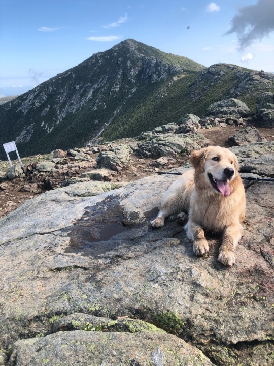
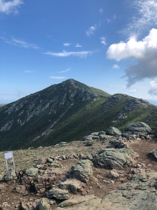

Franconia Ridge Loop
18 notes
·
View notes
Text


Franconia ridge trail loop, NH. 5260’ elevation
#health & fitness#fitblr#fitgirl#fitness#happy#fitspiration#fitfam#girlswholift#fitbit#fitspo#hike#hikelife
13 notes
·
View notes
Photo

💥•💥• Photo of the day! 💥•💥• Thank you @trailrunn4r for sharing this great picture with us ~ Congrats! 🎉 🎈 You captured the best of the day! We want to see your pictures too ~ thank you for following us at @igersnh and tagging #igersnh With love from the gang: @meg_unwell @phresh.klix and today's judge was yours truly: @kateputnam18 ⚓️🔅🍀 ** Posted @withregram • @trailrunn4r On Mountain Time ⏱ • If you ever have an extra 5-7 hours to spare, the 9 mile Franconia Ridge Loop trail is definitely worth a go. Easily my favorite hike on the East Coast, as you’ll find yourself bagging three peaks along the 1.5 mile ridge above the clouds (if you’re lucky on a good day!) ➖➖➖➖➖➖➖➖➖➖➖➖➖➖➖➖ Discount Code : TrailRunn4R - @AnzoUSA - @Tactilian.US - @AlphaFoxtrotDesign ___________________________________________ (at New Hampshire) https://www.instagram.com/p/CbJcontOyma/?utm_medium=tumblr
0 notes
Text
The Semi Pemi
Back at again, Redline Guide Arlette Laan just did two trips back-to-back. The first was a hike, the second a 3D/2N “Semi Pemi” educational backpacking trip. For those who don’t know, a Semi Pemi is a shortened “Pemi Loop.” In this particular case, the team skipped Franconia Ridge altogether. From this point, since Arlette kindly shared these details, we’ll let her tell it. DAY ONE: Lincoln…

View On WordPress
0 notes
Text
Spectacular Summits: Uncover Mount Wildcat, A Peak, South Carter, Liberty, and Garfield
Mount Wildcat, A Peak - Elevation: 4422 ft
Difficulty Level: Mount Wildcat, A Peak is a moderate - more difficult hike. If you refer to my January 15th blog post, you will note that this is a part of the Wildcat Ridge. This is a chance to… you guessed it… peak bag! Wildcat A through E peaks can be accessed via the Wildcat Ridge trail that I will link below. Please understand that only Wildcat A peak and Wildcat D peak are recognized as part of the NH 48 4,000 footers.
Trail: Wildcat, A Peak can be accessed via the Wildcat Ridge Trail (out and back). AllTrails link below:
Wildcat Ridge Trail, New Hampshire - 505 Reviews, Map | AllTrails
View from Wildcat, A Peak looking across the Carter Notch:

Wildcat Mtn. – A Peak (4,422′). (2021, October 10). Unnecessary Climb. https://unnecessaryclimb.wordpress.com/wildcat-mtn-a-peak-4422/
South Carter Mountain - Elevation: 4430 ft
Difficulty Level: South Carter Mountain is another moderate - difficult hike. I am sure by now, a trend within my documentation of trails is becoming very apparent. The pattern being that peak bagging opportunities are common! South Carter is no different in this. This hike presents the chance to summit Middle Carter and Carter Dome (I will discuss these peaks in next week’s posts).
Trail: South Carter Mountain can be summited a few different ways. The most common trails are via Imp Face → Middle Carter → South Carter Mountain, and Carter Range Loop trail. Hikers can choose to complete the entire loop, or they can simply summit South Carter in an out and back fashion.
Imp Face, Middle Carter and South Carter Mountain, New Hampshire - 73 Reviews, Map | AllTrails
Carter Range Loop, New Hampshire - 146 Reviews, Map | AllTrails
View from near the summit of South Carter:
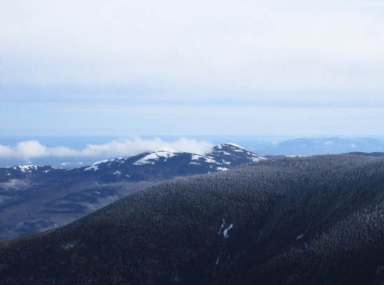
FranklinSites.com. (n.d.-a). Carter Dome, South Carter Mountain, Middle Carter Mountain - New Hampshire - January 28, 2012 Hike trip Report - FranklinSites.com Hiking guide. https://www.franklinsites.com/hikephotos/NewHampshire/carterdome-2012-0128.php
Mount Liberty - Elevation: 4459 ft
Difficulty Level: Mount Liberty is generally seen as a moderate hike. I have yet to summit this peak personally, but have only heard amazing things about it from my friends and family! Yet another peak bagging opportunity exists with this mountain. Mount Flume is 1.2 miles from the summit of Mount Liberty (as discussed previously). Again, as these mountains are within the Franconia Range, I want to stress the importance of being prepared and knowing when to turn around. The weather in this particular area of the White Mountains can be fierce, and the terrain even more so. There is no shame in turning around if you feel it has become unsafe to summit.
Trail: The two most popular trails to summit Mount Liberty are the Liberty Spring trail (out and back), and the Liberty Spring → Franconia Ridge Trail (out and back). AllTrails links below:
Mount Liberty via Liberty Spring Trail, New Hampshire - 1,328 Reviews, Map | AllTrails
Explore Mt. Liberty and Mt. Flume via Liberty Springs, and Franconia Ridge Trail | AllTrails
View from Mount Liberty, looking at Flume Mountain:
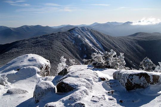
Dailey, C. (n.d.-c). Mount Liberty & Flume Mountain ~ January 15th, 2012. https://whitemountainimages.blogspot.com/2012/01/mount-liberty-flume-mountain-january.html
Mount Garfield - Elevation: 4500 ft
Difficulty Level: Mount Garfield is considered an easy - moderate hike. Depending on a hiker’s stamina, the trek can seem difficult due to the length of the trail. It is a fairly level trail, with steep areas closer to the summit. I guarantee you that the 360 degree views from the summit will make this longer hike worth the work!
Trail: The most common trail to access the peak of Mount Garfield is the Mount Garfield Trail. AllTrails link below:
Mount Garfield Trail, New Hampshire - 3,421 Reviews, Map | AllTrails
Views from Mount Garfield:
Looking at the Franconia Ridge

Looking at the Twin Mountain Range
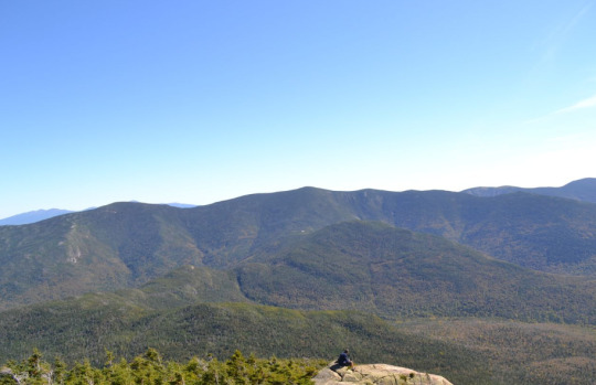
Both pictures from:
NH family hikes. (n.d.). http://www.nhfamilyhikes.com/hike-pics.php?hike=Mt.%20Garfield
0 notes
Text
2021 Year in Review
Thanks for tagging me @notesonartistry and @slowmotiondoublevision 💕
Top 5 movies
Disclaimer: I watch a lot of movies and have a hard time remembering which ones I watched when, so I'm going off my recent memory.
fourteen peaks
Joker
the rescue
A boy called Christmas
Argo
Top 5 TV shows
Money heist
Hanna
The 100 (it isn't new but was new to me)
Absentia
Lost (wasn't new but was new to me 😅)
Top 5 songs
All too well 10 min version - taylor swift
Better man - taylor swift
Mr. Perfectly Fine - taylor swift
Pierre - Rynn Weaver
Headsick - userx/Matt maeson
Top 5 albums
Fearless taylor's version
Red taylor's version
Bank on the funeral - Matt Maeson (not new but I love it)
Sour - Olivia rodrigo
How long do you think this is gonna last - big red machine
Top 5 books
The 7 husband's of Evelyn Hugo
The silent patient
Final girls - Riley sager
Verity - Colleen hoover
The nightingale - Kristin hannah
Positive things that happened this year
Hiked the Franconia ridge loop in NH, which I've wanted to do for a long time
Brought my furry floof named Koda home
Attended to my health (vaccines, workout, eating healthier, blood work, wisdom teeth removal)
Got licensed and a raise for being licensed
Met more tumblr swifties 💕
I tag: @explorerswiftie @ohh-goddamn @dress @chiara-swiftiedreamer13 @lotsofloveish @thenotefromthelocket
2021 Year in Review
Thanks for tagging me @tolerateit and @slowmotiondoublevision
Top 5 Movies
I can't really think of movies that I watched other than a couple of documentary movies:
- Alex Ferguson: Never Give In
- Folklore Long Pond (of course!)
Top 5 TV shows
- Mare of Easttown
- Vigil
- Line of Duty
- Escape to the Chateau
- Murder Island
Top 5 Songs
- I Bet You Think About Me
- Stop Making This Hurt, Bleachers
- Someone Else, Bishop Briggs
- Long Way Home, Brynn Catrelli
- John Hughes Movie, Maisie Peters
Top 5 Albums
- Red (Taylor's Version)
- You Signed Up For This, Maisie Peters
- How Long Do You Think It's Gonna Last?, Big Red Machine
- Human, One Republic
- Take The Sadness Out of Saturday Night, Bleachers
Top 5 Books
- A Day Like This
- Meet The Brennans
- The Last Thing He Told Me
- The Holiday
- Beach Read
Positive Things That Happened This Year
- Cool hiking trips in Oman
- Finishing my 35km run
- Taylor's versions and tumblr
- I finally made it home for a visit!
tagging @genxtraordinaire @emilyandelissaswift @rachlou86 @it-feels-like-a-perfect-night @cardsharksplayingames @danceundersparklinglights @yourheartbeatonthehighline @nifty-swifty @explorerswiftie
26 notes
·
View notes