#Even if she could retrace her steps hundreds of hundreds of miles up north?
Explore tagged Tumblr posts
Note
🍉 - What is something they have done that they feel the most guilt over? How do they handle this guilt? Does the guilt ever get resolved?
Random Headcanons

One of if not the biggest thing Khare feels like utter shit about even to this very day? Not helping the other people unfortunate to get locked up and experimented on alongside her. Not while escaping, not going straight to the authorities and telling them about the place the moment she walked free, Khare did absolutely nothing, focusing purely on saving her own hide and the guilt eats away at her every single day. It wasn't as though they were friends but she watched for months as others were subjected to countless experiments and injections like her with many of them dying, if they hadn't been grossly mutated beyond recognition or driven mad as a result. Some of them were like her, young people snatched from the streets by chance. Some were older with families of their own, wondering if they'll ever see their loved ones again. Many were barely teenagers, runaways or problem children who wouldn't be missed. It was a horrible time for them all, wondering who would be next to go, be it in a body bag or on the autopsy table as their captors investigaged their findings more thoroughly. As soon as the opportunity to escape presented itself, Khare grabbed the chance, snatching the keycard and running off into the wilderness where the facility had been hidden deep in the mountains, away from prying eyes. It took a while to find civilisation and when she did... Khare said nothing to anybody, focusing purely on making her way down south, to put as much distance between herself and her captors, in case they were still pursuing her. Where the facility actually was, Khare is unable to recall and not a day goes by where she doesn't think of those left behind, still being tortured and warped beyond recognition as their tormentors focus on their sick goal of creating their own metahumans, of finding out how to bestow powers onto ordinary human beings. Could she have grabbed a few survivors? Could she have unlocked their cells and led a rebellion against their captors? Or could it have all failed and she'd be yet another corpse for them to study, making them one step closer to their plans?
The what-if's and could-be's keep her up most days, and it's a relief when she finally goes into torpor if only to stop thinking for a while.
#themckaytriarchy#memes ;; random headcanons#🌈 || headcanons#If there's one thing Khare will always hate herself for it's this#She always imagined it would be like in a movie where you'd valiantly fight back or lead the authorities back to help#But the reality was so much worse#Especially as somebody who was no longer supposed to be in the country#And after what they did to her she was very much afraid of getting found again#And who would believe her anyway?#Even if she could retrace her steps hundreds of hundreds of miles up north?#The authorities or FBI might just sling her on the dissection table themselves after what her body's been put through#This group was all about experimenting on the human genome and finding out how to reactivate meta genes#Or implant them into people who didn't have them#Make super soldiers if you will#Khare's genes were just stable enough to endure everything they did to her until escaping#She feels like utter shit for being such a coward :/#human experimentation tw#human experimentation cw#human trafficking tw#human trafficking cw
5 notes
·
View notes
Text
2. Marsh Madness
The Sheboygan River/Lake/Marsh - Saturday, April 4th
It’s 5pm and Cindy and I have been kayaking on the Sheboygan River and Marsh now for 5 freaking hours! And we just hit a devastating dead end (#L) on our way back to the St. Cloud put-in. We’re now lost in the middle of the Sheboygan Marsh, both phones almost out of power, just a few sips of water left between us, a few hours of sunlight left, Cindy’s shoulder in pain, and no place to land our kayaks. The floating Marsh cattails surrounding us on all sides have no base for us to stand on. If we can’t find our way soon back to the main river ditch we may have to sleep in our kayaks over night - and maybe on the 40 degree water. Wow, could we survive the night in these bizarre conditions? The Bear Grylls’ voice inside me thinks so but it could get dang cold and wet thru the night. I couldn’t help but think of the two twenty year olds who died just a week ago fishing in Lake Winnebago when their canoe capsized late at night in windy and cold conditions. Would this be another “what were they thinking” tragic story line? Wow, how did we get here?
After an amazing 6-week snowbird trip to Florida (kayaked 12 times), Cindy thought the Sheboygan River from St. Cloud to the Sheboygan Marsh would be a nice 2nd waterway in our quest to do 21 Wisconsin waterways this year. Sounded great to me. We spent the night of our 2nd date (August) camping at the Marsh so it would be fun to revisit the area. Hmm, maybe the violent lightning storm and large branch that just missed falling on me during that campout were signs that the Marsh wasn’t as friendly as it looked. Oops, forgot about that warning. I was too jazzed about breaking out my new wetsuit for this trip to worry about the evil Marsh. Dammit, I was not going to drown of cold water shock if I fell into the nippy river today.
Cindy had done some recon with her patio landscaper guy who recommended that we head down the north track of the river to get to the Marsh takeout. Cindy mentioned that the cattails move around and the river pathways could get plugged up. Moving cattails? What does that exactly mean? We didn’t have any stinkin’ cattails in Fox Point. I checked out Google Maps during the drive out and it looked like both the north track and the main river routes were open to the Marsh take-out. No worries. It looked like a 6 to 7 mile river route which should take us around 4 hours. Possibly leaving us time for a quick 9 holes of golf at Lancelot’s afterwards. Right.

The route via Google Maps. Looked clear on the map.
We dropped off my car at the Marsh take-out and headed southwest in Cindy’s car to the put-in (#A) around little St. Cloud. We quickly inflated our kayaks and put in at 12:15pm. After just 50 yards we went under a gorgeous limestone arch bridge with the only little rapids we would encounter all day. We quickly settled in for a very pleasurable ride eastward on the Sheboygan river. There was a small current helping us along, the air temp was in the 60’s, virtually no wind, and the wild life was eager to entertain us. Deer, cranes, blue herons, geese, and ducks were the main players and it was an awesome ride. Very quiet and peaceful - no cars, no people. Ah, nature. Our new water thermometer showed the water at a cool 43 degrees and Cindy’s new GPS speedometer app clocked us at a 2 MPH clip. We were cruising. We both chuckled when Cindy said we should have brought her 14 year old granddaughter along with us. Maybe a little later in the spring when the water warms up.

St. Cloud put-in with limestone bridge at the start
About an hour in we went past another little put-in (#B) by a farm side road. A good spot to start from in the future for a little shorter trip. A half hour later we hit a long east-west straight-away ditch that provided a shortcut to the Marsh. Another half hour went by and we came upon a bizarre little hunting shack, which Cindy nicknamed Shit’s Corner (#C), alongside the river ditch route. It could only be accessed from the river and it had 3 little docks. Cindy remembered this place from a previous trip where she and a friend had encountered some scary looking hecklers as they nervously passed by. This time Shit’s Corner was empty so I docked my kayak to poke around and stretch my back. I peered inside to see just a large fireplace and picnic table. Very backwoods looking but it certainly could provide some warmth from the elements for those hunters.

Shit’s Corner - along the main ditch route
So far the river has been lined mainly with forest and a few beautiful cattails here and there. Within another half hour we hit the start of the thick Marsh cattails section, with only cattails along the banks. I wondered what they were resting on or attached to and how fast they moved around. And how deep they were. And, and, and. We then hit our first big fork (#D), a major 3-pronger, in the cattails maze where Cindy’s patio guy advised us to go left . That route would take us north of the Sheboygan Lake and in theory bypass the major cattail stuff. After 20 minutes heading north our river path ended with a little 4-foot wide opening (#E) to the other section of this route. This opening had just a few flattened cattails lining the top of the water and looked very passable. No worries, right? Cindy enthusiastically paddled into the opening but quickly got stuck. Her kayak was resting on a floating cattails patch and there was no way to get any leverage to push or pull past it. A very unique stuck kayak situation. After 15 minutes of trying different pushing and pulling manuevers, I managed to pull Cindy’s kayak back out of the opening. Argh, that was a lot harder than it first appeared. What are these super cattails made of? Do they have brains? Are they networking? Egads!

It looked so easy to pass thru...
Cindy really looked flustered. Our recon info had failed us and we didn’t really have a good plan B. No worries? We backtracked to the fork and tried door #2 - straight east towards the Sheboygan Lake. Now on the Google Maps this looks like a pretty good size lake but it’s really hard to tell how much water versus cattails there is in this lake. But after a hundred yards this eastward section also ended up blocked by another cattail wall (#F) - this time without any little openings. Solid cattails. Are these things moving while we’re kayaking? Now this is getting a little too interesting. So we backed up again and tried door #3 to the south. I felt much better about this path since I could see the larger part of the Sheboygan River in that direction and figured the more water the better chance of clear passage all the way to the Marsh take-out. Sounds logical, right?
We popped down to the bigger part of the Sheboygan River (#G) and headed northeast towards the Marsh take-out. After 30 minutes or so I could see the Marsh lookout tower across the lake and the park restaurant next to it. Things were looking up. The river turned into the lake at some point and we were kayaking in fairly big water for the next hour or so as we slowly made our way to our destination point. We started getting quite giddy as we closed in on the edge of the lake. We talked about stopping for a drink at the restaurant to celebrate our survival. There were cattails fronting the shoreline but we could see a path jutting north in front of the cattails that would take us to the take-out. Yay, we had made it. An epic trip coming to a sweet end. But what’s this? As we finally approached the cattail wall, 50 yards in front of the shore (#H), we could NOT see a way north thru the cattail maze. It was completely blocked! Are you kidding me?
I said to Cindy “we’re going to have to turn around and head back to St. Cloud. It’s the only path we know for certain and we don’t have any time to risk getting blocked again”. It was now 4pm. She couldn’t believe it. “Another 4+ hours to paddle back - and upstream?” she questioned. As ugly as 4+ more hours of paddling sounded, there just weren’t any other alternatives in my mind. I had little faith in that even if we could find a northern route that it would be open all the way to the take-out (#T). So time to suck it up and head back before it gets too late - and dark. And it will get dark soon. The good news was that the air temp is fine, there’s virtually no wind, there’s not much current to paddle against, and we’re still feeling in decent shape. Cindy’s really a trooper and while her shoulder is in pain, she’s not complaining about it at all. But I’m worried that her shoulder may be hurting a lot more than she’s owning up to. And that she’s getting really worried about our predicament.
So as we head back southwest thru the lake to the Sheboygan River, Cindy is scoping out any northern exits which may lead us back up to the north ditch route. The problem with following any of those routes if they do appear is that they may be blocked farther up and then we’ve lost more time with our daylight rapidly fading. Classic risk/reward dilemma. If we’re very lucky we could find a route which would get us out of the water in 30 minutes or so. But if we try one of those routes and it doesn’t pan out, then what? Seems like the low-risk route of retracing our steps seems the smart play now - even if it does mean another 4 hours of paddling, with some of it in the dark. Without flashlights. Cindy calls her sister Lisa and leaves a message informing her of our plight and plans to get to the Marsh restaurant later tonight. Lisa is the now only one who knows we are out here. But at least someone knows. If she listens to her messages.

Google Maps satellite view shows paths open. How old are these?
We take another hour getting thru the big lake again and back onto the river. As the river narrows we realize that we didn’t go past this part of the river before and we must have missed our link back to the main ditch route. But we’re going in the right direction and this part of the river will meet up with the ditch route farther down so we should still be ok. Our phones are both very low on power but I am able to still look at Google Maps and verify our route. We snake our way thru the narrowing river section and start heading north towards the ditch crossing which looks to be another 20 minutes or so away. And then - we hit another freaking cattail wall! (#L) Oh my god! Are you kidding me! It’s now 5pm. This was our lowest point. I tried to stay positive but was worried that Cindy was really getting very anxious about our situation. But she wasn’t showing it if she was. Cindy’s a rock. Strong German. I checked Google Maps again and determined we had to backtrack about 30 minutes to get to the ditch route linkage. We may have lost an hour by missing this exit earlier. That was my major mess-up by not checking Google Maps earlier to make sure we didn’t miss this. Trying to conserve phone battery by using my “guy-dar”. First major “guy-dar” failure in a long time. I had really sold Cindy on my “guy-dar” back in Florida. She now wants a refund. Lovely.
We snake our way back east for 30 minutes and Cindy finds the original exit (#G). Hallelujah! My fears of the Marsh cattails quickly moving to close down our only exit and lock us in the cattail hell maze forever are gone. Now it’s just a matter of hunkering down and paddling for another 2-3 hours, with limited water and phone power, daylight fading, and our bodies aching from 6+ hours of kayaking. We could even “camp” overnight at Shit’s Corner if need be or take-out early at the farm take-out and walk back to the car. At least now we had a few options that were much better than sleeping in kayaks on the cattail water.
Around 6pm we pass Shit’s Corner (#C). With adrenaline kicking in, there’s no desire to stop to stretch or pee. Daylight is quickly fading with sunset targeted around 7:20pm. The next checkpoint is the farm put-in (#B). We put down another of our epic $100 bets with Cindy wagering we’ll hit that put-in around 6:30pm while I say 7pm. Cindy already owes me around $1100 from previous adventure bets and this bumps up a bit more as we hit the farm put-in around 7pm. She’ll never learn. Still no need to take-out at this point as we still have some light to finish with. And we’re not even sure where this country road leads to and how far it would be to walk to our car. And we have no flashlights.
So now it’s the final stretch to the St. Cloud take-out (#A). Cindy’s feet are dry and warm but her hands are starting to get wet and cold as the sun is setting. I’m still worried her shoulder is really hurting but she insists she is ok. I’m still doing fine with my wetsuit so nothing is too wet or cold for me. I have my back brace on and while my back gets uncomfortable at times in the kayak, I was extremely lucky it hadn’t stopped me from being able to paddle during any part of the trip. We’re both in pretty good shape for being in our early 60’s.

Go towards the light! While there’s light...
This last hour leg seemed to take forever. But we were rewarded with great sunset views along the western river bank. Cindy was able to snap a few epic sunset shots on her phone’s last bit of juice. Once the sun finally set around 7:20pm we had another 30 minutes or so of dusk where we continually searched for the limestone bridge right around the next corner. At this point we had both sunk into a zombie-like state with our focus on the finish line - and a stiff drink at the Marsh bar afterwards. 8 hours of non-stop kayaking was getting very old. And I was kayaking blind for the last half hour after I took off my prescription sunglasses in the dusk darkness. Tree stumps on the river banks started looking like bystanders mocking us on our return. Surreal experience.
FINALLY, around 8pm the limestone bridge appeared around the last corner and Cindy quickly beat me to it. BTW, my kayak is a heavy fishing kayak and Cindy’s lightweight kayak beats me to every destination. Anyways, her excitement was quickly quashed when she got stuck going under one of the bridge’s archways. The combination of a strong current and shallow passageway made it virtually impossible to paddle back under the bridge. While she was stuck trying to get thru her archway, I tried all of the other 5 archways and ran into the same issue with all of them. Can you believe this? So close! I finally heard Cindy shouting that she’s “had enough!” and was just getting out at the bank before the bridge. That works for me. It meant getting our feet and hands wet but this was the end for us. It was time to freaking exit stage right.
We yanked our kayaks out of the water and struggled to pull them up a little hill to the road by the bridge. Cindy quickly retrieved her car from the put-in around 50 yards away. While my feet were still ok (wetsuit booties) my hands now were freezing. I could hardly push in the nozzles on my kayak to deflate it. Cindy was also freezing. As we drove away we noticed how dark it was now and how close we were to kayaking in the pitch black darkness. Wow, that was a rather close call. Crank the heat girl!
We drove back to the Marsh campgrounds, picked up my car, and headed to the Marsh restaurant for a well deserved drink. To say the least. We were pleasantly surprised to find Cindy’s sister Lisa and family there having dinner and expecting to see us at some point. They bought us a couple of tall strong cocktails and listened intently to our harrowing story. Hard to tell if they thought of us as tough adventurers or morons. Maybe a 25/75 split. We settled down for a little hamburger dinner, another drink, and caught some of the March Madness UCLA-Gonzaga epic semifinal game. Our own Marsh Madness had ended in triple overtime and we had avoided elimination. Success, sort of. What a day. What a lesson…

Satellite image from 2 days ago. A much clearer picture of the blocked paths.
Epilogue: I learned that most Google Maps satellite pics may be 1-3 years old. I scoped out some free satellite images websites and downloaded 3 day old satellite pics of the Marsh which showed the cattail blockages. For future waterway adventures that involve risky paths we’ll be certain to check out recent satellite images to see if any potential dangers lay in our way. Also it’s a good idea to plan a path that includes the riskier portions early in the trip. For our Marsh trip, it would have been smarter to put-in at the Marsh and take-out at St. Cloud, even though that would have meant going upstream. We would have encountered the cattail blockages early on and had plenty of time (and energy) to adjust our plans. Live and learn. Adventure and live!
0 notes
Text
Ice, Snow, and the Rest
Birthday present for @fury-brand. Happy birthday! This is part of her Aeris Soldier AU Thing which is really cool and deserved another fic.
Two First Class Soldiers sneak off to learn more about their heritage. Neither of them has permission to be there.
Grey and white -- that was all she could see for miles. Everything was covered in a layer of ice, anything alive and growing having long since withered away. The wind snatched at her hair, her face stinging as it was buffeted by snow. The cold air drank in every sound around her, leaving everything, even the roar of the helicopter behind her, strangely muted.
As the engine powered down, she was able to make out a crunching noise behind her. She didn't turn around, still staring inquisitively down the lip of the crater. The Turk she'd coerced into taking them out here was still with the helicopter. Strictly speaking, this wasn't quite an officially sanctioned trip, but none of the lower ranks had wanted to say no to a First Class Soldier, let alone Aeris Gast.
The footsteps stopped a foot or two to her right. "Someone will have noticed we've left by now," came Sephiroth's voice from behind her. An absolute madman -- who went around shirtless this far up north? Her coat was barely doing anything for her as it was.
"If you were worried about being written up, you wouldn't have come," she pointed out. "You volunteered for this."
"It was relevant to my interests," he said simply. "And more to the point, if you were worried about me following you, I doubt you would have allowed me to come."
"I thought I might get lost," said Aeris. Which wasn't true at all -- she didn't get lost. She did, however, get bored. "Come on. The snow's gonna pick back up any minute now."
She'd been planning this trip for a while now. Most other places she visited on her own time were easy enough to get to by her own means, but this far out of the way had required an airlift. The dreams had been the same for some time -- always white and grey, and always burning with green. It had taken her longer than she'd like to admit to recognise what that meant.
"You're certain it's here?" said Sephiroth after another moment of trudging through the snow in silence.
"Somewhere around here, anyway. I'll be able to listen better when we start getting close."
"And you got all this from your dream?"
"Sort of. It's hard to listen in Midgar. That's another reason coming out here will be good, won't it?" The ground seemed to just stop some distance ahead. She squinted through the snow blurring her vision -- they were approaching a cliff, it seemed. A big one. "Can't you hear a bit better already?"
Sephiroth mulled this over, approaching the lip of the crevasse and staring into it pensively. "...I wouldn't know. There will be a general feeling of something or other every now and then. Once, I heard a voice. I don't believe I understood what it was telling me."
"We'll consider this a learning experience, then." Aeris kicked a rock off the edge of the cliff. She didn't hear it hit the bottom.
She began to listen, then. Even away from Midgar, the Planet was a cacophony of a billion lives and memories, but they were muted now, as though the snow had buried those noises as well. Here, it told her, and home, and unclean. Unclean. Unclean.
"Stay here," she said, and began to carefully lower herself over the edge.
Sephiroth stared steadily at her. "Excuse me?"
"This is the spot. I'll probably be a while."
"I have as much right to be here," he said, and simply hopped off the edge. She heard him impact with something that wasn't the bottom and rolled her eyes, then followed him down.
I don't think the Planet wants you here, she thought about saying on the way down. She wasn't sure why. It had certainly led her here, through months and months of wheedling about her head.
Instead she said, "It's kinda funny, don't you think?"
Sephiroth paused mid-step on his way down the last stretch of the cliff wall. "What is?"
"I look like my mother, right?" Aeris hopped off and landed unsteadily on the ice below. It was strangely smooth. She'd expected craggy rocks. "I'm guessing you probably look like yours, too. I guess you've got the professor's nose, but..."
Sephiroth landed behind her, digging his boots into the ice to keep himself upright. "But what?" Something flashed across his face for a moment, too quick for Aeris to interpret it.
"I guess I was hoping there would be pictures. Maybe a mural. You have to be curious too, right?" she asked. She continued looking around -- the road of ice they were standing on seemed completely straight.
"Matters pertaining to my mother specifically or any personal attachment she may or may not have held for me aren't my concern at the moment," he said shortly. "I consider this a cultural exchange. As I'm sure you do as well, albeit on a more personal level."
"Maybe," said Aeris. "I don't think my mother's gonna be holed up in the ice anywhere, but it would be nice to learn all this and think, 'This is what she would have been like'."
The ground seemed to buzz beneath her feet, up into her ears. There were tracks here -- not any visible ones. Ones that had faded a thousand years ago, worn by the memories of living things that had crept along this road and lived and fought and feasted and died on either end of it, that had listened just as she was listening. She began to retrace their steps. The noise got louder.
"It's not like you have to file a field report on this either," she added. "No reason to stay impartial."
"If my company isn't appreciated..."
"I thought I'd drag you out here for your people skills. I don't know what I was thinking either."
"I'll be sure to ask you when I'm filing my report."
She was only half listening now. The Planet was as loud as she'd ever heard it. It was no longer pulling her forwards. It made a noise, the same noise she heard it making in the reactors, but immeasurably deafening. It was angry.
In the distance, the walls on either side of the crevasse burst into a shower of stone, and the entire thing began to crumble in on itself from the far end of the crack inwards. They both began to backpedal rapidly, but they needn't have bothered; it stopped long before it came within a hundred metres of them.
Whatever was on the end of that crevasse was buried in stone. The Planet was no longer pulling her anywhere. The noise made it difficult to think.
Sephiroth was saying something to her. Go. Something about leaving. She blinked to clear her head.
"...place could come down on us at any minute. We'll have to try again some other time," he said. Aeris nodded wordlessly.
She took another look back at the newly-created mountain of rock and ice, and as much as she scolded herself for it, she couldn't help but think she should have come here alone.
11 notes
·
View notes
Text
Moapa Peak from Jacks Pockets, Mormon Mountains

Deciding to hike Moapa Peak was a spur of the moment decision. I originally intended to have us take a rest day, however my plan to climb Mt Tipton on the following day was looking too challenging for us with the heavy snow cover at the higher elevations. Therefore, we postponed our rest day, which meant hiking on New Years Eve. I scanned trip reports while taking into account Asaka’s pregnancy and felt that Moapa Peak was the best fit. Several trip reports mentioned some class 4 climbing, but I didn’t take this seriously because California climbing ratings systems are usually tougher than those in other states. I felt confident we would be able to make the summit so long as the route remained snow free. Upon driving to the trailhead, there was no snow in sight.

We parked at the roundabout and began walking along the Jeep Trail towards Jacks Pockets. If I would have known the road remained in good condition, I would have drove a quarter mile further. We left the road and followed a wash uphill towards the base of the peak.

Having a GPS on this hike was very helpful. Route finding could be difficult without one. The wash entered a canyon putting us very close to the summit of Moapa Peak, just far below it.

We took our first long rest. Asaka wasn’t feeling good and requested that I go on without her, but I encouraged her to keep going. I reassured her and told her to take her time. As we continued, big cairn appeared in the wash. I would learn on the way back that this was meant to direct us out of the bottom of the canyon, however my GPS wasn’t detailed enough to highlight this slight navigational difference. For the time being, we remained hiking along the bottom of the wash, which began to resemble a slot canyon.

Towards the end of the slot we were greeted by a big dry fall. I wondered if this was the class 4 section that I read about in the trip report. It looked fun to climb, so we gave it a shot. I sent Asaka first while I spotted her from below. I followed her closely to catch any potential slips. The normally sticky limestone was smoothed over, but we were able to make it up with minimal difficulty.

The canyon turned left and we continued climbing up it in the shade.

The bottom of the canyon was heavily vegetated, so I stayed slightly above on some rocks. Our target was a small saddle a few hundred feet above to our west. Once atop the saddle, we could see Sheep Canyon Peak and Candy Benchmark down below.

We turned right at the saddle and climbed up the ridge. A use trail appeared every now and then. We hiked until confronted with a near vertical wall. There were a few cairns leading to a ledge, however the move to get on top of said ledge appeared tough. It turns out the holds were good and the rock was sticky, so the move which appeared to be class 4 at first ended up feeling more like class 3.

From the top of the crux, there were a series of crossing ledges that climbed up the steep face. The many cairns on this section made the route finding trivial.


We eventually traversed onto firmer ground, and soon were on top of the main ridge.

The peak looked so close, however it still remained a thousand feet above us.


Our route took us right below the summit, however a direct line was technical.

The standard route continued beneath this vertical face.

This traverse followed a use trail. I was reminded of the traverse underneath Mt Pinchot to Mt Stimson in Montana. In both cases, the traverse looked impassable from afar, but was rather easy once on the route itself.

The traverse took longer than I expected. Once clear of the vertical rock face, we took a left and resumed climbing back towards the top of the ridgeline to the east of the summit.

There was one chimney move right before the top of the ridge. This could have been avoided with a class 2 route, but the climbing was fun.

Once atop the short pitch, we were again confronted with a new obstacle. The trip reports advised us to stay on top of the ridge for the remaining distance to the summit, however getting on top of the next section appeared challenging.

I decided to circle around the north side of the rocks to find an easier way up. To our north was Mormon Peak, the high point of the Mormon Mountains.

I found what normally would have been an easy way up to the top of the ridge, however it was now more difficult than usual due to the large amount of snow on the route. I guess I was wrong about there being no snow on the peak.

The route was spicy from the start. Asaka no longer wanted to continue, justifying her reluctance by stating that she could lose the baby with a fall. I countered by stating that she would not only lose the baby, but lose her own life, and that she should just simply not fall. While the exposure was indeed high, I felt the climbing itself was relatively easy. There was a particularly sharp section of the knife edge that was giving Asaka pause, and I showed her several times how to traverse the pitch with relative ease. I eventually bolstered her confidence just enough, and she was able to continue on.

The going was very slow. We took great caution with each step. I felt comfortable with my balance and found it easy to walk atop certain exposed sections. Asaka took comfort in always having something to grab onto, even if she had to crouch over to do so.

I did my best to keep the bottom of my shoes dry, but there were some sections where stepping on snow was unavoidable. The rock quality was very good for the most part. We remained patient and vigilant. The traverse was taking much longer than I had anticipated. I started to wonder if we would make it back to the car before sunset.

We made it to the summit at 1:20pm. To the west was the Sheep Range.

To the north were Mormon Peak and Sharks Tooth.

To the east was Davidson Peak.

To the southeast was Virgin Peak.

To the southwest were the Muddy Mountains.

I wanted to keep our summit visit short considering the short daylight hours. We ate our lunch and I congratulated Asaka. I found Adam Walker’s signature in the register and I texted him the photo.

We had less than 3 daylight hours remaining, but I wasn’t really worried about that. All of my focus was on making it back across the knife edge safely.

We again took our time, encountering no issues on our way back.


We carefully climbed down the snow chimney to more solid ground. The temperature was much cooler in the shade. I wouldn’t want to spend a night out here this time of year.

I had some trouble finding the start of the section where we traversed under the rock face. At first we started cutting over too high, and only after closely checking my map did I realize we had to drop down further. We retraced our steps and eventually found a set of cairns leading the right direction.

Asaka was much quicker hiking down the mountain.


We admired the alpenglow on the limestone rocks prior to sunset.


This time we avoided the class 4 dry fall by hiking along the side of the canyon.

We reached the car at sunset. While it took longer than I would have liked, I was proud that Asaka was able to accomplish such a strenuous task with such good spirits.

We were eager to grab dinner in Las Vegas, so I drove rather quickly across the dirt road back out to the freeway. At dinner, Adam Walker texted me asking if we would like to join him tomorrow to hike some smaller peaks in the Muddy Mountains. He even offered for us to stay at his house. I already had a night booked in a different city and was content to take our rest day, so I politely declined. After dinner my transmission started to shift uncontrollably. It wasn’t possible for us to continue our road trip like this, and I needed to take it to the shop. I told Adam that we had a change of heart, and we would join him the following day, and accept his offer to stay at his place.
The next day we drove together with his girlfriend Frances to the trailhead of Mud Hill, Mud Tower and Mud Crag along Northshore Rd within Lake Mead National Recreation Area. Paula and James Raimondi also joined us for the New Years Day hike. We did a big loop following guidance from Courtney Purcell’s book “Rambles and Scrambles.” The hike was comprised of following a series of washes to the base of three small peaks. First we climbed Mud Hill via its southeast ridge.


Then we dropped off the southwest face of the peak and made our way to the northeast face of Mud Tower.

This face had some very loose scrambling, and I recommend bringing a helmet. James was very uncomfortable on the loose terrain.


There were some questions as to the precise summit location, as the map shows several challengers. Upon inspection, it appears that the middle summit is the highest. This is also the one marked in “Rambles and Scrambles.” From the summit we dropped off the southeastern face, and traversed until we found our way into some diagonal washes that took us to the base of Mud Crag.


We then climbed up the southwestern slopes of the peak to the final summit of the day.


From the summit, we dropped off the north side of the peak and followed the subsequent wash all the way back to the cars. We would drop off the Jeep at the dealership the next morning.
0 notes
Text
Day 7 Orcutt to Morro Bay This was the hardest day yet, not because it was a long day but because of the head wind that nearly pushed me over the edge. I departed Michelle's house at noon, which was a bad idea to stay so late but I got busy writing and didn't want to fall behind on that. That became compounded when I turned the wrong way down Clark St leaving town and went for a few miles inland. That is exactly the kind of lesson that I am learning on this trip, to not let stupid mistakes anger me. I always have and always will make mistakes, brain farts, that could ruin the day or the mood and drive me crazy. I can be prone to being too hard on myself and I hope to remove that from who I am, I know I'll never be perfect so why freak out when I'm not? To not be driven mad by the maddening. I figured out a route to continue on and not have to back track, the reason I went so far out of the way is I got so distracted by coasting down hill so effortlessly. I wasn't about to climb back up that hill. I imagine I added 10 miles or more to my day, which isn't that bad except for detouring through farm lands with insane head winds which were that bad! This is when I started cursing the wind, what a silly thing. It kept my general speed of about 15 mph to under 10, I was not doing well. I spend the first hour on the bike basically making no progress. Then it got even better (worst). I made it into a town, Santa Maria, and stopped at a classic truck stop for pancake breakfast which was fine. I then loaded up, except for securing my map bag, that also contains my passport and wallet, to the handle bars. It got left sitting loosely on top of the rear panniers. A few hundred yards from the truck stop it bounced itself off the bike and sat abandoned and lonesome in the middle of the road as I rode on for about another two to three miles before I went to lean onto my bars and rest that I realized something was missing. The only thing on my bike that if lost all was lost. I can't cross the border and make this trip successfully with no passport. My heart melted down into my clipped in shoes. That experience warranted a entirely different kind "oh shit" from than a wrong turn. I didn't even have a moment to be mad I simply went into panic mode, turned around and rode as hard as I could the wrong way down the road so I could see exactly where I had been. The clear plastic cover shimmered in the high sun from a block away and all was well, better than well, the opposite of disaster, this is the kind of things that make you believe in God. Not having experienced the roller coaster of emotion you might say "No it's not, all that happened was retracing my steps and finding what I lost, but when the stakes are that high, it sure feels like so much more. Faith is a funny thing, and made up of even funnier things. I'm going to write a sermon called lost and found faith one day and see if it can't get me kicked out of a church. The best truth starts as things that they'll throw you out of the church for! So all this craziness happened before I was back on the route even, making for quite a stressful day. The wind continued to work against me for most of it. After I rejoined the route in Guadalupe I had one of these spells I'm starting to recognize as a regular phenomenon on a trip like this. I black out stretches with in days. I think if nothing is especially interesting or stimulating and my body and mind are fatigued there's not a lot of energy to register vibrant memories, so I don't. I rode until I saw a logo of a hamburger man,which of course I remember, so I stopped and ate a "california burger," they call anything "california" if they put avocado on it, seams like a cheap trick to me but it's a thing. Refueled I was ready to go however the wind was still kicking my ass and I was worried about not making it before dark, well, that's the excuse I told my self to justify my next actions but the truth was I was fed up. I knew there would be days that sucked and I wouldn't want to go on, it happened the first time one week in. I saw some good ol boys loading into a pickup when I was pulling out and I asked them if they were headed north, told them I was behind schedule and could use a ride to the next town, luckily the were going south despite being confused about which was north and south at first. It blows my mind how many people I encounter on the coast who don't know their north from south, they certainly know which way the beach is but havn't put two and two together. Anyway I just fell back on my mantra to just keep pushing pedals and went on. Oceano, Grover, Pismo and Shell beaches were all quinticential California beach towns one after the other and they culminated with Avilia Hot Spring Camp site which I must return to. It, obviously has hot springs, had a hippy commune vibe but also appeared to have cabins that were tiny houses. There is a very strong possibility that when I get back to SD from this trip I will be building a tiny house so it took everything I had to not stop in there and check it out. After that I turned onto Ontario road, a frontage road along side the 101 nestled up against a big hill on the oceanside, effectively blocking the wind, I couldn't have been more grateful. Then I noticed the opportunity for a short cut by taking Los Osos Valley Road and cutting off going to San Luis Obispo, so I made up a little of the milage I added in the beginning. Too bad the trade off was one of the coolest town in all of the west coast for a bunch of miserable farm land, oh well, you can't have it, and I've had more than my share already in this life i'd say. By this point I was exhausted, I was still battling the wind, so when I turned off onto Turri Rd I had to go into full beast mode because I was starring at a big hill ahead of me and a giant cloud was blocking out the suns warmth above me. I was growling and huffing and yelling my way up this hill, I was rewarded for my show of determination with a juicy and curvaceous cruise down the back side where I saw rabbits, squirrels, and a big fox, plus that cool old windmill, I loved it. At the end it only got more beautiful, I was back at the coast and came upon a vast grassy river bed with several streams winding through it reflecting the light from the setting sun, and the ocean in the distance. I was in Morro Bay. I have been waiting several years to come here and visit skateboard legend Jack Smith, whom I'm humbled to call a friend. We met early on in my days starting push culture, in the memory of my spirit he gave me his blessing and was very encouraging. I started PC News by turning on my computer camera and reading the newsletter that he used to send out every monday, which was the precursor to the Skateboarders Journal Magazine he we later start. I loved it and I tried to share it with friends but I realized no one was reading that type of content anymore via email. It needed to be video so I hit record and that was the first episode. Immediately we sat Brian in that chair instead, I produced it and I could never tell that story without telling about Jack Smith and his influence. I am thrilled to be here, I was thrilled to see Jack, I was thrilled that when I got here my brother's letter from his realestate office was on the counter, it felt so nice to feel Brian's presence in that moment finally being in Jack's home where he was missed, and talked about with love. Jack's wife Kathy made an amazing chicken gnocchi soup for diner that night, I had seconds! Kathy is an angel and understands us guys being called to these big adventures (Jack has skated cross country 4 times since 1976) she has taken wonderful care of me and I've been full the whole time. She'll be retiring next year after 35 years of teaching, I'm really happy for her, she's delightful. I also enjoyed getting to visit with Dillon, Jack's son, who's smart and cool, has a great job, and is really fun to talk about skateboarding with. I'm taking a rest day here as well, I waited too long to be here to rush out right away. I rode electric skateboards to the Morro Bay skateboard museum with Jack, it's founder. We rode around the "volcanic cap," a huge rock called Morro Rock that jets out of the water 400 feet above Morro Bay. But thats another story.
1 note
·
View note
Text
Mt Bradley (13,264 ft) via University Pass via Onion Valley

The above image was from the summit of Mt Keith over a July 4th trip from 2017. Mt Bradley struck me as an impressive peak. I had climbed University Peak as a day hike when I was in college, so now it made sense to climb the large peak along the Sierra Crest between the two. It was the eighth day of the Sierra Challenge. Asaka and I participated on days 2 and 3, and after a few days at work, we felt refreshed and motivated to rejoin the challenge. We drove to Onion Valley on Wednesday night, arriving well after dark. There was barely any room to park. We squeezed into a spot next to the trailhead and went to sleep in the back of the Jeep.
The next morning we got a 15 minute head start from the rest of the group, leaving at 5:45am. The Sierra Challenge objective for the day was East Spur, a ludicrous proposal for a day hike as are most of the challenge peaks. I felt we were better served climbing Mt Bradley, which seemed a little easier and shared the same approach up and over University Pass. We hiked up the trail to Robinson Lake, which climbs approximately 1,300 ft over 1.4 miles. It wasn’t long before we started getting passed by most of the challenge participants. This aspect of the challenge is a bit demoralizing, but also good motivation to get into better shape. The trail ends at the lake but a use trail continues behind it. Route finding was simple as there was always someone ahead of us to follow. As we made it to the upper reaches of the drainage we watched the little ants scramble their way up the pass. It was amazing how fast the group was. The use trail turned to boulder hopping and then we began climbing the talus field up towards the pass. It was slow going and tough on me and Asaka, especially the final sandy slopes. From the pass we had a great view of Center Basin. We watched as others began their descent down towards East Spur, which was notorious for rockfall danger. Asaka was feeling discouraged and wanted to turn around. I urged her to at least climb Ph.D peak with me, which she did. It was a fun bit of exposed class 3 scrambling to the summit. We met another challenge member here and socialized for a bit. I eyed my route towards Mt Bradley. We would have to drop down over a thousand vertical feet unless we wanted to follow an unknown class 5 ridgeline over the Center Basin Crags. Since this looked daunting and Asaka had already voiced displeasure in the day’s adventure, I proposed that she go for University Peak instead. It was only about a mile’s worth of easy ridgeline from University Pass, and I luckily had a GPS track of the route loaded in my phone. We switch phones and I described the route to her, iterating that all she needed to do was make sure the blue dot on the scren stayed along the track. I told her to meet me back at University Pass when she was done, and to expect me to arrive later on since I had a much more involved trek. She showed some trepidation but I was convinced it was a fool proof plan and a win win situation. I said goodbye and looked for a route off the southeast side of Ph.D Peak. I found a chute which appeared to be free of any difficult climbing. I unintentionally kicked down dozens of large rocks while descending. A helmet is definitely needed here. I used my hands a lot and had to be extremely careful. After I was a couple hundred feet down, I heard a noise from above and realized Asaka was now following. The rockfall danger was too severe for such a staggered descent, so I screamed at her to not come down. I yelled about the danger and she eventually got the message. We would have to stick to the previous plan to stay safe. I made it to some class two slopes after a precarious down climb. Mt Bradley was in clear view, but there was a big dip still between us.

As I made my way towards the precipice, I found myself cliffed out. It appeared the only safe method would be for me to descend even further than anticipated. Patience led me to a steep gully which thankfully led me down to the rocky basin below. I dropped more than the 1,000 ft which I expected, and each additional unanticipated step down added to my concern about the return. I finally reached a place where I could safely sidehill underneath the Center Basin Crags towards the northern slopes of Mt Bradley. I crossed some snow patches and began the main ascent. Just when I thought the hard part was over, I began hiking up extremely loose sand. It was two steps up and one step down. Ugh! After paying my dues, I eventually emerged onto more gradual ground at around 12,200 ft.

I still had about a thousand feet left to go, but I was feeling good about my chances. First I would visit Center Basin Crag No. 5, which was advertised as non-technical and would required only a very minor detour. I hiked to the ridgeline where I got a good view of Center Peak.

From there it was an easy scramble to the top of the crag. To the west were Center Basin and the Bubbs Creek Drainage.

To the north were University Peak, Ph.D Peak and the four other Center Basin Crags. I wondered if Asaka was already on her way back.

To the east were the sandy northern slopes of Mt Bradley.

To the south was the summit of Mt Bradley.

I walked off the summit and continued my slog up the remaining 600 ft to the summit.


Success was achieved. I pushed myself to finish the peak quickly and felt pretty exhausted.

To the south was University Peak.

To the east was Owens Valley.

To the south were Mt Williamson and Mt Keith.

To the southwest were Junction Peak and Mt Stanford.

To the northwest were Center Peak, Mt Brewer and Center Basin.

I felt pressure to rush back so as not to keep Asaka waiting. The 1,500 ft descent to the Pinyon Creek Drainage was done with ease. I retraced my steps and took a rest before beginning the uphill section. I was worn out and still had a thousand feet to climb. I methodically climbed this last section, letting my concern for Asaka motivate me to make good time. I broke the last 500 feet into 100 foot sections. Once at the notch, I pushed on to University Pass where I planned to take a long rest. To my surprise, Asaka was nowhere to be seen. I sat around for a while pondering what this could mean. I figured the most likely scenario was she returned from University Peak hours prior and became tired of waiting. She had the GPS track so could confidently find her way back to the trailhead. I wasn’t overly concerned considering there was minimal danger on her route, so I began my descent down University Pass. As I was on the lower reached of the slopes, I heard the noise of a rock falling across the drainage in the direction of False University Pass. I felt a little excitement because this meant I would probably have someone to talk to on my hike back. As I scanned the boulder field, I spotted a tiny spec of pink. It dawned upon me that it was Asaka, but what was she doing over there?

I got her attention and did my best to direct her towards me. We couldn’t make out what each other were saying, so I waved my arms and pointed in the direction of Robinson Lake. I was out of water by this point so I scampered down to the creek where I refilled my bottles. I found Asaka shortly after along the lower reaches of the creek crying. My phone dropped out of her backpack somewhere along the ridgeline and she couldn’t find it after looking thoroughly for it. Since she had no phone, she also had no GPS and accidentally took False University Pass instead of the correct pass. She later realized she was on the wrong route and was completely unsure of where to go. She was scared and expected me to be mad, but in fact I was relieved. I embraced her and told her everything was okay, and that I could get a new phone from work. The only thing I would miss were my photos from the earlier part of the hike. I felt fortunate knowing things could have gone much worse. This explains the lack of photos from the earlier portion of the blog.


I was relieved to make it back to Robinson Lake. The last trail mile went by quickly and we were in good spirits once more. The few that remained at the trailhead were blissfully unaware of our incident, but it seems that such things occur often during the challenge. As we packed up, we noticed people were still coming off the trail even later than us. It was a very challenging day both emotionally and physically, so we decided to take the next day off. A safe and successful SPS summit was a perfect birthday present. We spent the following day recovering in the lobby of the Dow Villa Motel.
0 notes
Text
A Crazy Route up Crazy Peak (11,214 ft), North Face to North Rib

The main goal of my trip to Montana was to climb Crazy Peak, which is the high point of the Crazy Mountains and has about 5,700 feet of prominence. When we arrived in Bozeman for our extended Memorial Weekend vacation, I was surprised to find the higher peaks still covered with a substantial amount of snow. There were snow showers and thunderstorms forecasted throughout the week, and as I studied the trip reports more closely, I found the majority of ascents were done in August. Asaka and I sat in a coffee shop weighing out alternative options, when I noticed a new trip report appear on Peakbagger from just 3 days earlier. Alex and Duncan Lennon successfully summited the peak, calling it their best adventure of 2018. They wrote, “The section between the false and true summits was definitely serious as a snow climb, and there is considerable exposure as well as snow travel in narrow, 45-degree-angle couloirs. In fact, from the false summit, an unroped traverse to the true summit looks impossible. Fortunately, it’s very possible, as long as one has a decent amount of mountaineering experience and is comfortable with very steep snow and some exposure.” Knowing it could be done was all I needed to convince myself to try. Without knowing how experienced they were, it was hard to judge really how difficult the climb would be. Alex and Duncan both seemed very experienced, but did their abilities exceed mine and Asaka’s to the point where challenging to them would be impossible for us? We were confident enough to see for ourselves, so we got a motel in Big Timber less than an hour from the Half Moon Campground Trailhead.
The next morning we woke up in darkness. Alex suggested a 5am start, but we arrived shortly after. We left the car at 5:20am and followed Trail #119 west up Timber Canyon. Big Timber Peak stood above the canyon to our left.

We bypassed the turn off for Upper Big Timber Falls, planning to save this for the hike back. After a little more than half a mile we reached our first crossing of Big Timber Creek.


The water was flowing swiftly. Upstream was an older bridge from when the trail was an old road.


After a mile of hiking, snow completely covered the trail. This was a bit earlier than I expected to find snow. It was hard packed enough to where we didn’t need snow shoes, but our pace did significantly slow.

At a clearing we could see the north face of Crazy Peak to the right of Big Timber Peak. I wondered if it was possible to combine the two peaks.

We crossed the creek once more, but the boot track we were following disappeared. I used my Topo map to navigate through the forest.

3 miles from the trailhead we were confronted with our third crossing of Big Timber Creek, however the bridge was washed out. This fast running water scared me; I wanted nothing to do with this crossing. Putting safety first, I told Asaka that we must turn back. We hiked a mile back to the second crossing where we took a rest and reflected on our options.

I was really disappointed. Just getting to the base of Crazy Peak was a challenge and a big time commitment, and we now were faced with failure. We discussed what else we could do with our day, but nothing seemed appealing. My indecision led to frustration, and my frustration led to anger. I wondered how Alex and Duncan made the peak with the washed out bridge. Their boot track had disappeared at the second creek crossing, so they must have avoided the second and third crossings all together. There was a possible book track which disappeared into the forest, but it wasn’t reliable enough to have full confidence in. Either way, it was now surely too late. We were 20 minutes late to the trailhead and wasted an hour hiking the extra two miles to and from the third crossing. In addition, we had wasted another half hour sitting around wondering what to do next. I channeled this frustration into motivation. We flew all the way to Montana, spent a bunch of money, drove to the trailhead and woke up super early. When would I have another opportunity to climb Crazy Peak? I was here and still had plenty of time and energy. I told Asaka I wanted to continue, and she supported the decision. Setback aside, we were determined to give it our best shot. We continued on the south side of Big Timber Creek through the snow covered forest. I planned to stay above Thunder Rapids and Thunder Lake, then shortcut my way back to the original route. All the minor creek crossings on the ascent were covered with snow and were a nonissue. I eventually connected to a drainage where we discovered a faint boot track. This must have been from Alex and Duncan. We decided to follow this up towards the north face of Crazy Peak.

With the snow nice and firm, we put on our crampons here. After a few hundred feet we emerged from the forest. Crazy Peak stood directly in front of us. Rather than connect to the standard route, could it possibly be easier to climb the north face directly with our crampons and ice ax? I had a decision to make. It appeared that some boot tracks continued west towards the original route, but there also seemed to be a faint boot track heading up the north face. To make up for the almost 2 hours which we wasted earlier, I decided to give the direct north face route a shot.

The path ahead was either a boot track or marks from a falling boulder. The only way to find out was to inspect it up close.

Upon reaching the disturbance in the snow, it appeared the mark was from rock fall. While there was nothing suggesting we couldn’t continue this route, knowing we were probably on less chartered terrain made me nervous. We were already committed, so I decided to push forward.

As we climbed the north face, the snow field became steeper and steeper. It looked like there were recent snow slides, and with the sun now above, I wasn’t sure if the snow would be dependable on the even steeper section above.

As we climbed higher, I found an out. There were tracks leading to the rocky rib to our right. I wasn’t sure if these tracks were made by humans or animals, but it gave us a chance to get off the iffy snow. At the time I wasn’t aware of anyone ever taking this route. On later research, I learned Sam Grant ascended a similar route in July of 2016 and his track can be found on Peakbagger.

Upon reaching the rocks, we removed our crampons and took a break. I had no way of knowing if the route would go. The possibility of finding myself at the base of a technical climb or getting cliffed out really stressed me out.

The rib was loose, wet and covered with moss. Footing wasn’t good and the exposure was significant. Asaka later admitted that this was the scariest hike she had ever done.

I did not want to down climb this section, so I prayed we could continue all the way to the top. The views below were outstanding. We had the entire Crazies all to ourselves that day.

After carefully climbing several hundred feet, the ridge became less steep and the false summit came into view.

Further west was the standard route covered in snow.


My confidence was growing with every step, but success was still far from guaranteed.


The ridgeline to Big Timber Peak was serrated and looked too challenging to combine with Crazy Peak. We would leave this for another day.

At last we reached what appeared to be the crux in the ridge; one exposed class 4 step. A fall here would drop our bodies back down to the base of the north face.

With my long reach I crossed the step with ease. Watching Asaka do the same move made my stomach drop.

We were now in the catbird seat. Our shortcut actually worked, and we were only a few minutes away from the false summit. Additionally, there were clearly footprints ahead of us, meaning that others had come this way.

I watched Asaka cross the steep snow field before the false summit.

We switchbacked up the talus rocks to the ridge.


From the ridge we got our first view of the true summit. I was prepared for this false summit, but even so, getting to the true summit seemed very challenging.

Asaka and I traversed the final exposed section before reaching the very top of the false summit. I was happy we reviewed self arrest the day before. I felt like a true mountaineer.

Now came the chimney. It was very steep and intimidating. Asaka didn’t like the looks of it and she requested to turn around. I was committed to make the top, so I told her to wait for me while I went to the top. She asked me if the false summit counted, to which I responded with a resounding no. Alex and Duncan were able to descend the snow chimney, so why couldn’t I. With crampons back on my feet and ice ax in hand, I carefully plunge stepped down the soft snow. I made it down safely. It was easier than it looked. I was on my way to the next obstacle when I heard Asaka yell down to me. I couldn’t understand her, so I walked back to get into earshot. She was now ready to come down and join me. I was thrilled with her decision, and patiently waited for her down below, ready to catch her in case she slipped.

We followed the footprints through the snow and around a notch. The chimney was nothing more than a past worry.

There were up and downs, loose sections and some class 3, but we eventually emerged on the summit. To the east was Billings, Montana.

To the south was Fairview Peak.

To the west was Iddings Peak.

To the northwest was Conical Peak.

To the north was Big Timber Canyon.

To the northeast was Big Timber Peak.

youtube
Asaka joined me soon after. I was relieved to have made the top, but we still had several challenges ahead of us. I didn’t want to climb down our ascent route, so I had to again lead a route unfamiliar to me.

To make matters worse, a thunderstorm was approaching from the west. I wanted to get down to the treeline before the storm hit, while not rushing across the exposed traverse. I told Asaka we could take a longer rest down below, so we briskly retraced our steps back down to the base of the chimney. Climbing up the chimney was less frightening than the down climb, so getting back to the false summit was easier than expected. We carefully crossed the exposed ridgeline shortly after the false summit.

My plan was to follow the standard route down to Blue Lake, then head cross country from there.


The ridge was slow and monotonous. The first wave of thunderstorms missed us to the south. It was only a matter of time before one appeared overhead.


Eager to lose elevation, I decided to bail from the standard route a half mile early and pick a way straight down the north facing slopes. I broke trail through deep snow to a talus ridge and used this to safely drop several hundred feet.

I considered glissading, but I was fearful of a slab of snow giving way and taking us on a ride. Therefore we gingerly down climbed the talus while Asaka berated me for what she thought was a poor choice of route finding. When I felt the incline was safe enough, we glissaded the last few hundred feet to the basin below. We were now home free.


We glided across the firm snow and eventually reconnected with our previous route. As we entered the thicker forest, thunder started to echo throughout the canyon walls. We made it just in time. Finding the main trail was a trivial exercise. We took a long break here to eat lunch and put on our rain gear. I was elated and Asaka seemed cheerful. We did what we came to do. While there are reported to be no Grizzly bears in the Crazies, I did find several wolf tracks in the snow and mud.

The next big accomplishment was getting out of the snow. We reached the dry section of trail in no time.


This time we took the detour to check out Big Timber Falls. This time of the year the torrent of water was a formidable cascade. We paralleled the falls as it pounded its way down below.


It was an impressive sight. We reached the car a few minutes later then drove back to our motel in Big Timber. We reached cell phone service by 5:30pm and I was able to join my work call with Singapore. Even with the challenges presented to us, we succeeded in every aspect.

The next morning we decided to check out Natural Bridge which the locals recommended.

From the nearest viewpoint the falls was impressive.

What makes this waterfall special is that the Boulder River goes underground so water shoots out through the rock walls.

In the summer and fall the water level decreases to the point where you can actually walk across the “natural bridge” above while the water shoots our below. This attraction was well worth the drive. We flew back home to San Jose that evening.
0 notes
Text
McDonald Peak (9,820 ft), the High Point of the Mission Range
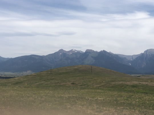
Laura Newman put me in contact with a guy named Jobe Wymore who was looking for a partner with whom to climb Mt Isto, the highest peak in the Brooks Range within the arctic circle in northern Alaska. While I was intrigued, the more I looked into it, the more I became hesitant about joining. Rather than completely bail on Jobe, I suggested that we try another peak first. We shared a mutual interest in McDonald Peak in Montana. I was interested because it is an ultra prominent peak and Jobe was interested because it is a western contiguous US county high point. This peak is known for lying within a grizzly bear conservation area, so I spent a lot of time recruiting other people to join. Since our trip was slated for the middle of July, which is prime hiking season, others already had plans elsewhere. The distance and elevation gain seemed manageable to do as a day hike, but as the trip inched closer, Jobe began to worry and requested that we do it as an overnight. I did not want to camp in grizzly country, but I also did not want to get stuck out on the mountain after dark in grizzly country. Over time the idea of an overnight trip grew on me. This would allow me to fish Duncan Lake and would give us an extra summit day from an advanced base camp if weather were to turn sour. I purchased Flathead Reservation camping and fishing permits online. The road to the trailhead was reported as questionable so Jobe offered to shuttle us in his Jeep over the last few miles. As the trip approached, the weather forecast was sunny and optimism was high.
Asaka and I landed at MSO on the evening before the climb. We picked up our rental car, which was a nice Ford Explorer, and drove to our motel. The next morning we had breakfast at a coffee shop where Asaka did some last minute studying. I watched a train transport several planes, which I thought was interesting.
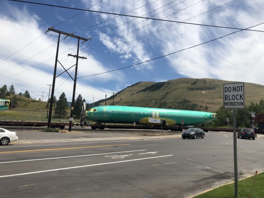
I picked up some bear spray and water downtown. We then drove north where we planned to meet Jobe in St Ignatius, an Amish town. We decided to meet at the Mission General Store. Jobe was much younger than I expected. He told me there were three things we needed to know about him; he likes beer, hiking and The Grateful Dead. After lunch, we caravanned to the start of the rough road where I left the rental. The remaining road wasn’t very tough to follow and I probably could have made it in my rental car. We parked the car in the dirt lot at road’s end and followed the use trail along the ridge above Ashley Creek.
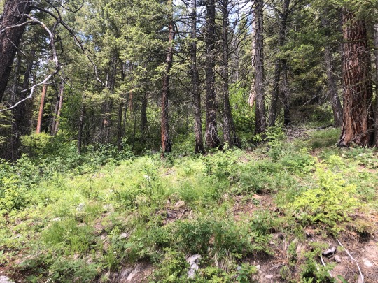
Jobe was confident that we wouldn’t have any issues with bears, claiming that in the United States there has never been a documented attack on a group of 3 or more people. I still kept an eye out as we followed the faint use trail up the ridge.
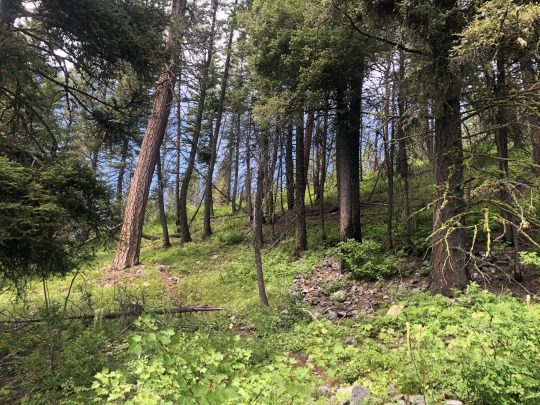
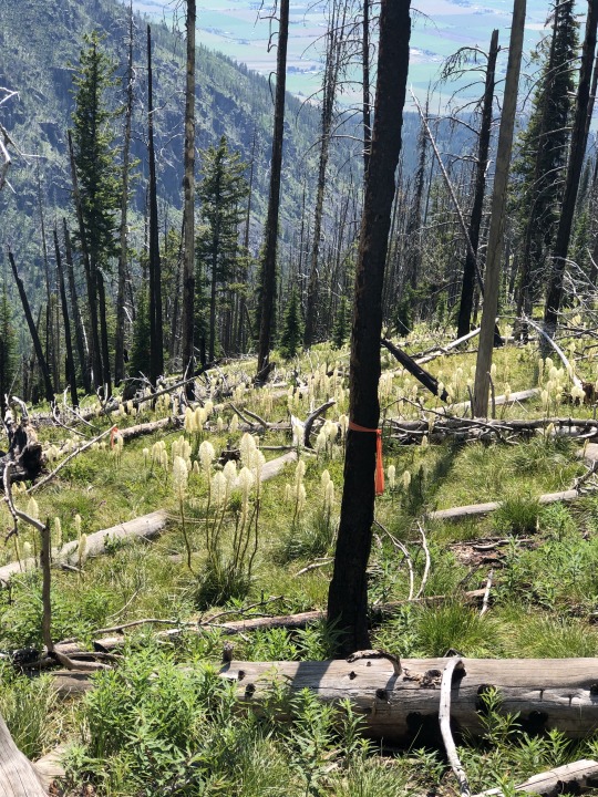
It was a lot warmer than I expected. There were no ticks, which we heard there were plenty of several weeks ago. We broke out of the forest into a burn area. There were many downed logs we had to step over. Jobe taught us about bear grass, and how cumbersome they can make a hike.
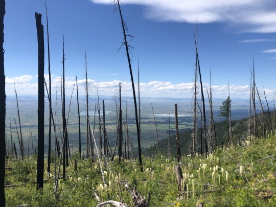
Sheep Peak stood above us. I wondered if it would be easier to climb up and over the peak rather than do the relentless side hill.
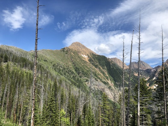
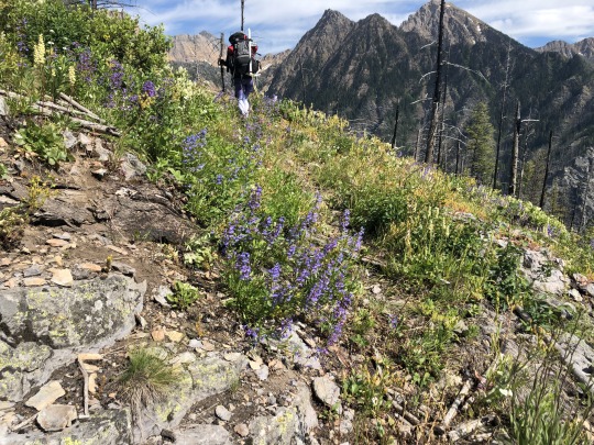
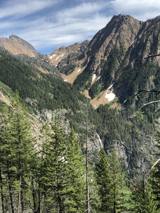
As the trail disappeared we began to follow flagging as our side hill began.
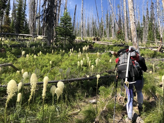
Even the unnamed peaks here are impressive.
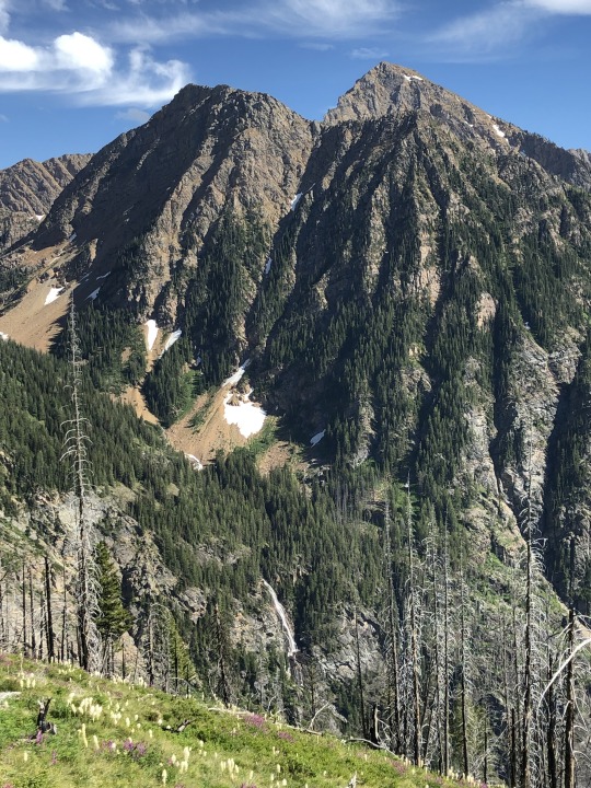
The side hill was every bit as tedious as described, and doing it with a heavy pack made it even more brutal. The bear grass was extremely slippery and it was hard to get a good footing. After slipping and falling, I used more caution and slowed my pace.
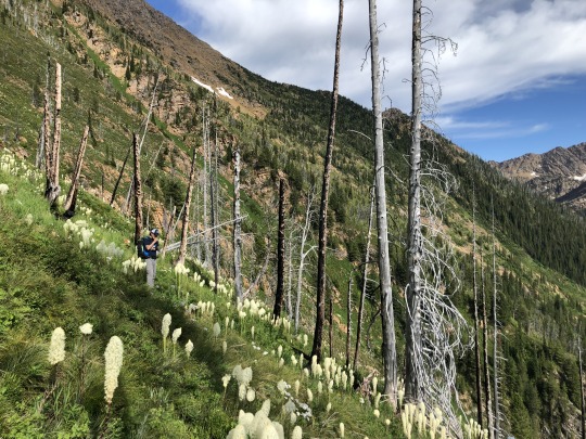
There were some cliff section we had to avoid. We had to climb up or down in elevation to find the weaknesses in the rock bands. Vegetable belays were sometimes necessary.
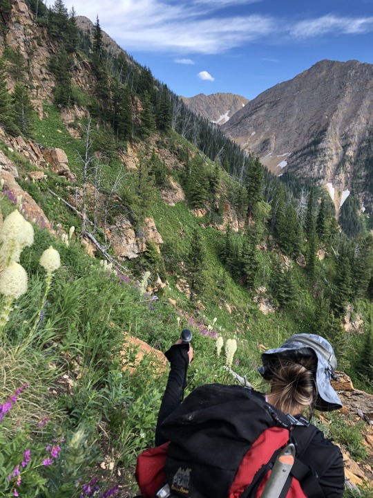
Ashley Lakes appeared below, reminding me of the Devil’s Pulpit on Bear Mountain in California. Previous reports advised strongly against following the trail to Ashley Lakes and climbing up due to a nasty bushwhack, however the never ending side hill couldn’t have been much better.
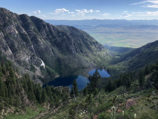
Progress was very slow. I just kept looking forward to the treeline, hoping that things would get better once off the bear grass. Jobe thought he spotted a reddish bear in the distance, but it never moved.
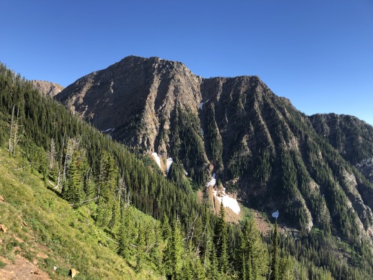
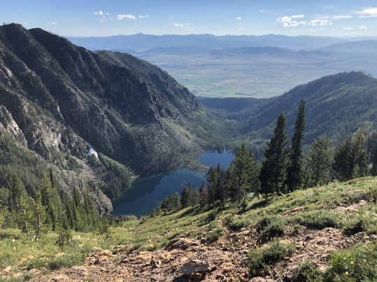
There was a brief rocky section which was a much needed respite.

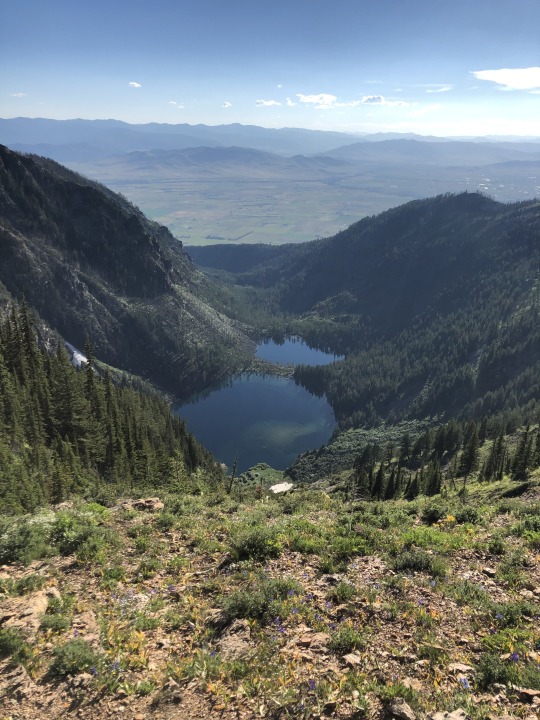
Reaching the forest marked a much anticipated checkpoint. I thought the hard part was over once across the open section, but I was sadly mistaken.
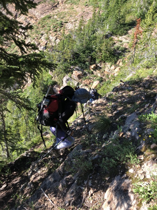
There was a very short segment of trail that appeared, but then it was back to more side hilling, except rather than maintain our elevation, this time we also had to climb a few hundred feet.
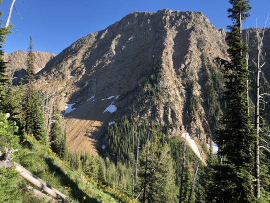

I was exhausted for the last quarter mile to the lake. Even though the distance and elevation gain wasn’t that much, I was using a set of muscles that never get used to that extent. We were rewarded with the breathtaking view of Duncan Lake.
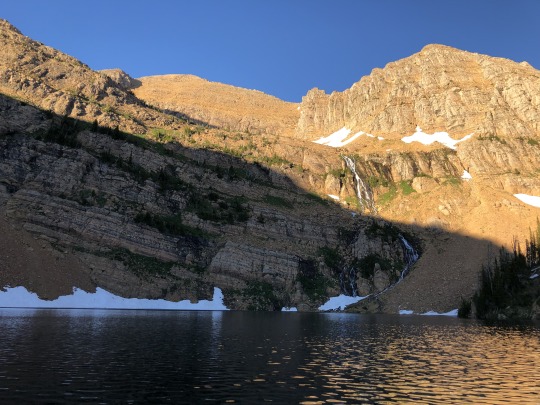
As we scouted the water’s edge for our camp, Jobe excitedly proclaimed that there were no grizzlies in the area. There was mountain goat fur stuck to various nearby trees, and he claimed that mountain goats do not hang out in grizzly bear areas.

At this point, I wanted to believe him, so I joked along. I pulled out my Tenkara rod and tried fishing Duncan Lake, but I had no action and didn’t see any fish rings. The water looked a bit swampy for being in such a pristine location. The only activity on the lake was a lone duck. I quickly gave up on fishing and turned my attention to making a fire. I told Asaka that we should cook dinner away from camp, but we were tired and didn’t want to move. Sure enough, Asaka spilled sauce on the rock right next to our tent. Dope! We ate dinner watching the miraculous alpenglow.
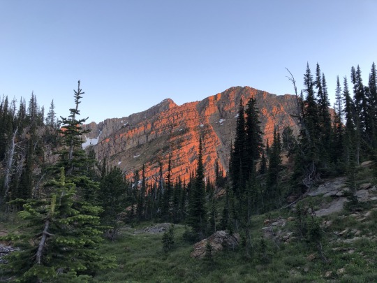
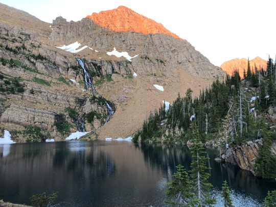
I had service at the lake, so I was able to check the latest weather forecast, which predicted mostly sunny and 0% chance of precipitation. We were only two miles away from the summit, so success was almost guaranteed.
No bears came through camp that night. We left for the peak a little after 6am. We crossed the outlet of Duncan Lake and headed southeast.
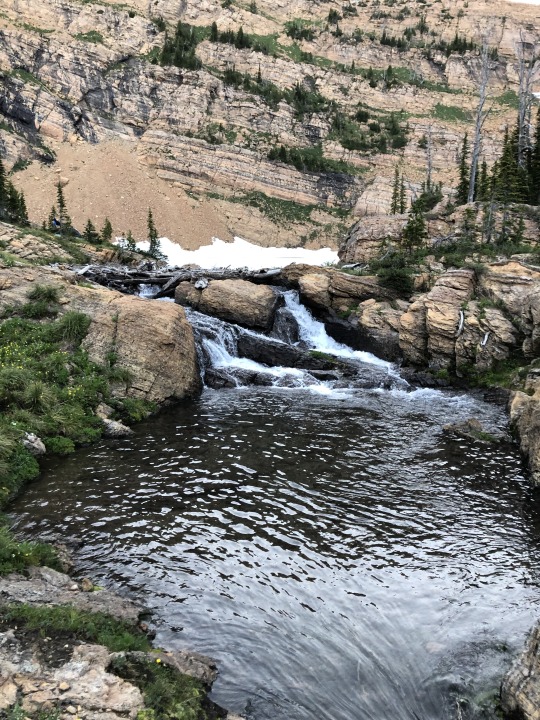
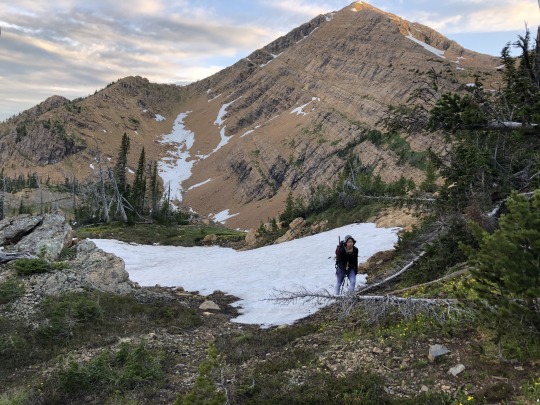
I led a convoluted path up, around and down over some rocky knoll. I was off to a bad start. We hiked through a small gap and contoured towards the south side of McDonald Peak.
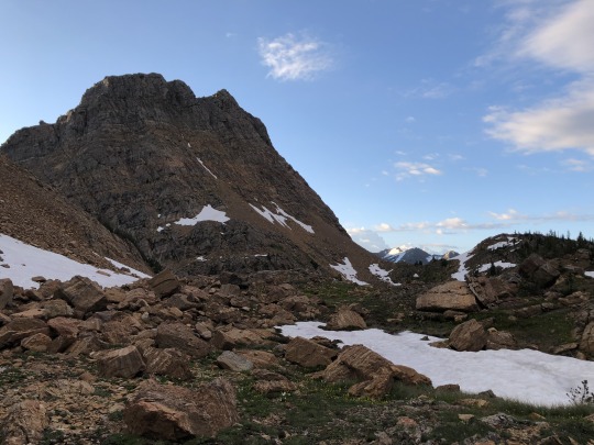
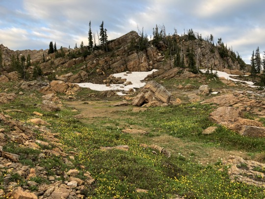
Our first obstacle was an icy snowfield. We managed to walk across this without putting on our crampons.
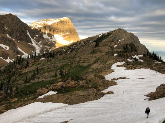
While we tried to maintain our elevation, a series of rocky ledges forced us to down climb a couple times. The strain on my feet made me realized that we were still side hilling. When would the side hill finally end?
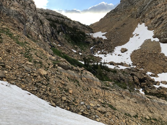
There was water everywhere throughout the canyon. It was such a beautiful place.
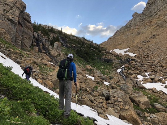
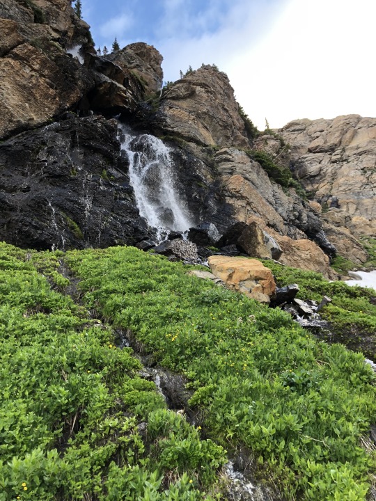
We scrambled up the creek until McDonald Peak was finally visible. We followed a series of ledges towards the base of the snow field. Asaka didn’t feel like carrying her bear spray, so she left it on an open ledge.
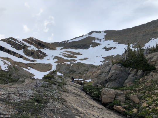
The weather above us appeared threatening. I pulled out my phone again and the forecast still showed mostly sunny with 0% chance of precipitation.
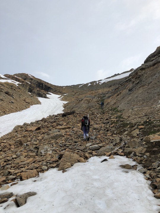
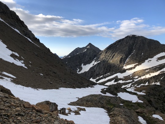
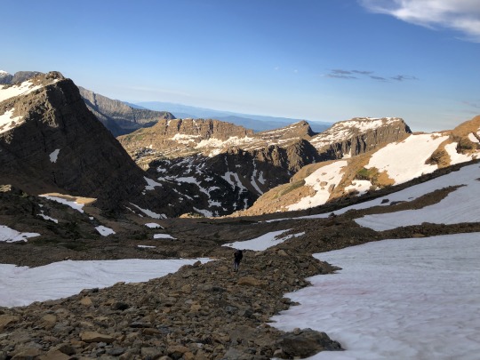
We reached the base of the snowfield where we put on our crampons. Jobe took the lead here while I stayed back to help Asaka.

We followed Jobe’s footsteps. Asaka did not have a flat enough sole on her boot, so her crampons kept falling off on the climb. This issue allowed Jobe to take a huge lead ahead of us. He was laser focused on getting his western contiguous county high point. To minimize the impact of Asaka’s failing crampons, we got off the snow prematurely and made our way up the rocks.
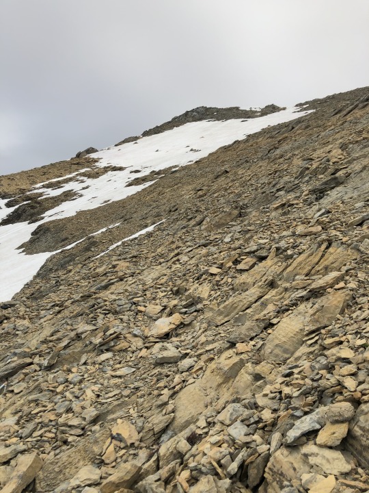
The rock was loose and progress was slow. I started to doubt my weather forecast as the western skies continued to get darker and darker. Rumbling in the distance started to worry me.

We spotted Jobe atop the summit. He passed us on his way down, gave us some words of encouragement and informed us he would wait at the bottom of the snowfield.
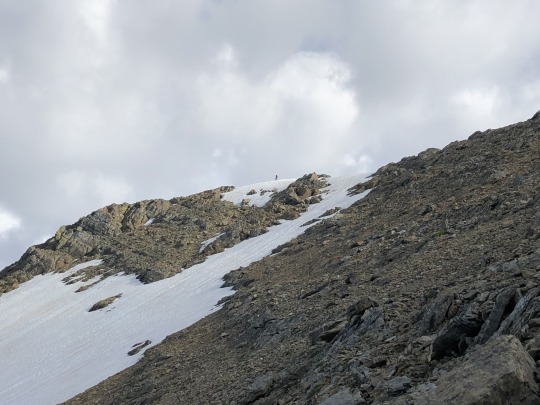
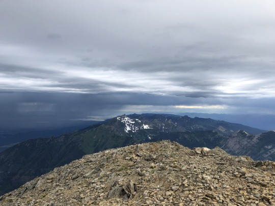
A few minutes later we made it to the summit. To the west was Sheep’s Head.
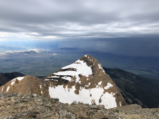
To the north was Mt Calowahcan.
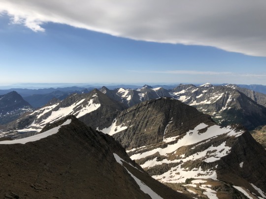
Asaka approached on the ridgeline to the east.

To the southeast were Icefloe Peak and Glacier Peaks.
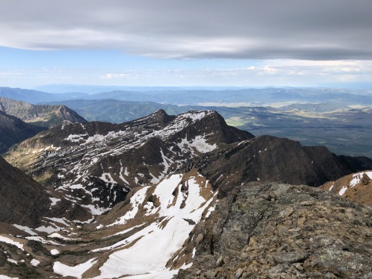
To the southwest was Kakashe Mountain.
youtube
We watched Jobe as he made his way down the rocky section.
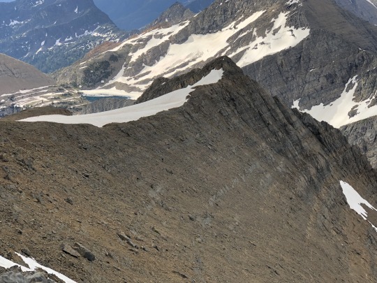
The cliff on the north side of the peak dropped over a thousand feet.
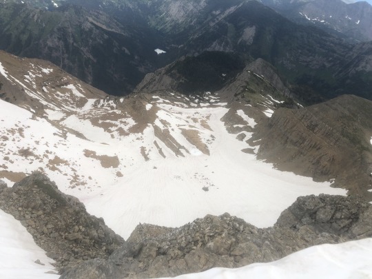
The weather continued to deteriorate so we set off to join Jobe down below. I tried to glissade down the snowfield however it was too icy. I clumsily made it down the snow field but Asaka did not feel as confident. We shouted at each other across the snow field until she decided to follow the rocks down instead. I waited with Jobe, expecting him to become impatient, however he was all smiles. He only had 10 more western contiguous county high points left. While we tried to retrace our steps back, we somehow ended up on another ledge and we couldn’t find Asaka’s bear spray. Hopefully someone else finds this and it doesn’t become litter.
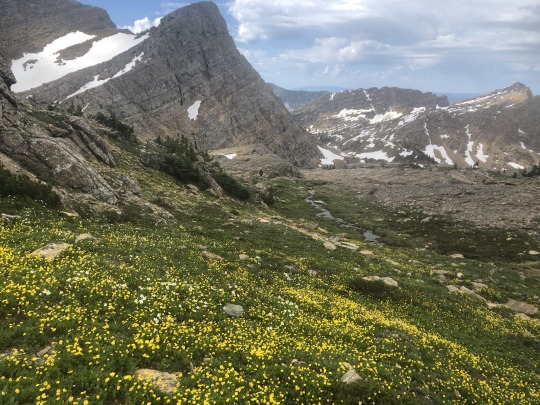
It started to rain once we reached the creek. So much for 0% chance of precipitation. I didn’t bring my rain jacket and got thoroughly soaked. I checked the forecast once more and it hadn’t changed. I’m glad we got off the summit when we did.

We spotted a marmot hanging out on some boulders.
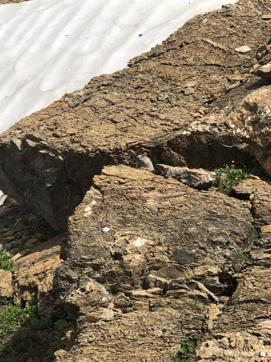
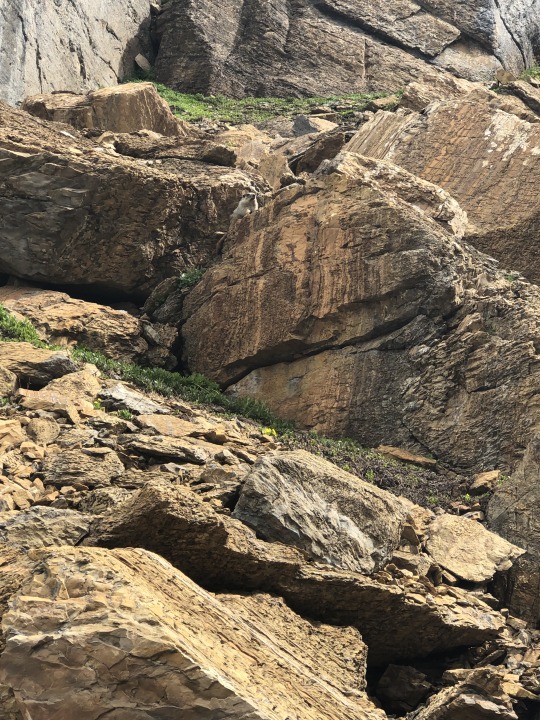
The remaining walk to camp was a wet one.
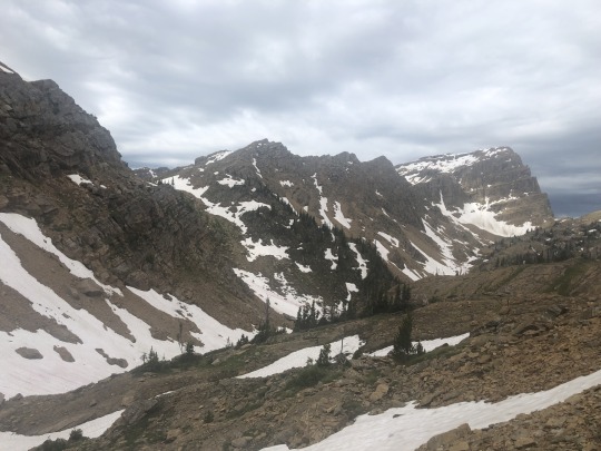
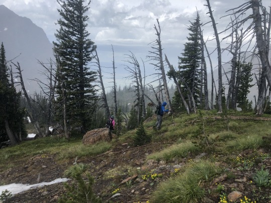
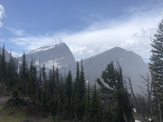
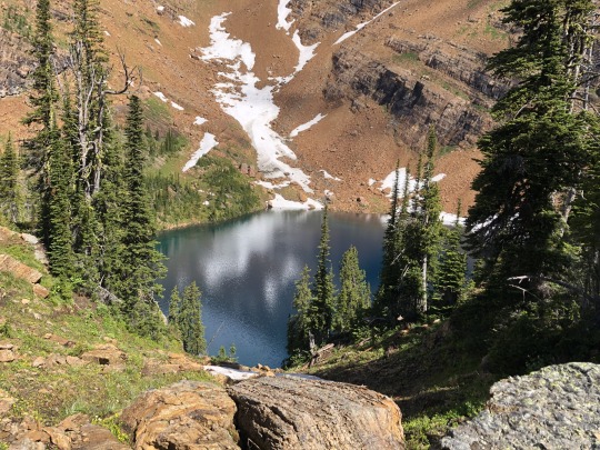
The weather cleared up as we approached Duncan Lake. Our camp was soaked so we spread out everything hoping that the sun would stay out long enough for the gear to dry. I passed time by jumping into Duncan Lake.
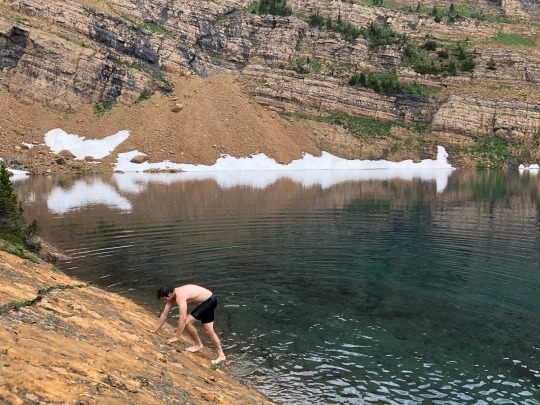
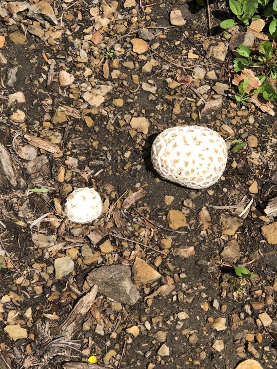
Clouds threatened but it didn’t rain again for the rest of the day. We noticed several climbers on the ridgeline between Sheep’s Head and West McDonald Peak. We joked that it was probably Kerry Breen and Dean Gaudet. I still have no idea what people could have been doing there. We packed everything up and began our hike back to the car. Jobe was excited to find some Puffball Mushrooms on the way.
We understood the next few hours would be rough, so we sucked it up and marched forward.
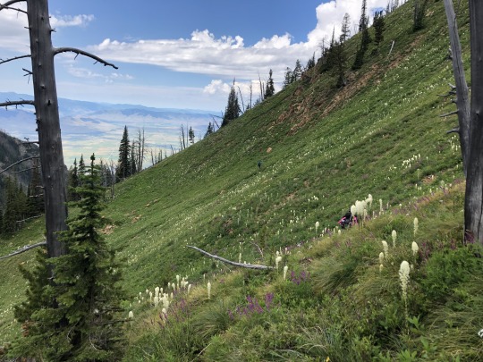
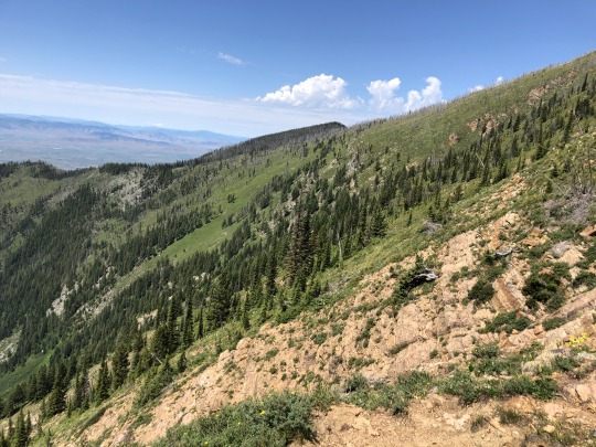

The side hill ended up being easy on the way back. The cliff bands still posed a challenge, but after some patient route finding we got through. I took another hard fall along the way, but damage was superficial. I was relieved to make it back to the flagging.
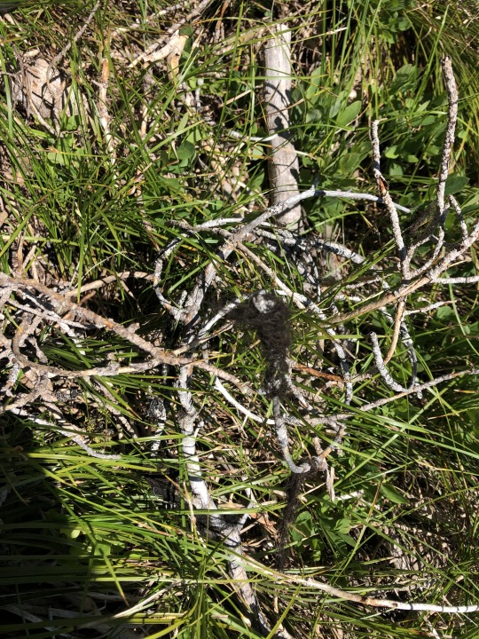
We followed the ridgeline back down towards the use trail. I noticed some bear fur stuck to a twig. Maybe there are bears here after all.
We lost the trail several times over the last mile. We found ourselves hiking along an overgrown logging road. I corrected our mistakes using my pre-loaded GPS track. The heat was starting to get to me, and I requested that we rest several times in the shade. Since I had service, I booked a hotel for the night in Pinnacle. I was especially relieved to finally reach the car. We hopped in the jeep, drank a beer and listened to The Grateful Dead all the way back out to my rental. We stopped for an early dinner at Post Creek 44 Bar Steak and Tap House. Jobe enjoyed his vegan burger while I chomped on my beef burger.
The next day Asaka and I did the tourist thing and drove through Glacier National Park.
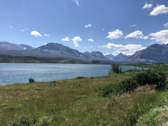
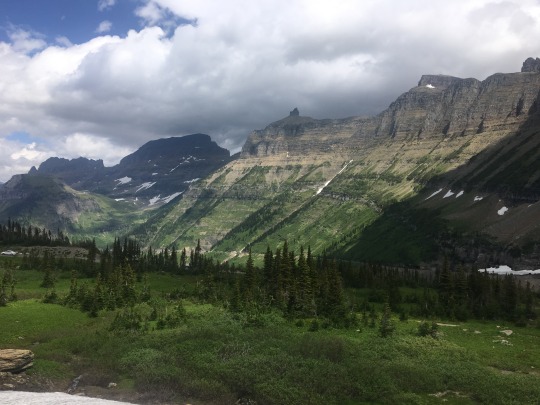
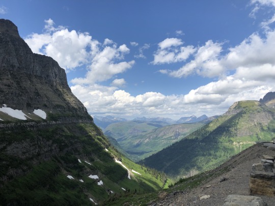
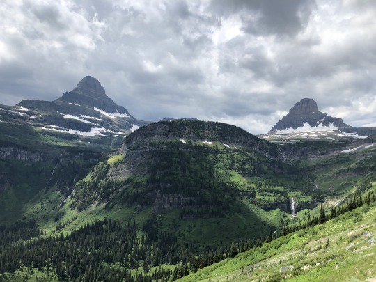
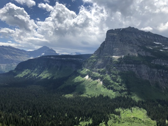
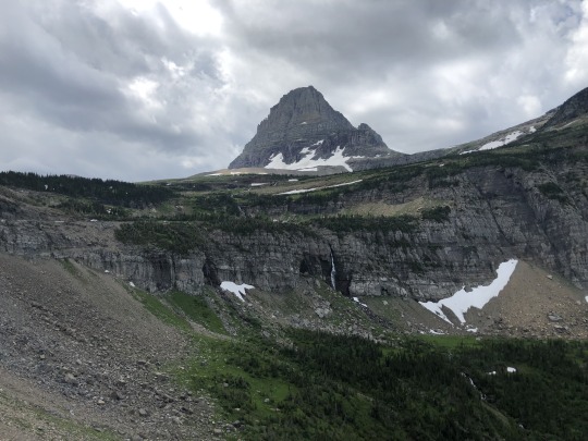
I stopped a few places to fish but I had no luck.
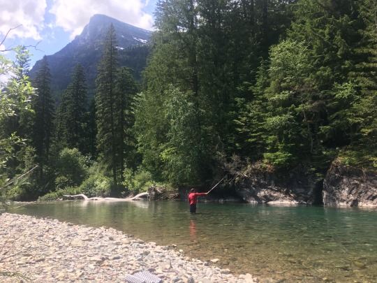
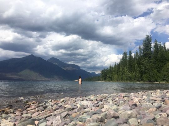
The next morning we drove up Desert Mountain, a P2k just outside of Glacier National Park.
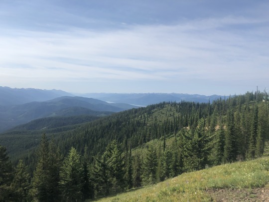
Great Northern Mountain caught my attention.
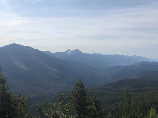
The high peaks of Glacier National Park were also visible.
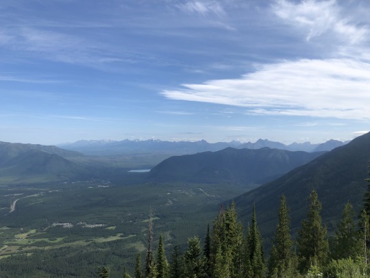

This trip made me fall further in love with Montana, and little did I know I would go back a little more than a month later.
0 notes
Text
Sonora Peak & Stanislaus Peak via St Marys Pass

It was the end of October and we still hadn’t received any significant snowfall. Rather than cry about global warming like most Californians, I took advantage of this opportunity by planning another trip to the Sierra Nevadas. Highway 108 was still open, so I planned a day hike near Sonora Pass. I settled on combining the Alpine County high point of Sonora Peak with the SPS listed Stanislaus Peak. I later remembered I already had plans that weekend, so in order to squeeze in my peak, I decided to hike on Friday and WFH (work from home). We also had tickets to the Warriors game that night, so we needed to get an early start since I didn’t want to have our tickets go to waste. We drove up to Twaine Harte on Thursday night and stayed in the El Dorado Motel. The next morning we drove to Saint Marys Trailhead where we started our hike.

Sonora Peak stands right next to Sonora Pass, but was still 2,000 ft above us at the start of our hike.

We had views of Leavitt Peak’s northern slopes which had much more snow than anything we planned to hike today.

The plants were dry, waiting for more precipitation. Certain parts of the trail had water running over it, making a steep trail a little slippery.

The trail didn’t aim for the low point in the pass. It actually climbed several hundred feet above the pass to the east.

When we reached Saint Marys Pass, Asaka wasn’t feeling good. Her stomach was hurting, and we assumed it was due to the overnight change in altitude. It’s funny how altitude sickness seems to hit on the most benign peaks. She wanted to turn around, but I wasn’t about to let her do so.

Sonora Peak was only about a mile away, so I urged her to continue. She wasn’t happy, but I spent good money on a hotel room and I took time away from work, and I didn’t want the day to go to waste. We continued northeast across the moonscape towards the peak.


At about 10,800 ft, the grade began to increase. Leavitt Peak stood above us to the south.

Just below the ridge, we encountered a trail which we completely missed on the way up. From here we followed the trail along the ridge towards the south to the summit.


We made it to the summit at 11:30AM. To the east were White Mountain and the Sweetwater Range.

To the southeast was Pickel Meadow and the Walker River Drainage.

To the south were Leavitt Peak and Night Cap Peak.

To the west was Saint Marys Pass.

To the north was our next objective; Stanislaus Peak.

Asaka wanted to turn back and wait for me at the pass, but again I really wanted her to continue. At this time I believed she had some interest in chasing the SPS list with me, and I was afraid that she would make me come back, but I’ve since learned that’s not the case. Meanwhile, I wanted to run the ridgeline, but I knew this would take much more effort than descending and following the trail. I didn’t want to split up, but I felt it would be the only way for me to get the bonus bumps listed on Peakbagger with both of us getting the main peak. As we made our way down the trail, I described the route I wanted her to follow. I told her to head cross country across the barren slopes until reaching the trail. After reaching the trail, I told her to follow it north to the bottom of Stanislaus Peak. Meanwhile, I would hike parallel to her on the ridge above, and I planned to meet her at the base of the peak in a few miles. Even with her upset stomach, I knew it would be challenging to keep up with her while off trail, so upon diverging on my own route I started hiking as fast as I could. I jogged down to the saddle to my north, then power walked up the southern slopes of Peak 11010. I felt myself losing distance versus Asaka on the uphill. I watched Asaka below follow the correct route, but eventually she went out of sight. I paused briefly on the summit of Peak 11010, but I didn’t even stay long enough to take any photos. I continued northwest across gradual and sandy slopes. There were some slight ups and downs but I was able to keep the elevation delta minimal. I climbed the next obvious high point along the ridge, which was a block of a summit that required a little bit of class 3 scrambling. While on the summit, I realized this was not the bonus peak listed on Peakbagger. Peak 10578, only a quarter mile to the northwest, was lower and less prominent, but was marked for some reason. I wonder if someone entered the incorrect location of the bonus peak, but either way I climbed both possibilities, which included Peak 10578 even though it was definitely not worthy. I was making slow progress climbing down the talus until I saw Asaka. This motivated me to continue and I was happy to reconnect with her on the southeastern base of Stanislaus Peak.

She reported that the trail was easy, which was good to hear. The trail disappeared over a steep pass here so we continued cross country through some brush and across sandy slopes. We found a use trail but it was very loose and tedious. The final 800 feet was a bit of a slog, with some loose class 3 near the very top. We walked across the summit plateau until reaching the 11,233 ft high point at 2PM. To the southeast was Stanislaus Peak, our first summit of the day.

To the south was Leavitt Peak.

To the west were Red Peak and Stanislaus National Forest.

To the north was Highland Peak.

To the northeast was the East Fork of the Carson River.

To the east were White Mountain and the Sweetwater Range.

We ate our sandwiches on the summit, and while the weather was enjoyable and I wanted to stay a little longer, we had to make it back for the Warriors game later that night. We retraced our steps and dropped back down to the trail. Looking back up was the bonus peak which I believe was more worthy than Peak 10578.

The trail was everything that Asaka had promised. It was very gradual and easy to follow. Asaka was moving slowly and I was having trouble staying patient. Her stomach problems were still persisting even this late in the day.


The trail followed the 10,400 ft contour on the topo map as well as it could until we reached Saint Marys Pass.

We changed our clothes and drove directly to Oracle Arena that afternoon. Needless to say, the NBA champion Golden State Warriors beat the hapless Washington Wizards 120-117 that night. Bradley Beal and Draymond Green were ejected after an on the court scuffle.

0 notes