#Bahía Motors Group
Explore tagged Tumblr posts
Text
Bahía Motors Group trajo a Panamá un nuevo Suv aprobado para tu familia: el HONDA BR-V
Honda continúa innovando y respondiendo a las necesidades cambiantes de las familias modernas con su más reciente lanzamiento: el BR-V. Este vehículo forma parte de la ampliación de la línea de SUVs de la marca y responde a su visión de brindar más opciones para las familias. El nuevo BR-V fusiona elegancia, funcionalidad y versatilidad para ofrecer una experiencia de conducción excepcional a…

View On WordPress
0 notes
Text
CLASE 02 - BRASIL - EL 22 DE ABRIL DE 1500
¡Hola! ¿Qué tal? Bienvenidos al Curso Portugués para Hispanohablantes.
¿QUÉ SE CONOCE DEL DESCUBRIMIENTO DE BRASIL?
¿Ya lo sabías? Hubo la posibilidad de BRASIL haber sido colonia de ESPAÑA. Pero, ¿cómo fue eso?
En junio de 1494 los Reyes Católicos firmaron el Tratado de Tordesillas (actual provincia de Valladolid) con Juan II de Portugal, el hijo de Alfonso V. El fin era acabar con las hostilidades que podían provocar una nueva guerra entre vecinos y perjudicar la colonización. De este modo, delimitaron una línea de polo a polo, 370 leguas al oeste de las islas de Cabo Verde, quedando el hemisferio oriental para la Corona de Portugal y el hemisferio occidental para la Corona de Castilla.
Este fue el motivo por el que BRASIL fue colonia portuguesa y no española, es que ese territorio se encontraba dentro de los límites pactados con Isabel y Fernando en el TRATADO DE TORDESILLAS. Ese es el motivo por el que Brasil.
Desde el siglo XV los marinos portugueses se habían convertido en excelentes navegantes, gracias al impulso dado a la navegación por Enrique el Navegante y su ESCUELA DE SAGRES, Bartolomé Díaz había doblado el cabo de las Tormentas (Buena Esperanza) en el extremo sur de África y Vasco de Gama, siguiendo la misma ruta, había llegado hasta la India en 1498.
Sin embargo, al tener noticias en la corte de Portugal de los descubrimientos colombinos en favor de la Corona de Castilla, se dispusieron a realizar sus propias exploraciones y colonizaciones, sobre todo porque en virtud del Tratado de Tordesillas (1494), firmado por las dos naciones descubridoras y arbitrado por el Papa Alejandro VI, correspondían a Portugal todas las tierras al este de un meridiano imaginario que pasaba 160 millas al oeste de Cabo Verde y dividía al globo terráqueo por la mitad.
Muy pronto los portugueses llamaron al territorio saliente de SUDAMÉRICA que caía dentro de su dominio «el Brasil», debido a la madera tintórea que se conocía como palo brasil y que por entonces constituía la principal riqueza de la región.
En el mismo año en que se iniciaba el siglo XVI, Álvarez Cabral, navegante enviado a la India por el rey portugués Manuel el Afortunado, se desvió de la ruta africana - según se cree, intencionadamente - y llegó a BRASIL, donde fundó una colonia que, con el tiempo, sería la base de la expansión portuguesa en aquel inmenso territorio.
Antes de la llegada de los portugueses el actual Brasil estaba habitado por cerca de tres millones de indígenas que conformaban diversos grupos tribales. No constituían un conjunto cohesionado o definido, mucho menos centralizado, como sucedía en otras regiones de América.
El explorador portugués nacido en Belmente, Pedro Álvarez de Cabral, fue el primer europeo en pisar tierras brasileñas en 1500. Al mando de 13 navíos y 1.500 hombres, descubrió unas playas sobre el océano Atlántico, a las que llamó Tierras de Vera Cruz tras tomar posesión de ellas en nombre de Manuel I. Luego, siguió su trayecto hacia Calicut. Brasil tuvo al comienzo un interés maderero y de enlace comercial, hasta que el descubrimiento de Álvarez fue finalmente retomado en 1515.
Gonçalo Coelho, Fernando de Noronha y Américo Vespucio, exploraron las extensas costas brasileñas, determinando claramente que éstas se encontraban dentro de la jurisdicción del rey de Portugal, de acuerdo con el tratado de Tordesillas.
La verdadera COLONIZACIÓN DE BRASIL tuvo que esperar hasta la década de 1530, en que se establecieron varias factorías a lo largo de la costa. La primera fue la de São Vicente, fundada por una expedición al mando de Martín Alfonso de Sousa. Aunque esta tierra fue originalmente llamada Veracruz, pronto adoptó el nombre actual, debido a que el llamado palo de Brasil producía un apreciado tinte vegetal, que constituyó durante la primera mitad del siglo XVI el más importante producto exportado de estas tierras.
Hacia 1532, los colonos portugueses, principalmente «bandeirantes» (aventureros paulistas) y jesuitas, avanzaron a lo largo del valle del río San Francisco.
En 1534, la región fue dividida en DOCE CAPITANÍAS HEREDITÁRIAS, entregadas a nobles portugueses. Sin embargo, este sistema fracasó, pues cuatro capitanías no fueron colonizadas y otras cuatro fueron destruidas por ataques indígenas, resultando solamente rentables Pernambuco y São Vicente.
Cabují, el volcán extinto que reivindica el descubrimiento de Brasil.
Varios historiadores e investigadores reivindican que el PICO DE CABUJÍ, el único volcán extinto en Brasil que conserva su forma original, fue el punto que avistaron los primeros portugueses que llegaron al país en 1500, un hecho que por siglos es atribuido al Monte Pascoal, en Bahía.
Localizado cerca del litoral de RÍO GRANDE DO NORTE, en el extremo NORESTE del país, el pico de Cabují es el único de los varios volcanes sin actividad que mantiene intacta su forma y hoy su nombre es más conocido por los brasileños por esa reivindicación histórica.
El primero en levantar esa hipótesis fue el investigador Lenine Pinto, profesor de la Universidad Federal de Río Grande do Norte - UFRN, que en 2012 publicó el libro "Reinvención del Descubrimiento", en el que afirma que Cabují es el Monte Pascoal y que el vecino municipio de Touros corresponde a la ciudad de Porto Seguro.
A pesar de las teorías que indican que el portugués Duarte Pacheco Pereira avistó, sin tocar tierra, lo que hoy es Brasil en 1498. Alvares Cabral era uno de los comandantes de la expedición portuguesa de Vasco da Gama que buscaba una ruta diferente para llegar a India, circundando el continente africano, y de acuerdo con los relatos históricos avistó primero el Monte Pascoal y luego desembarcó en lo que hoy es la ciudad de Porto Seguro.
El ingeniero civil e investigador Manuel Oliveira Cavalcanti, que acaba de publicar "1500: De Portugal al saliente potiguar", un libro que recoge los estudios a partir del viaje del propio autor al país ibérico para conocer con más detalles la "Carta del Descubrimiento", el documento oficial portugués sobre Brasil.
"Hay una tesis de un historiador sobre que el descubrimiento de Brasil fue en Río Grande do Norte y sobre esa tesis seguí", dijo a Efe Oliveira Cavalcanti, quien recopiló el trabajo de Pinto y reforzó la teoría con más datos basados en la interpretación de los relatos de los portugueses.
De acuerdo con el autor, "hay nuevos hechos, nuevas evidencias y el libro muestra eso, que Brasil fue descubierto en Río Grande do Norte. Fueron dos años de investigación".
"Estuve en Portugal, en la Torre do Tombo, e investigué decenas y decenas de libros, investigué las corrientes marítimas, la plataforma continental, las corrientes aéreas y por ahí va todo el trabajo para demostrar esa teoría", apuntó.
Pinto, Oliveira Cavalcanti y otros investigadores se apoyaron también en una expedición conjunta realizada entre los Gobiernos de Brasil y Portugal para la celebración de los 500 años del descubrimiento, en la que los navegantes utilizaron la ruta, condiciones y equipos similares a los empleados por Alvares Cabral.
Para llegar el 22 de abril de 2000 a Bahía, un Estado más al sur de Río Grande do Norte, la expedición necesitó de un motor auxiliar más potente, pues en las mismas condiciones de 1500 sólo conseguirían tocar suelo brasileño, en esa fecha, en Touros.
Con coordenadas de 5° 42' 22" S 36° 19' 15" y una altitud de 590 metros, el pico de Cabuji, cuyo nombre indígena tupí-guaraní significa "pecho de muchacha", también es llamado de Serrote da Itaretama, que en la misma lengua se traduce como "sierra de muchas piedras".
El pico forma parte del Parque Ecológico Cabugi (con 'g'), una extensa área de preservación vigilada por el Gobierno regional y que cada vez cuenta con más turistas nacionales y extranjeros que buscan una opción de aventura diferente a la ofrecida por las paradisíacas playas en esa zona. (Ney Douglas).
REFERENCIAL BIBLIOGRÁFICO:
Fuente: https://brasilmasquefutbol.com/2015/04/04/por-que-brasil-fue-colonizado-por-portugal-y-por-espana/
Fuente: https://mihistoriauniversal.com/edad-moderna/conquista-de-brasil/
Fuente: https://historiaybiografias.com/explorar_elsur/
Fuente: https://www.efe.com/efe/america/sociedad/cabuji-el-volcan-extinto-que-reivindica-descubrimiento-de-brasil/20000013-3613989
Ahora ya sabes cómo surgió el GIGANTE de Sudamérica y que por poco los brasileños hubiera sido más un país de lengua española en América. Sigues estudiando esta lengua tan hermosa que es el PORTUGUÉS.
MUITO AGRADECIDO PELA ATENÇÃO
C O N T A T O:
- Zoom / Skype: [email protected]
- Telegram: https://t.me/Jetenol
- Tumblr: < https://jetenol.tumblr.com/ >.
- Instagram: < https://www.instagram.com/jetenolcorreia/?hl=pt-br >.
- Facebook: < https://www.facebook.com/pg/Jetenol/groups/?ref=page_internal >.
¡MUCHAS GRACIAS!

1 note
·
View note
Text
On Mexico’s Marieta Islands, find the Hidden Beach that’s on bucket lists.
Marieta Islands, Mexico (CNN) — When the Mexican military used the Marieta Islands for target practice in the early 1900s, little did they know their efforts would lead to the creation of a future tourist destination.
But, in fact, repeated bombings on the islands are thought to have created what is now known as Hidden Beach. Yet, it’s not quite so hidden these days.
Wild Islas Marietas

The Marieta Islands are located just a few miles off the tip of Punta Mita on the west coast of Mexico.
Eduardo Alberto Mugica Muro/Riviera Nayarit Tourism Board
The Marieta Islands are located just a few miles off the tip of Punta Mita on the west coast of Mexico. This archipelago in Banderas Bay (Bahía de Banderas) is thought to have been formed by volcanic activity thousands of years ago. The islands have never been inhabited by humans, only by wildlife.
An aerial view of the islands reveals a large circular crater, and within the crater is the secluded beach Playa Escondida (“Hidden Beach”). It’s also called Playa del Amor or Lovers’ Beach.
The beautiful, hard-to-access spot (more on that later) is highly sought out by tourists from around the world. No doubt its somewhat “secretive” location adds to its allure, but its pristine, sugary white sand and bright blue water help, too.
The challenge of actually getting there — the short stretch of beach is only accessible by swimming through an underwater tunnel — plays a role in its intrigue too.
Overcoming the beach’s elusiveness is an accomplishment in and of itself.
Damage control
Unfortunately, an increase in visitors eventually led to pollution and trash build-up, which, in turn placed the coral reef and endangered species living on the Marieta Islands in jeopardy.
Instagram is not all to blame, however.
Efforts to protect the islands and the mystical Hidden Beach actually began long before the internet went gaga over the photos.
During the late 1960s in an effort to preserve the environment and prevent harm to the area, scientist and marine conservationist Jacques Cousteau stepped in. Bringing much-needed attention to the islands when he began advocating for their protection, his efforts ultimately paid off.
Some 40 years later, in 2005, the islands were finally designated a national park — Parque Nacional Islas Marietas. Offering further protection from destruction, in 2008 they were also designated as a UNESCO MAB (Man and Biosphere) Reserve. MAB sites are those which aim to strengthen the relationship between people and the environment with the help of science.
These protective measures were, however, deemed not enough. By May 2016, there were almost 2,500 tourists visiting daily. Both natural phenomena and bad tourism practices continued to negatively impact the coral colonies in the area.
Officials declared the temporary closure of Hidden Beach as they worked evaluate the best way to keep the popular tourist attraction open for the long-term.

Only 117 people are allowed to visit Hidden Beach daily (and not Mondays or Tuesdays).
Riviera Nayarit Tourism Board
In August 31, 2016, the beach reopened, albeit with stricter visitation limits in place.
Authorities allow visitors to swim, but they’re not allowed to wear fins, and scuba diving is prohibited. Additionally, only reef-friendly sunscreens are permitted. (Look for ones that are free from oxybenzone and octinoxate, such as Think Sport or Badger.)
Down from the thousands of people visiting each day, now only 117 people are allowed per day, and the beach is closed to visitors on Mondays and Tuesdays.
These limitations may have decreased visitation, but demand to check off this bucket-list item has, unsurprisingly, only increased.
After all, it’s one thing to ooh and ahh over pictures on Instagram (users can search the hashtag hidden beach and be transported to turquoise waters and pristine sand), it’s another to experience it in the flesh.
Visiting Hidden Beach
In order to respect the maximum number of allowed visitors, only five operators (including Punta Mita Charters, Nayarit Adventures and Ally Cat Sailing Adventures) have permission to take groups to the Marietas Islands. Tours incorporate only a 20-minute visit to Hidden Beach.
Interested travelers would do well to book a tour at least a month or two in advance.
Here’s the kicker, though: Just getting a spot on the tour doesn’t guarantee a stop at Hidden Beach. Sea conditions could potentially omit the special stop.
Richard Zarkin, PR Manager for the Riviera Nayarit CVB, understands the interest, saying: “The Marieta Islands are one of our most treasured jewels in Riviera Nayarit, and one of the icons that people immediately tie back to Mexico’s Pacific Treasure.”
Zarkin also gets the Instagrammable appeal and credits it with helping boost tourism to the area in general. “We are extremely proud of this UNESCO-listed biosphere reserve,�� Zarkin says.
Home stretch
From Puerto Vallarta, Nuevo Vallarta, Punta de Mita and Sayulita, the voyage takes approximately one hour. As you motor out towards the islands, you may spot dolphins or whales in the water. About 75 meters (200 feet) from the entrance to Hidden Beach, the tour boat will drop anchor. After the boat is moored, you will be fitted for a life preserver and helmet.
Even skilled swimmers will need to wear a life preserver as the only way to actually reach Hidden Beach is by swimming to it through a tunnel.
Tour staff will be in kayaks nearby monitoring you as you approach the cave, but this is still not a swim for water-wary individuals. You must swim in during low tide when there is the maximum amount clearance between the water and the top of the rocky entrance.
And even then, the passageway only has approximately six feet of vertical clearance. But, get ready for a major adrenaline rush as the tide pushes you in through the opening. You might even feel like your head grazes the top of the cave. When you finally burst through the opening and into the crater, you will come right up on the shores of Hidden Beach.
With a sea of crystal clear blue ocean water surrounding you, if you look up, you’ll see a large dome opening straight up into the bright blue Mexican sky.
Paradise, at last.
Marieta Islands (Eduardo Alberto Mugica Muro/Riviera Nayarit Tourism Board)
The post On Mexico’s Marieta Islands, find the Hidden Beach that’s on bucket lists. appeared first on Tripstations.
from Tripstations https://ift.tt/2TTt8dW via IFTTT
0 notes
Text
Crunch Time
Since it’s our last week in San Sebastián before we go to Pamplona for three, we packed our schedules with wild and adventurous stuff to do before we go. We began this week with a trip to France, and though brief, our time there was full of rain and fun! We started the trip in a town called Irún on the Spanish side of the border. After walking around for a while and enjoying a coffee and a crepe at a local cafe, we crossed the border into France.
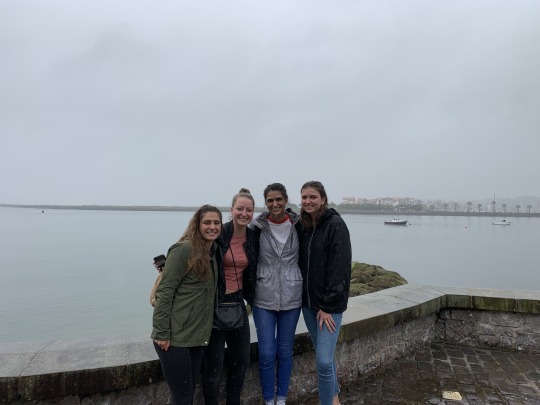
Here you can see Kat, Mary, Elena and Isabella drenched from the torrential downpour that hit right when we got to the border. Behind them is the Bidasoa River which separates Spain and France. The border between the two is so relaxed people were crossing in dinghies! We all brought our passports (and poor Jay ran a mile and a half from where we met the bus back to Olarain and back to get his) but we never even needed them.
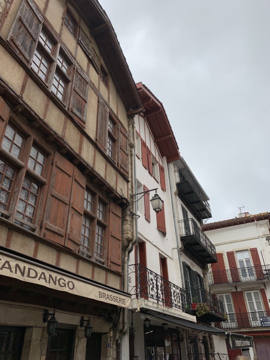
Saint-Jean-de-Luz, France was full of beautiful, wide cobblestone streets lined with stores below apartments. There were tons of clothing shops, cafes and bars on every corner. The buildings were all very old and it was breathtaking. The people were very nice. Even if they were mean, though, none of us would’ve known. Only about two of us knew any French, so navigation was fun. At one point, we heard church bells and I got some people to follow them and it led us right to the Church of Saint Jean the Baptist which was truly a marvel.
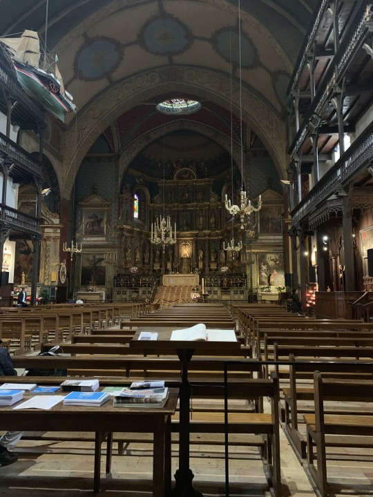
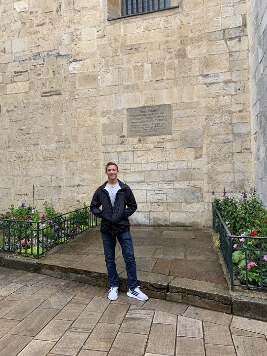
From reading the placards on the side, we found out it’s the exact church where King Louis XIV of France married Queen Maria Theresa of Spain in 1660 as a sort of coup so France could subdue Spain which was broke from its many wars at the time. How cool?! The rose gardens next to me in the picture below had memorial stones in them, and all of those gardens are tended to by local women.
In addition to France, IPE and TecNun took us surfing this week. Now, as someone from the lower Hudson Valley in New York where there are virtually no waves within an hour to two hour drive, surfing is foreign. I’d never been surfing before this trip, and only one person in my group had gone before. We went with the students from Penn State who were just as enthusiastic about the incredible new experience. The guys from Penn State went out in the first group with Jessie, Rebecca and me. The girls from Penn State went out with the other ten wolverines right after.
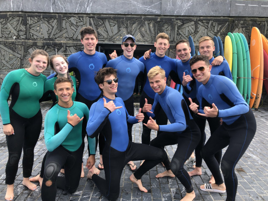
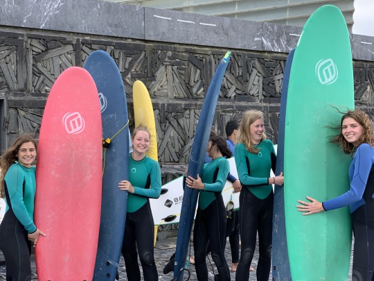
Three men from San Sebastián took us down to the beach where we learned the basics: paddling, catching waves and how to stand up. On land we were all getting pretty cocky but had a real quick reality check once we hit the water. It was harder than I thought, but we all got the hang of it relatively quickly. It was hard to get any really good photos since the best waves were kind of far out, but I did my best.
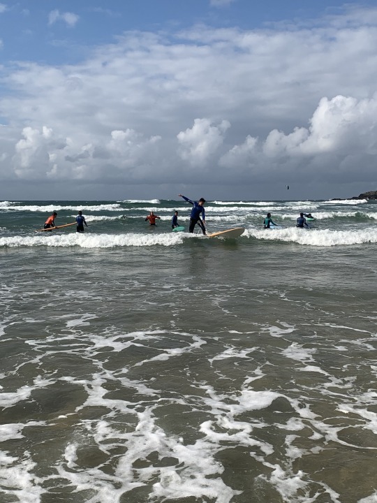
Anthony rode a wave from the instructor in the red shirt about 50 feet behind him all the way to the shore.
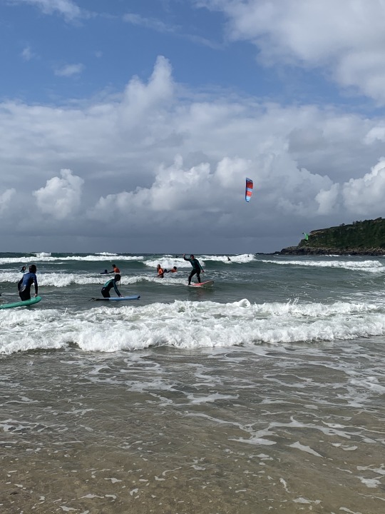
Kat caught on quickly and was showing a lot of us how it’s done. The instructors kept complimenting her on her solid stance with her knees bent and arms out for balance. She loved surfing and loves the ocean... maybe that’s why she’s going into naval architecture and marine engineering.
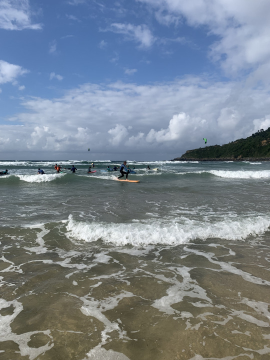
Jay also really got a hang of things quickly and rode waves from way out all the way to the water’s edge. He killed it!
Because it is technically a study abroad, we did have classes this week, too. In the product design course, they continued working on their projects to improve motorized scooters. In the renewable energy class, we began working with computer systems designed to take in data about the environment and electric grid systems to determine the optimal system. For example, if a city were trying to figure out whether it would be more cost effective and sustainable to invest in windmills, solar panels, or both, they would use the program we worked with.
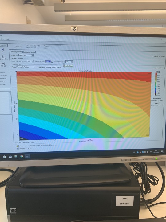
Graphs like the one above and charts of collected and projected data help engineers determine how to make the most efficient electric grid to save money and protect the environment. They compare thousands of possible scenarios for given wind speeds, sun exposure rates and tons of other factors. It took the computer about an hour to process all of the possibilities this morning, so this work would be nearly impossible without them. Today, we finished theoretical scenario in which we had to write a report on the optimal configuration for the electric system. I worked with Mary and Kat, and our report was almost 20 pages long! It was very interesting work, I really enjoyed it.
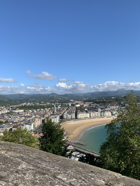
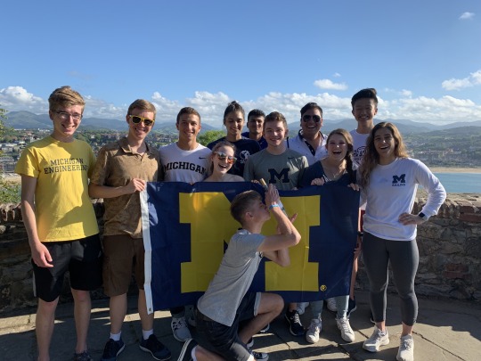
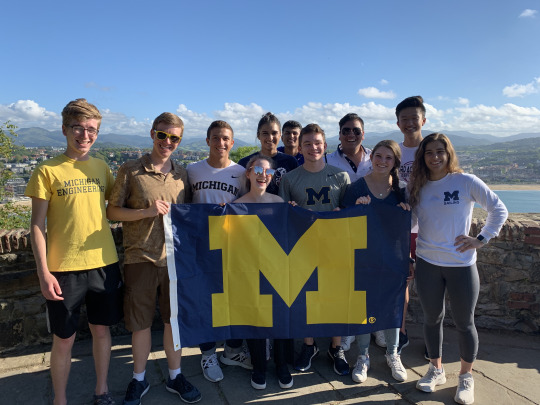
After all of the class time, though, we needed a break. We went to Lo Viejo and hiked up Mount Urgull, which is topped by a massive statue of Jesus that watches over San Sebastián and La Bahía de la Concha. The hike was not bad at all, and the views were stunning beyond belief. I can’t even find words to describe how picturesque the whole scene was, so here’s a few pictures which I’ve heard are worth at least a thousand words.

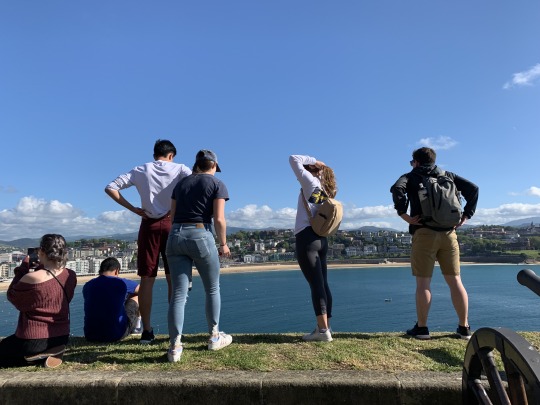
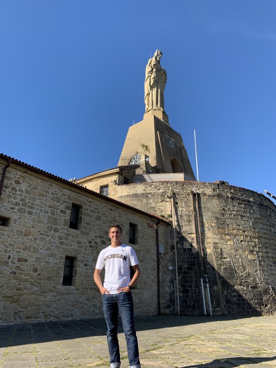
And of course... the obligatory Michigan flag picture which was taken by some very amused German tourists who were very eager to join in and show the world their love of wine!
Ryan DaCosta
Undeclared
Spanish Language, Culture, and Industry in San Sebastián, Spain
0 notes
Text
En busca del tubo perfecto en Oahu
Fuente original: En busca del tubo perfecto en Oahu Puedes ver más visitando Teleindiscreta - Las mejores noticias de actualidad, famosos, salud, belleza, cocina, motor, música y mucho más.
Playas paradisiacas, escenarios de película, lugares evocadores y… olas. Unas crestas gigantes que dan lugar a algunos de los tubos más perfectos del mundo y hacen realidad los sueños más fantásticos de los amantes del surf. Si es aficionado a este deporte, vaya a la isla de Oahu, en el archipiélago de Hawai, para contemplar el espectáculo de olas de 12 metros y a los mejores surfistas del mundo cabalgando sobre ellas. En febrero, clima y mareas se aúnan para hacer las delicias de surferos y espectadores. La bahía de Waimea, al norte de la isla, es uno de esos lugares donde se producen olas perfectas y enormes; en Pupukea, la rompiente Banzai Pipeline, que da nombre a las olas, provoca tubos perfectos al alcance de muy pocos, ya que la cercanía de los arrecifes y las rocas y la fuerza de las olas convierten la práctica del surf en especialmente peligrosa. Después de una jornada deportiva, puede recorrer los escenarios naturales donde se rodaron Parque Jurásico o la serie Lost, visitar la histórica bahía de Pearl Harbor o darse un baño en la famosa playa de Waikiki en Honolulu, y no se vaya de Oahu sin visitar el cono volcánico Diamond Head.
Informe: Toledo no es lugar para citas baratas
Sorprender a su pareja con una escapada pasional puede ser difícil y caro. Sin salir de España, el coste de una cita romántica en Toledo es un 31% más caro que la media nacional, lo que sitúa a esta ciudad como la más onerosa del país para un plan en pareja, seguida de Madrid (26%). Por el contrario, Zamora es la más barata, según un informe realizado por la web del ahorro Kelisto.es con motivo de San Valentín. El monto medio de estos viajes es de 85,79 euros, de los que un 57,8% se destina a hostelería; un 16,4%, a ocio, y un 9,6% se gasta en transporte.
Veladas inolvidables en edificios emblemáticos en Premium NH collection
Fresas, cava y precios especiales son algunos de los detalles con los que NH Hotel Group quiere sorprender a los enamorados en San Valentín en más de 40 hoteles situados en las ciudades más románticas de España y Portugal, algunos de ellos de la marca Premium NH Collection, ubicados en edificios emblemáticos.
De la huerta de Tudela a los manteles de Sagardi
Con bacalao y almejas, con mollejas de ternera o a la parrilla de carbón de encina, la alcachofa de Tudela protagoniza la carta de invierno del restaurante Sagardi. Especializado en cocina vasca, rinde homenaje a esta delicada verdura con recetas creativas que mantienen la pureza del sabor. En los menús también tienen sitio especial otros productos de la huerta navarra, como el cardo, las acelgas y la borraja.
Por San Valentín, azafrán, afrodisiaco y rejuvenecedor
Tan valioso como el oro, el azafrán ha sido desde la antigüedad una de las especias más buscadas y deseadas, debido a sus grandes propiedades gastronómicas, medicinales y afrodisiacas. La Melguiza, una tienda madrileña dedicada por entero al azafrán, propone para San Valentín regalarlo en bruto en un frasco de finas hebras (desde 10,40 euros) o en un kit de productos cosméticos (desde 54,55 euros) elaborados a base de esta flor tan estimulante y que incluye desde jabón de azafrán y rosa mosqueta hasta champú sólido de azafrán y romero, crema facial iluminadora con azafrán y bálsamo labial de azafrán, naranja y canela.
El dato
México recibió más de 298.000 españoles en 2016, un 4,5% más que en 2015, lo que sitúa a España como el séptimo mercado global y el segundo europeo del país norteamericano. Confía en elevar a 472.000 el número de turistas españoles hasta 2021, gracias a un plan estratégico para atraer visitas con una mayor conectividad aérea y promoción de productos y destinos.
Ibis styles, el estilo ‘happy mood’ invade los hoteles de Barcelona
Diseño, confort y happy mood (felicidad) son las señas de identidad de los nuevos hoteles Ibis Styles: el Barcelona City Bogatell y el Barcelona Centro, ambos con personalidad propia. El primero se ubica muy cerca de la playa y el segundo está a tiro de piedra de la Pedrera y la Sagrada Familia.
A bordo de Qatar Airways: el vuelo más largo del mundo le lleva a la Antípodas
Qatar Airways estrena récord –el vuelo más largo del mundo–; aniversario –cumple 20 años–; ruta –Doha-Auckland (Nueva Zelanda)– y frecuencia –diaria–. El vuelo en el Boeing 777 dura 17 horas y 30 minutos y cubre una distancia de 14.535 km. Para que el pasajero no se aburra, dispone de 3.000 opciones de entretenimiento a bordo.
La oferta del mes
Lo esencial de la India, en 8 días visitando Delhi, Jaipur, Amber, Fatehpur Sikriy Agra, con vuelos, traslados, alojamiento y régimen elegido, en Nautalia Viajes desde 868 euros tasas incluidas
Fuente: Cinco días
La entrada En busca del tubo perfecto en Oahu aparece primero en Teleindiscreta.
from En busca del tubo perfecto en Oahu
0 notes
Text
El nuevo Geely CoolRay viene aún más cool

View On WordPress
0 notes