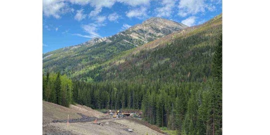
# aerial survey of affected areas
Explore tagged Tumblr posts
Visit Tumblr Blog
Explore Tumblr blogs with no restrictions, modern design and the best experience.
Last Seen Tumblr Blogs


Fun Fact
Tumblr.com rank in the US is 25.
Text
सीएम पुष्कर धामी ने आपदाग्रस्त क्षेत्रों का किया हवाई सर्वेक्षण, कहा, जल्द शुरू होगी चारधाम यात्रा
Uttarakhand News: मुख्यमंत्री पुष्कर सिंह धामी ने बाढ़ प्रभावित क्षेत्रों में जनजीवन सामान्य बनाने के लिए आवश्यक कदम उठाने के निर्देश देते हुए कहा कि क्षतिग्रस्त मार्गाें, पेयजल और विद्युत लाइनों को यथाशीघ्र बहाल किया जाए। उन्होंने केदारनाथ पैदलयात्रा मार्ग शीघ्र शुरू करने और हेली सेवा बुधवार से ही शुरू करने के निर्देश दिए। उन्होंने ऐलान किया हेलीकॉप्टर यात्रा की टिकटों में 25 फीसदी छूट राज्य…
0 notes
Text
Complete Guide to Drone and Aerial Survey Services – Epitome
In recent years, drone and aerial survey services have revolutionized how we collect, analyze, and interpret spatial data. These technologies are faster, more accurate, and more affordable than traditional survey methods. At Epitome, we provide state-of-the-art drone and aerial survey solutions to help clients across multiple sectors gain deep insights, improve planning, and enhance decision-making.
What Are Drone and Aerial Surveys?
Drone surveys involve the use of UAVs (Unmanned Aerial Vehicles) equipped with high-resolution cameras, LiDAR systems, or multispectral sensors to capture geospatial data from the air. These drones can fly over various terrains—mountains, fields, construction sites—and produce detailed 2D and 3D maps, models, and reports.
Aerial surveys, on the other hand, often use manned aircraft like helicopters or airplanes. These are better suited for large-scale projects or when higher altitude data capture is necessary. Both methods provide crucial geographic data, but drones are more flexible and cost-efficient for most small to medium-sized projects.
Applications of Drone and Aerial Surveys
At Epitome, we apply these technologies in various sectors, such as:
Construction & Real Estate: Monitor site progress, measure volumes, and generate 3D models of terrain and buildings.
Agriculture: Conduct crop health assessments, identify irrigation issues, and analyze soil patterns using multispectral imaging.
Mining: Perform volume calculations, pit analysis, and environmental monitoring without disrupting operations.
Infrastructure & Utilities: Inspect roads, railways, power lines, and pipelines with high precision.
Disaster Management: Assess flood, earthquake, or storm-affected areas quickly and safely.
Benefits of Using Drone and Aerial Surveying
These technologies offer a wide range of advantages over traditional methods:
Speed & Efficiency: Complete surveys in a fraction of the time.
Cost Savings: Reduce manpower and equipment costs.
High Accuracy: Use GNSS/GPS and LiDAR for precision mapping.
Access to Hard-to-Reach Areas: Survey rugged or dangerous terrains without risk to human life.
Real-Time Data Access: Get actionable insights quickly for time-sensitive projects.
How Epitome Delivers Excellence
At Epitome, we combine deep geospatial expertise with cutting-edge tools to ensure you receive accurate and reliable survey data. Our team evaluates each project individually, determining the right mix of drone or aerial technology based on your goals, location, and budget.
We follow a clear, structured approach:
Project Consultation & Planning
Flight Scheduling & Permits
On-Site Data Collection
Post-Processing & Analysis
Deliverables in Your Preferred Format (maps, models, reports)
Choosing the Right Survey Type When deciding between drone and aerial surveys, consider these key factors:
Project Size: Drones are ideal for smaller or more complex areas; manned aircraft work better for large regions.
Resolution Needs: Drones provide ultra-high-resolution imagery.
Budget & Timeline: Drones offer lower operational costs and faster deployment.
Access & Safety: Drones are perfect for surveying hazardous or restricted areas.
Conclusion
Drone and aerial survey technologies are no longer futuristic tools—they’re essential components of modern spatial analysis and planning. Whether you're managing infrastructure, agriculture, mining, or urban development, Epitome offers you the accuracy, speed, and insight needed to succeed.
0 notes
Text
Preparing Your Land for Sale: Essential Steps to Take
Introduction
Deciding to sell land can be both exciting and daunting. Whether you’re looking to downsize, upgrade, or simply turn a profit on an investment, getting the land ready for sale is crucial for attracting potential buyers. This article outlines essential steps to take when preparing your land for sale, ensuring you maximize its value.
Understanding the Land Market Invest in land
Before you put your land on the market, it's important to understand the current land market conditions. The value of land can fluctuate based on several factors:
Location: Proximity to urban areas, schools, and amenities significantly influences land value. Zoning Regulations: Different zoning laws affect how land can be used, impacting its appeal to buyers. Market Trends: Keeping an eye on local real estate trends can help you set a competitive price.
Research and Analysis
Conduct thorough research on similar land sales Find out more in your area, paying attention to size, features, and prices. Websites like Zillow and Realtor.com can provide valuable data. Speaking with a real estate agent specializing in land sales can also offer insider insights.
Assessing Your Land
Proper assessment of your land is key to understanding its value. Here are steps you should take:
Land Survey: Hire a professional to perform a survey to determine the exact boundaries and features of your property. Environmental Assessment: Investigate whether your land has any environmental restrictions or issues such as wetlands or contamination. Utilities and Access: Determine if your land has access to essential utilities like water, electricity, and sewage. Accessibility via roads is also crucial.
Documentation
Gather necessary documents such as property deeds, tax information, and any relevant surveys or assessments. Having these documents ready will make the sale process smoother and more transparent.
Enhancing Curb Appeal
Curb appeal isn't just for homes; it applies to land as well. Make your property more attractive to potential buyers by:
Land Cleanup: Clear away any debris, litter, or overgrown vegetation. A clean and tidy plot of land is more appealing. Landscaping: Invest in simple landscaping projects like planting grass in bare areas or trimming trees to enhance the natural beauty. Mark Boundaries Clearly: Installing fencing or placing markers can help potential buyers visualize the land boundaries.
Photo Presentation
High-quality photos are essential in marketing land. Consider hiring a professional photographer to showcase your property in the best light. Aerial drone footage can also provide a unique perspective that captures the entire area.
Setting the Right Price
Determining the appropriate asking price is critical. Here’s how to set a competitive price:
Comparative Market Analysis (CMA): Use a CMA to assess the prices of similar properties that have sold recently in your area. Consider Professional Appraisals: Hiring a professional appraiser can give you an unbiased
0 notes
Text
Boundary Line Surveys: Modern Approaches in 3D Land Surveying
Accurate boundary line surveys are more crucial than ever in the complicated property market of today. Thanks to technological improvements, especially in 3D land surveying, local land surveyors are offering developers, property owners, and legal entities previously unheard-of clarity and precision.
Knowing How to Interpret Boundary Line Surveys
The legal borders of a property are established by a Boundary Line Survey, which pinpoints the exact location of one land parcel's end and another's beginning. These questionnaires are necessary for:
Settling disagreements between neighbors over property lines
Getting ready for building projects
Buying or selling real estate
Establishing rights-of-way or easements
Respecting the zoning laws in the area
Property lines have always been represented in two dimensions by traditional boundary surveys. However, the advent of three-dimensional methods has caused a significant change in the surveying industry.
The 3D Land Surveying Revolution
The definition and comprehension of boundary lines have been revolutionized by 3D Land Surveying. In contrast to traditional techniques, which mostly concentrate on horizontal measures, 3D surveying records a property's entire spatial reality, including:
Changes in elevation and vertical borders
Topographical characteristics that impact how properties are used
Subterranean structures and utilities
Comprehensive display of boundary interactions using volumetric study of space
Property borders are more accurately depicted by this improved viewpoint, especially in regions with complicated topography or large elevation changes.
Local Land Surveyors' Function
There are several benefits to hiring Local Land Surveyors when property owners need boundary surveys:
Regional Knowledge: Local surveyors are well-versed in the surveying history, typical boundary disputes, and local laws in a given area. This contextual knowledge frequently comes in very handy when settling disputes.
Accessibility: Being close by enables local surveyors to carry out extra fieldwork when needed and react promptly to urgent requests.
Regulatory Familiarity: Local experts make sure all surveys adhere to legal criteria by staying up to date on regionally specific county and municipal laws.
Community Relationships: Well-known local surveyors frequently maintain professional connections with nearby property owners, which can help to promote collaboration when determining boundaries.
Using Contemporary Technology in Boundary Surveys
Boundary line surveys of today make use of advanced technology that improve efficiency and accuracy:
LiDAR (Light Detection and Ranging) uses laser scanning to produce accurate 3D maps.
Using photos taken from various perspectives, photogrammetry creates three-dimensional models.
Accurate locating at the centimeter level is possible with GPS and GNSS systems.
Data points are automatically captured by robotic total stations with little human error.
Aerial surveying of ordinarily inaccessible locations is made possible by drone technology.
Selecting the Appropriate Survey Method
To ascertain the proper level of surveying for their particular requirements, property owners should speak with certified local land surveyors.
Among the elements affecting this choice are:
The intricacy of the terrain on the property
The intended application of the survey findings
Considering the budget
The jurisdiction's legal requirements
Time restrictions
Property owners can get through this by offering clarity, lessening disagreements, and facilitate well-informed decision-making for many years to come by utilizing contemporary 3D surveying methods and the knowledge of regional experts. For More Information: Contact Us
0 notes
Text


Floodwaters Surge Through the Australian Outback
Heavy rainfall in Queensland sent floodwaters sweeping across vast stretches of the Australian outback in late March 2025. More than a year’s worth of rain fell in one week in some places. The deluge caused major flooding along multiple rivers in Channel Country, submerging small towns and grazing lands in southwestern Queensland.
While some portions of the flooded area remained obscured by clouds in late March, the OLI (Operational Land Imager) on Landsat 8 captured this mostly clear view of Cooper Creek near the town of Windorah on March 29 (lower image). For comparison, the top image, acquired by the OLI-2 on Landsat 9, shows the same area on March 5, before the intense rains. Both images are false color to emphasize the presence of water.
As waters rose, helicopter evacuations were organized for residents of Windorah and Jundah, a town about 75 kilometers (47 miles) upriver, according to news reports. Aerial photos showed settlements and pasturelands submerged, and government officials estimated that more than 100,000 livestock across Queensland may be missing or deceased.
In the week ending on March 29, parts of the state received more than 400 millimeters (16 inches) of rain. Floodwaters near Windorah, Jundah, and other towns rose to higher levels than those seen in 1974, a historic year for outback flooding and the wettest year on record in Australia. Inundated roadways may leave towns isolated for weeks, according to news reports.

It is typical for the Channel Country to undergo cycles of drought and flood, and wet periods can prompt growth in pasturelands, supply water to wetlands, and support endemic species. Experts have remarked, however, that the rain and floods in March 2025 have been extreme. They cite several factors for the rain, including streams of humid air from the north and east that converged over interior Queensland. A low-pressure trough drove the moisture-laden air to higher and cooler levels of the atmosphere to trigger the heavy rain.
Flooding was widespread across western Queensland, with waters submerging thousands of kilometers of road, the AFP reported. The MODIS (Moderate Resolution Imaging Spectroradiometer) on NASA’s Terra satellite captured an image (above) of some of the affected area on March 29, 2025. In this false-color image, water appears dark and light blue; bare ground is brown; and vegetation is bright green.
Over the coming weeks and months, the water will drain toward Lake Eyre (also called Kati Thanda-Lake Eyre), about 600 kilometers southwest of Windorah. The lake sits at the lowest natural point in Australia and is dry most of the year. Every few years, some water flows all the way to the lake, but it is rare for it to fill completely. Following unusually abundant rain in 2019, the Australian Bureau of Meteorology estimated that 80 percent of the lake’s area ultimately became covered by water.
NASA Earth Observatory images by Michala Garrison, using Landsat data from the U.S. Geological Survey and MODIS data from NASA EOSDIS LANCE and GIBS/Worldview. Story by Lindsey Doermann.
1 note
·
View note
Text
Exploring the Critical Role of Land Surveyors in Forensic Investigations

Land surveyors play an essential role in shaping infrastructure, urban planning, and property management. However, their expertise extends far beyond these conventional applications. In forensic investigations, land surveyors provide invaluable insights that help resolve disputes, establish facts, and support legal proceedings. Whether in boundary disputes, accident reconstructions, or environmental assessments, land surveyors bring precision and accuracy to complex cases.
The Expanding Scope of Land Surveying in Forensic Applications
The work of a land survey company is no longer confined to measuring property boundaries or assisting with construction projects. In today's world, surveyors are increasingly called upon to assist in forensic investigations. Their expertise is critical in analyzing and documenting sites with meticulous detail, offering data-driven insights that can influence legal decisions and support expert testimonies.
When forensic experts collaborate with a land survey company in Regina, they leverage advanced surveying techniques to collect accurate spatial data. This data is often used to establish facts related to land ownership disputes, environmental damage assessments, and accident reconstructions. These investigations require a keen eye for detail and the use of cutting-edge technology such as 3D laser scanning, drone imaging, and GPS mapping.
Key Areas Where Land Surveyors Assist in Forensic Investigations
Land surveyors play a vital role in forensic investigations by providing precise data and expertise that support legal cases across various scenarios.
Boundary Disputes and Property Claims
Land disputes are common in legal cases, and determining precise property lines is crucial. Land surveyors utilize historical records, legal documents, and advanced surveying tools to establish clear boundaries. Their findings help prevent conflicts and provide unbiased, factual data to support legal claims.
Accident and Crime Scene Reconstruction
Surveyors assist forensic teams by documenting accident or crime scenes with high precision. Using technologies such as LiDAR and total stations, they create accurate representations of the scene, which can be used to analyze incidents, determine liability, and reconstruct events with a high degree of accuracy.
Environmental Investigations
Environmental damage assessments require precise data on topography, water flow, and soil conditions. Land surveyors contribute to forensic environmental investigations by mapping affected areas and providing baseline data for assessing changes over time. This information is crucial for legal actions related to environmental contamination or regulatory compliance.
Construction Defect Analysis
In cases involving construction defects or contract disputes, land surveyors play a critical role in verifying whether the project adheres to approved designs and specifications. Through comprehensive surveys, they can detect deviations and support claims of negligence or non-compliance.
Advanced Technologies in Forensic Land Surveying
Modern land surveyors employ a variety of sophisticated tools to enhance the accuracy and reliability of forensic investigations. Technologies such as 3D laser scanning provide detailed spatial models, allowing investigators to revisit a site virtually long after the initial survey. Drones equipped with high-resolution cameras capture aerial perspectives that offer additional context to ground-based data collection.
Accuracy and objectivity are paramount in forensic surveying. The data collected by land surveyors must be free from bias, meticulously documented, and easily reproducible. A reputable land survey company in Regina adheres to strict industry standards, ensuring that their findings are credible and admissible in legal proceedings.
For those seeking reliable forensic surveying services, partnering with an experienced land survey company in Regina ensures precise, objective, and legally defensible results.
For more information about Geomatics Services and Alberta Land Surveyors please visit:- CORE Geomatics
0 notes
Text
Exploring the Power of 3D LiDAR and Laser Technology in Mapping, Surveying, and Robotics
LiDAR (Light Detection and Ranging) technology has revolutionized industries that rely on precise data for mapping, surveying, and automation. From creating detailed 3D models of landscapes to providing vision capabilities for autonomous robots, LiDAR technology, along with its various components such as precision lasers and laser scanning, plays a vital role in transforming how we understand and interact with the world. In this blog, we will explore the powerful applications of 3D LiDAR, precision lasers, laser scanning, and how LiDAR vision enhances the capabilities of robots.
Understanding 3D LiDAR Technology
At its core, 3D LiDAR is a remote sensing technology that uses laser pulses to measure distances between the sensor and the object or surface being scanned. By emitting a rapid series of laser pulses and measuring how long it takes for the light to bounce back, LiDAR creates highly accurate, three-dimensional maps of the environment. These maps can then be used for various applications, including surveying, mapping, and enhancing autonomous systems.
One of the most significant advantages of 3D LiDAR is its ability to capture high-resolution spatial data with millimeter accuracy, making it an indispensable tool in industries like urban planning, civil engineering, and environmental monitoring. By using LiDAR for 3D mapping, professionals can generate accurate topographic maps, analyze terrain, and measure distances between objects in the real world with exceptional precision.
Precision Laser and Laser Scanning in LiDAR Systems
The heart of any LiDAR system is its precision laser. These lasers are designed to emit a focused beam of light that can travel over great distances and return with high accuracy. Precision laser systems in LiDAR technologies ensure that measurements are not only fast but also incredibly accurate, allowing for the creation of detailed 3D models.
Laser scanning is an integral component of LiDAR technology. It enables the LiDAR system to scan an area or object in a controlled and systematic manner, collecting millions of data points in a very short period. Laser scanning is typically used in fields such as construction, mining, and archaeology, where obtaining precise data over large or intricate areas is crucial.
Unlike traditional surveying methods that might require extensive manual work, LiDAR systems can complete surveys much faster while collecting more data points. This results in faster project turnaround times, fewer errors, and lower costs for businesses and professionals.
LiDAR Mapping for Surveying and Analysis
LiDAR mapping is crucial in industries that rely on detailed geographical data. Whether it’s creating high-definition topographic maps for urban planning or conducting environmental assessments, LiDAR mapping allows surveyors to capture more information than ever before.
LiDAR’s ability to work in various environmental conditions, including low visibility or difficult terrains, further enhances its utility. It is not affected by weather conditions such as rain or fog, and it works efficiently both in daylight and at night, making it a versatile tool for both fieldwork and aerial mapping (via drone-mounted LiDAR systems).
The precision of LiDAR mapping can also be seen in its ability to measure vegetation height, detect surface structures, and even calculate the volume of materials in construction and mining sites. This data proves invaluable for engineers and planners who need accurate, reliable information to make informed decisions.
LiDAR Vision for Robotics
One of the most exciting advancements in LiDAR technology is its application in robotics. Lidar Vision For Robots allows robots, particularly autonomous vehicles, drones, and mobile robots, to perceive and navigate their surroundings in real-time. Using LiDAR sensors, these robots can detect obstacles, map environments, and create 3D models of their surroundings to make informed decisions about how to move or interact with objects.
Autonomous vehicles, for instance, use LiDAR vision for obstacle avoidance, lane detection, and route optimization. This enables them to operate safely and efficiently in complex, dynamic environments. In the field of robotics, LiDAR-based vision is also used for precision tasks such as warehouse automation, where robots rely on LiDAR to move inventory, navigate aisles, and ensure safe interaction with people and objects.
LiDAR Vision in Robotics and Future Applications
LiDAR vision is expected to continue transforming industries like manufacturing, logistics, and healthcare. Robots equipped with LiDAR sensors can enhance the safety, speed, and efficiency of tasks in warehouses, factories, and delivery systems. Additionally, advancements in machine learning and artificial intelligence combined with LiDAR will allow robots to learn and adapt to their environments, offering more autonomous capabilities and reducing the need for human intervention.
In the future, LiDAR vision could extend beyond robotic applications to include consumer products. For example, home automation systems might integrate LiDAR sensors for advanced security features or to optimize space management and energy use.
Conclusion
LiDAR technology, with its precision lasers, laser scanning capabilities, and advanced mapping solutions, is setting new standards across a range of industries. Whether it's for surveying large areas, creating detailed 3D maps, or providing vision for autonomous robots, LiDAR continues to redefine how we collect data and interact with our environments. As the technology evolves, its impact on sectors such as construction, robotics, and transportation will only continue to grow, bringing even more innovation and efficiency to our world.
For businesses and professionals looking to harness the power of LiDAR, exploring specialized solutions from trusted providers such as Red Sensors can help unlock the full potential of this transformative technology.
#3d Lidar#Precision Laser#Laser Scanning#Lidar Mapping#Surveying#Lidar Vison#Lidar Vision For Robots
0 notes
Text
Using Drones: A Game-Changer in Wilding Pine and Willow Control
A wilding pine is merely a pine tree that has not been planted by human effort. They popped up by themselves as their seed had dropped and had been blown on the wind to a place where it was not meant to be. Wilding pine and willow pose significant threats to native ecosystems. Any negligence leads to the unwanted growth of this unwanted species of wilding pine. It will ultimately take over the entire landscape. They can form dense forests that acidify the soil. They soak up groundwater in the soil, drying out natural tarns and wetlands, lowering river flows, and affecting underground aquifer levels and productivity of the land for farmers. It should be controlled before it creates issues. One smart way to control wild pine is by adopting drone technology.

Invasive plant species like wilding pine and willow pose significant threats to native ecosystems, biodiversity, and land management. Traditional wilding pine and willow control methods including ground-based herbicide application, can be time-consuming. It is labour-intensive as well. It is often tough to cover the challenging terrains. Fortunately, there is an option to save your time, energy and labour costs. It is none other than the advanced drone technology. They bring a revolution in controlling such invasive species. Let's find out how drones are transforming the management of wilding pine and willow control:
1. Accuracy and Accessibility The wilding pine and willows tend to spread in remote, hard-to-reach areas including rugged hillsides or dense forests. It is challenging to access such areas and control them. Drone technology overcomes this challenge by providing access to these difficult landscapes It is equipped with high-resolution cameras and sensors. It can map out the locations of invasive wilding pine and willow species quickly and accurately. The level of precision it offers enables property owners or managers to target specific areas. It reduces the unnecessary damage to surrounding native vegetation.
2. Aerial Surveillance and Mapping The unarmed drones are equipped with advanced imaging technology. They are productive in monitoring large tracts of land. This technology allows land managers to quickly identify and map areas of infestation. They can track the progress of invasive wilding pine and willow species. Aerial surveillance makes the thing easier to remove early-stage invasions. It can help in preventing small infestations that become larger with time.
3. Targeted Herbicide Application Traditional methods of applying herbicides to control wilding pine and willow involve ground crews using backpack sprayers or vehicles with mounted sprayers, which can be inefficient and expose workers to chemicals. Drones offer efficient and safer alternatives for spraying herbicides. It targets specific areas from the air. The pinpoint accuracy minimizes overspray. It reduces the extra cost of chemicals as well. It eliminates extra labour involved in the process. The drone wilding pine and willow control technology is not only more environmentally friendly but also cost-effective as well.
4. Time and Cost Efficiency Drones drastically reduce the time required to survey, map, and treat areas infested with wild pines and willows. A task that might take days or even weeks with ground crews can be completed in hours with drones. The ability to cover large areas quickly allows for more frequent monitoring and faster response times to new infestations. The cost savings associated with drone use are substantial. Fewer personnel are required, less herbicide is wasted, and equipment costs are lower compared to traditional methods. This makes drone technology an affordable option for any land management project.
5. Minimizing Environmental Impact Environmental disturbance seems to be an advantage of using drone wilding pine and willow control processes. Traditional methods often involve heavy machinery. It can damage sensitive ecosystems. It can also disrupt wildlife habitats. The unmanned drone wilding pine and willow control treats specific areas without causing any ground disturbance. It can apply herbicides more precisely reduces the risk of chemicals affecting non-target species! It also protects the surrounding environment while removing the invasive wilding pine and willow species.
Conclusion: Drone can be a game-changer to control invasive species like wilding pine and willow. It can provide precision, and reduce labour costs. It decreases environmental impact and collects valuable data. Agri Drone Specialists offer a modern and efficient approach to controlling harmful plants. Call them today to preserve native habitats & biodiversity while controlling the spread of invasive species.
0 notes
Text
Harnessing the Power of Drone Cameras: Transforming Industries with Precision and Efficiency
In the past decade, drone camera technology has evolved from a niche tool for enthusiasts into a transformative force across various industries. Today, drone cameras are integral to sectors ranging from filmmaking and agriculture to construction and disaster management. These aerial devices are equipped with cutting-edge imaging technology, autonomous flight capabilities, and real-time data processing, making them invaluable for businesses looking to increase efficiency, accuracy, and cost-effectiveness.
The Role of Drone Cameras in Industry Advancement Drone cameras have proven to be indispensable in a wide range of applications. Whether it's for capturing cinematic shots, surveying land, or performing inspections, drones provide a level of precision and versatility that traditional methods cannot match. By using best drone camera technology for diverse applications, businesses can streamline operations, reduce costs, and improve safety, all while achieving higher-quality results.
Top Applications of Drone Cameras Cinematography and Filmmaking Drone cameras have revolutionized the film industry by offering filmmakers a tool to capture stunning aerial shots without the need for expensive helicopters or cranes. These drones are equipped with advanced stabilized gimbal technology for cinematic shots, ensuring smooth and steady footage even in high winds or turbulent conditions. With drones, filmmakers can create dramatic, wide-angle shots that enhance the visual appeal of their productions.
Construction and Infrastructure Inspections Construction companies rely on drones to monitor job sites, inspect buildings, and create detailed models of the terrain. With the ability to capture high-resolution imagery and perform 3D mapping, drone cameras offer a more accurate and efficient way to survey land and manage projects. Drones designed for industrial inspections and mapping are also used to monitor the progress of construction, ensuring that every aspect of the project is on track and within budget.
Agricultural Management In agriculture, drone cameras are revolutionizing how farmers monitor crops, analyze soil health, and optimize irrigation systems. Drones equipped with multispectral sensors provide insights into crop conditions that were previously difficult to obtain. By using drones for crop monitoring, farmers can take a proactive approach to farming, resulting in improved yields, reduced resource waste, and more sustainable practices. The agricultural drones with advanced imaging capabilities enable farmers to make data-driven decisions that enhance productivity.
Search and Rescue Operations Drones have become a vital tool in search-and-rescue missions. When disaster strikes, drones equipped with thermal imaging and high-resolution cameras provide real-time aerial views of affected areas, enabling first responders to make faster, more informed decisions. Drones play an essential role in locating missing persons, identifying hazards, and assisting in recovery efforts. Drones designed for disaster response operations are particularly useful in hard-to-reach areas that may otherwise be inaccessible by traditional means.
Advanced Features of Drone Cameras High-Definition Imaging and Sensors Modern drone cameras come equipped with high-resolution cameras capable of capturing 4K video, still images, and thermal or infrared scans. These sensors provide exceptional image quality and allow users to capture detailed visual data from various perspectives. Drones with advanced imaging solutions are used for precision tasks such as surveying, mapping, and inspections, offering an unmatched level of detail and clarity.
Autonomous Flight and GPS Technology Drone cameras have advanced to the point where many are fully autonomous. With built-in GPS systems and sophisticated sensors, drones can fly predetermined flight paths, monitor specific areas, and return home without manual control. This level of autonomy makes drones more efficient and allows them to collect data from vast areas with minimal human intervention. Drones are ideal for industries like agriculture and construction where large-scale monitoring is required.
Real-Time Data Collection and Processing Drones are capable of transmitting live video feeds and real-time data to operators, allowing for immediate analysis and decision-making. In industries such as disaster management and construction, this feature is invaluable. The ability to process and analyze data in real time means that critical decisions can be made swiftly, preventing delays and ensuring safety. Drones with real-time data processing and analysis capabilities are changing how businesses collect and utilize information.
Durability and Weather Resistance One of the most significant advancements in drone technology is the ability to withstand harsh environmental conditions. Modern drones are designed to operate in high winds, heavy rain, and extreme temperatures, making them ideal for a wide range of applications. Drones are capable of performing inspections and collecting data in challenging environments, such as offshore oil rigs or remote agricultural fields. Drones built for harsh weather conditions ensure that operations can continue without interruption.
0 notes
Text
Transforming Industries in India with Drones: 6 Key Benefits

1. Agriculture and Crop Management
Drones in agriculture are transforming crop monitoring, pesticide spraying, and soil analysis. They provide real-time data to farmers, helping them make data-driven decisions that increase crop yields, save resources, and improve sustainability.
2. Infrastructure and Construction
Drone technology enables efficient land surveys, project planning, and structural inspections. Drones provide accurate aerial mapping and 3D modeling, reducing time, labor costs, and enhancing safety, especially in remote or hazardous areas.
3. Mining and Mineral Exploration
Drones are used to survey mines, monitor excavation sites, and analyze geological formations. This reduces risks to human safety, provides real-time data, and improves the accuracy of mineral assessments, leading to more sustainable mining operations.
4. Energy Sector – Solar and Wind Inspections
Drones inspect solar panels and wind turbines, providing quick and detailed analyses of any damage or maintenance needs. Their use reduces downtime, operational costs, and the need for human intervention in dangerous locations.
5. Emergency Response and Disaster Management
Drones are invaluable in disaster response, providing aerial views of affected areas for faster decision-making. They aid in search and rescue, damage assessment, and even supply delivery, ensuring timely support in emergencies.
6. Logistics and E-commerce
Drones offer last-mile delivery solutions, particularly in hard-to-reach rural areas. This innovation speeds up deliveries, reduces transportation costs, and helps bridge logistical gaps, especially in remote regions of India.
Contact: +91 85277 87146, +91 18001237199
Website: SPH Aviation
Instagram: Sph Aviation (@sphaviation) • Instagram photos and videos
Facebook: https://www.facebook.com/profile.php?id=61550342603590&mibextid=ZbWKwL
LinkedIn: https://www.linkedin.com/company/sph-aviation?trk=blended-typeahead
#rpto#drone photography#industrial#drone pilot#uav#new technology#dronelife#drone#new career#drone training
0 notes
Text
Unlock Your Aerial Potential with Drone Flight Training in Lakeland
The rise of drone technology has opened up exciting new opportunities for hobbyists, entrepreneurs, and professionals alike. From aerial photography and videography to surveying and inspections, drones are revolutionizing multiple industries. If you’re located in Central Florida and looking to develop your skills, drone flight training in Lakeland offers the perfect opportunity to take your passion for flying to the next level. Whether you’re a beginner eager to learn the basics or an experienced flyer looking to refine your abilities, drone flying lessons in Lakeland, FL provide a structured pathway to unlocking your aerial potential.

The Importance of Drone Flight Training
Drone flying may seem as simple as picking up a remote and taking off, but it requires significant technical knowledge and hands-on experience to operate safely and effectively. For those looking to fly drones for commercial purposes or even just as a dedicated hobby, training is essential. Drone flight training in Lakeland helps you understand not only the fundamentals of flying but also the legal and safety regulations imposed by the Federal Aviation Administration (FAA).
Without proper training, novice pilots can easily make mistakes that lead to crashes, costly repairs, or worse, violations of FAA regulations. Drone flying lessons give aspiring pilots the foundational skills they need to navigate through various airspaces, understand weather patterns, and capture quality footage or data—all while adhering to the legal framework that governs drone usage.
What to Expect from Drone Flight Training in Lakeland
If you’re considering enrolling in drone flight training Lakeland, you can expect comprehensive lessons that cover all aspects of drone operation. Courses typically focus on both theoretical knowledge and hands-on flight experience to prepare students for a range of real-world applications.
Here are some key areas that drone flight training in Lakeland covers:
FAA Regulations: A critical part of flying drones is understanding the legal environment. Lessons will cover Part 107 of the FAA’s Small UAS Rule, which governs commercial drone operations in the United States. You’ll learn how to avoid restricted areas, fly within allowable altitudes, and operate safely in various airspaces.
Flight Techniques: Whether you're learning to hover or execute complex flight paths, drone flying lessons in Lakeland, FL will teach you essential maneuvers. Instructors focus on precision, control, and safety, allowing you to become proficient at flying under different conditions.
Weather Patterns: Drones are sensitive to weather, and understanding how to interpret forecasts and plan for safe flights is essential. Training sessions help pilots understand how wind, rain, and temperature changes can affect a drone’s performance.
Aerial Photography and Videography: For those interested in capturing breathtaking images or video from above, many drone training programs include specialized courses on aerial photography. You’ll learn how to compose shots, control camera settings, and use flight paths that enhance your footage.
Safety and Emergency Protocols: Handling unexpected situations is a key part of being a responsible drone pilot. Training teaches you how to respond to system failures, lost signals, or other emergencies that can occur during flight.
Why Choose Drone Flying Lessons in Lakeland, FL?
Lakeland’s unique location in Central Florida offers a prime environment for drone flight training. With relatively clear skies year-round and varied landscapes, from urban environments to natural reserves, it’s an ideal place to hone your flying skills. Drone flying lessons in Lakeland, FL are designed to accommodate both beginners and experienced flyers, offering flexible options to suit your learning curve and objectives.
Whether you aim to fly recreationally or intend to pursue a commercial drone license, professional training can help you meet your goals. Lakeland’s courses are taught by certified instructors who bring real-world experience and insight into drone operations, ensuring that each student leaves with a strong understanding of not only how to fly but how to do so responsibly.
Opportunities After Drone Training
Upon completing drone flight training in Lakeland, a world of opportunities becomes available. Many industries now rely on drone technology, and the demand for skilled pilots is on the rise. Here are some fields where drone skills can lead to exciting career opportunities:
Aerial Photography and Videography: With a growing demand for high-quality aerial footage, professional drone pilots can offer their services to real estate firms, wedding planners, media companies, and more.
Agriculture: Drones are now widely used for crop monitoring, irrigation management, and soil analysis. Farmers rely on drones to enhance productivity and make data-driven decisions.
Construction and Infrastructure Inspections: Drones play a vital role in surveying large construction sites and inspecting critical infrastructure, including bridges, roads, and pipelines. Trained pilots who understand how to gather and interpret data are essential in this field.
Environmental Monitoring: Drone pilots can work with environmental agencies to monitor wildlife, track deforestation, or assess damage from natural disasters.
For those pursuing a commercial license, a job as a drone pilot can be both lucrative and fulfilling. By completing drone flying lessons in Lakeland, FL, you position yourself to take advantage of these growing opportunities, whether you’re interested in freelance work or full-time employment.
Conclusion
Drone flight training in Lakeland is an essential investment for anyone looking to unlock their aerial potential. Whether you’re flying for fun or pursuing a commercial career, training helps you build the skills, knowledge, and confidence you need to fly safely and effectively. With FAA-certified instructors and a diverse range of training programs, drone flying lessons in Lakeland, FL provide the foundation for success in this fast-evolving field.
Unlock the skies and elevate your drone piloting skills with professional training that can open doors to exciting career opportunities across a variety of industries.
0 notes
Text
Aviation Humanitarian Efforts_ Disaster Relief and Aid Transport Services with Aviation Buffs such as Douglas G. Matthews
Douglas G. Matthews
Aviation Humanitarian Efforts: Disaster Relief and Aid Transport Services with Aviation Buffs such as Douglas G. Matthews
Aviation plays a critical role in humanitarian efforts, particularly during times of disaster and crisis. As natural disasters, conflicts, and other emergencies strike communities around the world, the need for swift and effective response mechanisms becomes paramount. Aircraft provide a lifeline, facilitating the rapid transport of relief supplies, medical aid, and personnel to affected regions. In the United States, both commercial airlines and specialized humanitarian organizations leverage aviation resources to deliver crucial assistance in times of need.
The efficacy of aviation in disaster relief stems from its ability to reach remote areas that may be inaccessible by land. This capability not only enhances the speed of response but also allows for the efficient distribution of resources to those most in need. This blog explores the various aspects of aviation's role in humanitarian efforts, highlighting successful operations, the organizations involved, and the challenges faced in providing disaster relief and aid transport services.
The Role of Aviation in Disaster Relief
Aviation serves as a vital component in disaster relief efforts, enabling rapid deployment of resources to affected regions. Following major natural disasters, such as hurricanes or earthquakes, the ability to deliver supplies quickly can mean the difference between life and death for those impacted. Aircraft can transport food, water, medical supplies, and personnel to areas that may be cut off from traditional supply routes. This swift action is crucial for stabilizing communities and initiating recovery efforts as emphasized by aviation enthusiasts like Douglas G. Matthews.
Furthermore, aviation allows for real-time assessment of damage and needs on the ground. Aerial surveys conducted by helicopters or drones provide critical information about affected areas, helping humanitarian organizations prioritize their response efforts. By understanding the extent of destruction and the specific needs of communities, responders can allocate resources more effectively. This integration of aviation into disaster management enhances overall response strategies and promotes better outcomes for affected populations.
Key Organizations Involved in Aviation Humanitarian Efforts
Aviation buffs such as Douglas G. Matthews mention that several organizations in the United States are at the forefront of leveraging aviation for humanitarian purposes. Notable among them is the American Red Cross, which collaborates with commercial airlines and charter services to facilitate disaster response efforts. The organization mobilizes volunteers and resources quickly, utilizing aviation to deliver aid where it is needed most. Their partnerships with various aviation entities enable them to create effective logistical solutions during crises.
Additionally, government agencies such as the Federal Emergency Management Agency (FEMA) play a pivotal role in coordinating aviation resources for disaster relief. FEMA works closely with the National Guard, which operates helicopters and fixed-wing aircraft to transport personnel and supplies during emergencies. This collaboration ensures that the necessary support reaches impacted areas promptly and efficiently. By harnessing the capabilities of aviation, these organizations maximize their impact in humanitarian efforts.
Logistics and Coordination Challenges
While aviation significantly enhances disaster relief efforts, various logistical challenges often arise. Coordinating flights, securing landing rights, and navigating airspace restrictions can complicate operations, especially in times of crisis. For example, following a major disaster, air traffic can be congested, leading to delays in the delivery of critical supplies. Flight enthusiasts including Douglas G. Matthews underscore the importance of effective coordination among multiple agencies and organizations to ensure that resources are allocated efficiently and reach their intended destinations without unnecessary delays.
Additionally, environmental factors, such as adverse weather conditions, can hinder aviation operations. Rainstorms, fog, and high winds can pose safety risks, delaying flights and preventing aircraft from landing in affected areas. Humanitarian organizations must develop contingency plans to address these challenges, including alternative transport routes and modes of delivery. By proactively addressing logistical obstacles, responders can enhance the overall effectiveness of aviation in disaster relief.
The Impact of Technology on Humanitarian Aviation
Advancements in technology have significantly transformed the landscape of humanitarian aviation. Drones, for instance, have emerged as valuable tools for assessing damage and delivering supplies. These unmanned aerial vehicles can access hard-to-reach areas and provide real-time imagery to aid organizations. As a result, responders can make informed decisions regarding resource allocation and support efforts more effectively.
Moreover, the integration of data analytics and communication technologies has improved coordination among various stakeholders involved in disaster relief. Software platforms that track resources and map affected areas enhance situational awareness, allowing organizations to respond more efficiently as noted by aviation enthusiasts like Douglas G. Matthews. By leveraging technology, humanitarian aviation can adapt to the evolving needs of communities, ultimately leading to more effective aid transport services during crises.
Community Engagement and Volunteer Efforts
Community engagement is a crucial aspect of successful aviation humanitarian efforts. Local communities often possess valuable insights into their needs and can significantly enhance response strategies. Collaborative initiatives that involve community members in planning and executing relief efforts ensure that aid is culturally appropriate and effectively addresses the unique challenges faced by those affected by disasters.
Additionally, volunteer pilots and organizations play a significant role in aviation humanitarian efforts. Programs such as Pilots N Paws and Angel Flight provide a network of volunteer pilots willing to transport medical supplies, pets, and individuals in need. These volunteer-driven initiatives expand the reach of aviation in disaster response and highlight the importance of community involvement in humanitarian efforts. By working together as encouraged by aviation buffs such as Douglas G. Matthews, volunteers and organizations can create a more robust framework for disaster relief and aid transport services.
Aviation plays an indispensable role in humanitarian efforts, particularly in disaster relief and aid transport services. By enabling rapid response and facilitating efficient logistics, aviation helps save lives and rebuild communities affected by crises. Organizations like the American Red Cross and FEMA, alongside advancements in technology and community engagement, significantly enhance the impact of aviation in disaster relief.
As the frequency and intensity of natural disasters continue to rise, the importance of aviation in humanitarian efforts will only grow. A commitment to effective coordination, innovative solutions, and community involvement will be essential for optimizing aviation's role in disaster relief. Ultimately, harnessing the power of aviation for humanitarian purposes not only addresses immediate needs but also fosters resilience and recovery in the face of adversity.
0 notes
Text
A Guide to the Techniques, Benefits, and Role of Aerial Surveys
Discover the main techniques, benefits, and critical role of aerial surveys—the epitome of modern geospatial data collection and mapping technology. In today's fast-paced and data-driven world, the demand for accurate, efficient, and scalable mapping solutions is higher than ever.
Aerial surveys have emerged as one of the most powerful tools for gathering geospatial data across a wide range of industries. From urban development and construction to agriculture and environmental monitoring, aerial surveying has transformed how we observe, plan, and manage the world around us.
Understanding Aerial Surveying
An aerial survey is a method of collecting geographic information from an elevated perspective, typically using aircraft, drones, or satellites equipped with advanced imaging technology such as high-resolution cameras, LiDAR (Light Detection and Ranging), and multispectral sensors. These tools capture precise data over large areas in significantly less time than traditional ground-based surveys.

Key Benefits of Aerial Surveying
Extensive Area Coverage Aerial surveys are capable of covering vast and often inaccessible terrains—such as mountains, forests, and flood-affected regions—with remarkable efficiency. This broad coverage reduces the time and effort required for manual surveying.
High Accuracy and Detail Modern aerial survey technologies offer data accuracy down to the centimeter level. This level of precision is crucial for infrastructure development, land-use planning, and engineering applications.
Time and Cost Efficiency While the initial setup of aerial survey operations may require investment, the long-term savings are significant. These surveys reduce manpower needs, minimize on-site time, and deliver faster results, making them highly cost-effective for large-scale projects.
Versatility of Data Applications The data captured through aerial surveys can be used for various purposes including topographic mapping, 3D modeling, vegetation analysis, volumetric calculations, and construction progress tracking. This multi-use capability makes aerial surveys a strategic asset across industries.
Real-Time Data Acquisition With the integration of drone technology and real-time sensors, aerial surveys can provide immediate insights. This rapid access to data enables quicker decision-making and improved responsiveness, especially in critical situations like disaster management.
Primary Applications of Aerial Surveys
Urban and Regional Planning: Facilitates accurate mapping and infrastructure planning for smart city development.
Construction and Engineering: Enhances site monitoring, project management, and quality assurance.
Agriculture: Supports precision farming through crop health monitoring and soil condition analysis.
Mining and Quarrying: Allows for precise measurement of stockpiles, terrain modeling, and safety assessments.
Environmental Monitoring: Aids in tracking deforestation, water body changes, and biodiversity conservation.
Disaster Response: Provides timely data for assessing damage from natural disasters such as floods, earthquakes, and wildfires.
Technologies Powering Aerial Surveys
The effectiveness of aerial surveys is largely driven by advanced technology:
Fixed-Wing Aircraft: Suitable for high-altitude surveys over large areas.
Helicopters: Used for detailed inspection work and lower-altitude surveys.
Unmanned Aerial Vehicles (Drones): Offer flexible, cost-effective, and high-resolution data collection, making them accessible for smaller or recurring survey needs.
LiDAR, photogrammetry, and multispectral imaging have further expanded the capabilities of aerial surveys, providing diverse and high-quality data outputs.
Challenges and Considerations
Despite their advantages, aerial surveys require careful planning and execution. Key considerations include:
Regulatory Compliance: Flight permissions and airspace regulations must be adhered to, especially for drone operations.
Weather Dependence: Adverse weather conditions can impact data quality and flight safety.
Data Processing Requirements: Skilled professionals are needed to analyze and interpret large volumes of collected data accurately.
Conclusion
Aerial surveying represents a significant advancement in the field of geospatial data collection. It offers unparalleled efficiency, precision, and versatility across numerous sectors. As technology continues to evolve, aerial surveys will play an increasingly critical role in shaping the built and natural environments of the future.
Whether for planning, monitoring, or decision-making, aerial surveys provide the comprehensive and reliable data necessary to move forward with confidence.
0 notes
Text
Florida's resilience is being tested as the aftermath of Hurricane Milton continues to unfold, with the death toll currently at 22.
As of Monday afternoon, the death toll has reached at least 22, with several victims having lost their lives in powerful tornadoes that struck the state before Milton made landfall.
Days after Hurricane Milton made a devastating landfall as a Category 3 storm, Florida is still grappling with the aftermath.
The storm unleashed winds exceeding 100 mph, near-record storm surge, and a historic outbreak of tornadoes, leaving nearly 4 million people without power. As recovery efforts continue, many areas of the state are still struggling to regain a sense of normalcy.
As of Monday afternoon, the death toll stands at least 22. Several victims were killed by strong tornadoes that swept through the state prior to Milton's landfall. At least two individuals lost their lives due to falling trees, while another was fatally electrocuted after stepping on a downed power line in the storm's aftermath.
President Joe Biden visited the Tampa Bay area on Sunday for an aerial survey of the damage caused by Hurricane Milton in Tampa and St. Petersburg. Following the tour, he received briefings from officials and delivered remarks from St. Pete Beach.
Weather Forecast For 85255 Scottsdale AZ:
https://www.behance.net/gallery/202907107/Weather-Forecast-For-85255-Scottsdale-AZ
"We've been in constant communication, and it’s in moments like this that we come together to support one another, not as Democrats or Republicans, but as Americans," Biden stated on Sunday morning. "We are Americans who need help, and Americans who would offer assistance if you were in the same situation. We are one United States."
As residents across multiple communities assess and clean up the destruction left in the wake of the storm, widespread power outages continue to compound the challenges. Tens of thousands of linemen have descended upon the state, restoring power to more than 3 million customers since Milton made landfall on Wednesday.
Despite the restoration efforts, roughly 1 million people remained without power Sunday morning, including hundreds of thousands in the Tampa Bay-Sarasota area, which experienced the worst of the storm’s winds, leading to downed trees and power lines.
Restoration work has been relentless, and as of Monday morning, around 370,000 outages were still reported statewide. The outages have also impacted fuel distribution at ports around Tampa Bay, with reports indicating that as many as 75% of gas stations were either closed or out of fuel by Friday. Florida Governor Ron DeSantis announced on Saturday that the state is working to deliver fuel to gas stations and has established fuel depots in severely affected areas, providing 10 gallons of free fuel per person.
Historic Tornado Outbreak Strikes Multiple Neighborhoods
Hours before Hurricane Milton's powerful eye wall made landfall on Florida’s western shores, the storm's fierce outer bands unleashed chaos across the central and southern peninsula, resulting in a record-breaking tornado outbreak.
Three Florida National Weather Service offices collaborated to issue 126 Tornado Warnings, setting a record for the most warnings in a single day in the state.
"These tornadoes were particularly energetic because Milton was beginning the early stages of transitioning into a non-tropical system," said FOX Weather Meteorologist Stephen Morgan.
He explained that as Milton approached land, the jet stream was injecting energy into the hurricane. Additionally, the presence of dry air contributed to rising and twisting motions, creating conditions often associated with tornado outbreaks during the spring.
Dozens of tornadoes have been reported, though the exact count is still being assessed. At least four communities experienced significant damage related to these tornadoes.
In St. Lucie County, an EF-3 tornado struck the Spanish Lakes neighborhood, resulting in at least six fatalities, according to the sheriff’s office, which also faced substantial damage from the storm.
"The hardest-hit area is a half-square-mile community of older modular homes that the tornado completely devastated," St. Lucie County Sheriff Keith Pearson said Wednesday. "They are mangled, and there are people trapped underneath them."
Climate and Average Weather Year Round in 36830 - Auburn AL:

flickr
Another tornado hit the West Palm Beach area, leaving a path of destruction behind. This storm has been preliminarily rated as an EF-3, a significant classification since less than 1% of tornadoes spawned by hurricanes achieve that rating, according to Morgan.
In nearby Wellington, FOX Weather Meteorologist Kendall Smith described the scenes of destruction as surreal.
"The devastation I encountered is the most severe I've seen so far while covering the aftermath of the tornadoes produced by Hurricane Milton," Smith remarked on Friday. One ranch home lost its entire roof, and cars were thrown several yards across the street.
Amid the wreckage and debris, Smith noticed a teddy bear that caught her attention. It did not belong to the ranch owners and was found lodged in a wall, its red lights blinking as it sang "Happy Birthday."
Another tornado tore through Fort Myers, leaving a path of destruction in its wake.
"The front door blew into the house, so all that wind and water came rushing inside," recounted one storm victim.
Local NWS offices are still working to provide a more accurate tornado count and specific ratings due to challenges with fuel, travel, and staffing stemming from Milton's impact.
100+ mph Winds Pummel Tampa Bay Area
Hurricane Milton made landfall just south of the Tampa area near Sarasota, narrowly sparing Tampa Bay from what could have been a historic and devastating storm surge if the storm had tracked just 25 miles further north. However, the region still experienced fierce winds exceeding 100 mph.
Peak gusts reached 102 mph in St. Petersburg and 97 mph in Tampa.
See more:
https://weatherusa.app/zip-code/weather-83283
https://weatherusa.app/zip-code/weather-83285
https://weatherusa.app/zip-code/weather-83286
https://weatherusa.app/zip-code/weather-83287
https://weatherusa.app/zip-code/weather-83301
The fierce winds ripped the roof off Tropicana Field in St. Petersburg and toppled a massive crane from a downtown construction site. Skies illuminated in eerie blue hues—not from lightning, but from the constant explosions of electrical transformers, plunging over a million residents in the Tampa Metro area into darkness.
In Sarasota, gusts also peaked at 102 mph, tearing off the roof of the main concourse at the city’s airport, which will remain closed into next week.
Storm Surge Brings Feet of Water to Shores South of Milton
While Milton's shift south spared Tampa Bay from potentially historic storm surge flooding, a wall of water 5 to 10 feet deep still inundated a broad stretch of Florida’s west coast.
In Bonita Springs and Venice, residents returned home to find their neighborhoods buried under feet of sand—an unwanted legacy from the Gulf of Mexico's storm surge that complicated ongoing cleanup efforts from Hurricane Helene’s devastation just two weeks prior.
"We just finished cleaning out this house earlier this week, and everything was completed," contractor Scott Roshak said, standing in front of a home once again buried under feet of sand. "The driveway was cleared down to the pavers, and now we have another 3 to 4 feet of sand to remove from the entire horseshoe driveway, plus another 3 to 4 feet that have accumulated in the garage."
Over a Foot of Rain Causes Hundreds of Water Rescues and Severe River Flooding
Although the tornadoes, storm surge, and hurricane-force winds have passed, flooding continues to affect several cities as 12 to 18 inches of rain struggles to drain from the predominantly flat river systems. Some rivers, including the St. Johns, have reached all-time flooding heights, surpassing levels seen during Hurricane Ian.
youtube
The flooding has resulted in over 1,000 water rescues throughout the region, with more than 700 taking place in Hillsborough County around the Tampa area, according to the sheriff's office.
These rescues included a 91-year-old woman from a flooded home along the Alafia River and a significant operation that saved more than 500 residents trapped in feet-deep water at an apartment complex in Clearwater. Additionally, the Tampa Police Department shared video footage on Saturday of officers rescuing a man who was stuck inside his truck amid the widespread flooding caused by Hurricane Milton. Police stated that the rescue occurred while officers were delivering supplies to residents in North Tampa. The man, whose identity has not been disclosed, was successfully pulled from his truck and brought to safety.
Moreover, sinkholes have begun to appear along Milton’s path, damaging sidewalks, streets, and even homes.
The National Weather Service warns that flooding impacts could persist for days or even weeks.
0 notes
Text

Los Angeles-Area Landslide Expands
Analysis of data from NASA radar aboard an airplane shows that the decades-old active landslide area on the Palos Verdes Peninsula has expanded.
Researchers at NASA’s Jet Propulsion Laboratory in Southern California used data from an airborne radar to measure the movement of the slow-moving landslides on the Palos Verdes Peninsula in Los Angeles County. The analysis determined that, during a four-week period in the fall of 2024, land in the residential area slid toward the ocean by as much as 4 inches (10 centimeters) per week.
Portions of the peninsula, which juts into the Pacific Ocean just south of the city of Los Angeles, are part of an ancient complex of landslides that has been moving for at least the past six decades, affecting hundreds of buildings in local communities. The motion accelerated and the active area expanded following record-breaking rainfall in Southern California in 2023 and heavy precipitation in early 2024.
To create this visualization, the ARIA (Advanced Rapid Imaging and Analysis) team used data from four flights of NASA’s UAVSAR (Uninhabited Aerial Vehicle Synthetic Aperture Radar) that took place between September 18 and October 17, 2024. The UAVSAR instrument was mounted to a Gulfstream III jet flown out of NASA’s Armstrong Flight Research Center in Edwards, California, and the four flights were planned to estimate the speed and direction of the landslides in three dimensions.
In the image above, colors indicate how fast parts of the landslide complex were moving in late September and October, with the darkest reds indicating the highest speeds. The arrows represent the direction of horizontal motion. The white solid lines are the boundaries of the active landslide area as defined in 2007 by the California Geological Survey.
“In effect, we’re seeing that the footprint of land experiencing significant impacts has expanded, and the speed is more than enough to put human life and infrastructure at risk,” said Alexander Handwerger, the JPL landslide scientist who performed the analysis.
The insights from the UAVSAR flights were part of a package of analyses by the ARIA team that also used data from ESA’s (the European Space Agency’s) Copernicus Sentinel-1A/B satellites. The analyses were provided to California officials to support the state’s response to the landslides and made available to the public at NASA’s Disaster Mapping Portal.
Handwerger is also the principal investigator for NASA’s upcoming Landslide Climate Change Experiment, which will use airborne radar to study how extreme wet or dry precipitation patterns influence landslides. The investigation will include flights over coastal slopes spanning the California coastline.
NASA Earth Observatory image by Lauren Dauphin using ARIA velocity magnitude data provided courtesy of JPL, USGS 3DEP lidar point cloud data data from the 3D Elevation Program, California Geological Survey data of active and dormant landslides, and building outlines data from the County of Los Angeles. Story by Andrew Wang, NASA’s Jet Propulsion Laboratory.
0 notes
Text
The Role of Magnetic Locators in Property Surveys
Surveying in challenging landscapes demands specialized skills and equipment to ensure accuracy, even when the environment presents obstacles. Rugged terrain, with its uneven ground, dense vegetation, and elevation shifts, often complicates the surveying process. Professionals undertaking a land survey in Regina must overcome these difficulties to collect precise data that supports property management, construction planning, and land development. Advanced tools and innovative strategies are essential for navigating these conditions effectively.
How Terrain Affects Surveying Accuracy
Rough terrain introduces variables that can interfere with standard surveying practices. Measuring distances on uneven surfaces may result in inaccuracies unless the correct techniques are used to adjust for slopes and obstacles. Precision instruments, such as total stations and GPS systems, help surveyors maintain the accuracy required during a land survey in Regina. These tools account for elevation changes and other irregularities that can otherwise compromise measurement reliability.
Natural features like dense forests, hills, and rivers can obscure sightlines, making it difficult to gather data points directly. In such cases, alternative methods like laser scanning or drone-based mapping are employed to ensure full coverage of the area. These techniques enable surveyors to collect accurate data from a distance, reducing the need to physically access every part of the landscape. The ability to remotely collect data saves time and enhances safety, especially in hazardous environments.
Overcoming Accessibility Challenges
Accessibility is a major concern when conducting surveys in remote or rugged areas. Professionals must devise efficient ways to gather data while navigating challenging terrain. When performing a land survey in Regina, surveyors often rely on UAVs (unmanned aerial vehicles) and terrain modeling software to address accessibility issues. These tools provide aerial views and detailed maps, reducing the need for on-site visits and minimizing the risks associated with rough landscapes.
Another key strategy involves pre-survey planning. Surveyors analyze available topographic data and satellite imagery to create a detailed route map before arriving on-site. This preparation ensures the team can optimize their time in the field, identify potential challenges early, and streamline the data collection process. Additionally, ground-based equipment such as all-terrain vehicles (ATVs) is often used to transport surveyors and tools to hard-to-reach locations efficiently.
Environmental Factors and Surveying Solutions
Environmental conditions also present challenges that surveyors must consider when working in rugged areas. Weather, in particular, can impact the reliability of data and the functionality of instruments. Heavy rain, snow, or high winds can delay operations and even damage equipment. Surveyors conducting a land survey in Regina often plan their work around favorable weather conditions to prevent disruptions.
To mitigate weather-related risks, survey teams use weather-resistant tools and protective equipment. Instruments like GPS units are calibrated to remain functional despite temperature fluctuations and humidity. Surveyors also monitor changing conditions during fieldwork to ensure safety and avoid inaccuracies caused by environmental interference.
In addition to weather, surveyors may encounter environmental regulations that restrict access to certain areas. Protected wildlife habitats or water sources might require special permits or careful planning to avoid legal complications. Surveyors must be knowledgeable about relevant regulations and adhere to best practices for working in sensitive environments, ensuring that their operations remain compliant.
Surveyors must strike a balance between efficiency and precision. Cutting-edge technologies, such as drone imaging and 3D mapping software, complement traditional tools, ensuring the highest level of accuracy even in difficult landscapes. This combination of modern solutions and field expertise enables surveyors to overcome obstacles and deliver dependable results to their clients.
For more information about Alberta Geomatics Surveying Services and Survey Services Okanagan Valley please visit:- CORE Geomatics
0 notes