Photos I take and nature/photography related things I've reblogged. High quality of my best shots on flickr: www.flickr.com/moonshinerising/
Don't wanna be here? Send us removal request.
Text

@sherrylephotography 5/23/22
My path lead me to this trail and I took it with no regrets.
Posted 2/2023
168 notes
·
View notes
Text
Twin Firs trail is a short loop almost 2 miles down the road from Longmire. For the national park, this is a lower elevation trail. Warning, it does get snow during the winter. But, as Spring comes back around Twin Firs is one of the first to melt out. While not the meadows of the subalpine, the forest wildflowers peep out shyly here giving you small jewels of color for your Springtime hike.

And really what’s not to love about this little 0.4 mile loop. Just 1 mile or so up the road from Kautz Creek, you park at the pull-out on the north side of the road. The trail heads up the hillside almost immediately, taking you away from the road and into this wonderful forest.
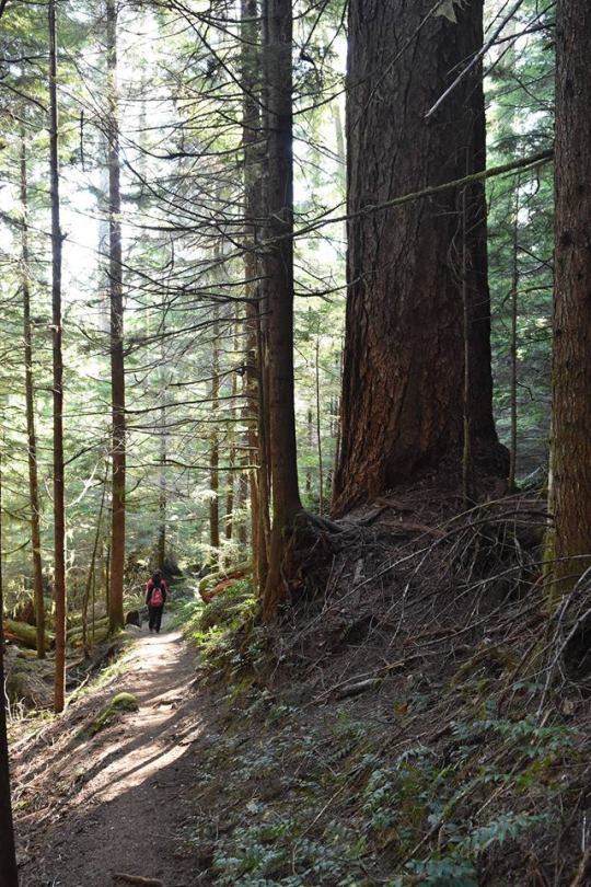
While the Twin Firs are no longer with us, this trail provides many gorgeous douglas-firs. And while you’re going up the hill and then down, you pass some lovely western hemlocks and western red cedars. Near the top of the loop, you cross a little creek. The peace and serenity are here can be wonderful.

Have you hike the Twin Firs trail? What is your favorite season for enjoying this little trail? How amazed were you by these amazing trees? ~ams

For more information on the trail, you can start with this webpage https://www.nps.gov/places/twin-firs-trailhead.htm . Check weather before hiking https://www.nps.gov/mora/planyourvisit/weather.htm. And please remember that tire chain requirements start November 1. For more information https://www.nps.gov/mora/planyourvisit/tire-chain-faq.htm .
These are not current photos but images from years past. NPS/Roundtree Photo. View from Twin Firs Trail looking up the trunks of some big trees. May, 2018. NPS/Roundtree Photo. Hiker on the dirt Twin Firs Trail beside tall trees. May, 2018. NPS/Spillane Photo. Creek tumbling down over rocks alongside fallen tree trunk. May, 2022. NPS/Spillane Photo. Violets blooming small yellow flowers along trail in May, 2022.
42 notes
·
View notes
Photo




Hello, all! Dusting off my Tumblr, allow me to reintroduce myself:
I’m Nicole “Thornwolf” Dornsife, an illustrator, marketing copywriter, and logo designer based in San Diego, CA.
I create custom and licensable wildlife and scientific illustrations, as well as offer creative marketing, strategy, and logo design services for entrepreneurs, nonprofit organizations, and other small businesses. My main focus is to work with zoos, parks, and other nature conservation-minded organizations to use my work for educational materials, merch, and more.
My work has been featured at the California Wolf Center, various county parks in San Diego County, the Living Desert Zoo and Gardens, the Anza-Borrego Natural History Association, and other gift shops across San Diego. I am freelance and available for work! Here’s where you can find me:
Website: www.thornwolf.com Shop: thornwolf.com/shop Patreon: patreon.com/thornwolf Twitter: ThornwolfArt Instagram: ThornwolfArt Ko-Fi: Thornwolf
32 notes
·
View notes
Text

Landscape Language
Erratics (noun) – Boulders that have traveled far from their source
Erratics are found throughout Mount Rainier National Park. In geology, boulders that are located far from their origin and differ from the surrounding rocks are called erratics. They are moved by the powerful forces that have shaped the mountain, including eruptions, debris flows, and glaciers. An easy place to view some erratics is along the Nisqually Vista Trail at Paradise, where several large boulders stand among the meadow plants. These erratics were carried down to Paradise by a lahar about 6,000 years ago.
NPS Photo of an erratic along the Nisqually Vista Trail, 8/3/21. ~kl
122 notes
·
View notes
Text


Landscape Language
Cedar flagging (noun) – shedding old foliage
It’s that time of the year! Leaves are changing color and falling from deciduous trees, but did you know that this natural process can also occur in conifer trees? Western red cedars are common in Mount Rainier National Park. During the fall, particularly after a hot, dry summer, you may notice that cedar trees can have brown branchlets at the base of the branches. Known as cedar flagging, the brown patches are growth from previous years that is being shed, while the more recent growth at the end of the branches is still green. Stress factors like heat and drought can result in more flagging than normal, but it is not a sign of disease. By spring, cedar trees will have shed all the flagging and be ready for new growth.
NPS Photos of cedar flagging on a western red cedar in Longmire, 9/23/22. ~kl
80 notes
·
View notes
Text
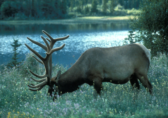
NPS/T. Stoker Photo of an elk grazing in a subalpine meadow on Mount Rainier.
Monitoring Elk
Mount Rainier National Park is home to several large elk herds. Elk are monitored by the North Coast and Cascades Inventory & Monitoring Network (NCCN), which also monitors elk in Olympic National Park and Lewis & Clark National Historic Park. Elk can have a large impact on ecosystems and are an important species to monitor to understand ecological change.
Monitoring includes trends in the estimated abundance, spatial distribution, bull:cow ratio and cow:calf ratio of elk present in selected subalpine areas during late summer. The surveys are conducted from helicopter between August 15th and September 15th each year. In Mount Rainier National Park, surveys were conducted in two areas that correspond with primary summer ranges used by the North Rainier Herd, which winters outside the park to the North, and the South Rainier Herd, which winters outside the park primarily to the South. From 2008-2017, 13 surveys of North Rainer study area and 15 of South Rainier study were conducted, finding an average of 359 elk present in North Rainier and 477 elk in South Rainier. Summer surveys at Mount Rainier are jointly supported by NPS, Muckleshoot Indian Tribe, Puyallup Tribe of Indians, and Washington Department of Fish and Wildlife.
Learn more about elk monitoring. Statistics are from Jenkins, K.J. and Others, 2021, “Elk monitoring in Mount Rainier and Olympic national parks: 2008-2017 synthesis report”.
~kl
137 notes
·
View notes
Text
Fireweed on the Mountain
Some plants and animals at Mount Rainier National Park are just meant for mountains.

NPS Photo of fireweed in front of unicorn peak.
The mountain is relatively young in geologic terms and is constantly changing. Geologic activity, glaciers, seasonal debris flows, and changing river channels can all disturb or destroy topsoil. That’s where fireweed comes in. Named for its ability to thrive in areas that have experienced a fire, fireweed grows in thin, well-draining soil. These areas have minimal nutrients, direct sunlight, and most importantly no competition.

NPS Photo of fireweed next to a road.
Look for fireweed at the base of glaciers, near glacial rivers, and at sites of man-made disturbance, like road construction. A seasonal flower, fireweed dies each fall. As the tall stems decay, they form the base for a new layer of soil enabling new plants to grow. Fireweed plays an important role in slowly turning a rocky scree slope into a forest. ~mmm
64 notes
·
View notes
Text
Lupines at Mount Rainier
Some plants and animals at Mount Rainier National Park are just meant for mountains.

NPS Photo of multiple broad leaf lupine in a meadow.
Some of those plants are species of lupine. Lupine is a genus of flower with over 200 species. Anyone who has failed to grow lupine in a home garden can tell you that some of those species are more resilient than others. Garden cultivators tend to be bred for big densely packed stalks and can be over three feet tall. Sometimes being big can also mean being fragile.

NPS Photo of the dense lupine flowerheads in a historic garden at another NPS site.
Mount Rainier National Park is famous for its seasonal wildflower meadows, but this is not a groomed garden. Broadleaf lupine is common in the park meadows. These flowers grow in volcanic soil, not garden fertilizer so they need to make the most of the available resources. If you look closely, each flowering stem has fewer individual heads. They are shorter, stouter, and stronger than your typical garden variety of lupine.
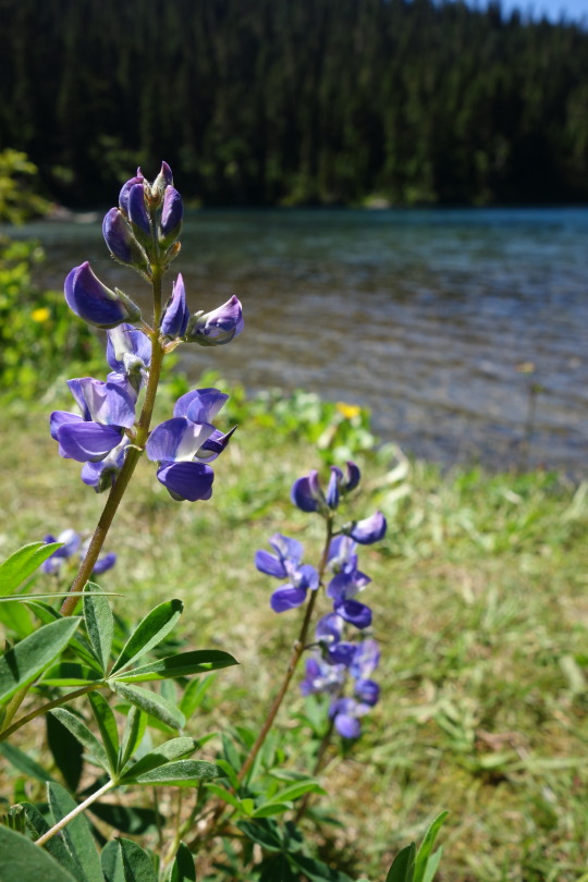
NPS Photo of broad leaf lupine flower head at Mowich lake.
At higher elevations, in rock outcroppings away from the meadows you will find even more resilient lupine species. The arctic subalpine lupine and dwarf mountain lupine species can be less than 6in tall with tiny leaves and flowers. There isn't very much food up here but there is also almost no competition. They are all alone on the rocky slopes and they prefer it that way.

NPS Photo of arctic lupine with tiny leaves and tiny flowers.
Other than trail restoration and species monitoring, Mount Rainier National Park doesn’t tend to the park meadows. We don’t need to. These plants were made for mountains. ~mmm
107 notes
·
View notes
Text
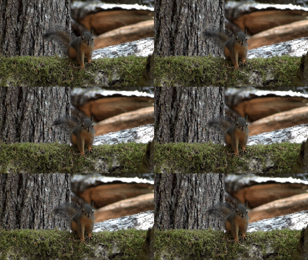

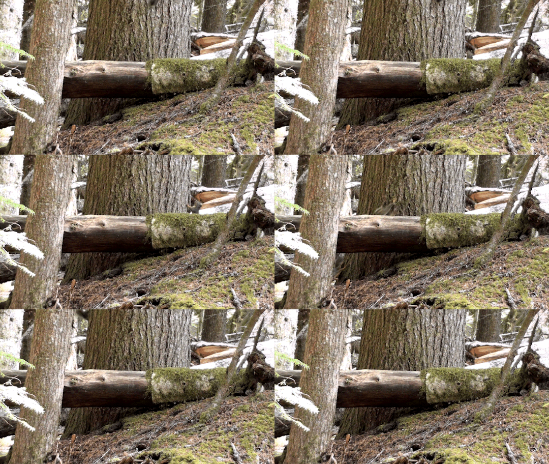
Douglas squirrels are usually solitary and territorial, but young squirrels may stay with their mother for up to a year. This curious young Douglas squirrel wasn’t sure about passing hikers, stomping its feet at a potential enemy. But it was soon distracted by playing with its siblings.
NPS Gifs ~kl
280 notes
·
View notes
Text
Mountain Moment: Waves on the Summit
It may look like a calm sunny day, but clouds curling over the summit reveal an active atmosphere. Clouds form as water vapor in the air is pushed up into colder altitudes as it hits Mount Rainier. The moisture condenses into clouds as it cools. Often these clouds have a smooth round shape and are called "lenticular clouds", but on this day the clouds where curling over the summit like waves hitting a shore.
NPS Video, filmed 4/6/22. Description: A layer of clouds ripples like the waves of the ocean as the clouds curl over the summit of a glaciated mountain (clouds at 2x speed). ~kl
31 notes
·
View notes
Text
Still buried under winter snows, high atop Shriner Peak, this fire lookout in the park’s southeast corner has a view to be envied.

Come summer, the snows melt and State Route 123 re-opens giving access to the Shriner Peak trailhead. The trail from 123 to the lookout is steep, exposed, and has no water sources so hikers and backpackers must carry all the water they will need. Hiking to the lookout in summer, you might wonder about the folks who built the lookout in 1932. How did they get to the lookout to build it? How did they get all the water they would need to work up there? Just getting all the materials and supplies to the site for construction must have been a logistical challenge.

Shriner Peak Lookout is no longer an active duty station for park rangers to watch for signs of smoke and fire. It tends to be a quiet part of the park. The summer hike of 8 miles round trip and a climb in elevation of 3434 feet is so challenging that some say it is best to wait for the cooler temperatures of fall. When was the last time you visited the Shriner Peak Lookout? Did you enjoy some of the summer wildflowers or autumn colors? ~ams

State Route 123 is still closed for the winter at the park’s southern boundary. Please check the park’s road status page for current information at www.nps.gov/mora/planyourvisit/road-status.htm You can also check Washington DOT’s webpages for current information for SR 123 and Cayuse Pass at https://wsdot.com/travel/real-time/ . For more park history, visit https://www.nps.gov/mora/learn/historyculture/index.htm
NPS/JH photo. In 1956, a park staffer stands on the balcony of the lookout holding binoculars. Large radio antenna visible. NPS/H. Edmonston. View of Mount Rainier from Shriner Peak Lookout area. NPS/C. Roundtree Photo. Image of Shriner Peak Lookout taken in July, 2018.
48 notes
·
View notes


