Text
Washington, DC
I had an opportunity to tag along with Nancy and Bob on a trip to Washington, DC. With some advanced planning, I was able to get us passes to tour the White House, Pentagon, and Capital Building. Once we were in DC, we discovered Senator Patty Murray holds a Thursday morning coffee session with constituents. We were all over that. Other than the scheduled tours, we really had no plans yet somehow we all flew home absolutely exhausted and lacking sleep.
When I arrived DC, Nancy and Bob were already there. Bob immediately invited me to rent bikes and go to Mount Vernon, George Washington’s estate. It was only 8 miles south of Alexandria where we were staying. The bike trail was awesome; up, down, weaving left and right. We only crossed a few street besides that we were along the river.
If you visit Mount Vernon, be sure to watch the 20 minute movie in the visitor center. We did not have time before before our scheduled tour of his home so we stopped on our way out. George really was an amazing man. It is said the only thing our government has ever agreed upon was that George would be our first president.
His home is very simple. The center is the original 4 rooms. Then George built up a floor. Then he had a wing on each side built.
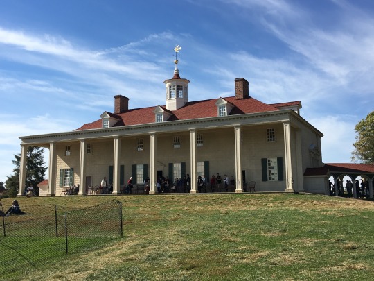
When you walked up the stairs, you used the original wood railing. The bed in George’s bedroom is the one he died in. The desk in his study is original. Almost everything on the estate is original. And when they need to repair things, they use materials from his time. Bob and I spent sometime watching the blacksmith make nails. For any history buff, this is a must see.
Bob and I spent the next 2 mornings getting up a 6:30 (eastern time), logging onto the Museum of African American History to try and get “day of” tickets. These tickets go so fast... 3 minutes max. This museum opened over a year ago and people still line up daily at 1pm to see if there is any open space in the museum.
The unique part of the Museum of African American History is that half of the museum is above ground and the other half is below. You start by taking an elevator down 3 floors. When the elevator open, you step into the beginning of slavery. How it all started. The museum moves you from slavery to racism to the civil war. Through segregation and the civil rights movement, ending with today and returning you to the ground floor.
They do an excellent job of incorporating movies, write ups, and visual experience like walking through a very dark slave ship where you hear individual talking about a day in the life of a prison. I liked the fact that at the end of each floor they had benches and another movie. Nice break before you headed into the next experience.
Not sure what was above ground. After 3 and half hours on the lower floors, my time was up and the museum was closing. I will definitely be going back.
The only other museum we got to was the Holocaust Museum. After being in Europe this last summer, I must say it had some difficult parts. What I did like was learning about what the USA saw and did. We did not have this view point in Europe.
As we exited the exhibit, there was this quote on the wall. Good thing to always remember.

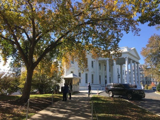
After 2 intense days of slavery and the holocaust, I was ready for the White House. The White House has the most amazing security, as it should. Our passports were examined twice, we went through a metal detector and some sort of screening that involved a dog, and we were only allowed to bring in a cellphone or small camera, car keys, umbrella (if raining), and a wallet (no purse). If you had a baby, you were still not allowed to bring a diaper bag.
Once inside, you could stay as long as you wanted but there are no bathrooms, water fountains, or food so eventually every has to leave.
We entered the White House through the East Wing and the gardens.
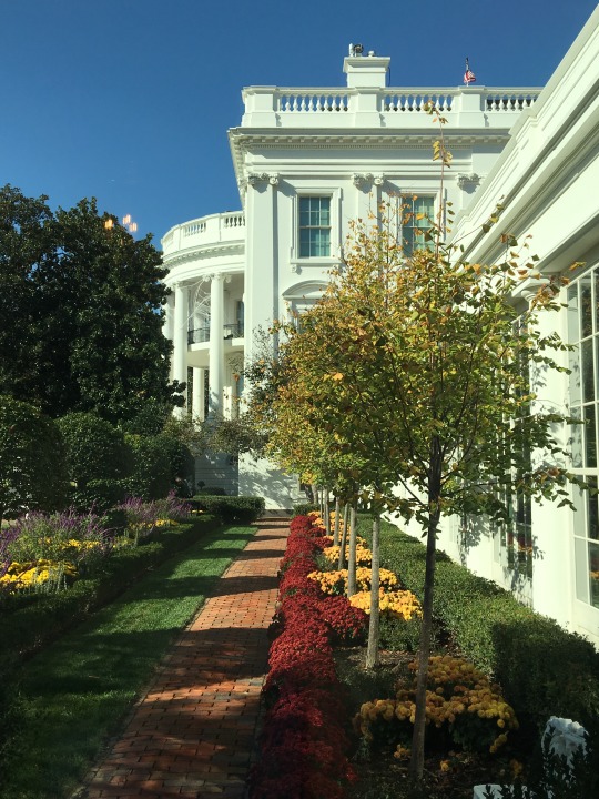
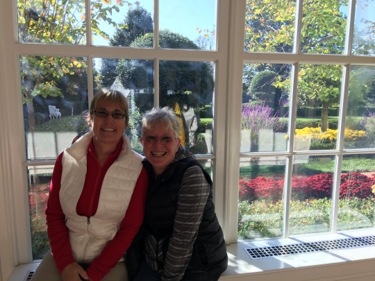
This hallway contains all the fun pictures of the Presidents. Lots of pictures of them playing with their dogs and kids.
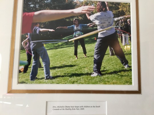
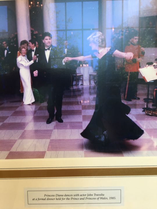
Other pictures include guests like this one with Princess Diana dancing with John Travolta.
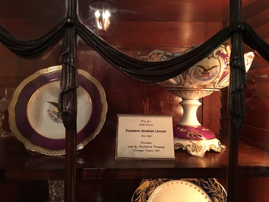
This is the wing that displays the Presidential China, ....
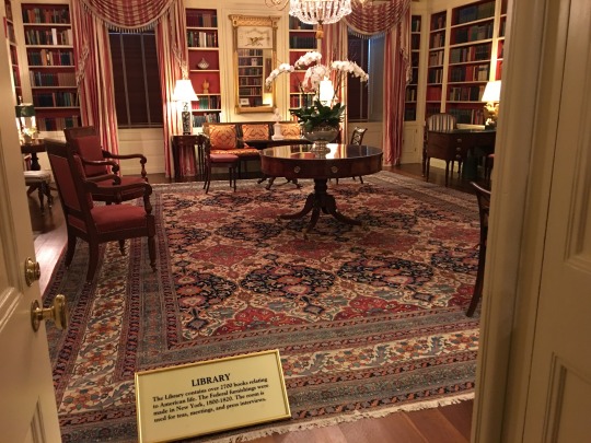
... has the library ...
... and the ever famous China Room.

We were not allowed to go into these rooms just look through the door. Once we were inside the main house, we were free to roam (under Secret Service supervision) through the Ballroom, ...
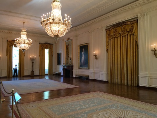
... the Green Room, ....
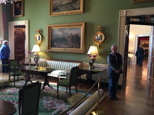
.. the Red Room, ...
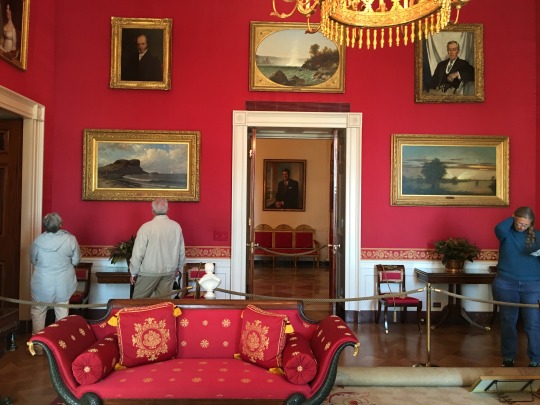
... the Blue Room, ...
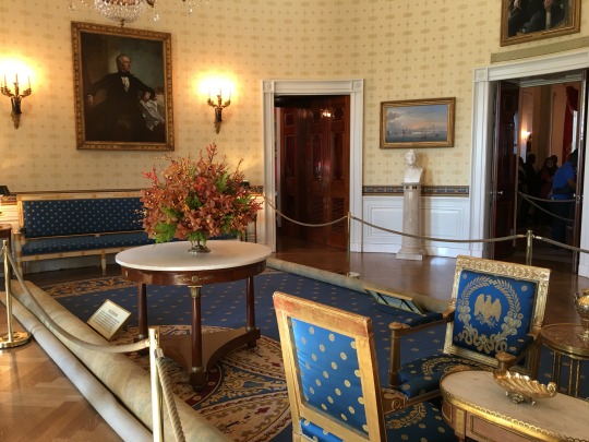
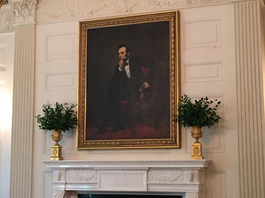
... and Dining Room with a painting of Abraham Lincoln over the fireplace.
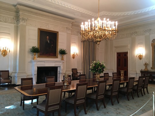
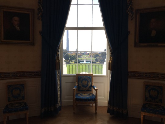
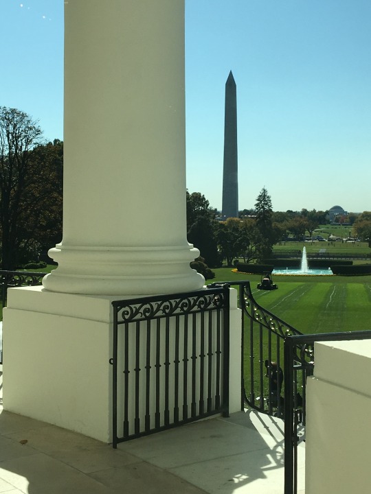
From the Blue Room, you could look out the windows and see down the back lawn all the way to the Jefferson Memorial.
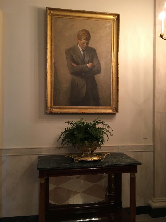
There were painting of previous Presidents all through the rooms.
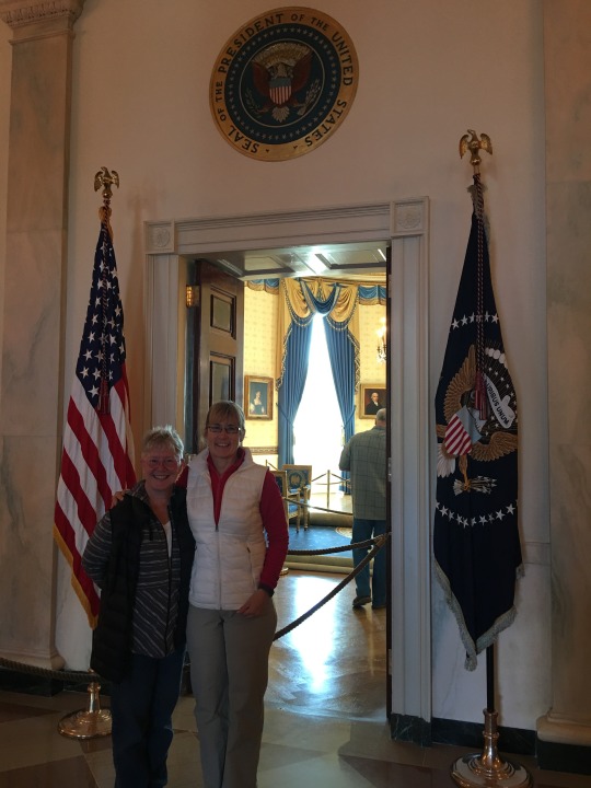
The tour ended with the flags inside the front doors where we had seen many famous pictures from.
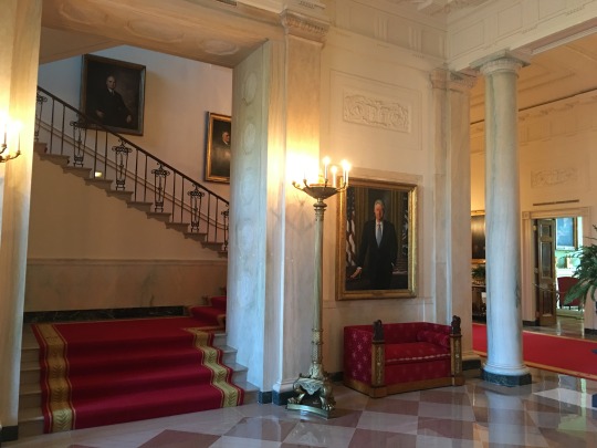
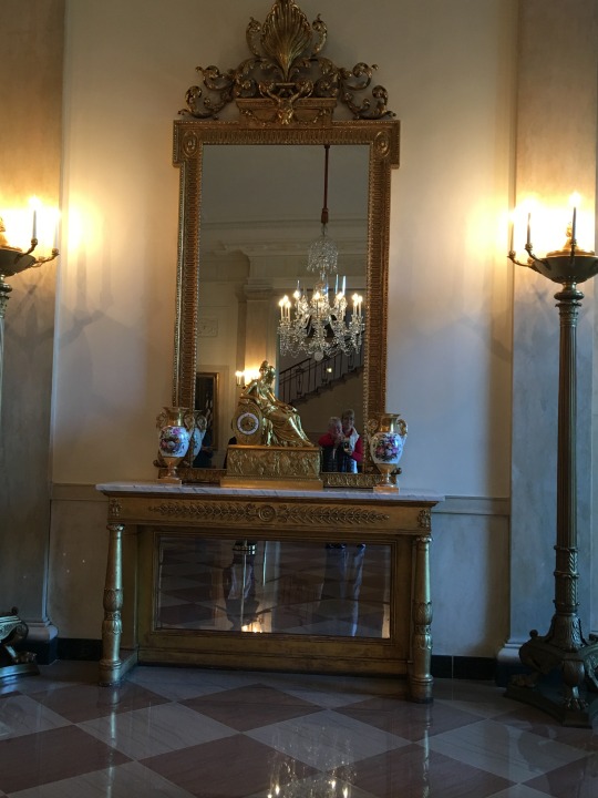
Nancy and I had a blast trying to get a picture of us as a reflection in the entryway antic.
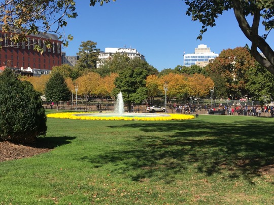
The tour ended with us walking down the steps in front of the White House looking out over the fountain and lawn at the people with their faces pushed up against the gates.
The Pentagon was not as impressive but security was pretty much the same. We were not allowed to take pictures once we got past the meeting room.
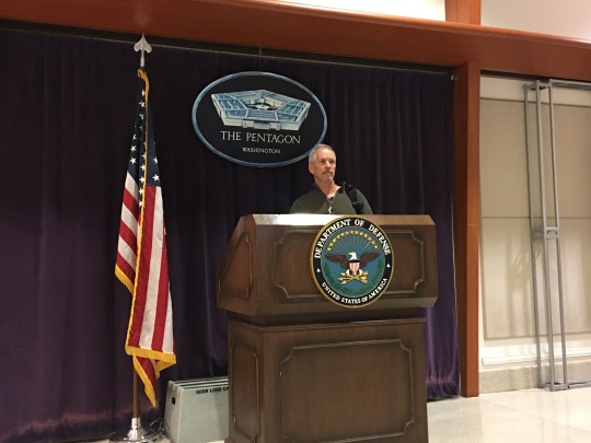
After leaving this room, we went up escalators, past the guy with a machine gun (yes, machine gun), and through small glass doors. We entered a private city with a chocolate shop on the left and a bank on the right. Everything one might need is inside security: doctors, dentists, hair salons, and grocery stores.
The tour was non-stop walking. They don’t let you stop any where. If you need the bathroom, the group goes with you. Not sure I would recommend the tour but the 911 Memorial outside on the grounds is very well done. I would visit it again. (If you go, make sure you dial the phone number at the entrance so you get the audio tour.)
We spent the rest of our trip on Capital Hill. We had coffee with Senator Patty Murray.
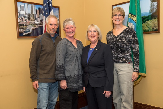
She was very friendly yet direct. Talked to us about what was going on right now and in the near future. Then took questions and discussed issues that we had. There were 14 of us. We only got 30 minutes of her time but we all felt privileged.
The Senate and the House were both in session and had votes taking place. She gave us tickets to the Galleries so we could watch. The first day we sat in on the Senate. We missed the vote but we were still fascinated by the going ons.
The first thing we learned was a Senator has to sit in the main chair if there are in session even if they are the only one in the room (they rotate ever 60 minutes). There are pages everywhere. They look like high school age kids. They ran documents, got water, and setup/took down podiums.
Different Senators came in, stood at their desk, and addresses the empty room with the issue at hand (today it was the life time appointment of judges). Every Senator has their personal desk. They are ordered by seniority and look to be from the 19th century.
The next day we went to the House. It was a big room with benches. Democratics on the left and Republicans on the right. Both faced a stage with the Speaker of the House or someone representing him.
They were working on a Vote so we got there early to avoid a long security line. By the way, you are not allowed to bring anything into the Galleries. You check you stuff in before you go through security.
The House ran more like a courtroom. The first hour was closing arguments on the Vote. Each side took turns address either the Speaker of the House or the crowds in the Galleries. Their speeches were timed and multiple Representatives spoke from each side. No one had the floor for longer than 2 minutes. When it was over, one side asked for a postponement of the vote so everyone voted on that.
Directly in front of the Galleries where wallpaper once was a reader board appeared with all the Representatives listed. As each voted, a Y or N appeared in front of their names. On the ends of the assembly room, scoreboards appeared displaying the number of “no” votes versus “yes” votes plus a 5 minutes timer which was counting down.
When the vote was over, the “no” votes won so all the votes were cleared and they immediately went to voting on the the issue. It was awesome to watch the floor come alive. When we first got there, it was civilized with only 20 people in the room. By the time the vote came, there were 400 people in the room. A few brought young kids around 4 or 5 years old. Bring your grand kid to work day?
After the vote, it took about 15 minutes for the Speaker to get the floor cleared so they could move on to future business. At this time, the Majority Leader and the Democratic Leader took their prospective sides and started to discuss where they are on current projects.
They both summarized their visit to Puerto Rico and talked about issues there. Then they discussed a few more issues before the release of the new tax cuts hit the floor. It was at this point that things got really interesting. They went back and forth like attorneys arguing a court case. We were very impressed with the manure they conducted themselves.
After about 30 minutes on the tax cuts, they moved on to other committees and the issues they are working on. It was interesting to hear that there is an issue that is being held hostage. Something they both agree on but the Majority Leader won’t bring it to the floor. I have heard of this but it was interesting to see it was real.
We were so very lucky to get to see our government in action. This was not something that could be planned. If you are in DC, I advise asking the guards at the bag check in. They seem to know what is really happening. Don’t rely on the published schedule. Things are always changing.
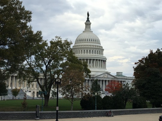
While at the Capital Building, we did take the public tour. I have taking it before and I consider it a must do. New to the tour was the original Supreme Court meeting room.
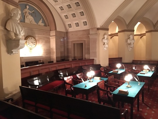
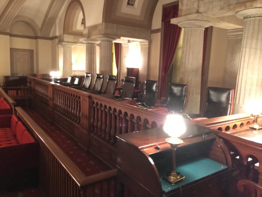
They also showed us the new chambers.
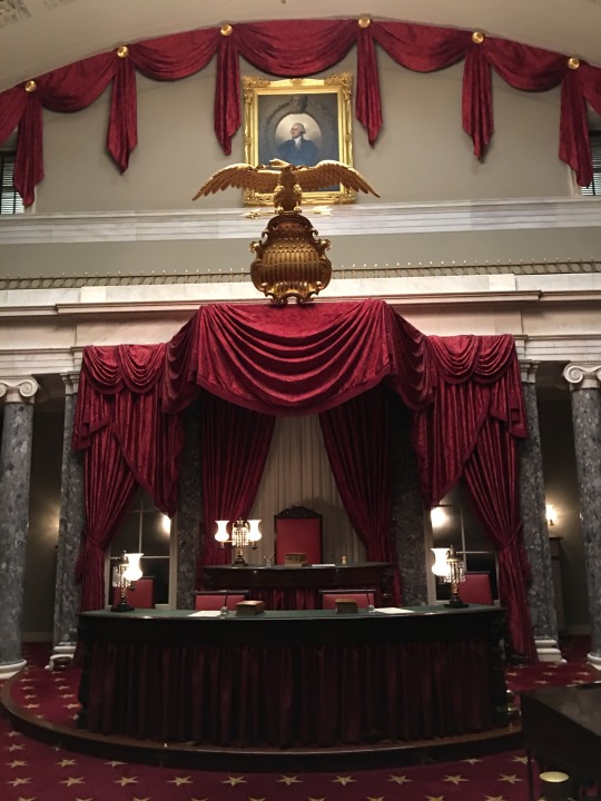

All this under one roof
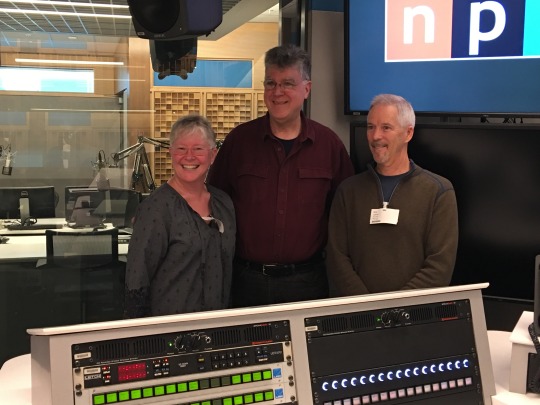
During our time in DC, we were able to fit in a tour of NPR (National Public Radio)
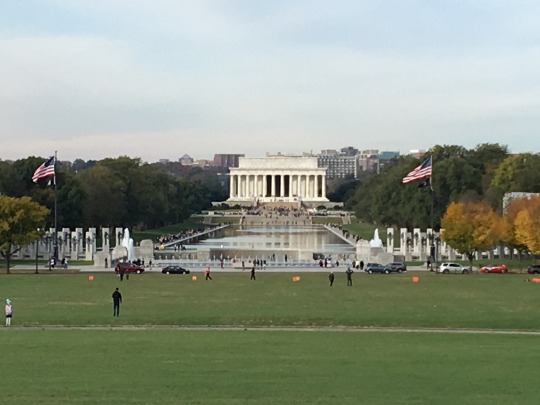
I took a 4 hour walking tour of the National Monuments. Highly Recommend.
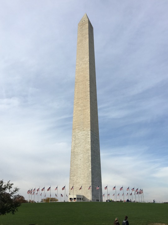
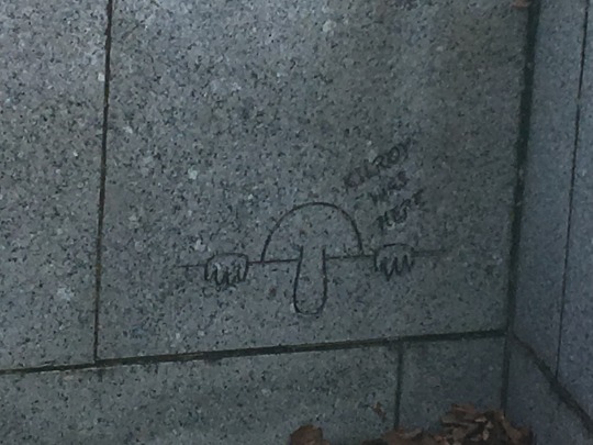
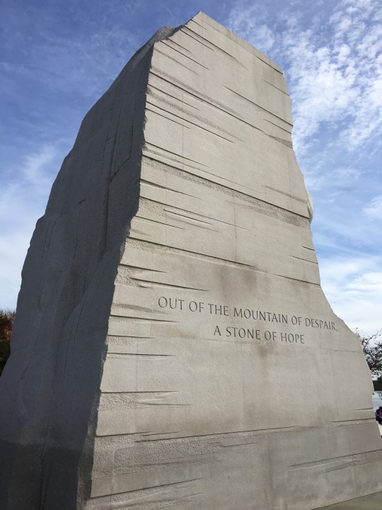
The Martin Luther King Jr Memorial is new. They carved him stepping out of “A stone of hope”. The detail was amazing.
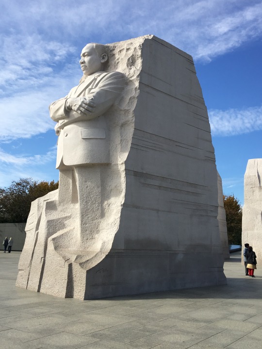
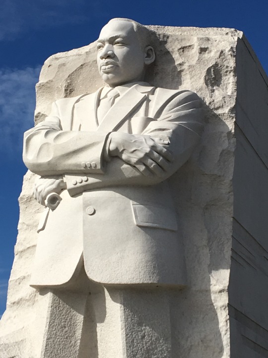
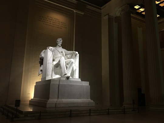
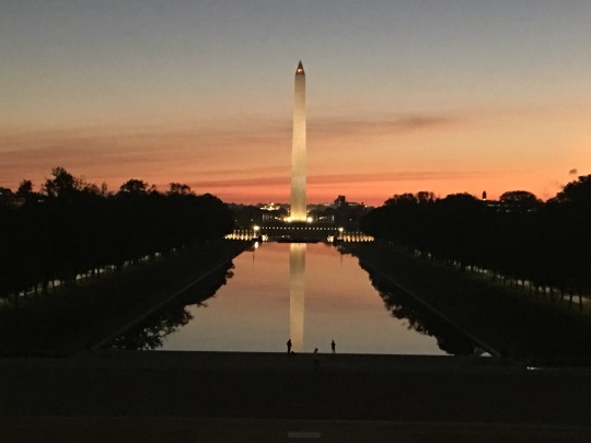
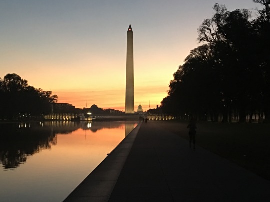
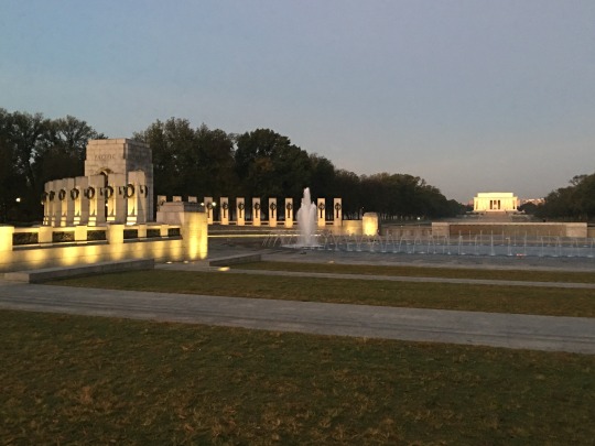
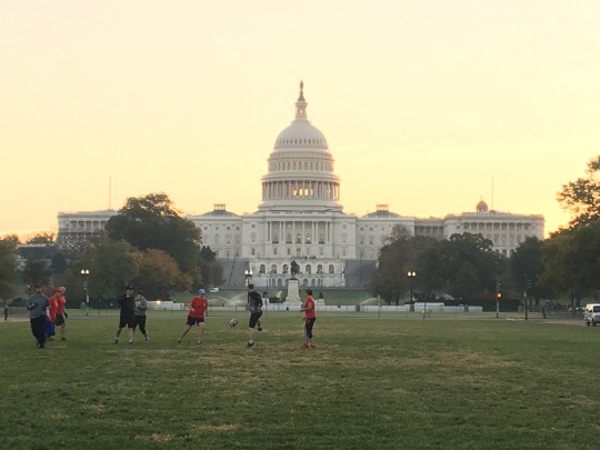
One of the trips highlights was watching the sunrise from the Lincoln Memorial. You would think we would have the National Mall to ourselves but there were joggers everywhere.
0 notes
Text
Mazama Mountain Biking Weekend: Buck Mountain Loop
Last weekend was our annual mountain biking trip to Mazama, Washington. The forecast for the weekend did call for a little snow and rain on Saturday but Friday looked good. We loaded up the bikes, packed up some food and wine, and hit the road around 1pm. Mazama is about a 4-1/2 hour drive going over Hwy 20, the North Cascade Hwy, so we should get there before dark.
When we arrived, we found that we were the only guests at the Mazama Country Inn. Actually, we were the only people. The restaurant closed the week before (until Thanksgiving) and the front desk person had gone home for the day. This was fine by us, we setup up a table in the dining room, lite some candles, opened a bottle of wine, and reheated soup in the microwave. Added a little music and the night was perfect.
The next day was blue skies. We rented me a full suspension bike (Jim bought one while I was in Europe this summer) and headed up to the Buck Mountain Loop near Rendezvous Pass. It was still hunting season so Jim and I were in our high visibility clothing including Hunter-Orange bike helmet covers.
We really enjoy the Buck Mountain Loop. It starts with a hill climb on dirt roads, then a ridge run of up and down single track.


Then comes the long single track descent off the South East ridge. Seems to take 20 minutes to hit the trees.


About the time we hit the trees, I was pretty tired but the car had to be close. There was actually another 40 minutes of up and down single track before we hit the dirt road and flew to the car. Total loop took us just under 4 hours which included a minor repair to Jim’s bike and a few work phone calls (When did we start to get cell phone reception in the middle of no where. Jim got better reception on the Buck Mountain ridge than we did in the town of Mazama).
Our plan for Saturday was to bike into Winthrop on the Community Trail. We woke up to very wet snow steadily coming out of the ski. I quickly changed my plans to a bike ride across the suspension bridge turning around at Brown’s Farm and returning to Mazama via the Community Trail.
When we left the Mazama Inn, it was 33 degrees and snowing pretty good.

By the time we reached the Suspension Bridge. the ground was white.

As well as the trails ...

This snow was very unusual for this time of year. Here is what the bridge typically looks like...

... And the Community Trail looks like this...

Even though we were in rain gear, I was getting cold. Didn’t help that somehow I was sweating. My core was warm but my feet and legs were freezing. I decided to turn around just before we hit the highway. Jim decided to continue on into Winthrop (it is very difficult to get him to change his mind once he focuses on something). We agreed to keep our cell phones on so I could track him on “Find Friends”.
The ride back to the Mazama Inn was so pretty. By now there were lots of joggers and walkers out enjoying the weather.
We woke on Sunday to 4+ inches of snow. The Mazama Inn had power but most of the homes and the Country Store did not. We heard that there were any known problems on Highway 20 so we ate breakfast, packed up , and headed for home.
Anyone that travels the North Cascade Highway know that it closes during the winter months. The road gets so much snow that the snow plows cant keep up. As Jim and I headed up to Washington Pass, the traffic came to a stop. They were closing the highway. Missed it by 5 mintues. Now we had to turn around and go back through Winthrop, Twisp, Wenatchee, and Cle Elem. Our 4-1/2 hour drive just became 6+ at least it was a pretty day. Blue skies and white snow.
2 notes
·
View notes
Text
Golden Larch Trip to Seven Finger Jack and Ice Lakes, Entiat Mountains
It was time once again to go in search of the Golden Alpine Larch tree. This is a coniferous tree that losses it's needles in the fall. The elusive alpine larch grows at high elevations, on the east side of the Cascades. They like wet, shady areas and can tolerate high winds. These trees can survive where other trees cannot. The alpine larch is slow growing. It takes about 50 years to obtain 2 inches in diameter.
For this year's Golden Larch trip, we headed into Ice Lakes which is known to have some of the oldest larch trees in Washington state. We did a loop trip through Leroy Basin into Ice Lakes and out Carne Basin. We made it a 5 day trip to allow for time to climb Seven Finger Jack, South Spectacle Butte, and Maude.
Our group of 8 hiked up the Phelps Creek valley trail until we hit the climbers path up to Leroy Basin. As we climbed into Leroy Basin, we were treated to a beautiful waterfall.

When we broke into the basin, Seven Finger Jack was directly above us. What a brilliant ridge line.

Climbing this time of year means lots of tent time. It gets dark and cold around 7pm and the sun doesn't come up until 6:30am. If you are camped in a basin, the sun might not hit you until 9 or 10am.
After 11 hours in the tent, our group was happy to get up at 6am even if it meant wearing all your clothes. We had a quick breakfast and headed out to climb Seven Finger Jack. We were all anxious to get moving so we could warm up.

Soon we were above the ridge line and able to see Buck Mountain (summit goal of a previous Golden Larch trip).

The sun was slow to hit this side of the mountain. We climbed in the shade for several hours.

We finally found the sun 1000 feet below the summit. It made the final ascent very enjoyable.

The summit was quite comfortable with room for all of us to stretch out and enjoy the sun rays. For some reason, there was no wind.


The north side of Maude is a vertical face. Hard to believe the other side is a walk up.

After a long summit stay, we headed down. We still needed to pack up camp and hike to Ice Lakes which would be our camp for the next 2 nights.
The hike to Ice Lakes was on trail surrounded by the fall colors.

As we crested the final ridge out of Leroy Basin, we enjoyed one more break and a view of Seven Finger Jack.

When we arrived Ice Lakes, the sun was already gone making for a cold camp but this was ok since this side of the ridge got morning sun. Jim has been to Ice Lakes basin many times and says it is always windy. We found a nice wind break some previous campers had built so we were able to sit out and enjoy dinner as the full moon rose.
The morning brought blue skies and amazing color. The views were worth getting out of the tent for.


Over breakfast, we discussed our plans for the day. We had received a weather forecast which showed some wind and snow coming in overnight. Three of our group decided to climb Maude and head out to the cars. They were not interested in hiking out in the snow. The rest of us wanted to enjoy Ice Lakes and see if we could climb one more peak before our season came to an end.
Five of us said goodbye to Deb, Steve, and Brian and headed off to the Spectacle Buttes. North Spectacle is a Class 2 climb where South Spectacle requires some Class 4 climbing. When we reached lower Ice Lakes, Lisa and Doug decided to climb the north peak (the rounded peak on the left) while Fay, Jim, and I went for the south peak (the point one on the right).

Jim and Fay had already climbed South Spectacle but they were willing to share the experience with me. The route description I had from Beckey was different than the route they had taken previously. We all thought it would be fun to do something different and follow the route I had.
We dropped out of lower Ice Lakes and headed for the col between North and South Spectacle. We headed up too early and soon found ourselves on the wrong side of the north peak and faced with an enormous gully with no entry point. We either had to drop several hundred feet or climb up and over the gully. If we went up, we would have to traverse around North Spectacle Butte at cliff level. This looked to involve rock ledges and a lot of unknown terrain. We were all in. It is surprising that the three of us don't get into more trouble together.
After a couple hours of teasing out the traverse, we arrived in the correct basin directly under the col between the north and south peaks. We quickly followed the route description I had which took us up the northwest ridge of South Spectacle Butte.
After a 1000 feet, our route came to an impasse. We looked around for several minutes before agreeing that the climb was over. How could Beckey have messed this up so bad? (We discovered after returning home that I had got my route description out of the old version of Beckey. The route was corrected in the newer version. Lesson Learned)
We did get a great view of Maude and Seven Finger Jack as well as the weather coming in.

From here, the quickest route back to camp seemed to be over the summit of the north peak. We returned to the col and then continued around the back side of North Spectacle. This route went through scree feilds and was out of the wind.
Once on the north ridge, we headed up toward the summit on nice dirt. The final 100 feet involved some Class 3 scrambling on solid rock.
As soon as we crested the summit, we were hit with high winds. Very cold. We searched for the high point and a spot to get out of the wind. There was a nice ledge with a great view of South Spectacle Butte.

From here you could see both Ice Lakes under Maude. The weather was getting worse. Time to head for camp.

We descended the 1200 feet to lower Ice Lakes in record time.

On the way back to camp, the weather came in. Instead of fluffy snow, it was ice pelts. With the high winds, this was awful and painful. The only thing we still had going for ourselves was daylight. We arrived camp just before dark.
After checking in with Lisa and Doug, we ate a quick dinner and retired to our tents to get out of the weather.
It was 10:30pm when the winds picked up, pulled out one of our stakes, and the tent collapsed on us. Jim was unable to get the stake to hold so he took a runner, anchored it to the tent, and buried it with rocks. With our tent upright again, Jim decided to check in on the others.
Doug had brought a pyramid tent with a center pole. To Jim surprise, it was laying flat on the ground covering Doug. "Doug? You OK?" Jim heard a "Ya" from under the flattened tent. Turns out a large gust sent the center pole straight through the top of his MegaMid.
Jim moved onto Fay and Lisa. Lisa had spent time earlier in the day anchoring the stakes down with extra rocks so they were doing fine. Jim actually heard them laughing. Once everyone was accounted for, Jim returned to our tent and we tried to get some sleep.
About 11:30pm the wind gusts picked up and started to swirl through the basin hitting the tent from all sides. The wind quickly pulled out so many of our stakes that Jim had to hold the tent up from the inside. This gave me the job of going outside and restaking everything.
After 15 minutes of finding rocks and tightening everything up, I felt confident that none of the stakes would pull out again. I returned to the tent and cuddled up next to Jim to get warm. We recently switched from sleeping bags to a comforter system to save weight and bulk. We were the warmest people in camp.
Just when we thought we were good for the night, the gusts actually got worse. This was nothing I had every experienced in the mountains. Then a gust hit us so hard, it actually picked up the bottom of our tent. This was more than our 3 season tent could take and a pole broke tearing through the tent fly. Not good. Now with every gusts, the tent would fall against us. There was snow coming in the tent through the netting. Everything was getting wet.
We did the best we could to stay dry by putting our rain gear on top of us. At 4 am, Jim wanted to get everyone up and hike out. I couldn't stand the thought of getting up in the dark during a blizzard and hiking. I convince Jim to wait until 5:30.
At 5:20 am, Jim was up and packing. The tent was so collapsed that only one of us could move at a time. We had 6 inch snow drifts on each side of the tent which pushed us against each other. After doing all the packing Jim could do in the tent, he headed out to get everyone up.
He found Fay's tent mostly collapsed with a broken poles and a tent fly tear. The girls had as much snow in the tent as out. The laughter had ended sometime around midnight. Needless to say, everyone was relieved to be getting going. We had survived the night.
Though the wind was still bitter cold, we did have blue skies which rose our spirits just a little. As the sun came up, we got to enjoy the beauty of the basin under the fresh snow. What a transformation from the day before.

The larch trees are so beautiful in the snow.

The snow made the trip out a little interesting since we kept losing the trail but I always enjoy hiking through white meadows.

We started the trip in shorts and short sleeve shirts and ended it by hiking in everything we brought that was still dry. To quote Fay, "... very memorable trip. The start was lovely but I sure would not like to repeat the ending."
(I credit the last 5 photos to Jim. My iPhone battery was so cold, it would not turn on.)
#climbing#cascades#entiat#golden larch#seven finger jack#7fj#south spectacle butte#ice lakes#carne basin
0 notes
Text
Yosemite National Park, Sierra Mountains
Since Derek moved out of the college dorms and into a house with a few of his friends, I need to take him down a few things that couldn't fly with him like his bike. Mostly I wanted to check out the house.
I talked Jim Aga into sharing the drive with me and stopping by Yosemite for a day. Neither of us had been to Yosemite National Park.
We had beautiful sunny weather with a cold breezy to keep us from baking.
We started at Yosemite Valley. The big walls were everything we imagined them to be.
El Capitan is the first wall you see as you enter the park.

Then Yosemite wall with the upper and lower falls. It was unusal for the falls still to be flowing in last September.

Though Half Dome is outside the valley, there are still many views of it.

We also got to enjoy watching some climbers. Yosemite is famous for them.

After hiking around the valley floor, we decided to head up to the rim. Along the way, we stopped at the major tourist viewing platform of Tunnel View. Instead of fighting the crowds, we hiked up the hill a ways and enjoyed our own private viewing from Angle’s Tunnel.

El Capitan was especially impressive from here.

We hoped back in the car and climbed another 3000 feet to the rim of the valley. There were tons of hiking options on the rim. We decided on Sentinel Dome. It provided a 360 degree view of the National Park.
During the hike to the dome, Jim and I could not see how you could possibly climb it.

The closer we got, it still looked unclimbable.

Turns out there is an easily walkable ramp on the backside. The top of the dome looked like the moon.

We were able to see the Sierra Mountains from here including Mt Whitney.

The view of Half Dome from here was very unusual. You could almost see the hiking routes to the top.

We were told to watch sunset from Glacier Point at the end of the road. This point sits directly across from Half Dome. What a spectacular valley. Definately worth returning for some backpacking.


0 notes
Text
Rock Mtn, Steven’s Pass, Cascades
Seems like over night the weather changed to fall. Jim and I only had a 2 day weekend and I needed to be back early on Sunday. We decided on a trip to Rock Mtn on the other side of Steven's Pass. Typically a day trip but we would camp on the summit where the old lookout cabin was.
The fall colors were starting to show...

as well as the temps (wow the wind was nippy)

The first snow of the season was still lingering in the meadows.


The summit was perfect for our tent.

Soon after we set up camp, we found ourselves in a cloud. Good thing we had the comforter so we could keep from freezing while eating dinner.
We woke to beautiful blue skies and got to enjoy this wonderful view point.


0 notes
Text
Bannock Lakes and the Hanging Gardens, Cascades
On September 10th, Fay and I headed out on our annual trip. Just the two of us. The Hanging Gardens and Bannock Lakes hit both our radar last year so it was easy to decide where to go.
It would be a loop trip starting on the Suiattle river trail, joining the PCT over Suiattle pass, then leaving the trail from the basin under Saddle Bow peak and heading straight up hill to the pass above Bannock Lakes, over to Ross Pass and the Hanging Gardens, then hike out past Canyon Lakes, over Miners ridge, picking up the trail at Image Lake and heading back out the Suiattle river trail.
We allowed 5+ days to give us time to climb Saddle Bow from the Bannock Lakes basin and take a stroll through the Hanging Gardens. Jim and I wanted to climb Sitting Bull and Plummer from Image Lake so the plan was for Fay and I to do our trip and then on the last day, Fay would hike out and Jim would hike in while I swam in Image Lake. My plan saved me 4000 feet of elevation gain.
The Suiattle river trail is in excellent shape as is the PCT through this area. Fay and I chatted the day and the miles away. We got about 2 miles further than expected which put us in great shape to make it to Bannock Lakes on Day 2.
On Day 2, we finally got high enough to break out of the trees and enjoy some of the views of the area. The north end of Fortress mountain sticks right up from the PCT.

Soon we crossed Suiattle Pass and got views of Plummer and Sitting Bull from the East. Not sure how Jim and I were going to climb these, but this was a problem for another day. (Or as Brooke says, "It is a problem for future Eileen")

Plummer is a real mass of pinnacles and ridges...

where Sitting Bull has one scary face.

Fay and I arrived the basin below Saddle Bow by 1pm. Plenty of time to reach Bannock Lakes by the end of the day. I hoped the cross country travel would go well so we would have time to climb Saddle Bow. After all it was Fay's 75th birthday today and she should sit on a summit to celebrate.
After taking a break and changing out of trail shoes and into climbing boots, we headed up hill. This was my first trip using trail shoes and it certainly makes a difference on these good trails. We would have never got this far if I was in climbing boots the whole way.
Fay and I should have spent a little more time discussing the route before charging off. We were a bit too excited. We headed left instead of right. By the time we realized our error, there was too much brush between us and the correct route. We ended up heading straight up the treed cliffs.
The next 400 feet took us 3 hours. We pulled our way up trees and steep forest duff. Just trying to move 10 feet at a time. I was completely amazed every time I looked back and saw this 75 year old woman climbing the cliffs with a full pack on her back. She is truly an inspiration.
When we finally popped out of the trees and hit the heather, Fay was off.

I was dragging behind trying to enjoy the beautiful basin instead of thinking of the 1000 feet we still had to climb.

Finally, we reached the pass and could see the summit of Saddle Bow.

It was 7pm and dark would be coming soon, we would have to climb Saddle Bow tomorrow. Since Fay was not going to get a summit on her birthday, I had her find the highest rock at the pass so we could take a birthday picture.

Thankfully the drop into upper Bannock Lakes was quite easy through rolling heather benches and magical larch trees, not sure either of us could do much more. We set up camp in the dark, ate dinner, and celebrated Fay birthday.

Since Fay and I had built some extra time into our schedule, we slept in...

and enjoyed the seldom visited Bannock Lakes.

After a slow morning, we headed off to climb Saddle Bow. A smaller but scrappy peak which offered amazing views of Bannock and Glacier Peak to the west, the Dome peaks to the north, and the Bonanza massif to the east.

The climb of Saddle Bow included heather meadows, boulders the size of cars, loose scree, hard dirt, class 3 ledges, and loose climbing rock. Everything one would want in a scramble, right?
The summit did not disappoint. There are not many places where you can get a picture of Dome, Sinister, Gunsight, and Agnes all in the same frame.


As we hiked back to camp, we really got a sense of being in a very special place where not many people visit.

After our mistake getting into Bannock Lakes, Fay and I want to take some time to make sure our exit to Ross Pass and the Hanging Gardens was as efficient as possible. We thought it would be better to move camp down to lower Bannock Lakes so we could get a good look at the route tonight before we climbed out in the morning.


Lower Bannock Lakes is just boulders and scree everywhere. No heather benches and larch trees. This was the day the weather went from summer to fall. Temperatures dropped and the winds came up. Luckily we were able to find a camp just big enough for Fay's small 2 man tent. It had rock walls on 3 sides which kept us out of most of the wind. It did offer a good view of our exit route as well as Dome, Sinister, and Gunsight.

The next day, our exit went smoothly and soon we found ourselves taking a break on some heather evaluating our traverse to Ross Pass.

After another hour, we arrived at the Hanging Gardens, about 2.5 hours from lower Bannock lake. I saw the backside of Stonehedge for the first time. What an incredible range of peaks.

The Hanging Gardens are so difficult to describe. Heather benches, rock out croppings, and clumps of evergreen trees rolled across the foreground.

We had some time so Fay and I dropped packs and went off to find the high point. To our delight, the high point was a large heather bench with a close up shot at Dome and Sinister.

As well as a view of the climbing route on Agnes. So glad I have already climbed Agnes. From here it looks impossible.

Behind us, you could see the Bannock Lakes, Saddle Bow, and Bannock mountain. I hope that someday I get to return to this magical place.

Fay went off to find the true high point of this bump. I think she found it in these trees.

Our goal was to get past Canyon Lakes today so we picked up our packs and headed across the Hanging Gardens towards Totem Pass.

The traverse was lovely heather not too steep. The last 500 feet to the pass was nice solid rock slabs.

After a quick break, the cold wind didn't allow for a long break, we dropped into Canyon Lakes and a view of Glacier Peak.


We still had an hour or so of daylight so we decided to climb the 800 feet out of the lake basin and camp along the Canyon Lakes trail. After about 2 miles, we found the most beautiful camping spot with views of Glacier and Plummer.

This would be Fay and I's last night together so we sat out watching the sunset and the stars come out. Good thing Jim and I recently switched to a comforter sleep system. It kept Fay and I warm until we decided to turn in.

For our last day, Fay and I had about 4 miles of trail and 1200 feet of gain before we reach the heather benches right below Miners ridge. Image Lake was just on the other side of the ridge. I decided this was a great spot for Jim and I to camp. It would put us in a good position to climb Sitting Bull plus the views were pretty dang good.
I said goodbye to Fay. I don't think we can ever top this trip. Definitely one of my top 10 ever.

I setup camp, packed up some clothes that desperately needed washing, and headed to Image Lake where I swam, napped, and waited for Jim to arrive. Thankfully, I was blessed with one more day of summer.
0 notes
Text
Sitting Bull and Plummer, Cascades
After my 5 day trip with Fay through Bannock Lakes and the Hanging Gardens, I anxiously awaited Jim's arrival to Image Lake so we could climb some of the peaks I had marveled over the last few days. I knew he had a long day of hiking with lots of elevation gain so I had no idea when he would arrive.
I was going to wait at the lake until 5pm at which time I would pack up and move uphill, closer to where I had setup camp. This would allow Jim to avoid dropping into the lake basin.
As I was packing up, I heard a familiar hoot from the other side of the lake. My heart leaped and I hooted back, Jim had arrived. We had just enough time for Jim to jump in the lake and shed the dust of the trail, then we hiked up to Miners ridge. Along the way, we got some wonderful even light which showed why so many people have photographed Image Lake.


I had setup camp on the north side of Miners ridge on a high heather bench. Our camp had great views of Bannock, Sitting Bull, and Plummer. Not to mention the Bath Lakes traverse with Stonehedge and the Great Wall.
We enjoyed a long dinner while I told him all about Fay and my adventure. We watch 2 deer in the basin below munching on berry leaves. In the morning, we saw a bear in the same basin filling up on blueberries. The berries were perfectly ripe and very yummy.
Sitting Bull is on the ridge between Plummer and Bannock mountain. It is a complete vertical mass from the east but on the west you can climb steep heather slopes ....

until you are faced the final 300 feet which is class 4 rock with dirt and rocks scattered in. Exposed and a bit a nerving.

Jim and I had decided to use a short rope with limited pro. Though it wasn't much, it made us both feel a lot better.
Jim lead out. I was glad to be on a short rope since there was almost no way to avoid rock fall. We climbed slowly with a lot of communication.


About the time we ran out of gear, the mountain eased back and got a lot more solid and clean. The final pitch was exposed class 3 but solid.

Our plan was to camp two nights at Miners ridge to enjoy the views but since the smoke had come in and the forecast for rain had been moved from tomorrow evening to mid-day, we decided to pack up camp and move closer to Plummer. Our goal for tomorrow.
Along the way, we got to pass through the Image Lake basin as the sun was going down.

We ended up camped at Lady Camp. The horse camp for Image Lake. It has a full on view of Glacier Peak. We could only see parts of Glacier since smoke was rolling in from one of the remaining forest fires.

Though Plummer has cliffs and rock ridges on three sides, the fourth is a field of heather which takes you within 100 feet of the summit. After traversing a little rock...

Jim arrived on the summit.

Though the smoke made pictures of most peaks impossible, we did get a great view of Sitting Bull. Glad we never have to go back there.

We didn't stay on the summit long. The wind was icy cold and we knew the rains were coming in.
After packing up camp, we took a nice long break, strategizing how to add this camp site to another trip in the future. We really felt that we missed out on the full experience of Glacier Peak from here.
We were able to drop down to Dry Camp under Image Lake before the rains came. They were off and on the rest of the day. Luckily, it was not raining when we setup camp about 4 miles from the trailhead.
It rained during the night but when we woke in the morning the rain had stopped. We packed up in record time and quickly headed out to the car, arriving just as the rain was returning.
0 notes
Text
Bear Mountain Attempt via Whatcom Pass High Route, North Cascades
The high route above Whatcom Pass has been on Jim and my list since we met. Neither of us had ever been in the area. The high route has the benefit of being directly across from Challenger, one of the prettiest mountains in the North Cascades.
We decided to combine the high route with the climb of Bear Mountain and make it a seven day trip. The schedule would allow us to have time to play in the lakes. The Whatcom Pass high route starts at Tapto Lakes then traverses past Middle Lakes, Tiny Lake, and East Lake. The actual high route continues to Pass Lake and on to Bear Lake ending in the Chilliwack mountain range.
With Bear Mountain as our climbing goal, we decided to camp in Indian Basin which required us to drop off the ridge before we reached Pass Lake. We now know why the high route goes through Pass Lake, Indian Basin is not the best camping. Unless you like hiking and camping on scree. Oh, and enjoy sharing the forest with wasps.
Kevin Koski, Fay, Lisa, and Kevin Loper joined us for the adventure. Day 1 was straight forward. We headed in from Hannagen Pass trailhead with US Cabin campground as our goal. Thankfully we had a slight break in the heat.
Our second day was mostly a climb to Whatcom Pass and then onto Middle Lakes. It did include the fun cable car crossing on the Chillawack river.

Special note, Lisa and Kevin were celebrating their 30th wedding anniversary. Most couples go to Hawaii, they go on a 7 day climbing trip. My kind of people.

As we neared Whatcom Pass, we discovered the ripe blueberries. This took the sting out of the last 500 feet of gain. The climb up to Middle Lake treated us with views of Whatcom Peak and Challenger as well as ripe blueberries everywhere. We had many breaks to graze and take everything in.

Middle Lakes was not our favorite swimming lake but the views were stellar. One of the best dining areas ever.

We all enjoyed the view of Challenger turning pink as the sunset...

and the moon rising.

We woke to blue skies even though there was a forest fires off to the East. We were very lucky that the winds were coming from the West. We headed off to do the long traverse to Indian Basin.

First, we past Tiny Lake. I made a mental note to swim here on the way back. Then we came into East Lake. It was so beautiful. We all enjoyed a break before heading up to the ridge line above East Lake.


After some tedious side hilling, we reach the last ridge and could finally see the gap to Indian Basin. This deserved another break in the shade. These were the last smiles on our faces for the day.


The traverse to the gap was long and hot.

When we finally reached the gap, we got our first look at Bear Mountain. Our route was to traverse the East ridge. The summit is the last horn on the left. Boy, that is a long way.

After some discussions on what our route was going to be, we headed down into Indian Basin. Beckey said there were ledges. We certainly couldn't see any from here.

Soon we found ourselves in steep forest, then a wasps ground nest. Then Jim lost the bottom of his pole and we found another wasps nest. I lost a part of my pole but was not about to hunt around the forest to find it. We all just wanted out of there. At this point, we had 13 wasps stings between us.
We finally hit Indian Creek and then found a scree field. Now to find camp. We kept climbing. All the heather benches were lumpy with large rocks. Eventually we had to just pick a spot and make it work. Jim and I ended up with our head and feet high. Built up the sides so we didn't roll out of the tent. This must be what it feels like to sleep in a hammock.
The next day we were treated to another cloudless, blue sky. We climbed out of Indian Basin and gained the East ridge of Bear. The views of Redoubt, Spickard, and the Mox Peaks were fabulous.


The route up the ridge of Bear was a combination of scree and heather. Nice climbing.


Soon things got harder but the ledges Beckey promised did appear. The entire route was ledges and gullies.

We did have an exposed ridge run.

Eventually, we traversed as far as we could go which was right under the summit. One problem. The summit block was sheer rock. No hand holds. No foot holds. No place to put gear. We really needed a few pitons and rock shoes.

Jim wanted to try an alternative route so we roped up.

He was able to reach the ridge line but from there he could only admire the summit. He was stuck less than 50 feet from the summit.
We pulled the plug and headed back to camp.

As usual, we were heading back later than we wanted and fighting daylight. But that didn't stop me from getting some sunset pictures of the entire Northern Pickets. I love Challenger.

And Mount Baker...

We got off the technical stuff before the sunset but arrived camp under headlamp. Typical for us.
The next day, we had to start the journey out. Everyone was a bit jittery about the wasps but we had no option. We were able to obtain the saddle above Indian Basin with only one more wasp sting. We considered that a success.
As we traversed back towards Middle Lake, all we could think about was stopping for a swim in East Lake.

After a refreshing dip, we were all ready to traverse some more. By the time we reached Tiny Lake, we were ready for another swim. Who could pass this place up?

Once we reached Middle Lake, we became very aware of an additional forest fire breaking out to our East. We watch the fire grow as we ate dinner.


We awoke the next day to a smoke filed valley. Good thing we were headed out. We made good time getting down to Boundary Camp which is not a glamorous camping spot but it is functional. Camping here put us 5 miles from the car. We were all back to the cars before 11 the next day.
We might not have summited Bear Mountain but we still considered the trip a success. Good friends. Amazing views. Swimming in Alpine Lakes. And of course, the cable car crossing.

21 notes
·
View notes
Text
Del Campo and Gothic Peaks, Monte Cristo Range
Since I was still getting over jet lag from Europe, Jim and I decided to do a 3-day trip into Del Campo and Gothic peaks. Jim was able to work until early afternoon on Friday. We were on the trail just before 4pm and arrived Foggy Lake just before dark. We enjoyed a quite dinner at the outlet stream. The mice here are very brave.
We awoke to blue skies and had breakfast just above the lake. We had Gothic peaks on the left side of the lake ....

and Del Campo on the right side of the lake ..

After a leisurely breakfast, we headed up Del Campo. As we hiked up the rib leading to the rock, we enjoyed views of all five Gothic Peaks.

Del Campo is a really fun class 3 scramble with very stable rock. It is climbed so much, the route is very clean.

We had the summit all to ourselves and enjoyed an hour of naming.


We slowly downclimbed the summit block...

and then headed over to Gothic just as the hordes of climbers showed up.
We had to drop clear down to the lake in order to switch over to the Gothic side. We headed across the scree to make a complete loop out of our trip.

Gothic was a nice climb from this side. Lots of slabs and benches. The top was a bunch of scree but we did find this slab which gave us a break.

After scrambling the final rock pitch, we enjoyed another summit all to ourselves. This was surprising since there were so many people camped at Foggy Lake.

We headed back to camp in time to clean off in the lake and dry off in the sun. It was nice to be camped at Foggy Lake for one more night so we could have dinner while admiring the peaks we had just climbed.
The morning was uneventful. The hike out was quick and we were home before 3pm.
0 notes
Text
Review of a Summer in Europe
Derek and I spent the flight home summarizing our amazing adventure.
Stats
Number of ... Days - 47 ... Cities - 29 ... Countries - 17
Number of ... Towers - 16 ... Hikes - 10 ... Bike rides - 7 ... Tours - 12
Number of ... Miles walked - 370
Number of ... Airplanes - 14 ... Trains - 21 ... Gondola - 3 ... Boats - 1 ... Car rentals - 1 ... Buses - ???
Number of Lost ... bags - 1 (recovered the next day) ... sunglasses - 3 ... water bottles - 2 ... headset - 1
Number of Pastries - too many to count
Europe Must Do
Eileen: D-Day beaches, Normandy ... Derek: Anne Frank House.
Lists of Favorites
City - Eileen: Tallinn, Estonia ... Derek: Krakow, Poland
Country - Eileen: Switzerland (no duh) ... Derek: Norway
People - Both: The Danes, Denmark (very dry, sarcastic sense of humor)
Architecture - Eileen: Switzerland ... Derek: Amsterdam
Dessert - Eileen: Apple Strudel with Vanilla Sauce ... Derek: Pofferjies, Amsterdam
Food - Eileen: Pierogi, Poland, fried not boiled ... Derek: Iberian Beef, Spain
Activity - Hiking disqualified, Eileen: sea kayaking ... Derek: Jumping Into the River, English Garden, Munich.
Learning Activity - Eileen: Tour of Normandy, Aushwitz runner up ... Derek: Anne Frank House
Tower Climb - Eileen: The Church of Our Savior, Copenhagen ... Derek: Giralda a Tower, Seville, Spain
View - Eileen: (Switzerland disqualified) Top of the hill overlooking Dubrovnik during sunset, Imperjial Fort ... Derek: Top of Southern Mound in Krakow
Sign - Both: "Push, if that doesn't work, pull, if that doesn't work, we're closed" door sign in Riga, Latvia
Biggest Tourist Trap Fallen Into - Both: ending up with forty five dollars worth of ham and potatoes in Prague
Top Three Best Memories
Eileen (had to disqualify Switzerland)
1. Sunset while kayaking in Croatia 2. Jumping in the river with the locals in Munich 3. Hiking in Norway in the amazing weather
Derek
1. Standing on the bow of the boat in Norway 2. Jumping into the River in Munich's English Garden 3. Eating lunch at "the Dance Floor" in Switzerland
Top Three Most Powerful Moments
Eileen 1. Walking into the Crematory in Auschwitz, Poland 2. Being part of the demonstration in Warsaw, Poland 3. Seeing what people said about visiting Anne Frank's house
Derek 1. Seeing that Anne Frank's name was really Annaliese Marie Frank in the Auschwitz Roster 2. Walking into the gas chamber in Auschwitz 3. Seeing the first tombstones of the American cemetery in Normandy
Lessons Learned
Push if that doesn't work Pull if that doesn't work we are closed
Always pay in the locally currency when using a credit card
Always decline the negotiated exchange rate at a cash machine
Climb the towers early in the day before the crowds or you might get stuck on the tower waiting for tourist to take every last angle of the city
Always verify if a restaurant is selling lunch by the pound or you could end up with $45 of ham and potatoes
Get an unlimited international sim data card. No need for phone call. My SIM card worked in every country. Email Brooke if you have questions, it was a gift. [email protected]
The British are way louder than the Americans
Google maps is better than Apple maps. Even knew all the tram and bus schedules
Gaia topo maps have all of Europe. Norway does have their own topo but it is available on Gaia
Air conditioning is an American luxury
Toilets (they need a category all to themselves)
Always carry coins in the local currency for the toilet
If you see a free toilet, use it. Even if you don't have to go to the bathroom
Use the restroom before leaving the airport
Use the toilet on the train right before you get off
Nice department stores typically have free toilets
0 notes
Text
Normandy and Paris, France
My priority for France was getting Derek to the D-Day beaches in Normandy. I actually think everyone should see them and hear the stories of unity and sacrifice so others can be free.
Back in January, I signed us up for an all day D-Day tour. It was a small group tour, max of seven. We caught the first train in the morning from Paris to Caen where we met our guide. They dropped us back off at the train station 9 hours later so we could catch the last train to Paris. It was the one tour that our consultant at Rick Steve's said we had to do. She was spot on.
Our tour started at the local war museum in Caen set on top of an old German bunker used as a head quarters.


We arrived at the parking lot, where we were greeted by all the flags of the countries that came together to create the Allies. I love that about Normandy. It focuses on everyone’s part in freeing Europe.

Here we spent 2 hours learning about the events leading up to D-Day. How the treaties signed at the end of World War I were all in the favor of France and England. And how Germany and Japan basically got screwed at the end of World War I.
After the war, Germany fell into economic crisis along with the US and a bunch of other countries while Stalin was taking hold in Russia. Hitler, who was a soldier in World War I, began to aspire for politics. The Nazi party was formed out of the workers, the common people. Events transpired and by the early 1930's, Hitler was Prime Minister of Germany and basically took over. Arrested all the members of Parliament that were not in the Nazi party and replaced them with those that were.
Soon after that, Hitler started breaking the treaties signed after World War I. France and Britain did nothing. Everyone was still suffering from the aftermath of the first world war. Hitler took Austria and then Czechoslovakia. Still nothing was done. France was more scared of Stalin than Hitler.
When Hitler was ready, he quickly took Poland, Belgium, Sweden, Norway, and France. He immediately built the Atlantic Wall which ran from the top of Norway to Spain. The wall was in the form of concrete bunker with guns on turrets so they could rotate, protecting both sides of the beach. The beaches were lined with mines and barbed wire. There was no spot left unprotected on the English Channel.

Hitler over-protected all the port cities since that was the logical spot for an invasion from the British. He left southern France unoccupied. His army was running thin and Italy was working on taking over North Africa. The Americans were still not in the war. We had our own problems with the Great Depression. Then Pearl Harbor happened, and we were in.
It took 2 years to plan D-Day. The Allied Forces made up of American, Canadian, and British soldiers were heavily supported with intel from the French Resistance which was underground prior to D-Day. The Allied Forces also included many soldiers from countries Hitler had already taken. Soldiers that were able to retreat to England before Hitler took hold of their land.
The first thing done in the planning of D-Day was to establish a landing spot. The logical landing would be a port during high tide. They wanted to plan something not logical.
The Allies decided on Normandy, which was a very long section of beaches with no ports, they would have less defenses. (Some how the Canadian's got left off this map. They landed on Juno.)

The problem of no port would be solved by pre-fabricating pontoons manufactured in England. Two ports were build by the British the year leading up to D-Day. They were then dragged across the English Channel right behind the landing units.
In the end, the Allies had two fully functional ports on D-Day plus 9 days. They had partial ports on D-Day plus 1. It was critical to have a faster way to unload men, tanks, truck, and supplies.
Here is some of the pontoon port which still floats in the English Channel.

Here is a sample of the metal structure that was mounted to a pontoon and assembled to make unloading docks strong enough to support tanks.

The Allies also decided on low tide which would expose the mines and barbed wire on the beaches. However, the disadvantage of low tide was the longer period of time for the soldiers to reach the shore.
Derek and my tour of Omaha beach was during low tide so we got to see just how far the troops had to go.

The year leading up to D-Day, there were several diversionary landings. Three landings in North Africa to force Hitler to spread his troops south. One landing on a port city, north of Normandy. This landing was done by a Canadian unit that lost 80% of their men. There was even a fake military unit equip with dummy tanks and bunkers built in England on the narrowest part of the English Channel.
The Allies needed to use every trick. Hitler had developed superior tanks, weapons, and aircraft. He really had control of both the skies and the ground. The French Resistance was key to supplying the Allies with maps of bunkers and military forces. The Allies used this information to bomb the crap out of the French coast line. The bombings took place for a year leading up to D-Day.
After the battle of Normandy which ended 100 days after D-Day, 80% of Normandy was destroyed. Many civilians were killed inadvertently during the 2 years prior to the end of the battle of Normandy.
Point Du Hoc is the point between Utah and Omaha beach. This area has been left untouched since the war. There are still huge craters where the bombs hit and concrete blocks laying everywhere plus the remains of a hit bunkers.


Point Du Hoc was a strategic point that had to be taken on day one. Guns existed there that could reach both Omaha and Utah beach. It was also the German command point for this area.
The Americans assembled a Special Forces Ranger squad. They were to land on the beach at the point an hour before the D-Day beach landings, scale the wall, and take out the command post. Due to changes of winds and currents on D-Day, they arrived right after the Omaha and Utah beach landings. The Rangers no longer had the element of surprise. They were sitting ducks on the small beach below the walls of Point Du Hoc. 200 Rangers landed on the point. 30 Rangers walked away 3 days later when the point had been completely taken.


This is taken from inside the main bunker on the point.

The Rangers reached the top of the wall late morning of D-Day. At that point, the Germans locked themselves in the bunkers. The Rangers systematically went from bunker to bunker. The destruction is shown on the bunker walls and door jams.

Point Du Hoc was between Utah and Omaha beach. Both landing sites for the Americans. The majority of casualties on D-Day happened on Omaha beach, known as "Blood Omaha" today.
The problem with Omaha was the terrain. After the beach was sand dunes followed by thick brush and black berry bushes, nature's barbed wire. There were four low spots with roads leaving the beach. These were of course protected by guns built into the hillside. The hillside protected the bunkers from the bombings. The guns were all fully functional.
The French erected a monument where the first wave of Americans landed. It is dedicated to the men who sacrificed their lives to free Europe.
It was here that we were struck by the fact that this was not the Allies war. We were not fighting for our independence. Men were sacrificing their lives to free others.


On D-Day, 156,000 Allies landed on the beaches or were dropped from the skies. The Americans had two airborne units and the British had one. Due to the changes in the winds, the airborne units had their problems and lost over 3000 men. Most of which were Americans.
Our tour ended at the American cemetery above Omaha beach.

The timing was such that we were there for the lowering of the flags and the playing of taps. It was quite moving. I was especially impressed by all the non-Americans respecting the process and standing in silence, honoring the American Soldier.


Upon arriving back in Paris, Derek and I were ready to walk around. I was eagerly awaiting my first street crepe.
We walked for over 2 hours. Visiting the Louve, ...

Notre Dame, ...

The Arc Du Triumph,...

And, the Eiffel Tower

I love Paris at night.

The next day would be our last full day of the trip. We had been planning to make the Eiffel Tower our last tower climb but they only allow you to climb to the second floor any more.
While visiting Notre Dame, we discovered that you can climb to the top. The real top. 422 steps. This would be our last climb.
We ended up with tickets for 5pm so I took Derek to my favorite Paris tourist activity: watching the traffic from the top of the Arc Du Triumph. It is truly an amazing thing to observe.
Twelve roads come together at, what must be, the largest traffic circle in the world. There are no lines in the traffic circle. The cars can be 10 deep. Everyone moves around the circle in an incredible feat of Parisian trust. And then there are the really stupid tourists who run across the street instead of taking the tunnel under it. If you have never been there, be sure to visit if you are ever in Paris.
It has been 20 years since I was in Paris last. I was surprised to see that they have built themselves a bunch of sky scrapers.

The climb of Notre Dame was perfect. Spiral stone stairs followed by a really fun tower entrance to view the bells.


Then we continued to the top on more spiral stairs. We were greeted by gargoyles and an amazing view.


What a great end to an amazing 7 week adventure.

0 notes
Text
Switzerland - Murren, Gimmelwald, and Grindlewald
Our first really hiccup of the trip happened when our airlines changed the time of our flight leaving Seville, Spain making it impossible for us to catch our connection to Geneva, Switzerland. After being on hold for 20 minutes, the airlines got things fixed by sending us to Munich and then back to Zurich.
This changed our 7 hour travel day to 9 hours, gave us some really tight connections, and got us to Murren, Switzerland after 10pm... but it worked.
Derek and I were most worried about us and our bags making the connection in Munich. While we were awaiting boarding our Munich plane, our bags arrived on a delivery truck all by themselves. So after 2 planes, 3 trains, 2 buses, and a gondola ride, we arrived our hotel in Murren. Yeah! We did get to enjoy the sunset from our train on the way to Interlaken.

For Switzerland, we were planning to explore the Berber Oberland region. Home of the Eiger, Monch, and Jungfrau which the tourist call "The Big Three".
Having arrived after dark, we had no idea what this region really looked like. We awoke the first morning to find vertical rock wall and snow all around us. I was quick to surmise that there was nothing here we could climb. Not even a bump. Every ridge ended in a vertical point.
But after three days of just "hiking", Derek and I can barely walk. Every time I see stairs, I cringe. We are sunburned though our forecast was for rain (didn't even get to wear my rain jacket). My feet are killing me. And I have a huge smile on my face.

We ended up doing three hikes: Schilthorn Peak, Oberhornsee Lake Traverse, and the Eiger North Face Base Trail. We also took the train to Jungfraujoch, the roof of Europe. Very touristy but how do you skip a train ride to 11,782 feet.
Schilthorn Peak
This was the one peak that Derek and I could climb and just barely. We could have taken the gondola with all the other tourists but where's the adventure in that.
We headed out of Murren on a road that went pretty much straight up hill. We wondered what type of vehicle traveled these roads. Eventually we hit a trail which was equally steep, we climbed for a while longer.


Soon we were above the town and the "Big Three" accompanied by 12 of their buddies made up the ridge line behind us.
"WOW!" was all we could say. Derek and I decided we really needed to improve our vocabulary. The sun was rising right behind the mountain range so pictures would have to wait for later in the day.
We were completely taken back by how steep the rock faces were. And how they went all the way down to the valley floor.

The trail just kept climbing. Straight up. Does anyone outside the United States use switchbacks?
We kept waiting for it to level off but it never did. They after 3000 feet of gain, we got a break where we started a rising traverse headed between the two gondola stations.


Once past the intersection of the stations, the trail turned into the rock face of Schilthorn and our trail became a class 2 rock scramble. We were now facing the Big Three as we hiked / climbed. My pace dropped to a crawl as I gawked at the beautiful view.


The final 100 feet to the station involved rock stairs. Derek and I decided this would be our tower climb for Switzerland.

Schilthorn was used in the James Bond film, "On Her Majesty's Secret Service" in 1968. They had decked out the viewing platform with James Bond paraphernalia. This included the bathroom doors.

The views from up top were worth every painful step of the 4500 foot climb.


I did want to capture the massiveness of this mountain range which covered two sides of the station. I was going to have to learn to take a panorama. (I had to condense it to load it but I am sure you get the picture :)

After spending an hour on top, Derek and I decided to go down the trail off the backside. There were signs that said we could go that way and my topo confirmed it.
This trail actually started out on a ridge ...

Until the ridge stopped and dropped several thousand feet. Then we started a very interesting drop off the ridge which included hand lines and stairs.


Only problem was the stairs did touch the ground any more. This made for an interesting slither off the last step. The drop behind was not forgiving.


After an hour, we were finally off the ridge. One look back told the complete story of why this was so difficult, Schilthorn sits on a rock rib.

We started a decent of scree followed by fields of sheep and cows. The cow bells filled the air. We were reminded of the Christopher Walken Saturday Night Live skit with Kiss "What the song needs is more cow bells".

The trail kept climbing up and over ridge lines forcing us to descend more cliff bands. These made for lovely break spots to enjoy the views which now were all around us.
Up at Schilthorn

Down towards Murren, on the high bench in the distance, and Gimmelwald, the scatter of buildings on the lower plateau.

And across at the mountains ...


This was a perfect time to enjoy our last B-Ready. Because it is always good to B-Ready. (This is a light cookie filled with Nutella. Pure magic.)

As we moved from one farmers field to another, we encountered different types of fencing. We had to be careful because some were electric. Adds to the excitement.
We did encounter this gate which definitely deserved a picture.

After 9 hours of hiking, 5000 feet of gain and loss, we arrived our hotel. Picked up our backpacks. And headed to our hostel. We could hike to the hostel in Gimmelwald but opted to take the gondola.
See, we aren't completely crazy.
Oberhornsee Lake Traverse
The next day we weren't sure what to do. We had climbed the only thing we could. We had hoped to find a different view for the day but the massive ridge lining the valley didn't offer much.
Derek talked to a few people and found a map. Before long, we were headed off on the Oberhornsee Lake Traverse. There was a valley that ran under the massive mountain range. It ended at a lake under the head of the range. Sounded beautiful.
First we had to drop down to the river, then climb over the near by ridge. Jungfrau would be on our right for most of the morning. Wow, that is a steep cliff.

After two hours of descending and ascending, we were finally rounding the corner into the valley which ran under the massive peaks. There was a side trail that went up the ridge. We decided it would make a good lunch spot. Good Decision!!!

The top was a big flat spot. The German lady next to us, called it a dance floor. This was not the top just a bench on the steep ridge. But as far as we could go.

What a view!

And the waterfalls...

Just like everywhere else in the valley, the walls just went straight down to the valley floor. The rib we came up was the only way up here.
After an hour, we headed down excited to see the valley. The Oberhornsee area has been declared a world heritage site by UNESCO. There is actually a hotel (I use the term loosely) in the valley with unbelievable views.
Our route was to hike up one side of the valley to the high lake and then return on the other side of the valley under the glaciers.
We had to drop into the head of the valley and then started the climb up to the lake. The views were incredible... you had mountains, and glaciers, and waterfalls everywhere you looked.


We finally reached the lake. It was more of a tarn. We decided it was time for a break so I could soak my quads.

No camping... too bad.

We still had a lot of miles to go so we didn't stay long. Besides, we were both really curious how the trail architects were going to get us off this rocky cliff.
First, we went up. Then we went up more. Then we went up more. “How close to the glaciers were we going to get?”
Then we got our answer.

The decent was gradual at first, working us through the high benches. Then we came to the edge, "Were they really going to take us down this." We pulled out my gps and verified that we were still on the trail. And said goodbye to the glaciers.

Who ever found this trail was insane or had a lot of time on their hands. We wove around cliff bands and crossed waterfalls in safe locations. The trail was masterfully built.

Finally, we were off the cliff bands and ready to start the steep decent to the valley floor. We would be descending all the way to the gondola at the bottom of the valley, 1000 feet lower than our hostel.

We dropped through cow fields and sheep. How did they live on these steep slopes?
Finally, we came to some dirt roads. They were so steep I was sure I would slip and break an angle. Some how we survived and came to the town of Stechlberg where we enjoyed pizza and took the gondola home for the night.
After another 9 hour day which included 5000 feet of gain and 6000 feet of drop, I was happy to get on the gondola.
Eiger North Face Base Trail
Upon arriving in Gimmelwald, I read about "The Eiger Trail". A hike along the base of the north face of the Eiger. In order to do the hike, it made the most sense for us to move to the town of Grindlewald.
We found a cheap hotel just outside of town. Imagine my delight when I found this view of the dining room deck. I couldn't wait for breakfast.

The Eiger to the right and it's lesser known cousin to the left, Walcherhorn, a meager 12,116 feet high.
We had a quick lunch and then headed out for "The Eiger Trail". You are suppose to take the train to the top of the trail and walk down but our legs were much happier climbing up hill.
The trail goes across the entire base of the north wall.
We started by climbing to the base of the wall ...

and then traversing the face passing water falls, ...

And cows...

We had to stop from time to time in order to look straight up a grasp the greatness of the wall.


This is truly the closest I will ever get to a wall of this extreme. At least I can say I walked up and touched it before saying I couldn't do it.

We kept looking for climbers. You knew they were there but they had to be the size of gnats. That night over dinner, we could see the lights of two parties camped on the wall.
After two and a half hours, we reached the end of the wall. It was sad to have it over. We wanted to turn around and head back down but we had train tickets to go to Jungfraujoch. The train station happened to be where "The Eiger Trail" ended.
This was a hike I would definitely do again.

Jungfraujoch
Over lunch, Derek and I had decided to partake in the very touristy thing of visiting Jungfraujoch, The Roof Of Europe".
Jungfraujoch is a large research station studying climate change. At the base of the research station is the largest glacier in Switzerland.
The research station resides at 11,782 feet. In order to reach the station, there was a tunnel built through the Eiger. The tunnel was built in the early 1900's.


The Swiss have done an excellent job of making Jungfraujoch a fun destination for tourists.
Not only does it have the views, it sits between the two highest peaks in the area: Jungfrau and Monch, and looks down the glacier into Italy. But they have add a 360 degree theater that plays a 10 minute video. Created an outdoor fun zone with a 45 minute hike across the glacier to a hut.
We didn't have time for hike but that didn't stop us from playing on the snow. Boy was it cold.

From the glacier, we had a excellent view of the research center.

And Monch (the summit is in the picture but it is the same color as the clouds).

The remaining exhibits including paintings on the rock walls, black and white pictures of the building of the tunnel, and a tunnel through a man-made glacier.

We were glad to board the train to head back down to the base of the Eiger. Both of us had a bit of altitude problems. Mostly in our stomachs and legs.
We had talked about taking the trail back to Grindlewald but neither of us wanted to hike down 4500 feet in about 3 miles. We opted for the train. Good thing to, it was so steep I could hardly stand in the train.
Man, Switzerland is steep.

0 notes
Text
Seville, Spain
Many of my friends have traveled to Europe to see where their roots come from. This is the way I felt when I arrived at Seville. Not that I have Spanish blood but Seville was the center for discovering the New World.
Seville’s government hired Christopher Columbus. He was buried in the large cathedral in town.

Magellan set sail from here with a crew of 234 men. Only 18 men survived the journey but they had circumnavigated the globe. The first world maps to include the USA were created. To this day, Seville still holds all the documents regarding the discovery of America in it’s Native America National Archives building. I was so excited to go until I found out that none of them are on display. They are too fragile.
Funny to think of Seville as a trading port since it is 50 miles from the ocean. But the river is quite wide making it a desirable city for all the sea voyages. The Queen liked Seville because it was safe from pirate attacks.
The Romans were here first, then the Muslims, then the Christians and Spain. The Spanish government fled to Seville when Napoleon took Madrid.
Seville was the first processor of tobacco. They processed all the tobacco coming from the new world. 30% of the people in Seville worked with tobacco. No wonder the Spanish are heavy smokers.
On our first day, we went to Real Alcazar, a palace built in the 8th century which shows all the architecture of the inhabitants of Seville.


There were so many architectural styles on these grounds. It was a bit overwhelming. I got a stiff neck from staring at the coffered ceilings. Every room was different.

I love the architectural style of combining brick and ceramic tiles called Borec.

The Plaza de Espana was a great example of the Borec style.

The plaza was built about 100 years ago as an expedition of the unity in Spain. The building is built in a half moon facing Latin America representing open arms. There is a river built inside the half moon representing the Atlantic Ocean. It was a beautifully architected structure.

There are benches built in the Borec style around the inside of the half moon. There is one for each province. They are all different and include a picture of significance to the province.


Seville is home to the third largest cathedral in Europe.

The vastness definitely took your breath away. We had to sit down and try and take it all in.

This church also housed the highest tower in Seville. No steps in this tower. You reached the top on 34 ramps. Very civilized.
From the top, you truly got a feel for just how flat Seville is.


We did tour another church our guide recommended so we could see a true Spanish style. Our guide called the style "over done". We could not agree more.

Since the weather was a steady 100 degrees during our stay....

But it didn't get hot until 7pm. Welcome to the desert. The mornings are actually quite nice at about 75 degrees. We decided to rent bikes one day. But where to go?
Derek found the Roman town of Italica was only 12 miles up the road. We put the address into Google and off we went. Google had its first hiccup of our trip when it brought us to this lovely road...

We quickly back tracked to the main road and arrived Italica before the heat of the day started to set in.
Italica was home to an amphitheater which held 2,500 people. It was built in 100BC. Italica had about 10,000 residents.

Derek really offers scale to how really big this place is.
The tunnels under the arena were in great shape.

The bricks on the tunnel walls definitely showed their age.

The town around the amphitheater was just foundations and floors. Some of the mosaic floors were in surprisingly good shape for being over 2000 years old.

For our final night in Seville, we went out to the recent day structure the locals call "the mushroom". It is the same height as the cathedral. The only thing higher is the one skyscraper in Seville.


Special Note: If ever in Seville order the Churros with chocolate. The chocolate is served hot as well as the churros. Delicious combination.

0 notes
Text
Croatia
Derek and I spent 4 days in Croatia starting in Dubrovnik, the southern tip, and flying out of Zagreb, the capital city in the north. Our tour of Croatia involved hiking, sea kayaking, and driving the coast line. We even spent a day at the national park in the mountains dividing northern and southern Croatia. Though the highest point is only about 2500 feet, the temperatures over a year fluctuate about 125 degrees.
The Croatian coast line is scattered with lots of small medieval towns but Dubrovnik is the only one with its outer wall still intact. Dubrovnik has experienced two major earthquakes which destroyed most of the buildings inside the wall but the wall has stayed whole. The greatest damage Dubrovnik has seen was during their most recent war with Serbia.
Dubrovnik's old town is built in a bowl on the side of the sea walls. There are more than 5000 stairs inside the medieval walls. There was no way to walk them all. Many locals still live within the old town.


Dubrovnik functioned as a city state, stand alone government, until the early 1800's when Napoleon stopped to get supplies for his troops and didn't leave for 5 years. Napoleon's army is the only military force to ever penetrate the outer city walls. And he only did this by trickery.
Hiking Srd
Srd is the mountain that stands directly behind the old town of Dubrovnik. It is almost 1500 feet tall. During Napoleon's time Fort Imperijal (not a typo) was built on top to establish a better view of the Dalmatian Islands and Adriatic Sea. There is a cable car to the top or you can hike it using stairs followed by a bunch of switchbacks. We opted to hike.


Walking the Walls
The wall around old town is continuous and in great shape. Takes about 2 hours, including stops to take pictures and eat ice cream. The square towers were built before the 15th century. The round towers were after. The invention of gun powder made the round towers a better option.


We decided to end our wall walk with the big tower which dates back to the 1300's. This would have to be our tower climb for Dubrovnik.

Escaping the Heat
While hiding out in the air conditioning in our Airbnb, Derek found a tour which started in the walls of the big tower and continued into a medieval foundry discovered under one of the playgrounds. It was all underground and surrounded by stone walls. It had to be cool. We loved the eroding brick ceilings from the 1300's. They had stalactites everywhere.


Sea Kayaking in the Adriatic Sea

As soon as we arrived, I booked us on a 3 hour kayaking adventure which included cliff jumping, ...

snorkeling, ...

a sunset, and a glass of wine. One of my favorite things all vacation.


Driving the Coast from Dubrovnik to Split
Based on a recommendation from Rick Steve's office in Edmonds, we rented a car and drove the coast line. We passed through many little sea side towns. The road curves back and forth following the edge of the Biokovo Mountain Range which has its share of rock climbing. This drive included the added bonus of crossing through Bosnia and Herzegovina.


Hiking in Plitvice Lakes National Park
Plitvice Lakes National Park is famous for its waterfalls. The main walking trails which make up 15 miles of hiking boardwalks work their way through the 9 lakes connected by waterfalls. Since there is no fishing, swimming, or feeding the wildlife, the ecosystem here is alive and well. Not sure which got more attention from the tourists, the waterfalls or the fish.
It is a complete miracle that neither Derek nor I fell off the wood walking track and into the water. Everyone knows neither of us can walk a straight line. Especially when we are enjoying the views.


Cave in the National Park
Since there was obviously no tower in this park and no hill tops with views, Derek and I decided to settle for climbing into a cave.


1 note
·
View note
Text
Budapest, Hungary
Budapest: two cities in one. Buda, the wealthy, conservative side and Pest, the young, party side. Home of the Rubics Cube...

The third largest parliament building in the world (Yes, the Pentagon is the largest)

And, the first underground subway.

In Budapest, we decided to try something totally different, take city tour using scooters. We ended up being the only people on the tour so we had our own private guide. It was great to have a tour customized to our interests.
Anna, our guide, is a Jewish, Hungarian, High School, Physics teacher. Needless to say we had a lot of question unrelated to Budapest. Primarily, how did her grand parents survive the war?
Her grandfather was sent to a work camp while her grandmother was sent to the ghetto. Her grandfather was then pulled into the German army and sent to fight the Russian. He was injured in the war and while he was at the hospital recovering, he started working in the gardens. He was a gifted gardener so the hospital kept him instead of sending him back to the battlefield. Lesson here: you never know what will save your ass.
Once her grandfather was out of the ghetto and out of Budapest, Anna's grandmother paid to have fake papers made for her husband. Gave him a good Christian name. Remarried him. Declared herself Christian and left the ghetto. They did all this with postcards careful not to disclose too much since all mail was read.
They went back to Judaism as soon as the war was over. Today, Budapest still has a strong Jewish population.
Anna took us to the normal spots: the Parliament building, St. Stephen's Basilica, and the Chain Bridge.

She also took us to places like Liberty Square where the US Embassy is. This is the only guarded embassy in Budapest. Next to the US embassy stands the only monument left from the Russian occupation. Sort of a reminder. The US government donated their own statue to Liberty square....

She also too kind us to this university student senior project, having fire hydrants double as water fountains

Our conversations were quit frank and her sense of humor was very cynical. We really enjoyed her company.
To end our tour, she took us to her favorite ice cream place which was fabulous. I tried poppyseed and cinnamon (These are two different ice creams, not a combination.). Pretty weird. I had blueberry which had frozen berries in it.
We were in Budapest for two and a half days. The weather ranged from the hottest day in 92 years to the biggest thunderstorm they have seen all year.
We spent the hottest day at the Turkish baths with a thousand other people.


The outside had three big pools ranging from cold to warm. There were several therapeutic pools inside. These are natural baths heavy in sulfur. They ranged from very hot to very cold. They even had ones with currents for joint therapy.
We were lucky to be on a ferry on the Danube river returning from Szetendre for the thunderstorm. We spent the morning biking from Budapest to Szetendre, a medieval city turned beach town.

Our day in Szetendre was very pleasant. Nice lunch with a view of the beach. Ice cream near the medieval wall...

And a dip in the Danube...

We boarded the ferry about the time the thunderheads started to form. It was so beautiful to watch. There were bolt lighting everywhere and the sky was moving in the most amazing patterns.

We were able to climb the tower at St. Stephen's Basilica. We made it the last stop on our 10 mile walking loop from the Pest Market through the Buda Citadel, Castle, and Fisherman's Bastion.
The Citadel had the best views of the city.


Fisherman's Bastion was originally a lookout. Designed with seven towers to symbolize the original seven Hungarian tribes that settled Budapest.

Even though the Basilica tower is the highest building in the city by law, it did not offer the the best views. But it did offer the best shade which we enjoyed for at least 30 minutes before retreating to our air conditioned apartment. Not sure how we scored air conditioning. Had to be clean living.


We stumbled upon the most amazing fountain, light show. It was all set to music. It was to celebrate the world games for water sports being held in Hungary. It did make me wonder what I might stumble upon if I walked around my own backyard more often.
I posted a 17 second video below this blog.

1 note
·
View note
Video
tumblr
Musical Water Fountains Show in Budapest to celebrate the Hungarian Water Sports teams in the World Games
1 note
·
View note
Text
Vienna, Austria
Vienna was just an overnight stop on the way to Budapest. Derek and I did not expect to enjoy it so much. It might have helped that the guide for our free tour was an older Austrian man named Wolfgang.
The first thing Derek and I noticed was the change in the architecture. To date, the old cities have had sharp corners and were very dramatic. Vienna is more soft and elegant. (I am sure one of you knows the correct architectural terminology for this.)


Vienna is a very old city once occupied by the Romans. In the mid-90's, construction workers were digging a new subway line when they hit some ancient walls. The city has chosen to leave the walls exposed for all to see.

Although Austria was ruled by a monarchy until the 1920's, they have had rulers that were all about the people. In the early 1700's, one such ruler changed the law to give all children the right to go to school. He also opened the hospitals to all people. In his later years, he passed some rather weird laws like everyone is to be buried in mass graves.
It was interesting to hear our guide discuss World War II from the Austrian side.
Hitler annexed Austria before the war. This was easy for Hitler since 85% of Austrian's supported him. But after the war, Austria washed their hands of the situation and said "not our fault". Our guide told us that when he was in school, history lessons stopped at 1939.
In the 1970's, Austrian started to accept and talk about their part in the war. In the beginning of the 1990's, they placed a memorial in old town to remind the people of what they were capable of.
Some interesting facts: We all know that Mozart and Porsche are from Vienna, Austria. But how about the inventor of Red Bull. Currently the 2nd richest man in Austria. Gutenberg invested the printing press. Derek said without him, we would not have computers.
I didn't know Sigmund Freud was from Vienna and Jewish. We were told this created a major problem for Hilter because Freud was internationally known and respected. Hitler ended up allowing any Jewish person to leave Vienna of their free will before the war.
With our time in Vienna, Derek and I also visited the Anchor Clock which tells time by having different figures move across the face left to right. Every minute it moves closer to the other side until the next hour begins and a new figure appears. It was 4:32pm when I took the picture.

We climbed the tower at St Stevens church. 343 steps. All in a narrow, spiral staircase. We were both dizzy when we got to the top. The way down was actually worse.


We enjoyed some apple strudel and went out to the summer palace. What a place!


The grounds were huge! I loved Neptune's statue.


Our AirBnb was out of old town but professed to have a view of Vienna. The flat was in a cute neighborhood with fabulous food. And yes it had a view of the city. Our host said there was a view of the sunrise over the city, if I wanted to get up and see it. Sunrise was at 5:30 so I was going to need to get to bed early.
Derek and I headed out to get a late dinner. Markus, our host, recommended a little Italian restaurant right around the corner. A local place sounded fun.
We scored a table outside and the waiter quickly arrived. His English wasn't very good but neither is mine. I just started pointing to somethings on the next table, the green bottle of sparkling water, Pellegrino. And I asked for a pint of beer. Soon our drink showed up which was a beer and a bottle of Pinot Gris. Oops!
I hadn't had wine on the entire trip so I gave my beer to Derek and dove it. In the end, Derek helped me finish the bottle. Good thing we only had to walk a block.
I still set an alarm so I could watch the sunrise but ended up not needing it. I woke up at 5 with a pounding headache. Big surprise.
I sat on the deck, drinking water, holding a cold, wet towel on my forehead, watching the sunrise over Vienna. Not the worse hangover I have ever had.


0 notes