
Statistics
We looked inside some of the posts by allegrageller and here's what we found interesting.
Average Info
Notes Per Post
271K
Likes Per Post
147K
Reblog Per Post
124K
Reply Per Post
58
Time Between Posts
10 hours ago
Number of Posts By Type
Text
14
Photo
3
Last Seen Tumblr Blogs


Fun Fact
China blocked Tumblr because of pornography and censorship problems in 2013.

Text

Tolia Astakhishvili with collaborations with Zurab Astakhishvili and James Richards, and contributions by Ketuta Alexi-Meskhishvili, Kirsty Bell, Vera Palme and Ser Serpas The First Finger Bonner Kunstverein, Bonn March 25 – July 29, 2023
45 notes
·
View notes


Text
unfortunately i Do feel better when i clean my living space and eat enough fruits and veggies and go outside and generally remember i am a mammal :| real pity that knowing this does not make it easier to do those things
80K notes
·
View notes


Photo

Sheep on the Isle of Harris, Outer Hebrides, Scotland
by Bill Robertson
25K notes
·
View notes
Text
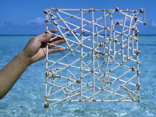
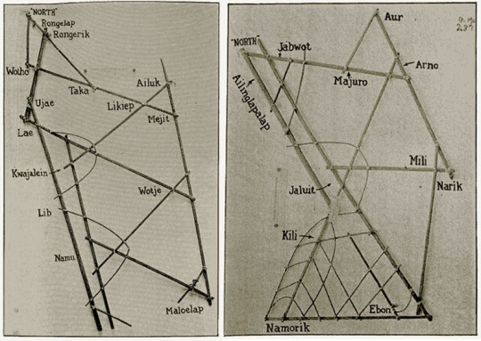
Polynesians did also rely on a form of a physical map called a stick chart, illustrating the specific wave and swell patterns surrounding different island chains. These were particularly helpful during cloudy conditions when the sun and stars were less useful. To navigate the Marshall Islands, the Marshallese represented ocean swell patterns using parts of coconut fronds and shells as islands. Like a subway map, they don’t so much represent distances as they do relationships. The complex and decorative stick charts were often only understood by the person who made them. They were memorised before a voyage by the pilot who would lie on the floor of a canoe to get a sense of swell movement and often lead a squadron of 15 or more boats.
33K notes
·
View notes

Text

Lenka Clayton. Counting Until Boredom Threshold Reached, 2015
126 notes
·
View notes

Text

Toshi Ichiyanagi. IBM for Merce Cunningham, 1960
140 notes
·
View notes

Photo

Jasper Johns, 0 through 9, (aluminum), 1961 (cast 1966) [MoMA, New York, NY. © Jasper Johns/ARS, NY]
943 notes
·
View notes

Text
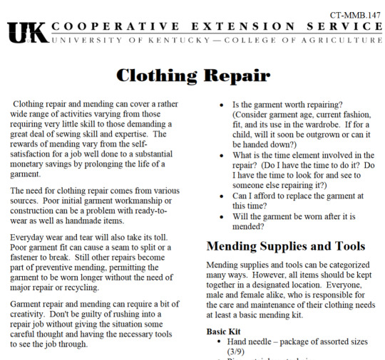
Download this easy DIY clothing repair guide (only 10 pages) from Uni of Kentucky
link to PDF
68K notes
·
View notes