#pakistan rice
Explore tagged Tumblr posts
Visit Tumblr Blog
Explore Tumblr blogs with no restrictions, modern design and the best experience.
Last Seen Tumblr Blogs


Fun Fact
There were a total of 171.5 billion posts on Tumblr in 2019.
Text
13 notes
·
View notes
Note
Eid Mubarak!! I'm sorry if I'm late, my community started celebrating it a little later than others >_< (shaytaan is begging the ummah to make up their mind on when eid is so he knows when he can come out lol) I really hope you have a beautiful eid with your family ❤ eat lots of biryani, nihari, gulab jamun and ras malai🤌 and please stay safe! InShaAllah may your Ramadan have been accepted and may you be rewarded with the highest of rewards ♥ 🤗
(Pffft, omg, I never thought about it that way, hahaha)
Eid Mubarak, Anon ✨✨🎉🎊🎉🎊 (I’m probably late, too, considering how long ago this was sent in, but) I hope you are having/have had a great time celebrating, and, InshaAllah, your Ramadan and deeds have also been accepted!!
I had a wonderful time yesterday ^^ Ahhh, nihari sounds soooo good rn… my family typically makes it once during Ramadan, but alas, there wasn’t any then nor at the party… InshaAllah, next year (and, well, sometime soon, too, because please).
Still a great time, though, ofc, ofc, haha (I managed to get the cards done! …At the expense of getting to the party an hour late, oops, but was worth it, haha). It’s funny, though—it was such an effort keeping awake at night this Ramadan, but the day it’s over, I get around an hour of sleep (in batches), and I didn’t feel tired in the least bit during the party/afterwards. Like, I’m usually pretty introverted even when it comes to just family get-togethers, but I wasn’t at all tired of social interaction when I left (though, we did play several rounds of an argument-based board game just before I left, and I do love me my debates, haha. Have late night discussions for a reason—energizes me right up). My arms and back did, however, end up somehow feeling pretty sore that night and this morning (which I do wonder if that’s where the lack of sleep contributed?).
But, yeah, had a good time this Eid, Alhamdulillah ^^ Hope you do/did, too <3
#asks#y’know as a kid when i found out one eid that my relatives in pakistan were gonna celebrate it after us#i somehow came to the conclusion that while the americas are behind overseas in the solar calendar#they’re ahead in the lunar calendar#and tbh it wasn’t until a few years ago that i realized nah#different countries might just sight the new crescent at different times#~18 years of thinking like this i knowwww 💀#on another note:#it sounds blasphemous i know but i’m not the biggest fan of biryani#can you tell i’m a picky eater? haha#i think it might be because it and similar foods are too dry? for me?#like when i eat shorba chawal i like to—how i dub it—flood my rice#on occasion you might not even see the rice#(and like i prefer eating with ‘plain’ white rice in general haha)#i do love the chicken right before you combine it with rice though—that’s delicious right there 👌#and while i used to adore gulab jamun as a kid i’ve only ever been fond of a few desi desserts#gulab jamun now removed from that list 😔#haha but i do hope you enjoyed all that and more!!
2 notes
·
View notes
Text
Rice exporters in UAE-SST Looking for rice from India and Pakistan? Discover top rice suppliers in Dubai and UAE offering high-quality products. Leading rice exporters in the UAE provide a wide range of Indian rice and Pakistani rice. Contact Indian rice suppliers in Dubai or UAE for reliable delivery and bulk orders of premium rice. https://www.sst.ae/Rice.html

#Rice from India & Pakistan#Rice suppliers Dubai#Rice suppliers company UAE#Rice exporters in UAE#Rice from India#Indian Rice suppliers Dubai#Indian Rice suppliers company UAE#Rice from Pakistan
0 notes
Text
.
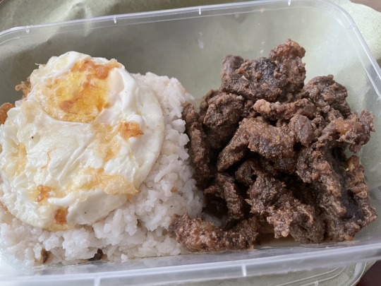
#ive been in pakistan for about 15 hours now#and the ROLLER COASTER I've had guys ksbsjhd#I haven't been on a plane in 15 years(so basically never since I was 2 then) so I was kinda anxious esp w my baby sister who is a FIREWORK#but the plane ride was fine and the food was acc nice(for plane food that is) and I saw the prettiest sunset when we went over dubai#and then as soon as I arrived at my family's house i CRASHED#when the family left me my parents and sister I SOBBED like it was a full on BREAKDOWN#and it was for a number of reasons but basically it was too much for me in that moment#it was 3am here then so I went to sleep an woke up to discovery for pakistani heat REALLY MEANT.#and let me tell you. its not pretty skhsjshsh#so I woke up feeling the same mentally but then I slept and had rice w meat#and realised hey the world didn't end yesterday I just needed basic nutrition skhsjshshsk#so now I'm feeling much MUCH better and appreciating that I get to see the rest of my family and the place my mum grew up in#anyways what did I miss?
1 note
·
View note
Text

BIOAQUA Rice Raw Pulp Essence Hyaluronic Acid Serum 15ml
#Whitening#Review#Price in pakistan#Bioaqua vitamin c#Bioaqua rice raw pulp#Bioaqua 24k gold#Anti acne serum#Hyaluronic acid#White rice
0 notes
Text
Rice suppliers company UAE:-
Dubai has a large food business, and consumers across the Middle East and North Africa can rely on our products and services. SST Foodstuff Trading, a global market leader, sells all kinds of spices and dried fruits. For more info visit us: https://www.sst.ae/Rice.html
0 notes
Photo

Recipe for Balti Chicken Pasanda Balti chicken pasanda is a delicious, creamy curry from Pakistan that is also well-liked in Northern India. 2 tablespoons finely chopped cilantro plus more for garnish, 3 fresh green chile peppers chopped, 2 medium onions diced, 1.5 pounds chicken cubed, 1 teaspoon salt, 1 teaspoon minced garlic, 1/2 teaspoon black cumin seeds, 1 piece cinnamon stick, 1 tablespoon ground almonds, 1/2 cup light cream, 1 teaspoon grated fresh ginger, 6 whole black peppercorns, 1 teaspoon chili powder, 4 tablespoons Greek yogurt, 2 teaspoons garam masala, 4 pods green cardamom, 5 tablespoons vegetable oil
1 note
·
View note
Text
Which country is biggest exporter of rice
India proudly holds the difference of being the biggest exporter of rice global. This extraordinary state has finished a distinguished role within the world marketplace, recognized for its extremely good rice production and unwavering dedication to meeting the world's demand for this essential crop. India's extremely good achievement as a rice exporter can be attributed to a combination of factors that set it aside.
for complete blog visit
0 notes
Text

3 notes
·
View notes
Text


Investigating the Indian Bullfrog
Indian bullfrogs, also known as Hoplobatrachus tigerinus is a large species of frog native to India, Pakistan, and Bangladesh. They are found in many types of freshwater habitat including wetlands, lakes, and urban ponds and rice paddies.
H. tigerinus is one of the larger frog species, weighing anywhere from 0.27 to 0.77 kg (0.6 to 1.7 lb) and measuring about 167 mm (6.60 in) in length; females tend to be larger than males. Outside the breeding season, males and females are virtually identical, with brown or olive green skin and a yellow stripe running down their back. During the breeding season males turn bright yellow, and their vocal sacs turn blue or purple. This bright coloration indicates to females that they're healthy and strong, and the brighter the color the more mates a male will attract.
Breeding for Indian bullfrogs occurs throughout the monsoon season, from July to November. Once they change color, males find a suitable watering hole and begin calling to attract females. After a female chooses a male, other males often attempt to climb on top of the mating pair and insert themselves into the pairing. Once she has finished with her selected mate, the female moves to a quiet area and attaches a clutch of up to 5,000 eggs to underwater vegetation. Several days later the eggs hatch, and tadpoles take several weeks to metamorphose into their adult form. Males reach full maturity in only 10 months, while females take up to two years. Individuals can live up to seven years in the wild.
Outside the mating season, H. tigerinus is nocturnal. They spend most of their time foraging in the leaf litter and brush surrounding their freshwater habitats. Their main diet consists of invertebrates like beetles, worms, and centipedes, and adults will also opportunistically feed on small mammals and birds. Tadpoles are primary predators of mosquito larvae. The main predators of adult Indian bullfrogs are snakes, especially the Asiatic water snake.
Conservation status: The IUCN has rated the Indian bullfrog as Least Concern. They are highly adaptable to urban environments. The species has been introduced in many countries outside its native range, including the Maldives and Madagascar, where it is considered an invasive species.
Photos
Kishan Meena
H. H. Harikrishnan et al.
Danile Nasika
#indian bullfrogs#Anura#Dicroglossidae#fork-tongued frogs#frogs#anurans#amphibians#freshwater fauna#freshwater amphibians#wetlands#wetland amphibians#urban fauna#urban amphibians#asia#south asia#india#animal facts#biology#zoology#ecology#nature
236 notes
·
View notes
Text
Pick a Novel: Keywords/prominent themes in your life
Pick the novel that draws your attention the most. If you can't decide between two, then look at the 2 readings. This is a general reading, so not everything will apply. Please take what resonates and leave what doesn't behind!
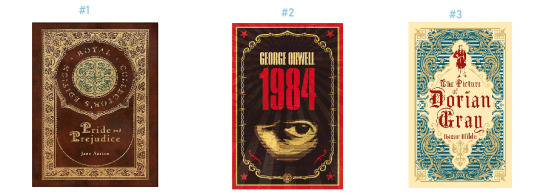
#1
Keywords: love, lust, passion, fun, temperament, cafe, sweet, bicycle, pen, books, music, loyalty, winter, sofa, furniture, thoughts, light, intuition, soulmate, art, obsidian, cake, carbonated water, skincare, socks, cooking
Celebrities/Public Figures: Audrey Hepburn, Min Yoongi, IU, Claude Monet, Angela Merkel, Andrew Carnegie, John Johnson, Mark Zuckerberg, Larry Page, Howard Schultz, Sam Walton, Amancio Ortega, Queen Elizabeth I, Jane Austen, Jennie Kim
Countries: Italy, Canada, South Africa, Thailand, Saudi Arabia, Singapore, Greece, Madagascar, Qatar, Sweden, Zambia, Taiwan, Solomon Islands
Numbers: 11, 1, 5, 9, 80, 888, 6
Brands: Hermes, Tiffany, Apple, Instagram, Taobao, Lamborghini, Deloitte, Microsoft, Chopard, Givenchy, Patek Phillipe, Chloe, Alaia, Kraft,
Kpop songs: Young Forever by BTS, Shine by PENTAGON, Me Gustas Tu by GFRIEND, Run to You by DJ DOC, Love Lee by AKMU, Deja vu by TXT, Back Down by P1Harmony, Love shot by EXO
#2
Keywords: economy, job loss, new opportunities, play, drama, anger, frustration, lost, compass, computers, battery, feet, head, brain, summer, pearl, avocado, junk food, fried chicken, challenge, frugal
Celebrities/Public Figures: Grace Kelly, Billie Eilish, Keanu Reeves, Rosé, Jung Hoseok, Salma Hayek, Pablo Picasso, Princess Diana, Thomas Edison, Sergey Brin, Mary I, William Shakespeare, Lee Nayeon
Countries: New Zealand, USA, Maldives, Indonesia, United Kingdom, Venezuela, Lithuania, Nepal, Portugal, Poland, Lebanon, Mali, Netherlands
Numbers: 4, 99, 101, 33, 13, 14, 0
Brands: Masion Margiela, Amazon, facebook, Shein, PWC, Missoni, Moschino Couture, Toyota, citi bank, Chaumet, Polene, Pizza Hut,
Kpop songs: Love Dive by IVE, Shangri-la by VIXX, Sweety by Clazziquai, I NEED U by BTS, The Chaser by Infinite, Magnetic by ILLIT, My House by 2PM, ICY by ITZY
#3
Keywords: tales, gossip, lies, funny, movies, theatre, cell phone, cool, kpop, magenta, ancient, history, claws, cats, tiger, fall, jealousy, games, aquamarine, lemons, makeup, pencil, groceries
Celebrities/Public Figures: Beyonce, Lady Gaga, Morgan Freeman, Kim Seokjin, Jang Wonyoung, Matt Damon, Napoleon Bonaparte, Shinzo Abe, Steve Jobs, Voltaire, Kim Jisoo,
Countries: Ethiopia, France, Russia, Ireland, Argentina, Afghanistan, Libya, Rwanda, Nigeria, Pakistan, Morocco, Malta, Kazakhstan, Kenya, Iraq,
Numbers: 2, 7, 69, 25, 55, 79, 1182
Brands: Saint Laurent, miumiu, Starbucks, Mercedez-Benz, Nestle, Oracle, Tod's, Bulgari, Rolex, KFC, SUBWAY, Carrefour, Kellog's
Kpop songs: Supernova by aespa, Maestro by seventeen, Not by the moon by GOT7, Alone by Sistar, Hip by MAMAMOO, Good Day by IU, Bite Me by ENHYPEN, Work by ATEEZ, The Feels by TWICE
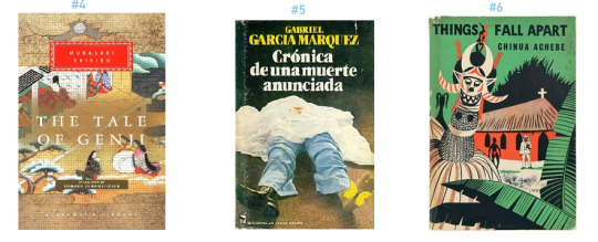
#4
Keywords: foreign, spicy, peppery, rice, no, objection, resistance, control, storms, thunderstorms, shower, tension, crush, pop, paper, mango, legs, fragrance, emerald, clothing rack, tomatoes, defeat,
Celebrities/Public Figures: Judy Garland, Margot Robbie, G-Dragon, Jeon Jungkook, Pharrell Williams, Emmanuel Macron, Bill Clinton, King Charles, Warren Buffet, Cleopatra, Kim Mingyu
Countries: South Korea, Philippines, Scotland, Spain, Albania, Guatemala, Malaysia, Iran, Romania, Honduras, Georgia, Croatia, Belgium, Czech Republic, Gambia, Guinea
Numbers: 31, 75, 412, 43, 486, 640
Brands: Chanel, Prada, Bentley, Gucci, Samsung, Disney, BMW, Hyundai, cisco, Van Cleefs & Arpels, Dior, Loro Piana, Shake Shack
Kpop songs: Gee by SNSD, If you by BIGBANG, Antifragile by LE SSERAFIM, Up and Down by EXID, OMG by NewJeans, Lion by (G)I-DLE, Hello by TREASURE,
#5
Keywords: death, mystery, mirror, reflection, shadow, black, grey, white, funeral, video, sprint, pool, gym, streets, metro, subway, chocolate, broken, knees, moon, ruby, surgery, teeth, race
Celebrities/Public Figures: Marilyn Monroe, Barack Obama, Kate Winslet, Kim Taehyung, Aamir Khan, Marie Antoinette, Elon Musk, Robert F Kennedy, Jeff Bezos, Richard Branson, Edward VIII, Charles Dickens, Abraham Lincoln, Park Bogum,
Countries: North Korea, China, Vietnam, Brazil, Bangladesh, Cambodia, Germany, India, Israel, Laos, Haiti, Dominican Republic, Congo, Cuba, Egypt, Mongolia
Numbers: 3, 97, 17, 19, 52, 98
Brands: Ralph Lauren, Celine, Ferrari, Huawei, Uber, intel, UPS, Calvin Klein, Piaget, Guerlain, Berluti, Pepsi, Cadbury
Kpop songs: Shut down by Blackpink, Seven by Jeon Jungkook, God's Menu by Stray Kids, Love Love Love by Epik High, Very Nice by SEVENTEEN, Birthday by Jeon Somi, Psycho by Red Velvet,
#6
Keywords: travel, toxic, break away, departure, memory, dreams, truth, unveil, diary, journal, coffee, jacket, shoes, hands, social media, news, competition, autumn, diamonds, electricity, TV, cheat, fashion
Celebrities/Public Figures: Jane Birkin, Kim Jiwon, Gigi Hadid, Charlize Theron, Park Jimin, Salman bin Abdulaziz Al Saud, Maximilien Robespierre, Bill Gates, Queen Elizabeth II, Vladimir Putin, Henry Ford, James Joyce, Lalisa Manobal
Countries: Japan, Australia, Mexico, Iceland, Finland, Eritrea, Ecuador, Costa Rica, Cyprus, Bolivia, Botswana, Bahamas,
Numbers: 8, 646, 152, 37, 49, 22
Brands: Louis Vuitton, Lexus, Tesla, Fendi, Walmart, Nike, Siemens, Google, Cartier, Burberry, Ferragamo, Burger King, Unilever
Kpop songs: ROCKSTAR by LISA, Cherry bomb by NCT 127, Move by Taemin, Dramarama by MONSTA X, Love Scenario by iKON, Get a Guitar by RIIZE, Replay by SHINee, Candy Sugar Pop by ASTRO, Mr. Simple by Super Junior
#psychic readings#love readings#psychic predictions#general readings#psychic#psychic reading#pac#pick a card#pac reading#pick a card reading#pick a pile#pick a picture#pick a photo#psychic reader#psychic readers#free psychic reading#life readings#predictions#intuitive#intuition#intutive reading
224 notes
·
View notes
Text

#Rice from India & Pakistan#Sugar from India#Cashew Nut from Vietnam#Rasins from India#Turmeric from India
0 notes
Text
Notes on a South Asian Tropical Cyrodiil (and more!)
So, many TES fans know that before Oblivion, Cyrodiil was supposed to be tropical. The most striking phrase to describe it, "most is endelss jungle", says it all. The quick and snarky explanation is that Todd Howard watched LOTR, was "inspired" by it, and that's why everything in Oblivion looks sort of like a Rennaisance Fair. In any case, I think it was a huge missed opportunity, especially in a world where most popular fantasy is European inspired, to have replaced what could have been very cool tropical enviroments with what is frankly a lame "Talos used his magic" lore retcon. You can read the 1st edition of the Pocket Guide to the Empire to see what we missed.
But it's not only Cyrodiil which we missed this way… Tamriel just makes more sense as a tropical continent. While the size and the exact location of the continent is discussed by nerdier nerds than me, I think it does make sense like this, and not only that, we have a very interesting world parallel to compare it to: India. From a tropical rainy south to the cold mountains of Skyrim, Tamriel is surprisingly similar to the Indian subcontinent, and many of its geographical quirks can be explained if, instead of assuming a temperate Cyrodiil, we go all out with that concept. This is going to be a long post, you have been warned.
So with that in mind, I'll try to make a not-so brief tour (with some evocative pictures along the way) of a rebuilt tropical Tamriel, following the rains of the moonson:
The position of Tamriel, in this case, would be roughly where the Indian subcontinent is located in real life, that is again, tropical, stretching the Tropic of Cancer (is there a name for the tropics of Nirn? Interesting to think about) Here, we see our numbers pan out well: Tamriel is mentioned to be between 4000 and 3000km across east to west and 2000 and 3000km south to north. VERY, VERY roughly, there is 4000km between Pakistan and Myanmar, and 3000km from Sri Lanka to the northern tip of Tibet. Plot that on a map, and you already can see some coincidences. Now, this is a rather average continent, not Pangea sized like some imagine Tamriel to be. This does help explain why, for example, the interior of Cyrodiil is rainy and good for agriculture instead of a desert. But it also means that it's very likely that Tamriel is ruled by monsoons. Monsoons are complex, but they basically form when there are plenty of warm places for water to evaporate (the South Indian ocean), and mountains that block cool winds from the opposite direction (the Himalayas). We have a very similar situation here, with a mountainous Skyrim on the north of a tropical Cyrodiil facing an equatorial southern ocean. So, what happens are monsoons, perhaps not as strong as IRL India, but carrying rains very deep into the continent. This would feed the rivers and the rich agricultural areas of Cyrodiil, and would have some other consequences.
So let's imagine our trip South to North. In the South, in Black Marsh, Blackwood and Lleyawiin, and Pellentine (southern Elsweyr) we would find, much like in the original lore, humid tropical climates, jungle, wetlands, and my favorite, mangrooves. I would expect mangrooves to stretch in this whole area, across rivers. In fact, one of the reasons why Black Marsh could be so hard to explore and control by the Empires at Cyrodiil would be the presence of thick mangrooves all over its coast. This is the region of Cyrodiil that would most resemble "endless jungle".
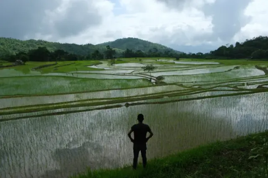
(Rice fields in India, what I imagine most of this Tropical Cyrodiil would look like)
However, as any lore person knows, Anequina, northern Elsweyr, is arid desert. Does this mean a contradiction? Far from it, we have a similar example in IRL India: the Deccan Plateau, which has a semi-arid to arid climate. This can be easily explained by higher elevations up to a small mountain chain separating it from Cyrodiil to the north, and the fact that little rain would reach behind this "Anequina Plateau" would make the region of Kvatch and Anvil more dry much like in canon, in this case, more scrublike. This highland desert would not be as harsh as Elsweyr is usually concieved, maybe, but its driest regions might justify places such as Dune. (On that matter, it always bothered me to read about the "cities" of southern Elsweyr and there being only two or three there. If I had to redesign it, I would move some from the north to the south).
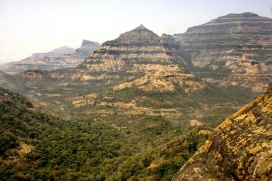
(the Deccan Plateau in India, it gets greener or drier according to the monsoon)
Keeping on our tour of Tamriel, the Topal Bay and the very rainy Black Marsh funnels the rainy monsoon from the south towards central Cyrodiil. Here we find the endless jungle of the Nibenay Valley. But unlike the rainforests of Elsweyr and Black Marsh, these dense forests and rich river plains are mediated by the monsoon winds, with dry seasons alternating with copious rain. This has huge effects on agriculture and culture in general, as agriculture is defined by the rythms of the rain. Keeping with our South Asian theme and the 1st edition of the Guide to the Empire, Cyrodiil would have huge extensions of rice paddies, as well as terrace farming and much hardier crops in the highlands, instead of the… well, almost absent agriculture we saw in Oblivion. The food, clothing, architecture and overall culture of Cyrodiil would be very different with this. The original Pocket Guide said some of its main exports besides rice and fruit are moon sugar and silk. Moon sugar in Cyrodiil, can you believe it?
Another thing I imagine Cyrodiil would be famous for would be fish and seafood, well, river food. Rice plantations can host fishes and crustaceans to get some extra protein, and well, what about mudcrabs? Hell, as preparing muddy soil is vital for rice cultivation, no wonder mudcrabs are considered a nuisance. Imagining critters in gameplay in such an enviroment also makes my mind roam. Tigers, elephants, rhinoceros, and this is not even getting into the more mythical creatures you could find, instead of endless wolves… Rice cultivation is also more labor intensive than other crops, and it also has a deep impact on the terrain, "terraforming" so to say, huge expanses into paddies and terrace farms. This level of cultivation also requires an established infraestructure of irrigation. While this does not necessarily means a centralized goverment, as farmers can build it and maintain it by themselves, the rise of an empire, i.e., the Empire, will also increase the complexity of these systems, adding canals, dams, reservoirs and more ambitious projects, like we see in India and China. I am sure some people more knowledgeable about those cultures can comment more.
While this Cyrodiil is a tropical/subtropical region covered in "endless jungle", some parts might indeed resemble the rolling hills and grasslands you see in Oblivion. Deforesting jungle for pasture is something very common around the world (some have joked this mass deforestation was later in canon explained as a gift from Talos lol) and you can see the results, like in tropical Australia and my closer Mata Atlantica, do superficially resemble temperate pastures in say, Europe. Until you notice the palm trees, of course. But yes, I can see the Nords being a mostly herding people (more on that below) bringing their sheep and cows to the tropical lowlands and, well, deforesting to make space for them.
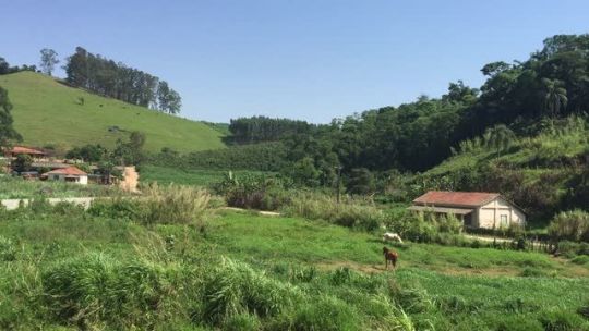
(ranches in Sao Paulo state, Brazil, notice the palm trees)
Imperial City just so happens to be built in an island in the middle of several river crossings, in what seems to be a swampland. The first thing that came to mind when I read that was Tenochtitlán. The districts of Imperial City would have been built over the centuries on artificial islands on a shallow lake, using plentiful mud and organic matter to make fertile chinampas. I believe this would make for a striking sight. Instead of just a city in the middle of a empty island, you would see the White-Gold tower and the rest of Imperial City rising from Lake Rumare, surrounded by rich farmland and its districts joined by walkways. (much like the old descriptions, actually, could you believe I wrote that without reading them?)
(Reconstruction of Tenochtitlán... and I just noticed, it's surrounded by (volcanic) mountains too, much like Imperial City)
Much like the Pantanal is one of the sources to the Paraguay River (which merges with the Paraná and then the Río de la Plata) IRL, here, the swamps of central Cyrodiil would be the source of the Niben. This does raise an interesting question, where is the source of the Niben? Is it Lake Rumare? No, I believe it would be several smaller rivers all the way from Bruma and even Skyrim. These small, violent mountain rivers eventually flow into the Rumare wetlands and only THEN in the placid great Niben. You DON'T want to be caught in one of the mountain valleys in rainy season. This does raise the question; won't the developments upriver, like Imperial City itself and the surrounding farmland, affect the course of the river downwards? There's plenty of water from the rain, but a more developed Cyrodiil might indeed have to grapple with this, supposing, for example, they manage to dam the river.
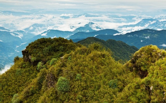
Looking west, we got the Colovian region, said to be composed of drier highlands and cliffs in the early Pocket Guide. Probably cut from the rain because of the Anequina Plateau, this is indeed more arid or "mediterranean", though I actually see it as more Australian. Maybe some of the drier parts near Hammerfell, resembling Argentine Cuyo and the northwest, would be a distant cry from the wetlands, having thorny dry forests and dry valleys, where yes, you could plant wine. The wetter cloud forests (much like the Yungas in South America, the place where the rain reaches last) could maybe be the home of the last pre-Imperial cultures of Cyrodiil. Fascinating places.
(Jujuy, Argentina. Just *near* are the Yungas cloud forests, where the last rains from the Atlantic meet the Andes, making for some AMAZING places)
Given that I mentioned enviroments near to/on the Andes IRL, let's talk about potatoes. Potatoes are unique crops, because they are the only ones who offer such calories and also be planted in cold enviroments like Europe. Or Skyrim. The discovery and spread of potatoes would cause demographic shifts on people living in cold areas. And they also originated in a unique enivorment IRL: the Andes, actually with possible hybridization from the Magallenic foresWHAT I MEAN, is that potatoes are very important and have been domesticated in very specific conditions. The Wroghtgarian Mountains would seem like a perfect equivalent of the Andes at the first glance, but they would be very different. The Andes, located between the Pacific Ocean and the greater Amazonian region, are very, very unique enviroments. These mountains, however, are in between inner seas. Something like the Atlas or the Alps? In any case, if there is some people who would appreciate hardy tubers that can grow in mountainous places, they are for sure the Orcs, or perhaps the Reachmen. Maybe an hybridization even between them?
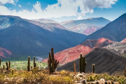
This returns me back to Bruma and Skyrim. Some people (who make those excellent Oblivion mods) imagine Bruma with a Tibetan flavor. Personally, I imagine it more like Pakistan or Afghanistan, with lots of mesas and plateaus and valleys. It would look dry and rocky with some very fertile valleys by snowmelt, but it would look like a snowy wonderland on winter, indeed, Pakistan and Afghanistan are very snowy. Eventually, of course, ending up in the great barrier of the Jerall mountains and finally, Skyrim.
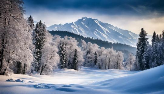
(the Alps? Skyrim? No, this is Kashmir on winter!)
In this scenario, Skyrim would be a quite dry place… or would it? There is no need for the Jeralls to be a straight line of peaks like the Himalayas. They could be a more "broken" series of mountains, like the southern Andes, but in any case, the rain from the south would clash into the higher mountains. Indeed, that is what actually happens in the Himalayas, the foothills of the Himalayas are some of the rainest places IN THE WORLD. These small valleys are something very unique and not very well known part of the world IRL. I can imagine the Skyrim equivalent would be as unique too, hard to navigate and live in. The forests of the Rift and Falkreath would be mazes of windy forests valleys, each with their own unique secrets under a perpetual fog and drizzle. This is a very interesting enviroment to imagine, where again, some of the older cultures of Tamriel could still live.
(forests of Bhutan, note how the humid valleys stretch into the distance before the cold Himalayas begin)
However, what does Skyrim look like once you cross the border with Ralof? I imagine some sort of more fertile Tibet, not as high as the Tibetan plateau, allowing for forest and alpine tundra. This is mostly because, while Skyrim is high up, I don't imagine as a plateau, but rather a series of broken mountains like the North American Rockies, which makes sense when you account for all the volcanic activity (there is another super-volcano down in Skyrim but nobody notices). I imagine that Skyrim would be a primarily herding pastoral land before the introduction of hardier crops such as potatoes, and even then. Nord culture would be very interesting reimagined like this; hillforts guarding herds of sheep and cows. It would also create a clash between the very, very agrarian south and the nomadic herding north, with High Rock and Hammerfell a gradient between the two.
But here we enter a problem; if we are operating on a level where Cyrodiil is roughly at the same latitude of India, wouldn't that make Skyrim too far from the poles to allow its tundra like climate, even with elevation? No doubt. Tibet is only as cold as it is because it's the roof of the world and far from any ocean. The northernmost tip Skyrim, like Tibet, would be at the latitude of Turkey, Korea or California, which can get quite cold, but not to the level of what we see on Winterhold or Dawnstar (Solitude sounds familiar, though). What's more, having an ocean up north would only moderate the temperature. Cool currents often don't bring cold per-se, just decrease rainfall. This would end with a very temperate and pleasant Skyrim instead of tundra. Which is on its own, interesting to explore.
Could Nirn be going through an ice age, like it's implied with the dissapearance of Atmora? Possibly, but it would imply revising everything I said before, as ice ages decrease rainfall and mess up with weather patterns all over the world. A colder Nirn would explain a lot, though.
I decide I will stop here, I haven't even touched Valenwood (though its subtropical forest seems rather coherent to me), High Rock (the most boring part of Tamriel IMO), Hammerfell, Summerset Islands (if you don't have tropical elves in your setting, you're a coward), or whatever the hell is going on Morrowind. But I hope you enjoyed this worldbuilding exercise and how to make sense of Tamriel's crazy geography. Next time, I'll try to play with tectonics and see if we can make it even more interesting.
If you liked what you read and would like more worldbuilding, consider tipping me on Ko-Fi and send me stuff to talk about, or just send an ask! I'm the kind of guy who reads encyclopedias and RPG manuals for fun, so I have plenty to talk about about everything from fantasy to science fiction to speculative evolution and alternate history!
#worldbuilding#tes#elder scrolls#skyrim#oblivion#the 'do more tropical worldbuilding you eurocentric cowards' agenda#fantasy#cosas mias#biotipo worldbuilding
306 notes
·
View notes
Text
If Ugandans have a social safety net, it is woven from banana fibers, and if there is a clear path to socialism, it will be lined with banana leaves. The lusuku model, premised on intercropping and smallholder farming, could be the basis for national agrarian reform that improves the lives of Uganda’s agricultural workers without accelerating the destruction of the natural environment. Uganda faces increasing difficulty feeding itself because of climate extremes and land degradation, and this affects farmers more significantly than anyone else. Moreover, since the 1990s, the ruling National Resistance Movement regime sold off and dismantled most of the coffee, tea, and cotton growers cooperatives, leaving smallholder farmers in the hands of the predatory middlemen which cooperatives had been established to protect them against. Unable to collectively bargain and exposed to dramatic fluctuations in the market prices for cash crops, many people left rural areas to search for employment in cities. This has been a driving force behind the massive inequality between rural and urban workers. Ugandans now produce more food than they consume, even exporting to other countries in the region, yet 41% of people are undernourished, and agricultural production has decreased over the last 20 years. For the most part, the strategy pursued by Uganda’s government has been to encourage the development of ecologically disastrous intensive agriculture for export, privileging foreign investors rather than developing the infrastructure that would benefit peasants. Indeed, while more than 70% of Ugandans are employed in agriculture, the sector only receives around 4% of public investment, and projects aimed at helping smallholder farmers have had very little success, even by their own standards. Many of the government’s investments in agriculture very clearly advantage larger landowners, to the detriment of the poorest farmers. For example, most of the government’s investment in labor-saving technologies has been spent on tractors, which are great for large plots but largely unaffordable or unsuitable for the average farmer, whose plot is usually between 1-3 acres large. However, a socialist transition premised on agroecological reforms could make use of the existing lusuku model to create the kind of growth that actually improves poor farmers’ lives without destroying their environment. This could begin with reestablishing cooperatives and engineering agricultural prices around social needs and goals, like guaranteeing access to food. Research from around the world has shown that while large, monocrop plantations are good at producing huge volumes of one crop, smallholder farms are more productive when evaluated on a per-unit area and are capable of securing national food sovereignty. Why, for example, should Ugandans buy rice imported from Pakistan or Vietnam when banana intercropping yields more calories per hectare than rice? Lusukus could feed the nation without relying on foreign experts, development aid, or the capital-intensive inputs now being imported to grow for export. Because lusukus are far better for the soil, they also improve the nation’s capacity to resist severe floods and drought, effects of climate change that hit poor farmers hardest. In these ways, the lusuku model could provide a sustainable path to socialist development.
287 notes
·
View notes
Text
Tokyo districts we've visited RANKED:
14. Akibahara: inhospitable for human life. only place in Tokyo where they not only spelled out why they specifically had 24hr surveillance on escalators but they felt the need to put signs reminding you on every available surface. so many signs telling you to Speak Up if you think someone has been molested. genuinely felt like an insane person there but at least my girlfriend found a Transformer there (we did discover that Akibahara is vastly more approachable when you get off the main roads)
13. Harajuku: this one also felt inhospitable for human life but in like an extreme gentrification way instead of like Literally Not Made For Humans way. very weird walking through THe Clothes District and finding no clothes I wanted. almost all of the food vendors were selling extreme overpriced meme foods but we did find a surprisingly good katsudon place
12. Shibuya: the Scramble ! nowhere else in Tokyo played as much Western music. clothes were either Y4k for some shit that looked like it would disintegrate in 5 days or Y20k for like. some canvas with stains on it. a robot served me a mid as fuck highball
11: Asakusa: It was insanely fucking hot the day we happened to be in Asakusa so maybe I'm not judging it entirely on its own merits but kind of an insane area in which to exist. Very touristy (largely towards people natively from Japan/Tokyo) ergo very expensive. Maybe if we had spent longer there I would have liked it more but for now my most vivid memory is of the rickshaws which my girlfriend pointed out were almost exclusively used by Japanese people
10. Ginza: This was not unexpected in any capacity but everything is so expensive here. Ginza was the only location we visited in urban Japan where we could walk for an hour and not encounter either a vending machine or a convenience store. "Do rich people not need to drink" - my girlfriend
9. Kichijoji: We bought Blue Ham Ham here and then ate at one of those restaurants that lets you pick from a selection of raw eggs to eat with rice which was good as fuck
8. Akasaka: kind of nothing here but bars, office buildings, and an entire block dedicated to Harry Potter so we didn't do anything of note here. Yu Gi Oh Curry !
7. Nagano: Pretty unremarkable except for having a mall full of old stuff but we went to some shitty hole in the wall where we were served by someone my girlfriend described as "definitely transgender" the moment we left the restaurant
6. Shimokitazawa: We saw some cool clothes here and like 15 seconds of an indie band playing in a building. Kind of the most insanely hipstery area in Tokyo by a huge margin like astonishingly so. Only time I saw anything be specifically marketed as vegan in Japan
5. Shinjuku: Shinjuku, or at least my personal experience with Shinjuku, is sort of hard to describe. It was the first district in Tokyo that I'd seen after leaving the airport and it imposes this vision of a city that is incomprehensibly vast and dense. I don't think other districts dispelled this image but Shinjuku is by far the most successful at affirming it
4. Ikebukuro: Kinda like Akibahara lite which makes it a lot more tolerable. I could not stop saying "are you inspired with lust for Irish women yet" any time we encountered a location that was even slightly notable. I don't think either myself or my girlfriend ended up buying anything here but we went to a nice restaurant so it all worked out. There's something charming about the police outposts that seem to be present on every 2 blocks and the number of cameras randomly scattered about
3. Ueno: We rly only saw the zoo here (it was mid) but upon stepping out into Ueno park we discovered a Pakistan-Japan Friendship Festival where we watched some women dance and bought some good as fuck sweets
2. Sumida: Quite cutes :) we spent a lot of time wandering around residential areas which always make me feel way more amiable towards an area. Skytree was cool though I probably wouldn't pay for it again. Katsushika Hokusai museum was very cool.
1. Jimbocho/Ochanomizu: We went to the Museum of Modern Art in Tokyo and walked around for 1 million years looking at books and posters and various other items and got some lovely coffee. Wonderful place
SPECIAL MENTION: Chiba: I got a really bad sunburn here
20 notes
·
View notes
Text
Rice exporters in UAE:-
Dubai has a large food business, and consumers across the Middle East and North Africa can rely on our products and services. SST Foodstuff Trading, a global market leader, sells all kinds of spices and dried fruits. For more info visit us: https://www.sst.ae/Rice.html

0 notes