#marine fluviale
Explore tagged Tumblr posts
Video
30 m de long ! juste pour passer les écluses... par brigitte lagravaire Via Flickr : 2014-05-22-StMarcel (52n)
#bateau#canal#sentier#marine fluviale#marinier#au bord de l'eau#Agen#Boé#Aquitaine#Gascogne#France#Lot-et-Garonne#20140522-52#France Sud-Ouest#TUMBLR#flickr
2 notes
·
View notes
Text
Wordplay Wednesday: Conglomerate
What is a conglomerate? It is a type of sedimentary rock that is characterized by it's rounded gravel, pebble, or cobble-sized grains cemented together by silica, calcite, or iron oxide.
There are many ways in which a conglomerate can be formed. Turbidites are deep marine conglomerates created by turbidity currents.
Many are fluvial in nature and occur in rivers with a high flow rate (immature river systems) such as the Buckhorn Conglomerate of the Cedar Mountain Formation in Utah, USA.
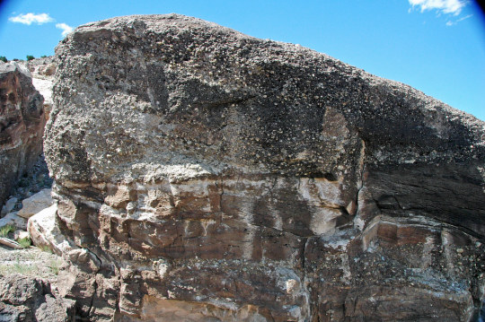
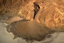
Alluvial fans along mountain fronts tend to make the thickest conglomerates. These are often called fanglomerates.
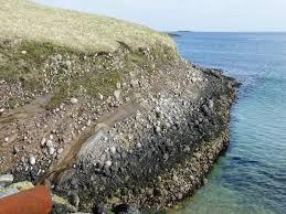
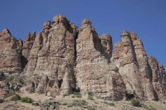
Debris flows also deposit conglomerates such as the Clarno Formation in John Day National Monument which was deposited by a lahar or volcanic mudslide.
Glaciers create tillites, a very poorly sorted type of conglomerate (no discernable pattern to size or shape of grains).
#geology#fun facts#rock formations#stratigraphy#conglomerate#John Day Fossil Beds#national monument#cedar mountain formation#lahar#volcano#river channel
18 notes
·
View notes
Photo

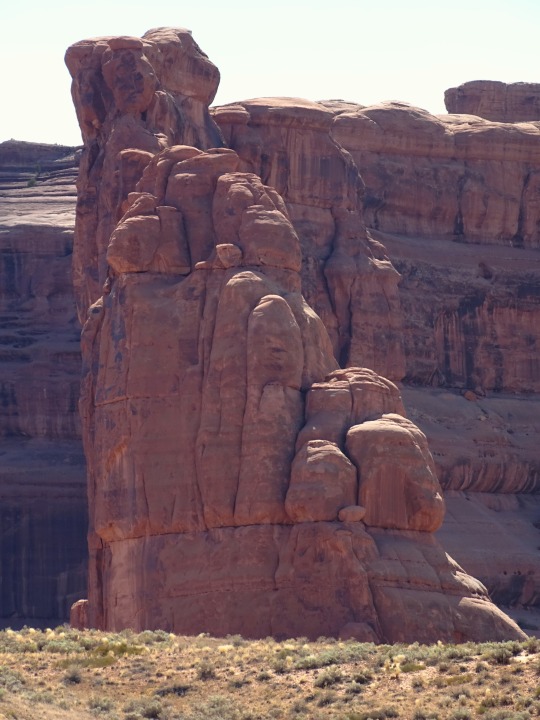
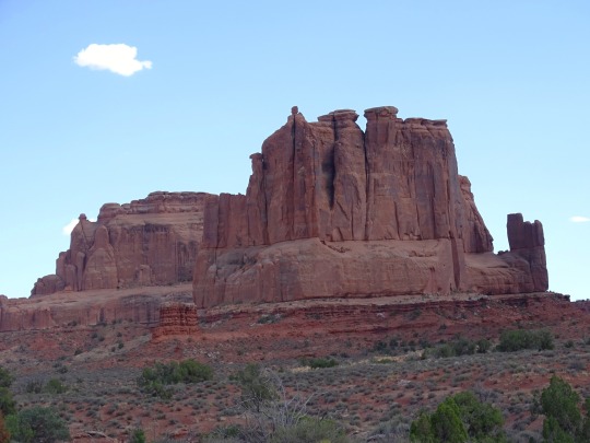

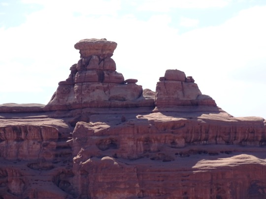
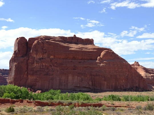


Great Wall, Arches National Park (No. 4)
During the lower Triassic Period the area of Arches National Park was covered by a shallow, marine sea and the reddish-brown mudstone, sandstone, and siltstone layers of the Moenkopi Formation were deposited. Tectonic activity decreased on the western margin of the supercontinent formed by the earlier collision of Gondwana and Laurasia. Sea level rose relative to the land and then dropped again, changing the shoreline and causing red beds to be deposited. These red beds are rust colored because when these sediment beds were exposed to air the iron in the sediment oxidized, a common feature of sedimentary rocks of this age throughout the southwest region.
During much of the Jurassic, the climate of the region that is now Arches National Park was desert-like, much like the modern Saharan Desert, with vast sand seas called ergs. The Wingate Formation was deposited during the lower Jurassic Period due to the erosion of sandstones, which were transported by wind and contains crossbedding and well-sorted quartz grains. Above the Wingate is the Kayenta Formation, also a Jurassic deposit, with abundant current ripple marks suggest a fluvial (river) environment. Above the Kayenta Formation is the Navajo Sandstone, a thick unit containing abundant groups of inclined layers, known as cross beds, which preserve ancient wind patterns. The Navajo Sandstone and the Entrada Sandstone are two of the major arch-forming formations within Arches National Park.
Source
#Courthouse Towers#Great Wall#Arches National Park#summer 2022#USA#Colorado Plateau#red rock#rock formation#sandstone#landscape#desert#geology#blue sky#original photography#grass#flora#nature#vacation#countryside#tourist attraction#landmark#light and shadow#Grand County#Utah#Western USA#hiking
84 notes
·
View notes
Note
Oh, also! Do we know what jelly drops actually are? From my research, they are still a mystery. Do you have theories?.... What is their significance to you?
You sent another ask before this inquiring about my opinion of the occult associations that pearls have, and I accidentally deleted it because tumblr mobile is terrible, so I apologize for that. To answer that last question here: as far as my own beliefs go, pearls tend to be particularly useful for healing and soothing magics. Given that pearls form as a way to defend their hosts against parasites and irritations, they possess associated virtues that can be called upon when they are incorporated into the framework of a spell. What's more, they can make good offerings to, or devotional items for, certain Aqueous spirits (though fluvial pearls tend to work best for fluvial spirits, and marine pearls tend to work best for marine spirits.)
As for the question you ask here, I'm not really sure what you mean. Jelly Drops are a fungus categorized under the genus Ascocoryne. Maybe you're referring to Star Jelly? As for my theories of what it is, they're no better than anyone else's (though I struggled to believe the hypothesis of them being amphibious remains partially digested by birds, mostly because I've seen a large section of forested area covered with deposits of it before, and I doubt that multiple birds were just circling that area and vomiting up toad goo all over.) As for what their significance is to me, it's a little fuzzy, since it's rare in lore and rarer still to come across in real life. But each of the times I've encountered it, it has been in a place, or following an event, that was heavily associated with the Gloaming Folk in some way. As such, I do think it bears certain Fae virtue.
17 notes
·
View notes
Text
How Pond Skimmers Work to Maintain Water Quality?

Pond skimmers (also known as skimmer boxes) sit near the surface of your pond to capture floating debris such as leaves/sticks/pollen/fish waste etc. Pond Skimmers serve as part of your mechanical filtration system alongside your pump and filter system. Filters are particularly effective at extracting organic matter that enters pond water bodies and can negatively impact its quality over time, and keeping circulation going optimally. They’re also invaluable in keeping algae at bay!
How Pond Skimmers Collect Surface Dirt
Skimmers Prevent Debris Buildup: Skimmers are an integral component of any pool cleaning system, helping prevent debris such as leaves and tanning oil from clogging your pump and filter, and collecting finer particles not captured by vacuuming alone.
Regular Skimmer Basket Maintenance: Your Pond skimmers basket must be regularly maintained to prevent blockages in your pool pump and filter system. A clogged skimmer requires your pool pump to work harder in cycling water through, shortening its lifespan significantly. To empty it out of the water and back into place again with its cover in place.
Benefits of Using a Fish Tank Surface Skimmer?
Protecting Fish from Algae Growth: Surface Pond skimmers are essential pieces of equipment in freshwater aquariums. They remove scum, film and waste that accumulate on the water surface which blocks light from reaching aquatic inhabitants and also prevent nutrient overload, leading to algae growth which in turn causes diseases, stress and even death in fish.
Keeping Aquariums Healthy with Surface Skimmers: Fluvial filter units offer another cost-effective option, featuring suction cups that secure it to your aquarium and an inlet with a toothed fringe to trap any debris that enters. They’re generally cheaper but still provide excellent performance — plus, they work seamlessly with existing internal filter systems.

How Floating Skimmers Maintain Water Quality?
Ideal Skimmers for Smaller Ponds: A floating Pond skimmers is an ideal solution for smaller ponds, moving with the water level to provide optimal cleaning. Furthermore, its floating design helps prevent debris from sinking to the bottom where it could decompose and compromise water quality — keeping your pond clean even as trees shed leaves. Like its counterpart, the floating skimmer relies on moving media to remove debris, such as belts, tubes, ropes or disks.
How Pond Skimmers Work? A Pond skimmers works by taking advantage of the difference in specific gravity between oil and water, where heavier oil floats on top, while lighter water stays below, creating an electromagnetic force which attracts oil into the skimmer where it can be trapped by its weir door. To make sure a skimmer works efficiently, it must be properly situated with its weir door open and closed according to plan. In order for it to collect organic debris effectively and reduce strain on your pond’s pump, combining with a pump is best used together with the skimmer can also help.
Simple Installation of Skimmer Boxes
Reduce Maintenance and Cleaning Time: A pond skimmer will dramatically enhance your backyard water feature’s aesthetics by keeping it clear and free from harmful substances and algae growth, as well as alleviating strain on its filter system. You will spend less time cleaning or maintaining, as well as protect fish and aquatic plants in your pond. Innovative Marine’s Skimmer is an outstanding example of an easy and user-friendly skimmer, designed for novice aquarists.
Regular Inspections Required: A skimmer box is simple to install, as it requires no plumbing connections. Ideal for smaller ponds and compatible with any pump that provides suction, this device should be regularly checked for signs of damage or wear to help spot potential problems early and deal with them before they become more serious. Regular inspections will help identify issues with your pond’s plumbing and pump, which could reduce its efficacy as a skimmer.

Why Choose GC TEK?
GC TEK offers reliable filtration systems to pond owners. Their innovative products, including Alpha ONE filters and Wonder Max pumps as well as beneficial microorganisms such as Alpha nine help improve water quality while decreasing maintenance requirements and supporting healthier ecosystems. Their expert customer service staff offer advice to meet any filtration requirements for any given pond or aquatic facility — invest in your aquatic future today by choosing GC TEK!
0 notes
Link
0 notes
Text
SETRAG/Mission à Ndjole : Projet de Port fluvial minéralier et commercial
Le Ministre des Transports, de la Marine Marchande et de la Mer, le Capitaine de Vaisseau Dieudonné Loïc NDINGA MOUDOUMA, accompagné du Ministre des Mines, Gilles NEMBE, et de la Ministre des Affaires Sociales, Nadine Natalie AWANANG épse. ANATO en mission conjointe à Ndjolé sur instruction du Premier Ministre, chef du gouvernement. Objectif principal de cette mission, la visite du site destiné…

View On WordPress
0 notes
Text

«Jacques Godbout était dans la salle et l’apercevant, je lui ai trouvé le profil de Voltaire, le regard métallique, les lèvres pincées, l’applaudissement prudent. Je ne sais pas si c’est empiéter sur sa vie privée que de décrire ici sa silhouette entrevue dans un lieu public. On ne sait plus sur quel pied danser dans nos droits et libertés, qui sont en train de devenir des corsets. Je me demande à quelle espèce marine, fluviale ou lacustre, appartient l’auteur de L’Aquarium et de L’Isle Verte.
[…]
Tout récemment, la statue de Voltaire, à Paris, a eu le nez fracassé».
François Hébert, Pour orienter les flèches. Notes sur la guerre, la langue et la forêt, Montréal, Trait d’union, coll. «Échappées», 2002, 221 p., p. 32.
1 note
·
View note
Text
Découvrir un canal en péniche : osez le voyage

Naviguer le long d'un canal en péniche est une expérience unique qui vous permet de découvrir la beauté paisible et intemporelle des voies navigables. Cette forme de voyage offre une perspective tout à fait différente, où chaque virage du canal dévoile de nouveaux paysages enchanteurs. Dans cet article, nous vous invitons à plonger dans l'univers captivant d'un voyage en péniche le long des canaux, en mettant en avant les charmes et les avantages de cette aventure exceptionnelle. Imprégnez-vous de l'histoire et de la culture locales L'un des attraits les plus fascinants de la navigation en péniche le long des canaux est la possibilité de vous immerger dans l'histoire et la culture des régions que vous traversez. Chaque canal est imprégné de récits anciens, de traditions locales et d'architecture qui racontent l'évolution de la région au fil du temps. En parcourant les canaux, vous aurez l'opportunité de visiter des villages pittoresques, des marchés traditionnels et des sites historiques, créant ainsi des souvenirs mémorables et enrichissants. Le rythme apaisant de la vie fluviale Loin du tumulte de la vie urbaine, un voyage en péniche vous permet de ralentir et de savourer le rythme tranquille de la vie fluviale. Glissant doucement sur les eaux calmes, vous serez entouré de paysages bucoliques, de la verdure luxuriante des rives et du doux murmure de l'eau. Cette expérience apaisante vous offre une pause bienvenue, où vous pourrez vous détendre, lire un livre, ou simplement contempler la beauté qui vous entoure. Un mode de voyage convivial et accessible Naviguer en péniche ne nécessite pas de compétences nautiques particulières. Ces embarcations sont conçues pour être faciles à manœuvrer, ce qui en fait un mode de voyage accessible à tous. Vous n'avez pas besoin d'être un marin expérimenté pour profiter de cette aventure. Les compagnies de location de péniches proposent souvent des briefings complets avant votre départ, vous donnant ainsi la confiance nécessaire pour explorer les canaux en toute sécurité. Créez des liens et des souvenirs inoubliables Voyager en péniche est une expérience idéale pour les familles, les groupes d'amis ou les couples à la recherche d'une escapade romantique. Passer du temps ensemble à bord de votre péniche crée des liens forts et des souvenirs inoubliables. Imaginez-vous en train de cuisiner des repas savoureux dans la cuisine de votre péniche, de partager des rires sur le pont en admirant le coucher du soleil et de vous réunir pour des moments de convivialité dans un cadre unique. La gastronomie locale à portée de main Pendant votre voyage en péniche, vous aurez l'occasion de déguster la cuisine locale des régions que vous traversez. Amarrer votre péniche près de restaurants locaux et de marchés vous permettra de goûter aux saveurs authentiques de chaque destination. Vous pourrez également préparer vos propres repas à bord en utilisant des ingrédients frais provenant des marchés locaux, créant ainsi une expérience gastronomique unique et délicieuse. A lire : Plongez dans la magie de Rio de Janeiro Concrétisez votre aventure en péniche En somme, un voyage en péniche le long des canaux est une expérience à part entière qui vous offre une immersion totale dans la beauté naturelle, l'histoire et la culture locales. Cette aventure apaisante et conviviale vous permet de créer des souvenirs durables tout en vous offrant une pause bien méritée du rythme effréné de la vie moderne. Alors, osez l'aventure et découvrez la magie de naviguer sur les canaux en péniche. Read the full article
0 notes
Video
Reflets au port par brigitte lagravaire Via Flickr : bien que le canal soit presque à sec 2022-01-25-port (7pr) cpr
#janvier#hiver#canal#port#bateau#Agen#Lot-et-Garonne#Aquitaine#marine fluviale#paysage urbain#TUMBLR#France Sud-Ouest#reflets dans l'eau#20220125#l'eau miroir du ciel#ciel et eau#flickr
0 notes
Text
Un equipo científico de la Estación Biológica de Doñana-CSIC alerta de la capacidad de la jaiba para invadir tramos de río situados muy lejos de las desembocaduras. Este crustáceo supone un problema añadido para la anguila europea, una especie que se encontraba ya en situación crítica antes de la invasión. Jaiba azul. / Pixabay Un equipo de la Estación Biológica de Doñana – CSIC alerta del potencial de la jaiba azul, también llamada cangrejo azul, para migrar decenas de kilómetros río arriba desde las costas y estuarios invadidos. La capacidad de esta especie de alterar las comunidades invadidas y causar declives de especies es ya bien conocida, pero un nuevo estudio pone de manifiesto que estos impactos pueden extenderse más de 100 kilómetros río arriba. Se introduce así una nueva amenaza para muchas especies de aguas continentales, algunas de ellas en serio peligro de extinción. Tras la llegada de la jaiba azul al Delta del Ebro en 2012, su expansión ha sido vertiginosa. Ha invadido toda la costa mediterránea española, ha cruzado el estrecho de Gibraltar y ha alcanzado Portugal en poco tiempo, a la vez que se ha expandido por las costas mediterráneas del norte de África. Los impactos ecológicos y socioeconómicos que genera en los lugares en los que se establece van desde el declive de poblaciones de peces o invertebrados acuáticos hasta el considerable daño de las artes de pesca. Hasta ahora, la atención generada por la invasión se focaliza en zonas costeras y estuarios, pero un nuevo estudio recién publicado en la revista Aquatic Conservation: Marine and Freshwater Ecosystems muestra que la jaiba puede ser una especie importante también lejos de las costas El origen de la investigación se remonta a 2019, cuando Sergio Bedmar, autor principal del estudio, localizó una jaiba azul en el tramo portugués del río Guadiana, a más de 70 km de la desembocadura. Conociendo otros eventos de migración a larga distancia en el río Ebro, el equipo investigó la distancia máxima de migración de la jaiba en la cuenca del Guadalquivir. Se localizaron especímenes tanto en la Rivera de Huelva como en el curso principal del Guadalquivir, hasta una distancia de 108 km de la desembocadura, justo bajo la presa de Alcalá del Río (Sevilla), que actuó como barrera. “Este estudio aborda una nueva dimensión sobre el alcance de esta invasión y avisa del riesgo que supone en tramos bajos de ríos, áreas de transición que, por su complejidad, tienen un valor ecológico irremplazable”, explica Bedmar, investigador de la Estación Biológica de Doñana – CSIC. La migración de la jaiba azul hacia aguas continentales, que a veces supera los 200 kilómetros desde las costas, se conoce bien en el área nativa. Ambos sexos realizan la ascensión fluvial, pero son las hembras las que realizan el viaje de vuelta, ya que las puestas deben eclosionar en aguas marinas. Hasta la fecha apenas se sabía nada de la migración de la jaiba azul en la zona invadida por esta especie. El equipo de investigación recopiló más de 16.000 datos de presencia de jaiba asociados a aguas continentales, tanto del área nativa como de la invadida. Las distancias de esos lugares hasta las respectivas desembocaduras se usaron para estimar el descenso en la probabilidad de presencia de jaiba al aumentar la distancia a la costa. Nueva peligro para especies amenazadas El artículo concluye que, aunque la probabilidad de encontrar la especie se concentra en los tramos más bajos, su potencial para penetrar río arriba es alarmante, incluso a más de 100 km. “Dado que se trata de un especialista depredador de bivalvos, la jaiba constituye una nueva amenaza para náyades o almejas de agua dulce, cuyas poblaciones han sufrido un colapso en las últimas décadas” comenta el científico. También supone un nuevo problema para las pequeñas cuencas costeras, que a menudo albergan especies endémicas con un frágil estado conservación, como el salinete o los cachuelos y colmillejas, exclusivos d...

View On WordPress
0 notes
Text
MORRISON BASIN GEOGRAPHY
Today for Monday Musings I would like to discuss the paleogeography of the Morrison Basin. There are a few things I want you to learn from this:
-How do we know what it looked like in the Late Jurassic Morrison Basin?
-How do we know it was a basin?
-There were different environments/ecosystems within this very large basin.
Okay, so first. How do we know it was a basin? Easy, the rock record only records deposition (or lack thereof). Deposition happens in areas of low relief: basins. We can extrapolate where the highlands were from fluvial deposits and where we find them (i.e. where the conglomerates vs. the sandstones vs. the mudstones are in the system). As we move downriver from the source rock, the grains in the rocks get finer. Therefore, shales are found in places where movement is minimal such as a lake bottom or ocean floor and conglomerates are found closer to the source rock where fast flowing water could still move the larger grains. Here's a very simplified sketch of this concept:

How do we know what the land looked like? Well, we can find our answers in the rocks. In Canada, the Morrison is not used but there are equivalent rock layers: The Fernie Formation, the Morrissey Formation and the lower part of the Mist Mountain Formation. The Fernie Formation is primarily shales with a few sandstones, cherts, and limestones.


These rocks tell us that this is where the Sundance Sea was during the last part of the Jurassic Period. The Morrissey Formation is made of conglomeratic sandstones primarily with rare beds of mudstone, siltstone and even coal. This indicates a deltaic, nearshore (littoral), beach environment. This formation shows forested rivers emptying into the Sundance Sea.

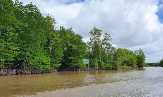
The Mist Mountain Formation is actually Late Jurassic-Early Cretaceous deposit. It is primarily shale, siltstone, sandstone, and mudstone. This formation represents fluvial channels, floodplains, deltaic, coastal plains and swamps along the Western Interior Seaway as it began to transgress back across the continent.
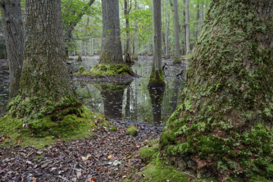
As we move south into Montana and Wyoming, we can see the environment start to change a little. The base of the Morrison here is the Windy Hill Member, a limey fossiliferous sandstone indicating warm, shallow seabed not unlike the Gulf of Mexico today. This is the extent of the Sundance Sea in the late Jurassic. By this point in time, the sea was regressing off the continent heading towards northwestern Canada and the ocean.


You can even see the white beach sand in the rock and the modern Gulf of Mexico! Neat! Following the Windy Hill in western Montana is the Swift Formation. This is also a marine deposit of primarily orangish brown, glauconitic sandstone. Commonly, it is filled with fossils. It is also shallow marine and some coastal deposits.

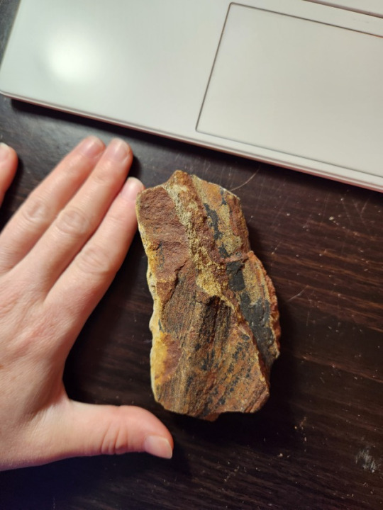
Next is the Morrison Formation proper. Like down south in the more famous outcrops, the Morrison in Montana consists of variegated mudstones and sandstones with minor limestones indicating fluvial and lacustrine deposits.
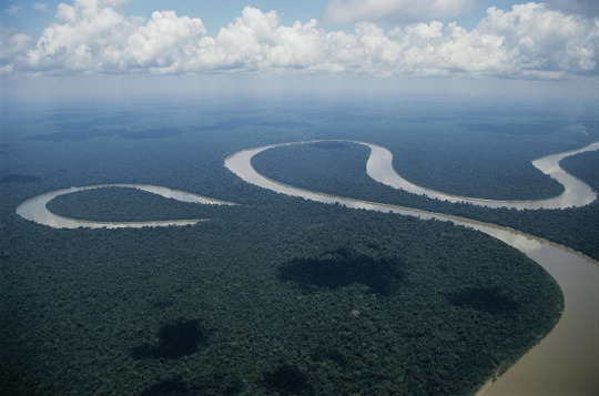
The biggest difference is that there is no clay change like on the Colorado Plateau (it doesn't become smectitic). This tells us there was no volcanic activity up north.
As we move south through Wyoming, the Morrison continues to have the typical variegated mudstone and sandstone profile, however, it has recently been noted to be mostly lacustrine (lake) deposits rather than fluvial (river). The basal Morrison in Wyoming is the Windy Hill Member (the regressive marine sequence). Perhaps the lakes were what was left after the sea retreated.
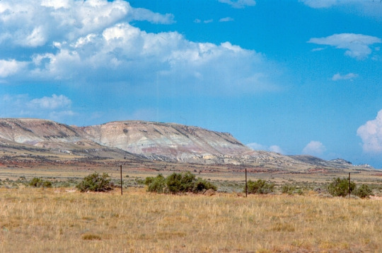

Northern Utah and Colorado are very similar to Wyoming with slightly more fluvial rocks than lacustrine, such as at Evil Tree Bonebed (I know, shameless plug but our site is so COOL). Things also start to show the clay change from illitic to smectitic showing that volcanism is becoming prevalent.
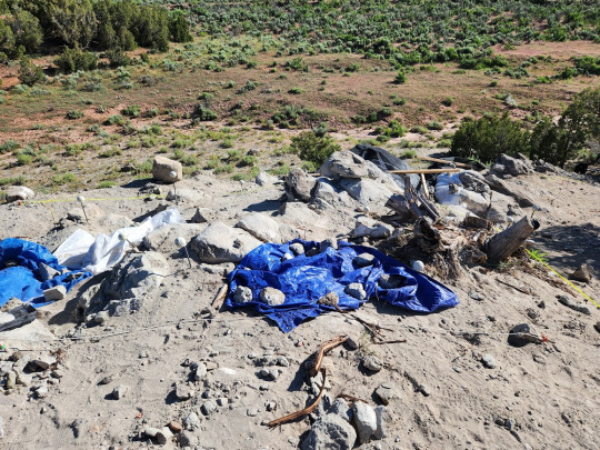

As we continue heading south through Colorado and Utah, more members are separated out and we see the seaonsal wet/dry cycles appear in the rock record. The Morrison down here is primarily fluvial sandstones and conglomerates and the variegated, smectitic mudstones.

(Grand Junction Morrison Formation)
As we continue south onto the Four Corners area, we become even more arid. In fact, there was a large saline lake there not unlike the Great Salt Lake in northern Utah now. It was called Lake Too'dichi and geochemistry tells us it was very saline and contained a lot of smectitic minerals that have aided in uranium ore development in the area.

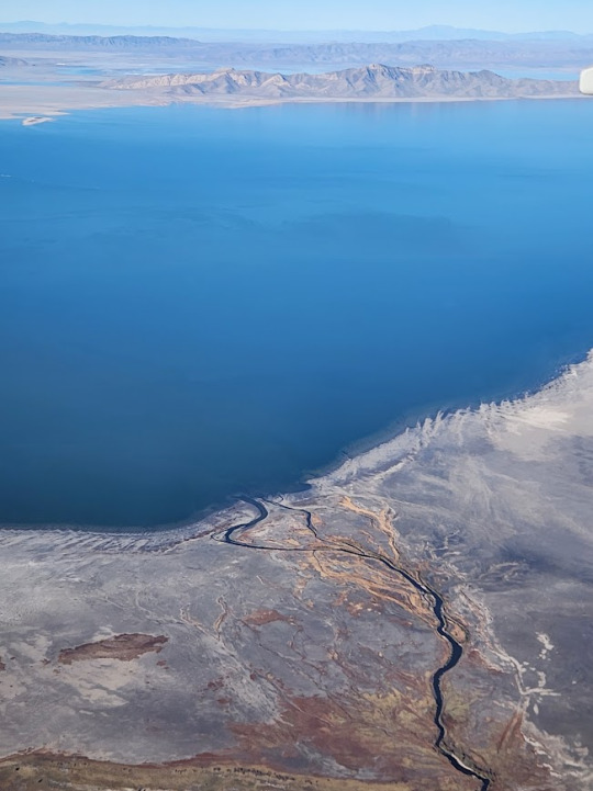
(the Great Salt Lake from my plane home from GSA)
Lastly, in South Dakota and in the Colorado Plateau we find sand dune deposits ( Bluff and Unkpapa Sandstones) indicating small deserts forming.
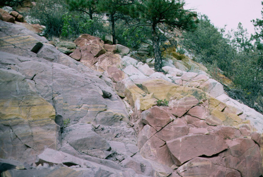
So, when we put it all together, we make a paleomap that looks something like this:

Neat, right? You can see the retreating sea and the large river systems and the arid areas. I personally would put Lake Too'dichi on there too as it's like Great Salt Lake size but this is good enough for our purposes.
I hope you were able to learn something new and exciting about how rocks tell us about paleoenvironment and I will fossilize y'all later!
#paleontology#geology#fun facts#mineralogy#morrison formation#paleogeography#paleomap#paleoenvironment#prehistoric#geologic basin
9 notes
·
View notes
Text
youtube
Nicole Brossard: "On ne peut pas prévoir pencher si soudainement vers un visage et vouloir lécher le corps entier de l’âme jusqu’à ce que le regard étincelle de toutes les fureurs et les abandons. On ne peut pas prévoir l’emportement du corps dans l’infini des courbes, des sursauts, chaque fois que le corps se soulève on ne voit pas l’image, la main qui touche la nuque, la langue qui écarte les poils, les genoux qui tremblent, les bras qui par tant de désir entourent le corps comme un univers. On ne voit que le désir. On ne peut pas prévoir l’image, les fous rires, les cris et les larmes. L’image est tremblante, muette et polyphonique. Fricatelle ruisselle essentielle aime-t-elle le long de son corps la morsure, le bruit des vagues, aime-t-elle l’état du monde dans la flambée des chairs pendant que les secondes s’écoulent cyprine, lutines, marines."
Daphne Marlatt: "You cannot foresee so suddenly leaning toward a face and wanting to lick the soul’s whole body till the gaze sparks with furies and yieldings. You cannot foresee the body’s being swept into the infinity of curves, of pulsings, every time the body surges you cannot see the image, the hand touching the nape of the neck, the tongue parting the hairs, the knees trembling, the arms with such desire encircling the body like a universe. Desire is all you see. You cannot foresee the image, the burst of laughter, the screams and the tears. The image is trembling, mute, polyphonic. Does she frictional she fluvial she essential does she all along her body love the bite, the sound waves, does she love the state of the world in the blaze of flesh to flesh as seconds flow by silken salty cyprine."
0 notes
Text
Gli Shardana, il temibile popolo guerriero
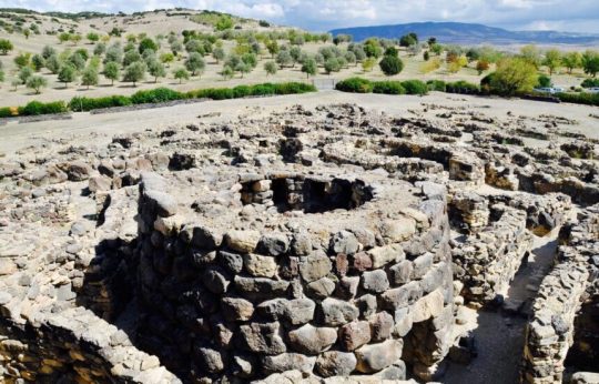
Durante l’età del bronzo, circa 1600 anni prima di Cristo, una moltitudine di popoli imperversò nelle acque del mar mediterraneo, e tra questi i più feroci e temuti furono gli Shardana. Ma chi erano questi antichi navigatori del mare? E qual è la loro origine? Oriente o Occidente? Gli Shardana (o Sherdana) hanno una provenienza incerta: c’è chi ipotizza che provenissero dalla Siria o dall’Anatolia (l’antica Turchia) e c’è chi invece pensa che corrispondano agli antichi sardi dell’età nuragica, o che si sovrapponessero ad essi, dando il nome all’isola, ma forse non lo sapremo mai con certezza. Sicuramente facevano parte di quei gruppi di navigatori che solcavano il Mediterraneo in lungo e in largo, in cerca di insediamenti in cui creare nuove colonie o di comunità con cui intrattenere rapporti commerciali o con cui scontrarsi per poterli depredare. Raggiunsero infatti la loro massima espansione durante l’età del Bronzo Recente (tra il 1300 ed il 900 a.C.), quando la loro influenza si allargò non solo all’Asia minore e alla Sardegna, ma anche alla Corsica e alle isole Baleari, e a vaste zone costiere dell’Africa settentrionale, della Spagna, dell’Italia centrale, della Sicilia e della Puglia. Tutti i territori occupati diventavano poi basi da cui intraprendere nuove spedizioni di conquista. Era una popolazione che basava la propria economia sull’agricoltura e sull’allevamento, ma il loro punto di forza fu la navigazione e la lavorazione del bronzo: sono infatti famosi i loro “bronzetti nuragici” raffiguranti guerrieri e navi. Mamma mia arrivano gli Shardana I primi a citarli furono gli antichi egizi, nelle tavolette di Amarna, datate 1350 a.C. circa, in cui erano definiti pirati, e chiamati col nome Sherdana. Infatti l’Egitto subì varie ondate di attacchi e incursioni, culminate negli scontri avvenuti durante il regno del faraone Ramses II, intorno al 1278 a.C. nelle zone del delta del Nilo. Il maggior terrore agli occhi degli egiziani era costituito dalle grosse navi da guerra a disposizione degli Shardana, che avevano massicci mezzi capaci di solcare le acque marine, mentre le imbarcazioni egizie erano di tipo fluviale, adatte cioè alle acque basse e tranquille del Nilo, non certo alle onde alte del Mediterraneo. Questo era un motivo per cui riuscivano a vincere facilmente le battaglie navali. Inoltre erano militari finemente addestrati, pronti a scendere in campo armati di tutto punto: grossi elmi cornuti, grandi scudi rotondi e lunghe spade, forti della loro tecnica di lavorazione del rame e di altre leghe metalliche, che dava maggiore potenza alla loro natura di razziatori. Ma in una di queste incursioni però, Ramses II fu capace di non farsi cogliere impreparato, riuscì a sconfiggerli, e addirittura a catturarne qualche centinaio, e avendone colto la loro audacia e forza in battaglia, decise di arruolarli nella guardia reale. I guerrieri Shardana divennero quindi anche dei mercenari, e per molto tempo non solo rimasero le guardie personali dei faraoni, ma furono impiegati anche in guerra. Tra quelle a cui parteciparono, è interessante ricordare la battaglia di Qadesh, una delle più importanti dell’era antica, combattuta tra gli egiziani e l’impero ittita sulle sponde del fiume Oronte in Siria, nel 1274 a.C., in cui il contingente di 520 Shardana si distinse per essere l’unica fanteria pesante presente nell’esercito. È giusto sottolineare che le fonti egiziane parlano di vittoria egiziana, mentre le fonti ittite parlano di vittoria ittita, quindi in realtà chi ebbe la meglio non si sa (probabilmente nessuna delle due parti), tanto che fu siglato un trattato di pace tra le due nazioni, il primo a noi conosciuto, per porre fine alla serie di guerre che da lungo tempo si protraevano tra i due popoli. Ma poi, che fine hanno fatto? Fonti storiche rivelano che probabilmente un grosso tsunami o comunque diverse inondazioni travolsero gran parte della Sardegna, distruggendo così il loro territorio e i loro villaggi, che li costrinse ad abbandonare l’isola e i suoi insediamenti. Le comunità che si erano insediate in altri luoghi, o come mercenari in Egitto, si pensa che col tempo si mescolarono con le società con cui erano entrati in contatto, integrandosi nella loro cultura e perdendo pian piano la propria identità di popolo. Ma tante domande restano ancora senza risposte, su questa gloriosa stirpe che ha solcato il Mediterraneo, e di cui, forse, non sapremo mai la vera origine. Nel frattempo, il dibattito resta aperto. Read the full article
1 note
·
View note
Text
Test Bank For Living Physical Geography Second Edition Bruce Gervais

Table of Contents
Contents The Geographer’s Toolkit 1. This introduction covers the traditional and modern tools and foundational concepts in wide use in geography. Part I Atmospheric Systems: Weather and Climate Part I explores how solar energy in the atmosphere creates atmospheric phenomena and organized systems. One chapter is devoted to the topic of climate change. 2. Portrait of the Atmosphere 3. Solar Energy and Seasons 4. Water in the Atmosphere 5. Atmospheric Circulation and Wind Systems 6. The Restless Sky: Severe Weather and Storm Systems 7. The Changing Climate Part II The Biosphere and the Geography of Life Part II is contextualized around solar energy’s work in the biosphere. Major ecological units and human modification of the biosphere are emphasized. One chapter is devoted to marine ecosystems. 8. Patterns of Life: Biogeography 9. Climate and Life: Biomes 10. Ocean Ecosystems 11. Soil and Water Resources Part III Tectonic Systems: Building the Lithosphere Part III explores uplift and building topographic relief via geothermal energy. 12. Earth History, Earth Interior 13. Drifting Continents: Plate Tectonics 14. Building the Crust with Rocks 15. Geohazards: Volcanoes and Earthquakes Part IV Erosion and Deposition: Sculpting the Earth’s Surface Part IV examines the work of solar energy, water, chemical reactions, and gravity in grading the Earth’s surface. 16. Weathering and Mass Movement 17. Flowing Water: Fluvial Systems 18. The Work of Ice: The Cryosphere and Glacial Landforms 19. Water, Wind, and Time: Desert Landforms 20. The Work of Waves: Coastal Landforms Read the full article
0 notes
